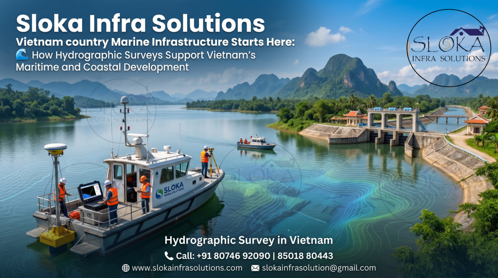
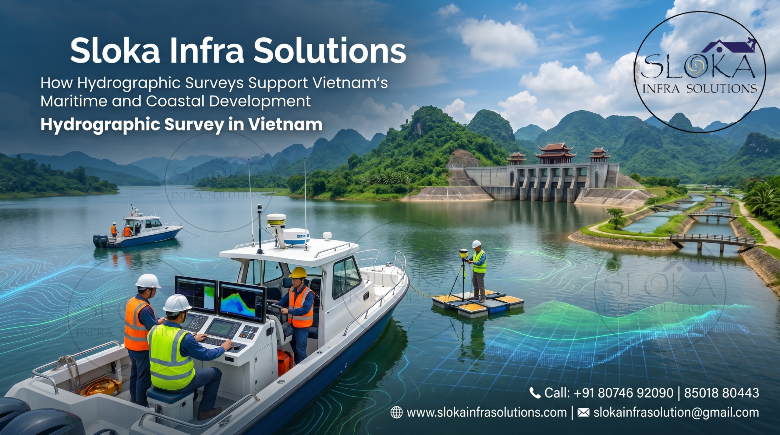
Hydrographic Survey in Vietnam
How Hydrographic Surveys Support Vietnam’s Maritime and Coastal Development
Call: +91 80746 92090
Hydrographic Survey in Vietnam is essential for mapping the country’s seas, rivers, deltas, ports, canals, reservoirs, and coastal zones with accuracy, safety, and long-term planning in mind. Vietnam is connected to water through its long coastline, river systems, islands, fishing zones, tourism waters, offshore energy locations, and inland waterways. Because the seabed and riverbed are hidden, survey data helps engineers, port teams, and authorities understand depth, hazards, sediment movement, currents, and construction risks before decisions.
Top Hydrographic Survey & Surveyors in Vietnam
Top Hydrographic Survey & Surveyors in Vietnam support safe navigation, marine construction, dredging, offshore development, environmental monitoring, and inland waterway planning. Vietnam’s water geography is diverse, from the Gulf of Tonkin and Ha Long Bay in the north to central coastal ports, lagoons, fishing harbours, Saigon River, Dong Nai River, Cai Mep-Thi Vai, Mekong Delta, Phu Quoc, Con Dao, and Gulf of Thailand waters. Each region has different depths, currents, sediment conditions, and survey challenges.
Why Hydrographic Surveys Matter in Vietnam?
Vietnam’s economy depends on ports, shipping, fishing, coastal development, offshore activities, tourism, and river transport. A small error in underwater data can affect vessel safety, dredging cost, bridge design, pipeline routes, or port expansion. Hydrographic survey shows what exists below the water surface and helps reduce uncertainty.
Important uses include:
- Checking safe depths in ports, berths, channels, and turning basins.
- Supporting dredging quantity calculation and post-dredging verification.
- Mapping riverbeds for bridges, intakes, outfalls, and embankments.
- Identifying rocks, wrecks, debris, pipelines, cables, and other underwater risks.
- Studying current speed, sediment movement, erosion, floods, and coastal protection.
- Planning offshore energy, marine terminals, reservoirs, canals, and inland navigation routes.
Vietnam’s Water Geography and Survey Needs:-
Vietnam has a long and narrow shape, creating many survey environments in one country. The north includes the Gulf of Tonkin, island waters, estuaries, and the Red River Delta. These areas often have sediment-rich water, busy navigation routes, fishing activity, and complex coastlines. Ha Long Bay needs careful survey attention because tourism routes, rocky islands, shallow areas, and ecosystems exist close together.
Central Vietnam has short rivers, open coastal waters, ports, beaches, bays, and lagoons. Rivers from mountain regions can carry sediment quickly into the sea after heavy rainfall, so surveys are needed for channel safety, harbour maintenance, coastal works, and storm impact assessment.
Southern Vietnam has the Mekong Delta, Saigon River, Dong Nai River, Thi Vai River, canals, estuaries, and Gulf of Thailand coast. Changing river currents, tidal action, floods, erosion, and sediment deposits continuously alter the underwater bed, making hydrographic surveys essential for safe navigation, dredging, bridge construction, bank protection, and effective water resource planning.
Core Hydrographic Survey Process:-
A professional hydrographic survey is not just boat-based depth measurement. It needs planning, field control, calibration, safe operation, correction, processing, and interpretation. Surveyors must consider tide, sound speed, vessel movement, current, weather, traffic, and local conditions.
A strong survey workflow includes:
- Understanding project purpose, accuracy level, survey limits, and deliverables.
- Reviewing charts, previous data, tide records, and local water conditions.
- Selecting single beam, multibeam, ADCP, side scan sonar, or sub bottom profiler.
- Planning lines, control points, calibration, safety routes, and backup methods.
- Collecting, correcting, validating, and processing bathymetry, sonar, current, and seabed data.
- Preparing maps, contours, profiles, 3D models, volume reports, and drawings.
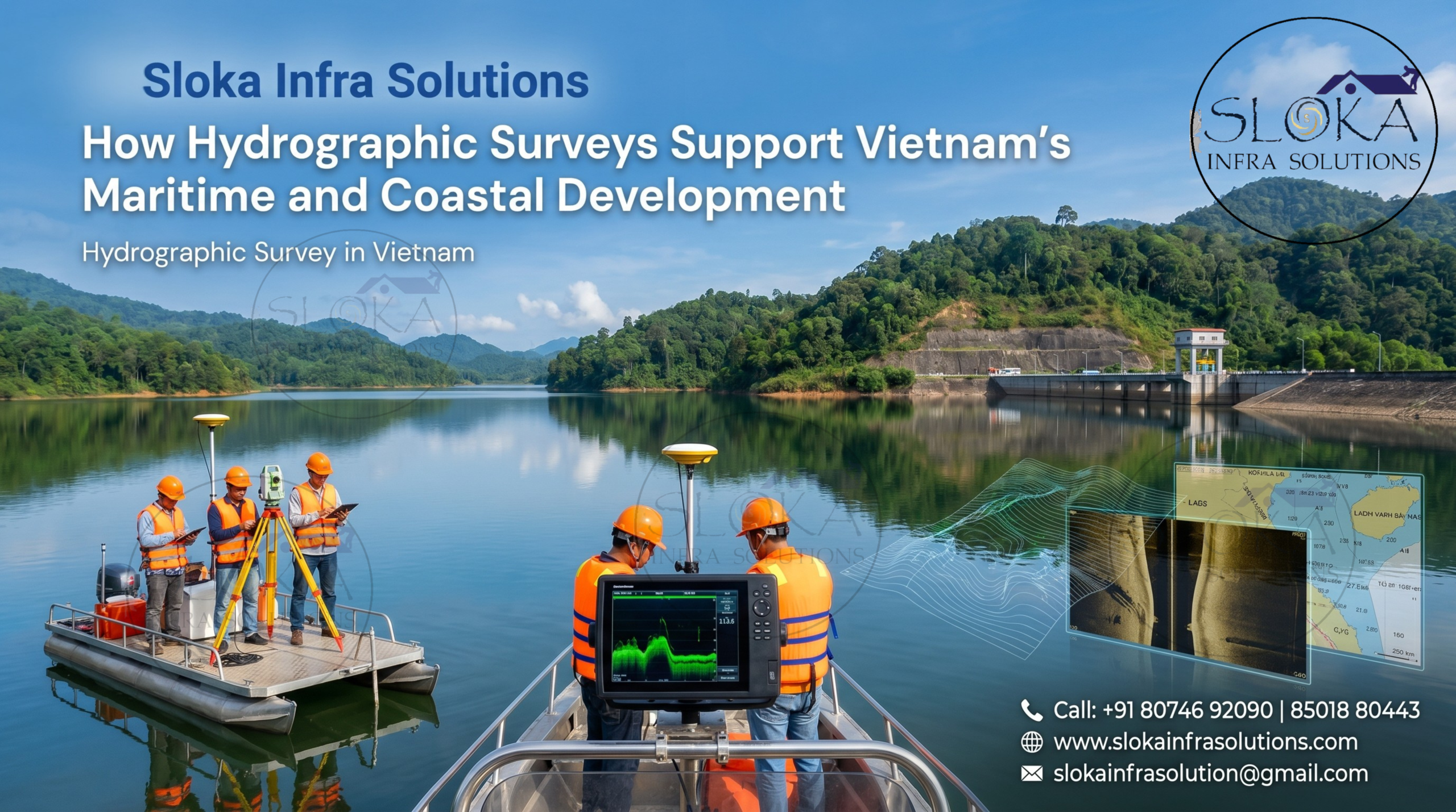
Single Beam Echo Sounder Survey:-
Single Beam Echo Sounder Survey is a simple, reliable, and cost-effective method used to measure water depth along planned survey lines. The system sends an acoustic signal vertically downward from a transducer and records the time taken for the signal to return from the seabed. With accurate positioning, these depth points are converted into river cross-sections, profiles, contour maps, and dredging reports.
In Vietnam, single beam surveys are useful for rivers, canals, reservoirs, irrigation waterbodies, small harbours, shallow lagoons, bridge locations, and preliminary dredging studies. They are practical in narrow waterways where larger vessels or complex systems may not be easy to use. In Mekong Delta canals, Red River channels, small port areas, and reservoirs, this method can provide dependable depth information when survey lines are properly planned.
However, single beam survey collects data only below the survey vessel, not across the full seabed width. If line spacing is too wide, small rocks, debris, holes, mounds, or wrecks may be missed. For high-risk locations, it is better to combine single beam data with side scan sonar or multibeam survey. Calibration, tide correction, sound velocity checks, and cross-line validation are necessary for accurate results.
Multibeam Echo Sounder Survey:-
Multibeam Echo Sounder Survey is used when detailed and full seabed coverage is required. Instead of measuring one line of depth, a multibeam system sends many acoustic beams across a wide swath, capturing dense depth data from side to side. This helps create accurate 3D seabed models, identify underwater features, and check whether dredging or construction work has achieved the required level.
In Vietnam, multibeam survey is useful for major ports, deep-water channels, LNG terminals, offshore energy projects, bridge sites, submarine cable routes, and complex seabed areas. Hai Phong, Da Nang, Ho Chi Minh City waterways, and Cai Mep-Thi Vai benefit from it because navigation safety and berth depth are critical. It can detect slopes, obstructions, scour holes, sand waves, dredging irregularities, and submerged objects clearly.
Multibeam surveys need GNSS, motion sensors, heading sensors, tide correction, sound velocity profilers, and processing software. Vessel roll, pitch, heave, yaw, tide, and sound speed must be corrected carefully. When handled by skilled surveyors, this method gives high-confidence data for engineering, navigation, and maintenance decisions.
ADCP Survey:-
ADCP Survey is used to measure water current speed and direction at different depths. ADCP means Acoustic Doppler Current Profiler. It releases acoustic signals into the water and tracks the movement of tiny particles flowing with the current. This allows surveyors to understand how water moves from surface to near-bottom levels.
In Vietnam, ADCP survey is important because rivers, estuaries, ports, deltas, and coastal zones are influenced by tides, monsoon rainfall, discharge, and sediment movement. In the Mekong Delta, ADCP data supports flood studies, discharge measurement, navigation planning, erosion assessment, and sediment analysis. In the Red River Delta and port areas, it helps study channel flow, berthing safety, dredging, intake design, outfalls, and monitoring.
ADCP surveys are useful for understanding not only where water exists, but how it moves. This matters for bridge foundations, pipeline crossings, dredging projects, coastal structures, and flood models. Surveyors must consider instrument frequency, boat speed, transect direction, water depth, turbulence, bubbles, and bottom tracking. When properly planned, ADCP Survey gives strong flow intelligence for Vietnam’s river and marine projects.
Side Scan Sonar:-
Side Scan Sonar creates acoustic images of the seabed. It scans both sides of the vessel or towed unit and records reflection patterns from underwater surfaces and objects. Hard materials, wrecks, rocks, anchors, debris, pipelines, cables, and seabed texture changes can appear clearly in sonar imagery.
This technology is valuable in Vietnam because many rivers, ports, estuaries, and coastal construction zones have low visibility. Divers may not see clearly in muddy waters, but side scan sonar can detect objects even when the water looks unclear. It is useful for wreck search, debris mapping, route clearance, port safety, corridor surveys, pre-dredging inspection, and hazard identification.
Side scan sonar does not mainly provide depth; it provides seabed imagery. Therefore, it is often used with single beam or multibeam echo sounders. Survey quality depends on line spacing, sonar range, vessel speed, altitude control, overlap, positioning, and skilled interpretation. In complex Vietnam waterbodies, it helps convert unclear underwater spaces into understandable survey evidence.
Sub Bottom Profilers:-
Sub Bottom Profilers help surveyors look below the seabed surface. They send lower-frequency acoustic signals into the bottom and record reflections from sediment layers, buried objects, rockhead, soft mud, sand lenses, shallow gas, and old channels. This makes them useful for engineering projects that need knowledge of what lies beneath the visible seabed.
In Vietnam, sub bottom profiling is useful for ports, dredging, reclamation, bridge foundations, pipeline routes, cable routes, offshore wind planning, and coastal engineering. Delta and coastal regions often contain soft sediments and layered deposits. Before marine construction or underwater utilities, engineers need to know whether the seabed is soft, layered, buried, hard, or unstable.
For dredging, sub bottom profilers can show soft material thickness and possible hard layers below. For cable or pipeline burial, they help identify suitable trenching conditions. For port expansion, they support early geotechnical understanding before detailed investigation. Data quality depends on frequency, water depth, seabed type, gas content, vessel noise, and interpretation skill. In Vietnam’s sediment-rich areas, this method adds an important deeper view of the seabed.
Challenges in Vietnam’s Hydrographic Survey Environment:-
Vietnam’s water conditions are often demanding. A survey team may face calm reservoir conditions in one project and strong currents, muddy water, heavy traffic, or rough seas in another. Good preparation is necessary to avoid delays, safety issues, and weak data quality.
Common challenges include:
- Low visibility in deltas, river mouths, and muddy ports.
- Monsoon rainfall, waves, storms, and sudden weather changes.
- Strong currents in tidal rivers, coastal channels, and port approaches.
- Sediment movement after floods, dredging, or coastal change.
- Wrecks, rocks, debris, cables, pipelines, fishing gear, and shallow zones.
- Heavy traffic near ports, ferries, fishing harbours, and industrial terminals.
- Data errors caused by weak tide correction, sound velocity changes, or vessel motion.
Hydrographic Survey for Ports, Rivers, and Coastal Protection:-
Ports need regular hydrographic surveys because safe depth is directly linked to vessel movement. If sediment builds up in channels or berth pockets, ships may face restrictions or grounding risk. Survey data helps check channel depth, confirm dredging results, locate obstructions, and support harbour maintenance.
Rivers and deltas keep changing. The Mekong Delta, Red River Delta, Saigon River, Dong Nai River, and Thi Vai River require bathymetry, flow measurement, erosion studies, and sediment monitoring for navigation, bridges, flood planning, embankments, dredging, and water management.
Coastal protection also depends on underwater mapping. Nearshore bathymetry helps engineers understand wave action, seabed slope, erosion, sediment movement, and structure design. Repeated surveys show whether a coast is deepening, shallowing, eroding, or recovering.
Choosing the Right Survey Method:-
Each project needs the right tool. Single beam works well for simple profiles, reservoirs, canals, and small dredging checks. Multibeam is better for full seabed coverage, ports, offshore areas, and engineering surveys. ADCP supports current and discharge studies. Side scan sonar helps with object detection, while sub bottom profilers reveal sediment layers and buried features.
Conclusion:-
Hydrographic Survey in Vietnam is more than underwater measurement; it is a foundation for safe navigation, better engineering, smarter dredging, environmental protection, and long-term coastal planning. The country’s waterbodies are wide-ranging and dynamic, from the Gulf of Tonkin and central coast to the Mekong Delta, Red River Delta, ports, islands, reservoirs, and inland waterways.
Top Hydrographic Survey & Surveyors in Vietnam must combine advanced equipment, field experience, safety awareness, accurate processing, and clear reporting. Single beam, multibeam, ADCP, side scan sonar, and sub bottom profilers each provide a different layer of underwater knowledge. Used properly, these technologies help Vietnam reduce risk, improve infrastructure decisions, protect marine environments, and support sustainable maritime growth.