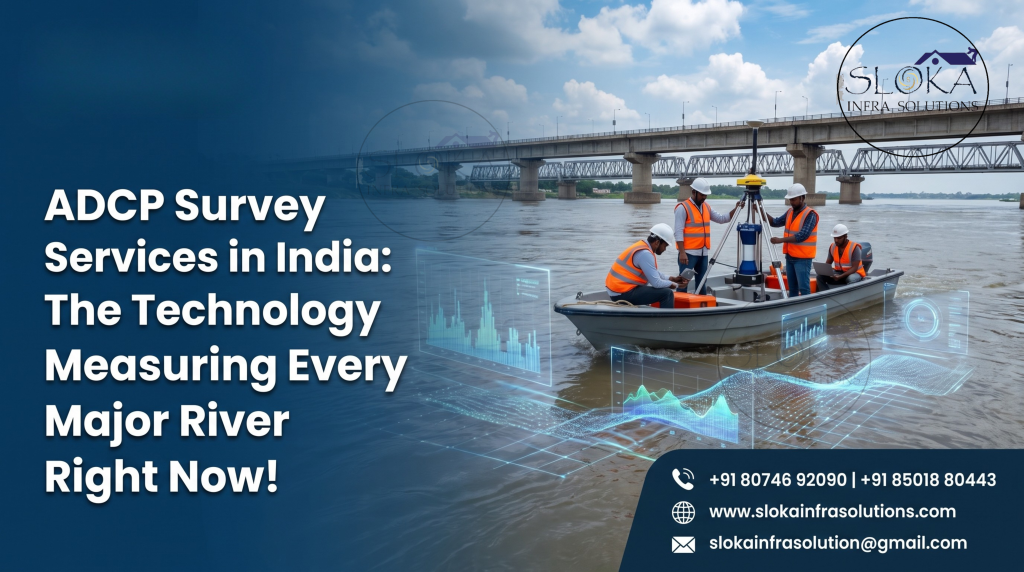
ADCP Survey Services In India
ADCP Survey Services in India: The Technology Measuring Every Major River Right Now
ADCP Survey Services In India have grown into an essential part of river management, hydropower planning, and flood forecasting over the past decade. ADCP stands for Acoustic Doppler Current Profiler, and despite the technical-sounding name, what it does is fairly simple to understand: it measures how fast water is moving, at multiple depths, all at once, using sound waves instead of mechanical meters. If you’ve ever wondered how engineers actually know how much water is flowing through the Ganga at any given moment, the answer is a small yellow instrument that gets lowered off the side of a boat. That instrument has quietly become one of the most important tools in Indian water management.
ADCP Surveyors Services in India
ADCP surveyors services in India are typically engaged by irrigation departments, hydropower companies, environmental consultants, and infrastructure firms who need to know exact river discharge figures — not estimates, actual measured numbers — before making decisions worth crores of rupees. Getting this measurement wrong can mean overestimating hydropower potential, misjudging flood risk, or approving a bridge design based on incorrect flow assumptions.
How ADCP Technology Actually Works
An ADCP works using something called the Doppler effect — the same principle that makes an ambulance siren sound different as it approaches versus moves away from you. The device sends short pulses of sound into the water. These pulses bounce off tiny particles suspended in the water — sediment, plankton, air bubbles — and reflect back to the instrument.
By measuring how the frequency of that returning sound has shifted, the ADCP calculates how fast the water (and the particles moving with it) is travelling. It does this at multiple depth layers simultaneously, building what’s called a current profile — essentially a slice showing exactly how flow speed and direction change from the surface down to the riverbed.
The technology has been around since the 1970s but really gained traction from the 1990s onward. It’s now the standard method used by hydrographic survey organisations worldwide, and roughly 98% of non-wading river discharge measurements done by the US Geological Survey use ADCP rather than older mechanical current meters — a fair indication of how much more reliable this method has become.
Why ADCP Beats Traditional Current Meters
Older methods for measuring river flow involved lowering a mechanical current meter at fixed points across a river cross-section, one point at a time, and taking readings manually. It worked, but it was slow, labour-intensive, and often risky — especially during high flow or flood conditions when accurate data matters most.
ADCP survey services in India have largely replaced this approach because of clear practical advantages:
- Speed — a full river cross-section can be measured in a single pass instead of hours of point-by-point readings
- Safety — surveyors don’t need to work in dangerous flow conditions the way older wading methods required
- Accuracy — comparative studies have found ADCP discharge measurements typically fall within 5 to 8 percent of conventional method results, with most measurements even closer
- Real-time results — discharge figures are available as soon as the boat completes the river crossing
- Depth-resolved data — instead of one average reading, you get flow speed and direction at every depth layer
What ADCP Surveys Are Actually Used For
River discharge measurement This is the core application. Knowing exactly how much water is flowing through a river cross-section at any given time feeds directly into flood forecasting, irrigation planning, and interstate water-sharing calculations.
Hydropower project design and operation Accurate flow data is fundamental to sizing turbines correctly and scheduling power generation efficiently. Underestimate flow and you leave capacity on the table; overestimate it and equipment gets damaged or underperforms.
Reservoir and dam management ADCP surveys help calculate inflow and outflow rates at reservoirs, which feeds directly into storage planning and spillway operation decisions — often working alongside bathymetric surveys of the reservoir bed itself.
Sediment transport studies Because ADCP data reveals current velocity at every depth, researchers use it to understand how sediment moves through a river system, which matters for both environmental studies and infrastructure planning like bridge foundations.
Environmental and ecological monitoring Flow patterns directly affect aquatic habitats, fish migration corridors, and pollutant dispersion. ADCP data supports environmental impact assessments for new infrastructure projects.
Port and estuary studies In tidal zones, ADCP surveys help map how currents change through tidal cycles — critical information for port operations, dredging planning, and coastal engineering.
How an ADCP Survey Is Actually Conducted
Moving-boat method (most common for rivers) The ADCP is mounted on a boat, which then travels across the river from bank to bank. As the boat crosses, the instrument continuously records current velocity at all depths, while also tracking the boat’s own movement using a technique called bottom tracking — essentially using the riverbed as a reference point to calculate true water velocity separate from boat movement.
Fixed or moored deployment For long-term monitoring, ADCPs can be mounted on the riverbed or a fixed structure, continuously logging flow data over weeks or months. This approach is common for tidal studies and long-term hydrological monitoring stations.
Vessel-mounted transects for research Larger studies, especially on major rivers, often run multiple repeat transects at different times to understand how flow varies with season, tide, or upstream releases.
Choosing the Right Frequency and Setup
ADCP instruments come in different acoustic frequencies, and the right choice depends on the water body:
- Higher frequency units (600 kHz and above) work well in shallower rivers and streams, offering better resolution over shorter ranges
- Lower frequency units (300 kHz and below) penetrate deeper water and are better suited to large rivers, estuaries, and coastal applications
Experienced ADCP surveyors services in India will typically assess the water body first — depth, expected flow speed, sediment concentration — before recommending equipment, rather than using a one-size-fits-all setup.
Common Challenges in Indian Field Conditions
India’s rivers present a genuinely tough working environment for ADCP surveys, and it’s worth understanding why:
- Monsoon variability — flow conditions can change dramatically within days, requiring flexible survey scheduling
- High sediment load — heavily silted rivers can affect acoustic signal quality, requiring careful frequency selection
- Shallow and obstacle-rich stretches — braided rivers and sections with fishing gear or debris need experienced navigation
- Boat traffic and access restrictions — near ports, naval zones, or busy waterways, surveys need proper coordination and clearances
Who Should Be Using ADCP Survey Services
- Irrigation and water resources departments planning canal and barrage operations
- Hydropower developers assessing site potential or monitoring existing installations
- Environmental consultants conducting impact assessments for riverfront or bridge projects
- Central and state Pollution Control Boards studying discharge and dispersion patterns
- Port authorities and dredging contractors working in tidal and estuarine zones
- Research institutions studying river hydromorphology and sediment transport
Sloka Infra Solutions and ADCP Work
Sloka Infra Solutions carries out ADCP-based flow and discharge surveys as part of its broader hydrographic survey capability, working alongside bathymetric and sub-bottom profiling services where projects need a fuller picture of a river or reservoir system. Since flow data and depth data often need to be interpreted together — particularly for hydropower and dam-related projects — having both capabilities under one team keeps the process efficient and the results consistent.
FAQs
What does ADCP stand for? ADCP stands for Acoustic Doppler Current Profiler, an instrument that measures water current speed and direction at multiple depths using sound waves.
How accurate is ADCP compared to traditional flow measurement? Field comparisons have generally shown ADCP discharge measurements falling within 5 to 8 percent of conventional mechanical current meter results, making it a reliable and widely trusted method.
Can ADCP be used in shallow rivers? Yes, with the right frequency setup. Higher-frequency ADCP units are specifically designed for shallow water and smaller rivers where lower-frequency instruments wouldn’t perform as well.
How long does an ADCP river survey take? A single cross-section measurement can be completed in minutes once the boat is in position. Larger studies covering multiple sites or repeat transects across seasons take longer to plan and execute.
Is ADCP survey useful for flood forecasting? Very much so. Real-time discharge data from ADCP surveys feeds directly into flood models and early warning systems, especially at gauging stations on major rivers.
Do ADCP surveys work in tidal or estuarine areas? Yes, ADCP is widely used in tidal zones to track how current speed and direction change through the tidal cycle, which is important for port operations and coastal engineering projects.
Final Word
River flow doesn’t stay the same for even a single day, which is exactly why real, measured data matters more than assumptions or outdated records. ADCP survey services in India have made it possible to get that data quickly, safely, and with a level of accuracy older methods simply couldn’t match. If your project depends on knowing exactly how much water is moving through a river, canal, or reservoir inlet, it’s worth talking to a team that runs this equipment regularly in Indian field conditions. Reach Sloka Infra Solutions at 80746 92090 to discuss your survey requirements.