
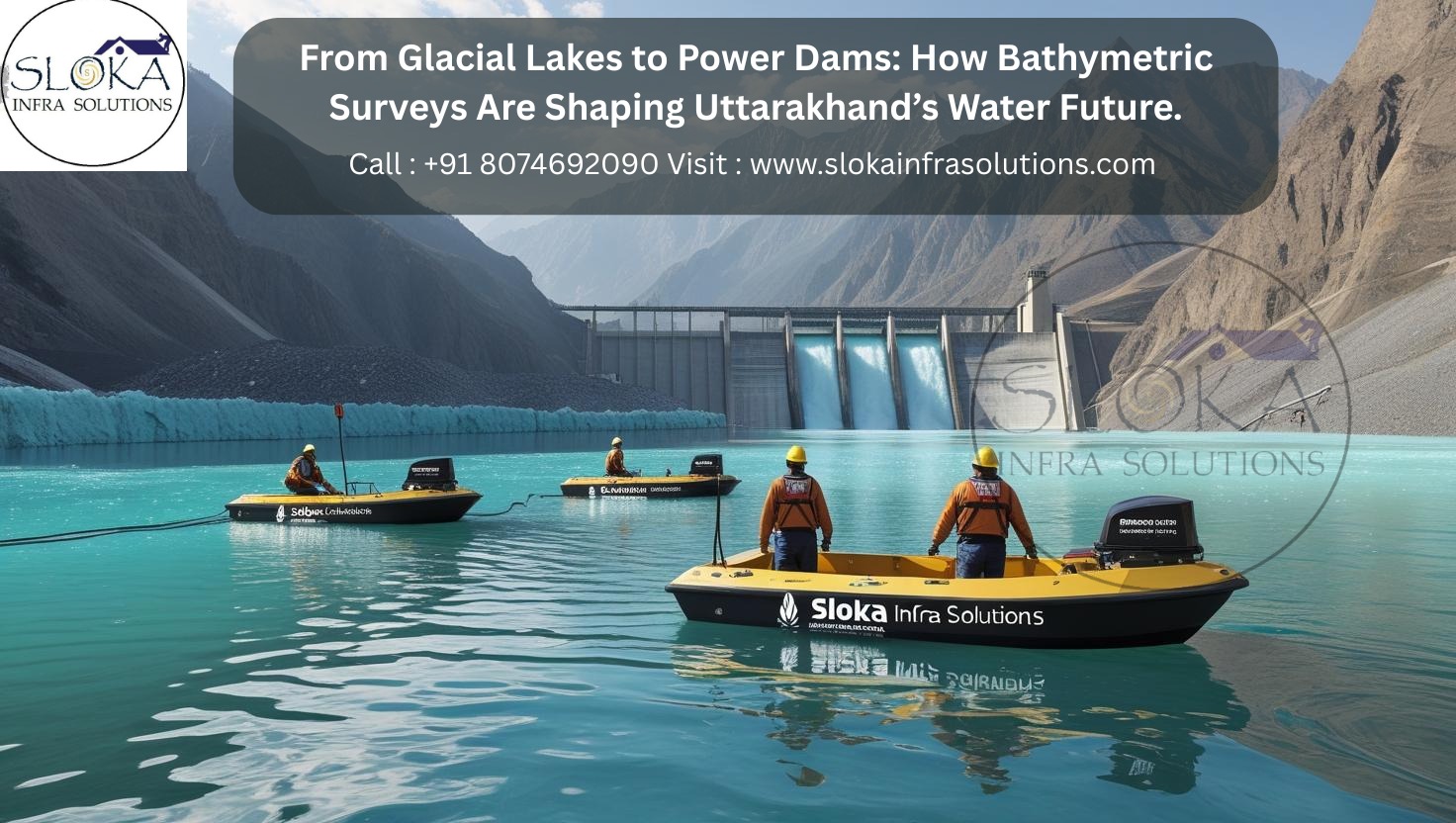
Bathymetric Survey in Uttarakhand
From Glacial Lakes to Power Dams: How Bathymetric Surveys Are Shaping Uttarakhand’s Water Future
Call: 80746 92090
Bathymetric Survey in Uttarakhand opens a window into the hidden underwater topography of the state’s diverse and dynamic water bodies, revealing depths, contours, and submerged features that are critical for environmental management, engineering projects, and scientific research. Nestled in the lap of the Himalayas, Uttarakhand’s myriad rivers, glacial lakes, and man-made reservoirs present a rich tapestry for bathymetric exploration. From the icy headwaters of the Ganges to the tranquil lakes of the Garhwal region, understanding what lies beneath the surface is essential not only for navigational safety but also for preserving delicate aquatic ecosystems.
Top Bathymetric Survey and Surveyor in Uttarakhand
Top Bathymetric Survey and Surveyor in Uttarakhand provide specialized expertise to chart underwater landscapes with precision, blending sophisticated technology with local know-how. Leading survey firms and independent hydrographic surveyors operating in the region deploy vessels, portable echo sounders, and satellite positioning systems to capture high-resolution depth data across remote Himalayan waters and busy reservoirs alike. These professionals work closely with government agencies, environmental organizations, and infrastructure developers to deliver bathymetric maps and analyses that guide dam construction, fisheries management, flood risk assessment, and eco-tourism ventures.
Understanding Uttarakhand’s Waterscape:-
Uttarakhand’s water bodies range from mighty rivers carved by glaciers to serene high-altitude lakes. Major rivers such as the Bhagirathi, Alaknanda, Mandakini, and Yamuna originate in the glaciated north and flow southward through deep gorges, while artificial reservoirs like the Tehri Dam and Koteshwar Balancing Reservoir hold strategic importance for hydroelectric power generation. Glacial lakes—such as Hemkund Sahib, Deo Tal, and Satopanth—dot the alpine zone, offering both scenic beauty and scientific intrigue.

Bathymetric surveys here must adapt to:
Variable Depths: From shallow margins around lake edges to deep central basins exceeding 100 meters.
Rapid Currents: High-flow rivers can challenge survey vessel stability and data accuracy.
Seasonal Ice Cover: Winter freezes require alternate techniques like air-cushion vehicles or fixed ice-drilling stations.
Remote Access: Many survey sites are accessible only by trekking or via limited mountain roads.
Key Technologies in Bathymetric Survey:-
1.Single and Multibeam Echo Sounders
Echo sounders emit acoustic pulses downward and record return times to calculate depths. Single-beam systems sweep a narrow path, while multibeam echo sounders fan out wide swaths—capturing thousands of soundings per second to generate detailed 3D models of the seafloor or reservoir bed.
2.GNSS and RTK Positioning
Global Navigation Satellite Systems (GNSS), augmented by Real-Time Kinematic (RTK) corrections, ensure horizontal positioning accuracy within centimeters—critical for georeferencing depth measurements onto topographic maps.
3.Side Scan Sonar
Side scan sonar produces imagery of lakebeds and riverbeds by emitting sound waves sideways, creating high-contrast acoustic images that reveal submerged obstacles, sediment patterns, and structural features. This technology adds a new layer of insight by revealing underwater details that traditional echo sounders often overlook.
4.Sub Bottom Profilers
Sub bottom profilers penetrate beneath the sediment–water interface with low-frequency acoustic pulses, mapping subsurface sediment layers to depths of several tens of meters. These profiles uncover buried channels, paleo-landforms, and sediment accumulation rates.
Sub Bottom Profilers:-
Sub bottom profilers (SBP) have become essential for archaeologists, geologists, and engineers exploring the hidden layers beneath Uttarakhand’s glacial lakes and alluvial terrains.By emitting low-frequency acoustic waves, SBPs penetrate underlying sediment layers beneath river beds, lake floors, and reservoir bottoms, returning echoes from buried interfaces. In Uttarakhand, where sediments can accumulate rapidly during monsoon floods, SBP surveys reveal the hidden history of river migration, sediment deposition, and underlying bedrock structures.
A typical SBP system comprises an acoustic source, a hydrophone array, and a data recording unit. A research vessel or small survey boat tows the SBP transducer close to the waterbody’s surface, sending pulses that travel through water into deposits of silt, sand, and gravel. Reflections occur at each interface of differing acoustic impedance—such as between recent alluvium and older glacial till—allowing technicians to reconstruct vertical cross-sections of subsurface stratigraphy.
In Uttarakhand, SBP data have illuminated:
Floodplain Evolution: Reconstructed sediment layers show how historic floods reshaped the Mandakini and Alaknanda floodplains, informing riverbank stabilization projects.
Reservoir Siltation: Profiling at Tehri and Koteshwar reservoirs quantifies sediment infill rates, guiding dredging schedules to maintain storage capacity.
Landslide Detection: SBP mapping near steep gorge walls uncovers slip planes and mass-wasting deposits—key to landslide hazard assessments along river valleys.
Paleo-Glacial Channels: Underhill channels revealed in glacial lakes such as Deoria Tal suggest ancient meltwater pathways, enriching our understanding of Himalayan deglaciation patterns.
By coupling SBP insights with coring data and radiometric dating, scientists construct timelines of geological and climatic change. In turn, policymakers and environmental managers use these timelines to predict sediment transport under future monsoon intensities and to design sustainable water management strategies.

Side Scan Sonar:-
Side scan sonar (SSS) imaging offers a complementary view to depth measurements by producing detailed acoustic photographs of underwater surfaces. In Uttarakhand’s mountain lakes and wide river reaches, side scan sonar surveys capture high-resolution textures of the lakebed, indicating rocky outcrops, sunken logs, boulder fields, and submerged structures that pose navigational risks or habitat niches.
An SSS system uses a towfish or hull-mounted transducer containing multiple narrow-beam projectors and receivers. Sound pulses directed sideways reflect off the bottom and return to the receivers, with signal strength mapped against time and range to create a grayscale image where lighter tones represent stronger echoes (hard surfaces) and darker tones represent softer sediments.
Applications of side scan sonar in Uttarakhand include:
Fish Habitat Mapping: Detailed imagery of submerged vegetation patches and rocky areas helps fisheries managers identify spawning grounds in lakes like Bhimtal and Sattal.
Infrastructure Inspection: Sonar data around dam toe areas detect scouring, seepage channels, or debris accumulation that could undermine dam safety.
Environmental Monitoring: Seasonal comparison of sonar mosaics tracks sediment resuspension during monsoon months, aiding in water quality forecasts.
Archaeological Discovery: In reservoirs inundating historic settlements, side scan sonar can pinpoint submerged ruins or artifacts for archaeological investigation.
Modern SSS survey cruises integrate GNSS positioning, inertial motion sensors, and automated processing software to stitch together continuous acoustic mosaics. The resulting maps are georeferenced, enabling seamless overlay on satellite imagery or topographic maps for comprehensive spatial analysis.
Steps in Conducting a Bathymetric Survey in Uttarakhand
1.Pre-Survey Planning
- Site Reconnaissance: Review maps, satellite images, and previous survey reports.
- Equipment Selection: Choose echo sounders, GNSS receivers, survey boats, and support vessels suited to waterbody size and access constraints.
- Permissions: Obtain clearances from the Uttarakhand Jal Sansthan, forest department, and local authorities.
2.Field Data Acquisition
- Vessel Deployment: Launch from accessible banks or piers; for glacial lakes, use inflatable crafts.
- Calibration: Perform sound velocity profiling to correct for temperature, salinity (in reservoirs), and depth-dependent speed variations.
- Survey Execution: Follow pre-planned transects at 50–200 m spacing for multibeam or 10–30 m for single beam, adjusting to survey objectives.
3.Data Processing and QA/QC
- Sounding Cleaning: Remove outliers, noise, and reflections from floating debris.
- Tide/Water Level Corrections: Apply real-time gauge readings; in non tidal lakes, reference to a benchmark.
- Grid Generation: Interpolate cleaned soundings onto a regular mesh to produce digital elevation models (DEMs).
4.Analysis and Reporting
- Contour Mapping: Highlight depth intervals, steep slopes, and flat basins.
- Volumetric Calculations: Estimate reservoir storage capacity, sediment volumes, and dredging needs.
- Hazard Assessment: Identify submerged obstacles, potential scouring zones, and flood inundation areas.
- Delivery: Provide GIS-compatible deliverables, interactive 3D models, and comprehensive technical reports.
Applications of Bathymetric Survey in Uttarakhand:-
Hydro-Electric Development
Precise depth maps of reservoir basins underpin dam design, spillway placement, and generator intake positioning. Tehri Dam—one of India’s tallest—relies on periodic bathymetric surveys to track sediment accumulation that could impede water flow to turbines.
Flood Risk Modeling
Depth data feed into hydrodynamic models, refining predictions of inundation zones during peak monsoon flows in narrow valleys like those of Mandakini and Alaknanda.
Environmental Conservation
Mapping of lakebeds helps identify critical habitats, pollution hotspots, and areas vulnerable to invasive species colonization in lakes like Nainital and Bhimtal.
Navigation and Safety
Tourist boats on Har-ki-Dun and Landour reservoirs use bathymetric charts to avoid hidden shoals and submerged logs, ensuring passenger safety.
Scientific Research
Geologists rely on sub bottom profiler data to uncover tectonic faults beneath riverbeds, while ecologists use it to connect underwater depth and sediment types with patterns of aquatic life.
Challenges and Mitigation Strategies:-
1.Extreme Weather
Challenge: Monsoon rains create high turbidity and unstable river flows.
Mitigation: Schedule surveys in pre- and post-monsoon windows; use turbidity-tolerant systems.
2.Logistical Constraints
Challenge: Remote high-altitude lakes lack infrastructure.
Mitigation: Employ inflatable vessels airlifted by helicopters; modular equipment kits.
3.Data Quality Issues
Challenge: Surface noise from wind and waves.
Mitigation: Apply wave filtering algorithms; conduct surveys during calm early morning hours.
4.Environmental Sensitivity
Challenge: Disturbance to fragile aquatic ecosystems.
Mitigation: Use low-impact vessels; strictly follow “no-wake” zones and wildlife protocols.
Case Study: Tehri Reservoir Sedimentation
A comprehensive Bathymetric Survey in Uttarakhand was undertaken at Tehri Reservoir in late 2024 to assess sedimentation rates after three decades of operation. Survey teams employed multibeam echo sounders and sub bottom profilers across the 52 km² water body:
Findings: An average infill rate of 0.12 Mm³ per year, with highest deposition near the Bhagirathi inflow zone.
Outcome: Recommendations for strategic dredging corridors, extending dam life by an estimated 15 years.
Impact: Informed Uttarakhand Jal Vidyut Nigam Ltd’s maintenance roadmap, optimizing hydroelectric output and water storage.
Conclusion:-
Whether mapping glacial lakes in the high Himalayas or charting deep reservoirs in the foothills, Top Bathymetric Survey and Surveyor in Uttarakhand plays a pivotal role in balancing developmental ambitions with environmental stewardship. From detailed side scan sonar mosaics to penetrating sub bottom profiler profiles, the state’s water managers and engineers depend on high-precision underwater data given by surveyors to make informed decisions. With technological innovations on the horizon and a growing network of skilled surveyors, Uttarakhand is poised to lead India in harnessing the full potential of its precious water resources.