Bathymetric Survey in Arunachal Pradesh
Exploring the Underwater Landscape: Bathymetric Survey Insights for Arunachal Pradesh
Bathymetric Survey in Arunachal Pradesh is unlocking the hidden depths of the state’s mighty rivers, reservoirs, and high-altitude lakes. Situated in the eastern Himalayas, Arunachal Pradesh is home to an intricate network of rivers like the Siang, Subansiri, Lohit, Kameng, and Dibang, along with countless glacial lakes and reservoirs that sustain both local communities and national hydropower ambitions. These waters are lifelines for agriculture, energy, transport, and ecology, yet what lies beneath their surface often remains a mystery. Bathymetric surveys provide a scientific window into underwater terrains, sediment dynamics, and submerged structures, creating data-rich maps that guide water resource management, flood planning, dam operations, and ecosystem conservation.
Top Bathymetric Survey and Surveyor in Arunachal Pradesh:-
Top Bathymetric Survey and Surveyor in Arunachal Pradesh professionals bring advanced hydrographic expertise to chart the state’s vast and often inaccessible water systems. Using state-of-the-art tools such as single-beam and multi-beam echo sounders, acoustic Doppler profilers, unmanned surface vehicles (USVs), and advanced GIS software, they deliver precision insights into underwater landscapes. From mapping the shifting beds of the Siang River to monitoring sediment build-up at the Subansiri Lower Dam, these experts provide actionable data to engineers, government bodies, and environmental planners. By combining global hydrographic practices with local terrain knowledge, they ensure that Arunachal Pradesh’s water projects are both sustainable and safe.

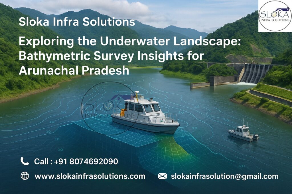
What Is a Bathymetric Survey?
A bathymetric survey is like creating a detailed map of the underwater world, much like a topographic survey does on land.Instead of charting mountains and valleys on land, it maps the contours and depths of riverbeds, reservoirs, and lakes. Using sonar technology, surveyors send acoustic signals into the water, which bounce back after hitting the bed or submerged objects. The time delay of these signals is converted into precise depth measurements, creating detailed 2D and 3D models. These models not only reveal the shape of the underwater landscape but also highlight sediment accumulation, hidden obstacles, and potential hazards.
In Arunachal Pradesh, where rivers are powerful and volatile, bathymetric surveys are critical for safe dam operations, flood forecasting, and understanding ecological changes.
Why Arunachal Pradesh Needs Bathymetric Surveys?
Arunachal Pradesh, often called the “Land of the Dawn-Lit Mountains,” is dominated by the Eastern Himalayas, dense forests, and fast-flowing rivers. Its geography makes it both water-rich and flood-prone. Here’s why bathymetric surveys are vital in this region:
1.Hydropower Management
Arunachal Pradesh is considered India’s hydropower hub, with projects on the Subansiri, Siang, Dibang, and Kameng rivers. Sedimentation reduces reservoir storage and turbine efficiency. Bathymetric surveys measure siltation levels, guide desiltation, and extend dam life.
2.Flood Mitigation and River Training
The Siang and Lohit rivers often experience sudden floods due to heavy Himalayan rainfall and glacial lake outbursts. Bathymetric data supports predictive flood models and helps design embankments and river training structures.
3.Glacial Lake Monitoring
High-altitude glacial lakes such as Shonga-tser (Madhuri Lake), Sela Lake, and Pankang Teng Tso are susceptible to overflow and outburst floods. Bathymetry maps their depth and volume, guiding early warning systems.
4.Inland Navigation and Border Connectivity
With Arunachal’s strategic location along international borders, bathymetric surveys aid feasibility studies for river-based navigation, improving connectivity for defense and civilians alike.
5.Ecosystem and Fisheries Management
Rivers like Subansiri and Kameng host rich aquatic biodiversity. Bathymetric insights help identify critical habitats, prevent overfishing, and conserve riverine ecology.

Key Water Bodies for Bathymetric Survey in Arunachal Pradesh:-
Siang River – The main tributary of the Brahmaputra, flowing turbulently with shifting beds and frequent flooding.
Subansiri River – Known for the Lower Subansiri Hydropower Project, requiring precise monitoring of sedimentation.
Lohit River – Originating from Tibet, it carries heavy silt loads, impacting downstream Assam.
Dibang River – Site of the massive Dibang Multipurpose Project, demanding detailed hydrographic mapping.
Kameng River – Supports both hydro projects and local irrigation systems.
Glacial Lakes – Sela, Pankang Teng Tso, Shonga-tser, and other alpine lakes vulnerable to climate-induced changes.
Tools Used by Bathymetric Surveyors in Arunachal Pradesh:-
1.Single-Beam Echo Sounders (SBES) – Ideal for smaller lakes and shallow rivers.
2.Multi-Beam Echo Sounders (MBES) – Generate high-resolution 3D underwater maps, essential for dam reservoirs.
3.Acoustic Doppler Current Profilers (ADCPs) – Measure flow velocity, sediment transport, and turbulence in rivers like the Siang.
4.Unmanned Surface Vehicles (USVs) – Safe for surveying deep, hazardous, or inaccessible waters.
5.GNSS & RTK GPS – Provide pinpoint spatial accuracy for integrating bathymetric data into digital maps.
6.Sound Velocity Profilers (SVPs) – Correct sonar readings in varying water conditions.
Step-by-Step Bathymetric Survey Process:-
1.Planning – Define purpose (flood risk, dam monitoring, navigation feasibility).
2.Calibration – Test sonar, GPS, and velocity profilers for accuracy.
3.Survey Execution – Use boats or USVs to follow planned transects while recording sonar returns.
4.Data Processing – Clean raw data, remove noise, and process using software like Hypack or CARIS.
5.Analysis – Generate contour maps, depth models, and volumetric calculations.
6.Reporting – Deliver GIS layers, 3D models, and actionable insights.
Sub Bottom Profilers: Peering Beneath the Riverbed
Sub Bottom Profilers (SBPs) are specialized tools that look beyond the surface bed of water bodies. Unlike standard echo sounders that measure only depth, SBPs penetrate several meters into the sediment layers below the bed. This helps reveal historical deposition, buried channels, and sub-surface geology.
In Arunachal Pradesh, SBPs are crucial because rivers like the Subansiri and Dibang bring enormous silt loads from the Himalayas. Understanding these sub-surface layers aids in predicting long-term reservoir sedimentation, identifying buried obstructions, and ensuring dam safety.
Applications in Arunachal Pradesh:
Subansiri Reservoirs: Measure sediment accumulation patterns to design dredging schedules
Dibang Basin: Study deep stratigraphy to assess seismic stability for dam foundations.
Glacial Lakes: Map buried debris beneath alpine lakes to understand past floods and future risks.
Archaeological Insights: Potential to detect submerged historical features in valleys where ancient settlements existed.
A typical SBP system includes an acoustic transmitter, hydrophone receivers, and data recorders. The low-frequency sound pulses penetrate the sediment, and reflections from different layers are recorded. Engineers then create vertical cross-sections, revealing the hidden history beneath rivers and lakes.
By pairing SBP findings with core sampling and geological data, hydrologists in Arunachal Pradesh can forecast sediment transport under changing monsoon patterns and plan sustainable water management strategies.
Side Scan Sonar: Imaging the Hidden Landscape
Side Scan Sonar (SSS) complements bathymetry by producing high-resolution acoustic images of the underwater surface. Instead of mapping depth alone, it gives a panoramic “picture” of the river or lakebed, detecting obstacles, debris, and textural details.
In Arunachal Pradesh, where rivers often carry uprooted trees, boulders, and landslide debris, SSS is invaluable. The Siang River, for example, is notorious for sudden floods and underwater obstructions that pose risks to navigation and hydropower projects.
Applications in Arunachal Pradesh:
Navigation Safety: Detect submerged logs, rocks, and debris in rivers like Lohit and Kameng.
Dam and Bridge Inspection: Monitor scouring and debris accumulation near infrastructure.
Fisheries Management: Map habitats such as submerged vegetation zones for aquatic species.
Emergency Surveys: Quickly assess underwater damage post-floods or landslides.
Side scan sonar systems use towfish or hull-mounted transducers that emit fan-shaped sound beams to the sides of the survey vessel. The returning echoes are converted into grayscale images, where lighter tones represent hard surfaces and darker tones represent soft sediments.
In mountainous Arunachal Pradesh, real-time side scan sonar imaging allows engineers and disaster teams to take immediate decisions, particularly after monsoon-induced floods. This makes it a vital technology for both development and disaster resilience.

Challenges in Conducting Bathymetric Surveys in Arunachal Pradesh
Remote Terrain: Many rivers and lakes are located in inaccessible valleys requiring airlifts or trekking.
Monsoon Variability: Extreme rainfall creates high turbidity, reducing sonar penetration.
Political Sensitivity: Rivers like Siang and Lohit originate in Tibet, making transboundary studies complex.
Environmental Fragility: High-altitude ecosystems require minimal disturbance during surveys.
Safety Hazards: Fast currents, landslides, and submerged debris pose operational risks.
Emerging Trends in Bathymetric Surveys
Drone + Bathymetry Integration: Aerial drones combine with sonar surveys for holistic mapping.
AI-Driven Sediment Analysis: Machine learning models improve silt classification and flood forecasting.
Digital Twins of Rivers: Real-time virtual replicas of rivers like Siang for monitoring changes.
Portable Sonar Kits: Enabling local communities and disaster teams to conduct rapid surveys.
Real-World Applications and Case Studies
Lower Subansiri Project: Bathymetric surveys mapped sediment accumulation, shaping reservoir desiltation strategies.
Siang Flood Studies: Multi-beam sonar and side scan sonar assessed riverbed changes after sudden floods in 2023.
Sela Lake Monitoring: Sub bottom profilers detected buried sediments, informing glacial lake outburst flood models.
Kameng Hydropower Project: Surveys revealed submerged boulders near intake zones, enabling safe turbine operations.
Benefits of Bathymetric Survey in Arunachal Pradesh
- Extends dam and reservoir life through effective sediment management.
- Improves flood risk forecasting and mitigation strategies.
- Enables safe navigation and infrastructure planning.
- Supports fisheries and biodiversity conservation.
- Provides critical data for scientific and archaeological studies.
Conclusion
The significance of Bathymetric Survey in Arunachal Pradesh lies in its ability to bridge the gap between unseen underwater landscapes and critical decision-making. In a state where rivers surge with Himalayan force, lakes hold glacial secrets, and hydropower fuels national energy goals, knowing what lies beneath the surface is non-negotiable. By embracing modern technologies—from sub bottom profilers to side scan sonar—engineers, policymakers, and environmental managers can build a safer, more sustainable future for Arunachal Pradesh.
Choosing the Top Bathymetric Survey and Surveyor in Arunachal Pradesh ensures not just data, but actionable insights that safeguard lives, strengthen infrastructure, and preserve ecosystems for generations to come.