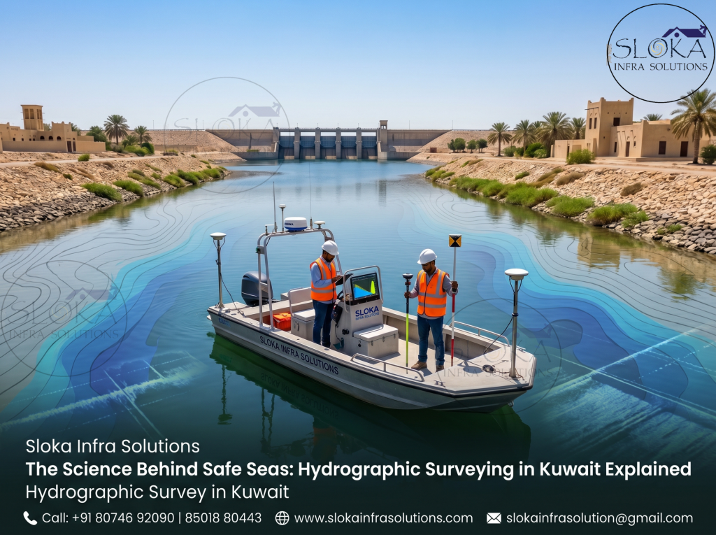
Hydrographic Survey in Kuwait
The Science Behind Safe Seas: Hydrographic Surveying in Kuwait Explained:-
Call: +91 80746 92090 | 85018 80443
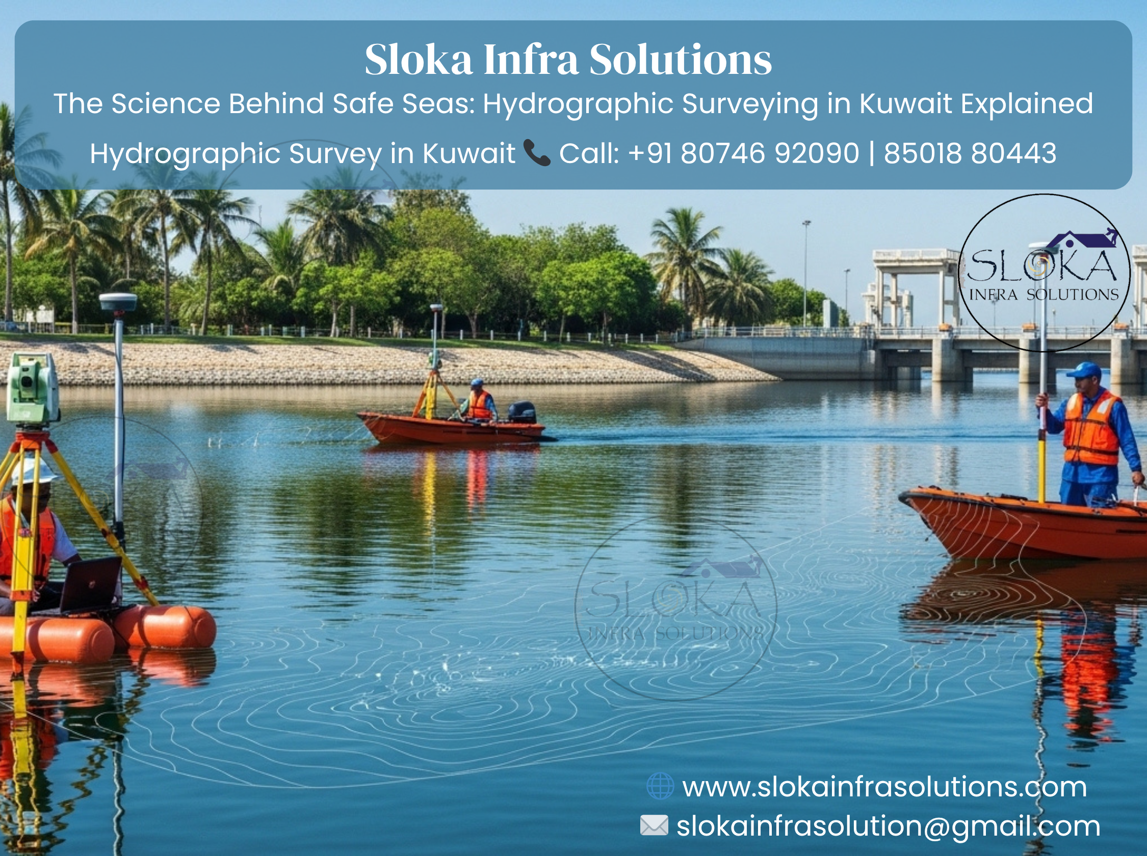
Hydrographic Survey in Kuwait plays a vital role in understanding, managing, and developing the country’s marine and coastal environments. Situated along the northwestern edge of the Arabian Gulf, Kuwait possesses a strategically important coastline, busy ports, and ecologically sensitive marine zones. From ensuring safe navigation to supporting offshore construction and environmental monitoring, hydrographic surveying serves as the backbone of maritime operations. In a region where water depth, seabed composition, and tidal variations can significantly influence economic and environmental outcomes, accurate hydrographic data becomes indispensable. With increasing investments in ports, oil terminals, desalination plants, and coastal infrastructure, the demand for high-precision marine surveys continues to grow rapidly.
Top Hydrographic Survey & Surveyors in Kuwait
Top Hydrographic Survey & Surveyors in Kuwait are known for delivering advanced, technology-driven solutions that cater to the country’s complex marine requirements. These professionals utilize cutting-edge equipment and international standards to provide precise data for navigation safety, offshore engineering, dredging operations, and coastal development. Their expertise extends across a wide range of services, including bathymetric surveys, geophysical investigations, and environmental assessments. As Kuwait continues to expand its maritime infrastructure, the role of skilled hydrographic surveyors becomes even more crucial in ensuring efficiency, safety, and sustainability across all marine projects.

Understanding Hydrographic surveying: Beyond mapping the seafloor:-
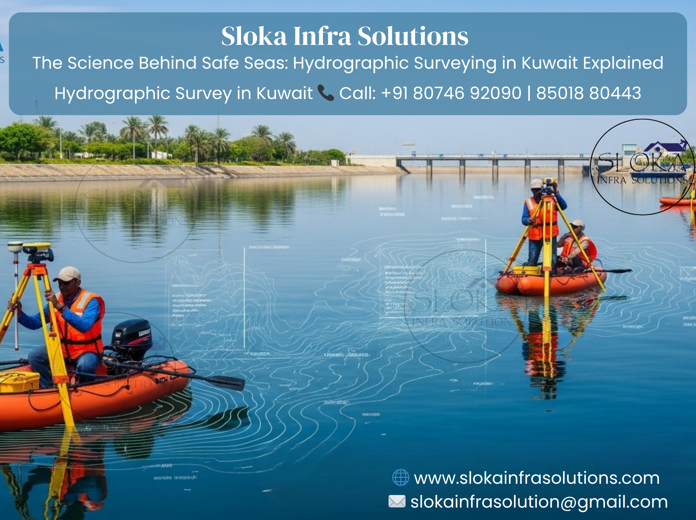
Hydrographic surveying is the science of measuring and describing the physical features of water bodies and adjacent coastal areas. In Kuwait, this discipline is particularly important due to its shallow coastal waters, extensive oil export terminals, and rapidly developing maritime infrastructure.
Kuwait’s coastline stretches approximately 500 kilometers, including mainland shores and several islands such as Failaka, Bubiyan, and Warbah. The northern Gulf region near Kuwait is characterized by silty seabeds, low tidal ranges, and sediment deposition from rivers like the Shatt al-Arab. These factors create constant changes in seabed morphology, making frequent hydrographic surveys essential.
The country relies heavily on maritime trade and oil exports. Ports such as Shuwaikh Port, Shuaiba Port, and Mubarak Al Kabeer Port require regular monitoring to maintain navigable depths. Without hydrographic surveys, shipping lanes could become hazardous due to sedimentation, underwater obstructions, or shifting sandbanks.
Where Hydrographic Surveys make an impact across Kuwait?
Hydrographic surveys in Kuwait are not just about mapping water depths—they support a wide range of critical activities:
1. Safe Navigation
Accurate charts ensure vessels can safely enter and exit ports without grounding. Given Kuwait’s shallow waters, even minor depth variations can pose risks.
2. Port Development & Maintenance
Ports require continuous dredging and monitoring. Surveys help determine sediment accumulation and guide dredging operations efficiently.
3. Offshore Oil & Gas Operations
Kuwait’s offshore oil infrastructure depends on precise seabed data for pipeline routing, platform installation, and maintenance.
4. Coastal Protection
Hydrographic data helps in designing coastal defenses against erosion and sea-level rise.
5. Environmental Monitoring
Surveys assist in studying marine ecosystems, sediment transport, and pollution impacts.
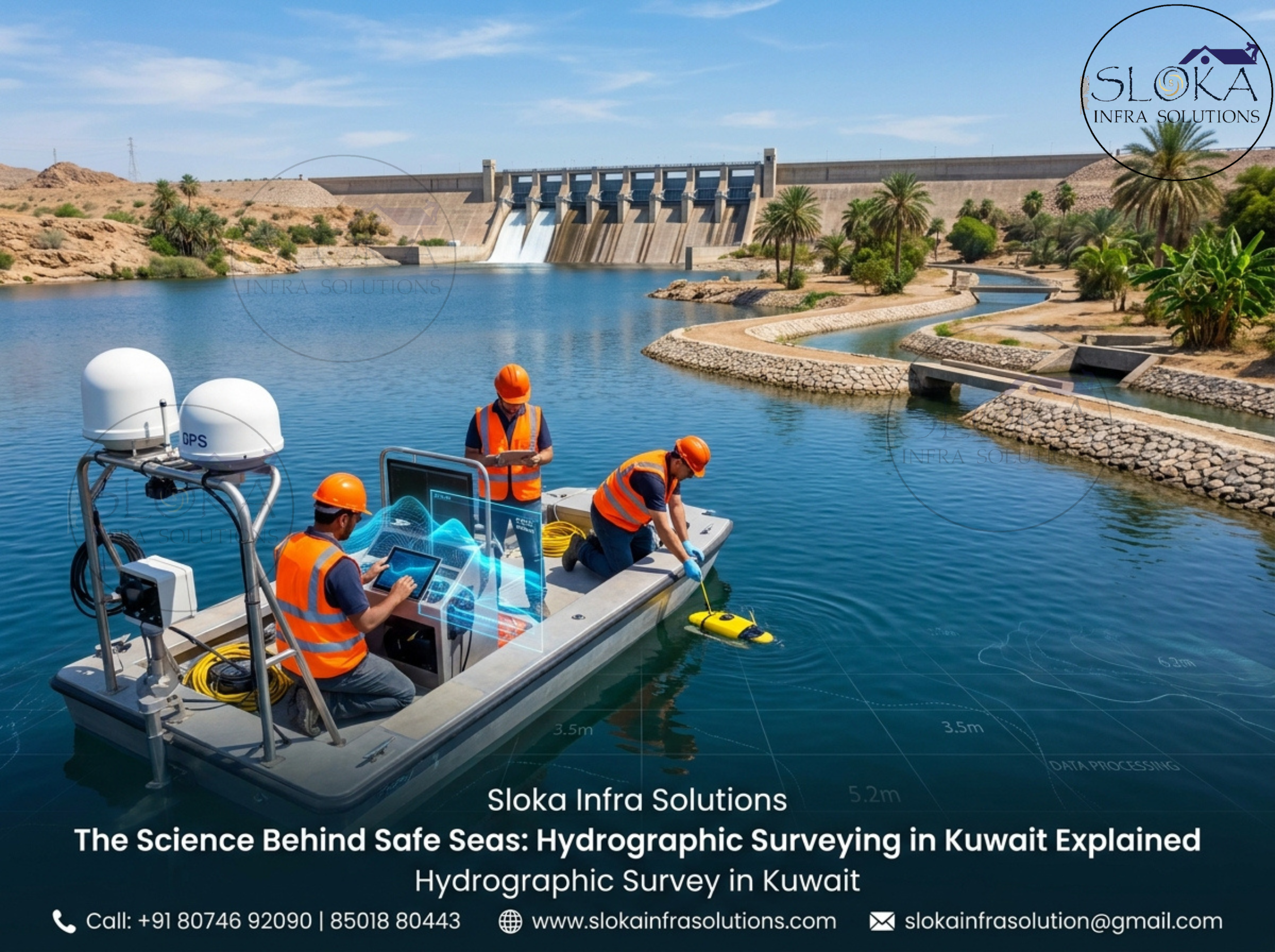
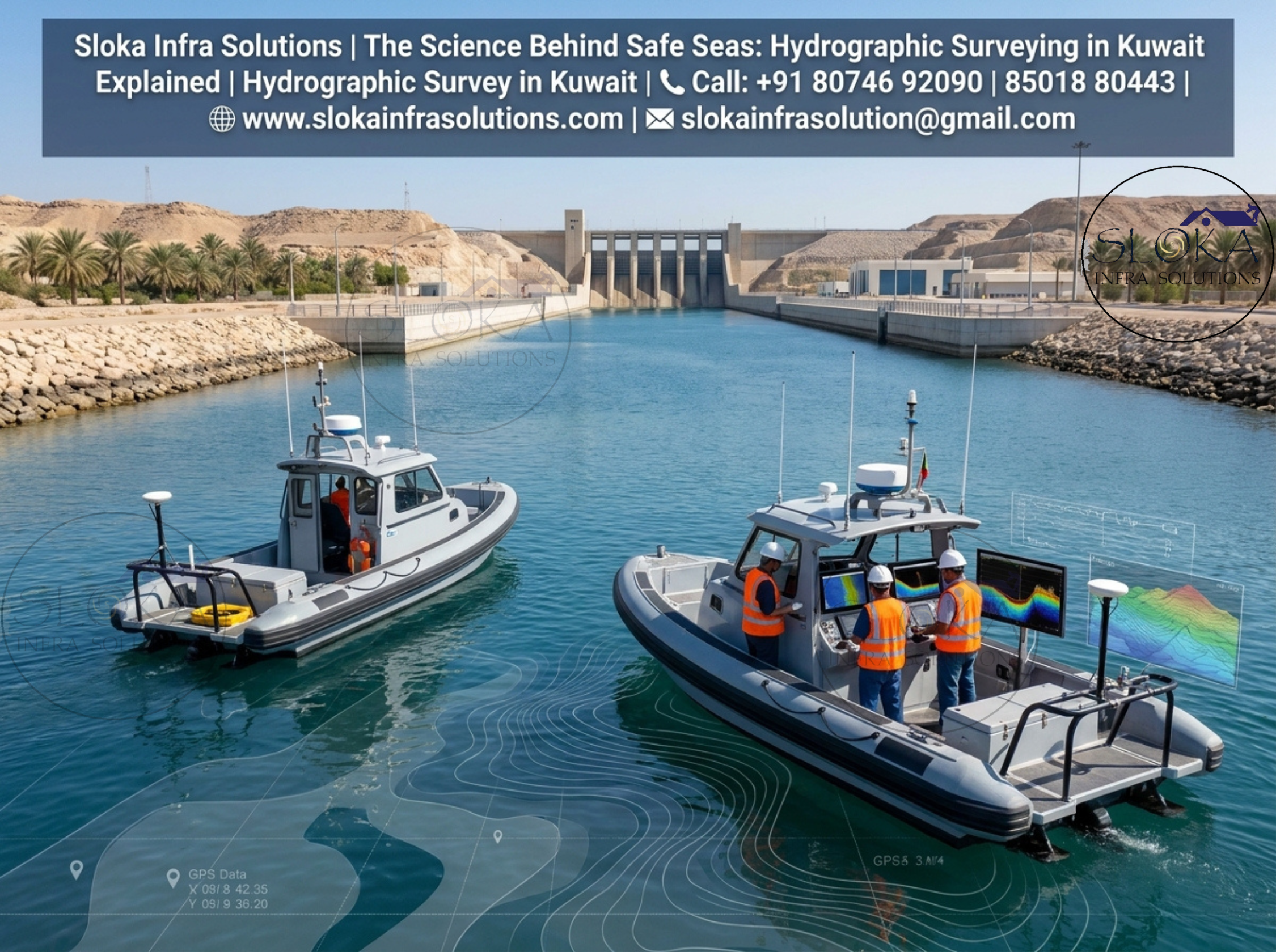
Modern tech behind accurate Hydrographic mapping:-
Modern hydrographic surveys in Kuwait use advanced equipment and techniques to collect high-resolution data:
- Echo sounders (single beam and multibeam)
- Side scan sonar systems
- Acoustic Doppler Current Profilers (ADCP)
- Sub-bottom profilers
- GPS and GNSS positioning systems
- Remote sensing and satellite imagery
Each technology serves a specific purpose, contributing to a comprehensive understanding of underwater environments.
ADCP Survey (Acoustic Doppler Current Profiler):-
ADCP Survey is an essential component of hydrographic operations in Kuwait, particularly for understanding water movement patterns in the Arabian Gulf. This technology measures the speed and direction of water currents at various depths using sound waves based on the Doppler effect.
In Kuwait’s marine environment, currents are influenced by tidal movements, wind patterns, and regional circulation. ADCP surveys help in capturing these dynamics accurately, which is crucial for multiple applications.
One of the primary uses of ADCP surveys is in port and harbor management. Understanding current behavior helps in designing safer navigation routes and improving docking operations. Strong or unpredictable currents can affect vessel maneuverability, especially in confined port areas.
In offshore oil and gas operations, ADCP data is vital for planning pipeline installations and platform stability. Engineers rely on current profiles to assess potential risks and design structures that can withstand marine forces.
Environmental studies also benefit significantly from ADCP surveys. By analyzing water movement, researchers can predict sediment transport, pollutant dispersion, and nutrient distribution in the marine ecosystem.
In Kuwait, where shallow waters dominate, ADCP surveys are often conducted using vessel-mounted or bottom-mounted instruments. These surveys provide real-time data and long-term monitoring capabilities, making them indispensable for both engineering and environmental applications.
Side Scan Sonar: Revealing the seabed in detail:-
Side Scan Sonar is widely used in hydrographic surveys across Kuwait to create detailed images of the seabed. Unlike traditional depth-measuring equipment`s, side scan sonar focuses on capturing the texture and features of the seabed rather than just depth.
This technology works by emitting sound pulses sideways from a towed or mounted device. The reflected signals are used to generate high-resolution images, revealing objects, seabed structures, and anomalies.
In Kuwait’s waters, side scan sonar is particularly useful due to the presence of soft sediments and potential underwater hazards. It helps identify:
- Shipwrecks and debris
- Pipeline routes
- Seabed features like sand waves and ripples
- Obstructions that may affect navigation
For port authorities, side scan sonar plays a key role in ensuring safe navigation channels. It helps detect any new obstructions that may have appeared due to sediment movement or human activities.
In offshore projects, this technology assists in route surveys for pipelines and cables. Engineers can identify suitable paths that avoid obstacles and unstable seabed conditions.
Side scan sonar is also used in environmental monitoring. It helps map habitats such as coral patches or seabed vegetation, contributing to marine conservation efforts.
In Kuwait, side scan sonar surveys are often combined with other techniques like multibeam echo sounding to provide a comprehensive view of the seabed.
Sub Bottom Profilers: Exploring Beneath the Seafloor:-
Sub Bottom Profilers are specialized equipment`s used to study the layers beneath the seabed surface. In Kuwait, where sedimentation is a major factor influencing marine conditions, this technology is extremely valuable.
Unlike sonar systems that only capture surface features, sub-bottom profilers penetrate the seabed using low-frequency sound waves. These waves reflect off different sediment layers, allowing surveyors to visualize subsurface structures.
This capability is crucial for offshore construction projects. Before installing pipelines, cables, or platforms, engineers need to understand the composition and stability of the seabed. Sub-bottom profiling helps identify:
- Sediment layers
- Buried objects
- Geological formations
- Potential hazards like gas pockets
In Kuwait’s northern Gulf region, sediment deposition from rivers creates complex subsurface conditions. Sub-bottom profiling helps in analyzing these layers, ensuring safe and efficient project execution.
Another important application is in dredging operations. By understanding sediment thickness and composition, authorities can plan dredging activities more effectively, minimizing costs and environmental impact.
Sub-bottom profilers also contribute to archaeological studies. They can detect buried artifacts or ancient structures, offering insights into historical maritime activity in the region.
Overall, this technology enhances the depth and quality of hydrographic data, making it a critical tool in Kuwait’s marine surveys.
Single Beam Echo Sounder Survey: Precision in simplicity:-
Single Beam Echo Sounder Survey is one of the most traditional and widely used methods in hydrographic surveying, including in Kuwait. This technique measures water depth directly beneath a survey vessel using a single acoustic beam.
The system works by emitting a sound pulse vertically downward. The time taken for the pulse to travel to the seabed and return is used to calculate depth. Despite being a relatively simple method, it remains highly effective for many applications.
In Kuwait, single beam surveys are commonly used for:
- Preliminary surveys
- Small-scale projects
- Inland and shallow water studies
- Monitoring dredging activities
One of the main advantages of this method is its cost-effectiveness. It requires less complex equipment compared to multibeam systems, making it suitable for routine surveys and smaller operations.
However, single beam surveys provide limited coverage since they only measure depth along a single line beneath the vessel. To achieve comprehensive coverage, multiple survey lines must be conducted, which can be time-consuming.
In Kuwait’s shallow coastal waters, single beam echo sounders are particularly useful for quick assessments and maintenance surveys. They help identify depth changes and ensure navigation safety in frequently used channels.
While newer technologies offer more detailed data, single beam surveys remain a reliable and essential tool in hydrographic operations.
Multibeam Echo Sounder Survey: Comprehensive Seafloor Mapping:-
Multibeam Echo Sounder Survey represents a significant advancement in hydrographic surveying technology and is widely used in Kuwait for detailed seabed mapping. Unlike single beam systems, multibeam echo sounders emit multiple sound beams simultaneously, covering a wide area of the seabed.
This technology provides high-resolution, three-dimensional maps of underwater terrain, making it ideal for complex and large-scale projects.
In Kuwait, multibeam surveys are extensively used for:
- Port and harbor development
- Offshore oil and gas projects
- Pipeline and cable route surveys
- Coastal engineering studies
Capturing precise bathymetric data empowers engineers and planners to make smarter, well-informed decisions. It reveals critical seabed features like channels, slopes, and potential hazards with impressive accuracy, ensuring safer and more efficient project execution.
Multibeam surveys are particularly valuable in Kuwait’s dynamic marine environment, where sediment movement can alter seabed conditions rapidly. Regular surveys ensure that updated and accurate data is available for navigation and development.
Another advantage of multibeam systems is their efficiency. They cover large areas in less time compared to single beam surveys, reducing operational costs and project timelines.
The data collected is often integrated with other survey results, such as side scan sonar and sub-bottom profiling, to create a comprehensive understanding of the marine environment.
Challenges in Hydrographic Surveying in Kuwait
Hydrographic surveying in Kuwait comes with its own set of challenges:
Shallow Waters
Large areas of Kuwait’s coastline are shallow, making navigation for survey vessels difficult.
Sedimentation
Continuous sediment deposition alters seabed conditions, requiring frequent surveys.
Extreme Weather
High temperatures and occasional dust storms can impact survey operations.
Heavy Maritime Traffic
Busy shipping routes demand careful planning to avoid disruptions.
Environmental Sensitivity
Surveys must be conducted responsibly to protect marine ecosystems.
The evolving landscape of Hydrographic Surveys in Kuwait:-
The future of hydrographic surveying in Kuwait is driven by technological innovation and increasing demand for accurate marine data. Emerging trends include:
- Use of autonomous and unmanned survey vessels
- Integration of AI and data analytics
- Real-time data processing and visualization
- Enhanced environmental monitoring techniques
As Kuwait continues to invest in maritime infrastructure and offshore energy projects, the importance of hydrographic surveys will only grow.
Closing Insights:-
Hydrographic Survey in Kuwait is a cornerstone of the nation’s maritime safety, economic growth, and environmental sustainability. From supporting navigation and port operations to enabling offshore development and scientific research, hydrographic surveys provide the data needed to understand and manage Kuwait’s marine environment effectively.
With advanced technologies like ADCP, side scan sonar, sub-bottom profilers, and multibeam systems, surveyors in Kuwait are equipped to handle complex challenges and deliver precise results. As the country moves toward further development and modernization, hydrographic surveying will remain an essential tool in shaping its maritime future.
Top Hydrographic Survey & Surveyors in Kuwait continue to play a vital role in this progress, ensuring that every marine project is built on a foundation of accurate and reliable data.