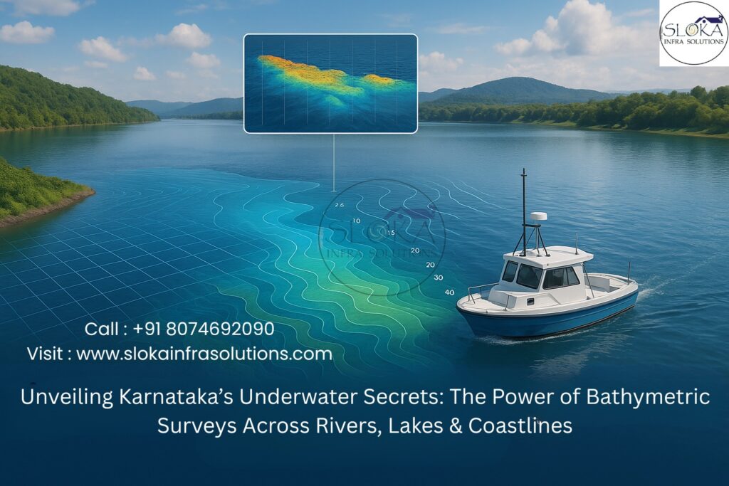
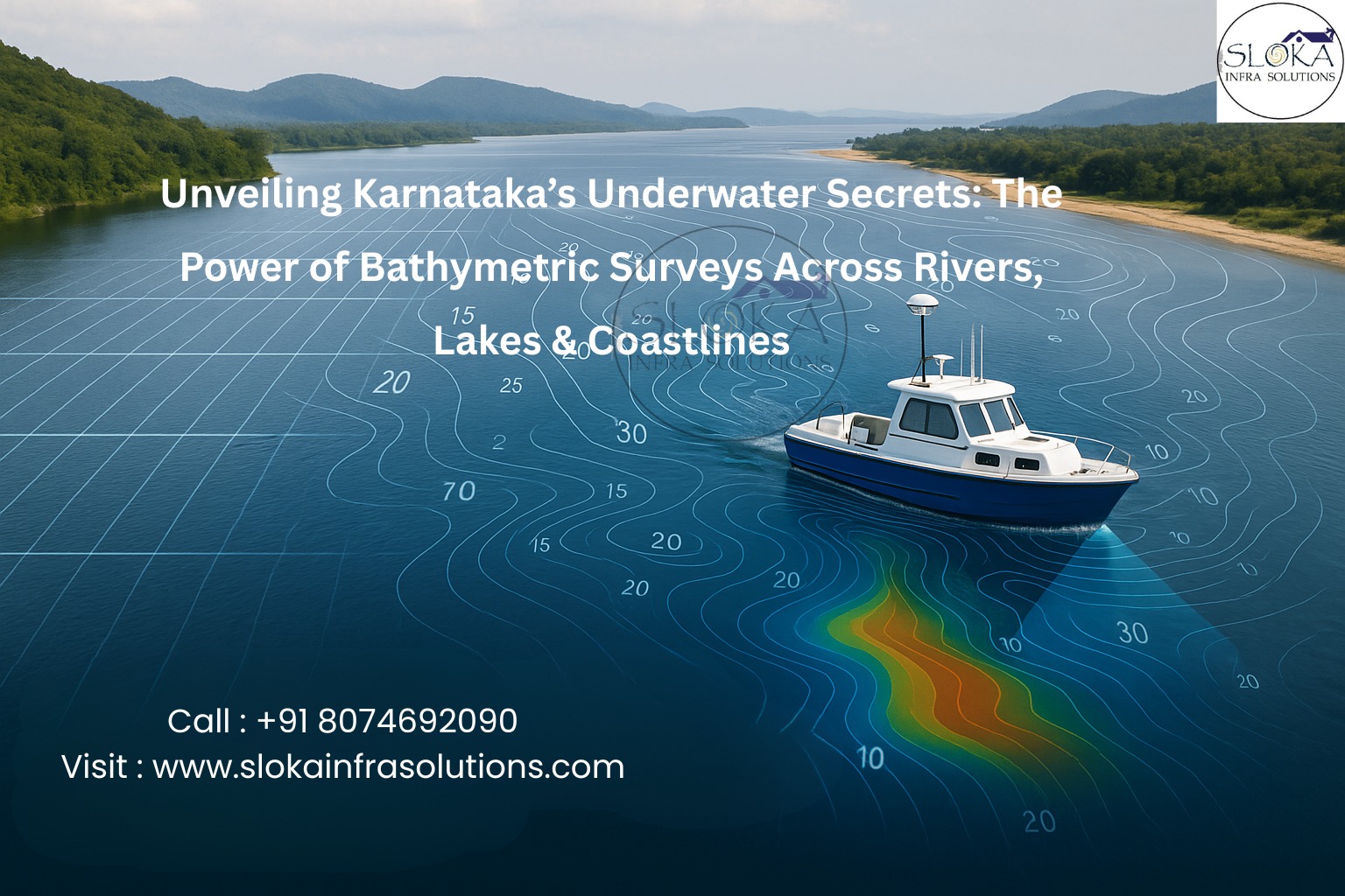
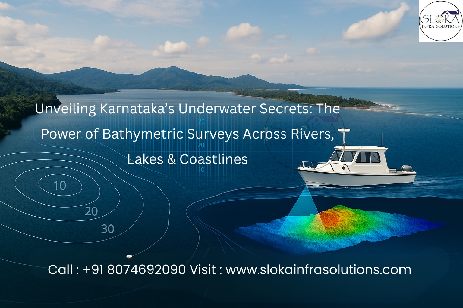
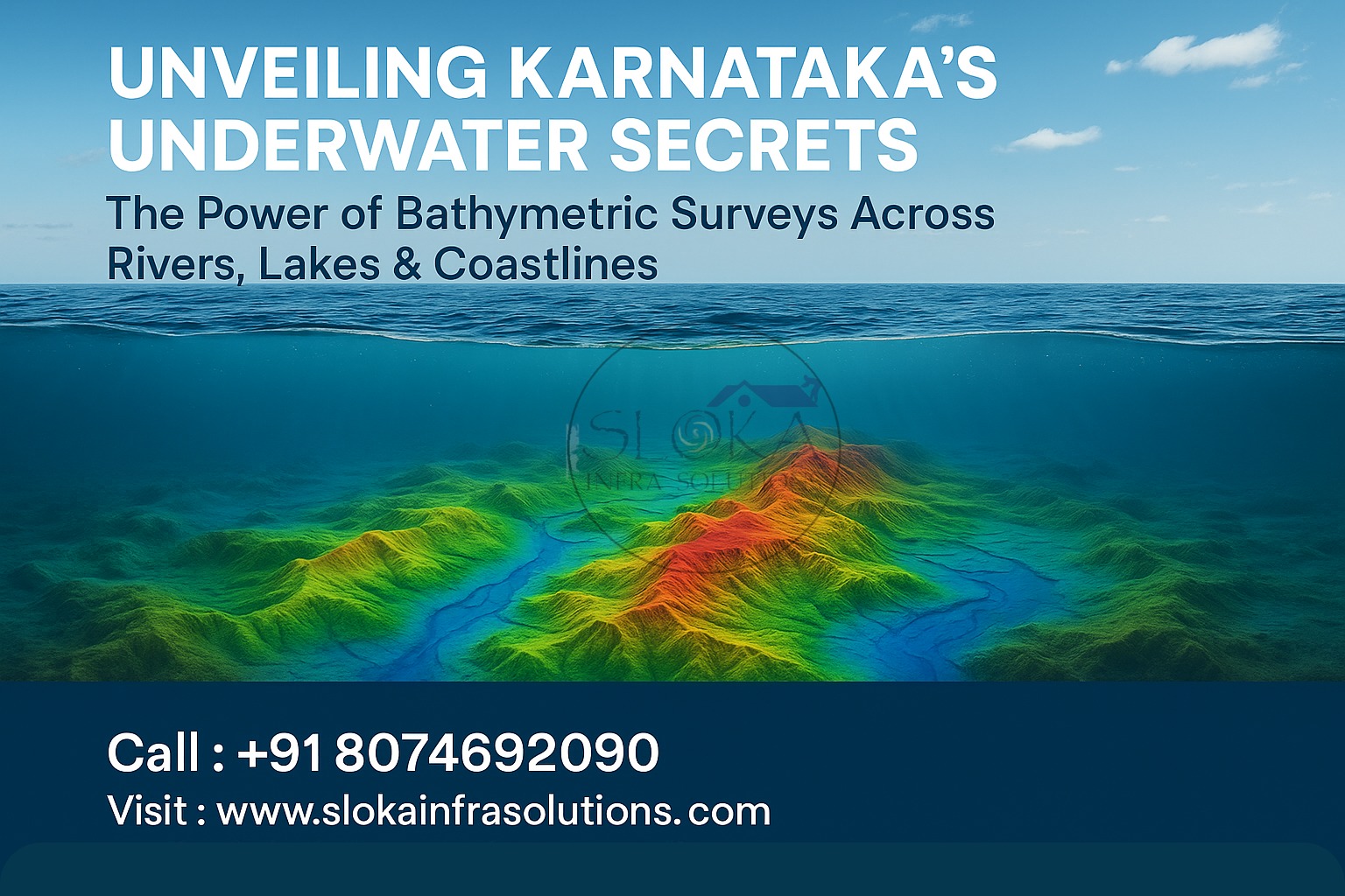
Unveiling Karnataka’s Underwater Secrets: The Power of Bathymetric Surveys Across Rivers, Lakes & Coastlines
Bathymetric Survey in Karnataka: Revealing the Hidden Landscapes Beneath Karnataka’s Waters
Call: 80746 92090
Bathymetric Survey in Karnataka
Karnataka, renowned for its vibrant cultural legacy and varied terrain, also features a remarkably diverse and dynamic network of water bodies. From the vast Arabian Sea coastlines to deep inland reservoirs and fast-flowing rivers, Karnataka’s aquatic geography is a treasure trove of untapped potential. Bathymetric Survey in Karnataka plays a crucial role in mapping and understanding these underwater terrains, offering data essential for coastal planning, flood management, infrastructure development, environmental conservation, and more.
Top Bathymetric Survey and Surveyor in Karnataka: Empowering Infrastructure, Ecology, and Safety with Underwater Intelligence
Top Bathymetric Survey and Surveyor in Karnataka
Top Bathymetric Survey and Surveyor in Karnataka use advanced technology—ranging from multi-beam echo sounders and ADCPs to LiDAR and USVs—to measure and visualize the underwater topography of Karnataka’s vast network of lakes, rivers, dams, and coastal zones. These professionals offer essential services for dam authorities, port managers, environmental researchers, and disaster management planners. Their precision and region-specific expertise ensure that each survey contributes meaningfully to both sustainable development and disaster resilience.
What is a Bathymetric Survey?
A bathymetric survey is essentially an underwater topographic survey that maps the depth and shape of submerged terrains in oceans, rivers, lakes, and reservoirs. Think of it as the “Google Maps” of the underwater world—it reveals everything from depth gradients and slopes to sediment accumulation zones and hidden underwater structures.
These surveys help generate Digital Terrain Models (DTMs), 3D seabed maps, contour profiles, and hydrographic charts. The insights they provide are critical for navigation safety, sedimentation management, urban drainage planning, fisheries, dam desilting, environmental protection, and scientific research.
Key Techniques & Tools in Bathymetric Surveying
Modern surveyors employ a blend of advanced technologies to achieve precise and thorough mapping of Karnataka’s aquatic landscapes:
1. Single-Beam Echo Sounder (SBES)
Used primarily for shallow water bodies like Hebbal Lake and Sankey Tank in Bengaluru, SBES offers vertical depth readings at specific points.
2. Multi-Beam Echo Sounder (MBES)
This technology is preferred for wide and complex water bodies like the Arabian Sea near Karwar or reservoirs like Tungabhadra. MBES covers broad swathes in a single pass, producing detailed 3D maps.
3. Acoustic Doppler Current Profiler (ADCP)
Deployed in dynamic river systems like the Sharavathi and Krishna, ADCPs measure flow velocity, turbulence, and sediment movement, aiding in hydrodynamic modeling.
4. LiDAR (Light Detection and Ranging)
Airborne LiDAR is highly effective in mapping shallow or intertidal zones such as the Aghanashini estuary or coastal wetlands in Udupi.
5. Unmanned Surface Vehicles (USVs)
These remotely controlled or autonomous boats fitted with sonar systems are invaluable in dangerous or inaccessible terrains, like flood-hit zones or silted dam inlets.
Why Karnataka Needs Bathymetric Surveys
Karnataka is home to a coastline stretching over 300 km, more than 20 major reservoirs, countless lakes, and a significant number of rivers originating from the Western Ghats. The region’s dependency on water for agriculture, drinking water, energy, and biodiversity makes understanding its aquatic landscapes crucial.
Key Drivers for Bathymetric Surveys in Karnataka:
- Tracking silt accumulation in major reservoirs such as Almatti, Supa, and Tungabhadra.
- Maintaining and expanding inland waterways and ports
- Flood risk modeling in districts like Belagavi and Raichur
- Assessing hydropower potential in hilly terrains
- Coastal erosion monitoring and mitigation
- Ecological conservation in riverine and estuarine ecosystems
Applications of Bathymetric Surveys in Karnataka
1. Dam and Reservoir Management
Karnataka is home to key reservoirs including Krishna Raja Sagara (KRS), Tungabhadra, and Almatti, which play a crucial role in supplying water for both irrigation and domestic use. Over time, sediment accumulation reduces their storage capacity, impacting water availability.
Bathymetric surveys help:
- Quantify sediment volumes and their distribution
- Plan desilting operations effectively
- Maintain optimal storage for agriculture and power
Case Example: A bathymetric survey at the Supa Dam in Uttara Kannada revealed over 25% sedimentation in key catchment areas, prompting urgent dredging operations and reshaping water release plans.
2. River and Floodplain Mapping
Seasonal flooding is a common occurrence in rivers such as the Kabini, Sharavathi, Malaprabha, and Bhima. Their flow dynamics shift significantly during monsoon months.
Surveys assist in:
- Modeling riverbed profiles for flood prediction
- Identifying overflow zones and designing embankments
- Supporting dam operation strategies during heavy rains
During the 2019 Karnataka floods, real-time bathymetric data combined with rainfall records was used to manage the release schedule at Linganamakki Dam, preventing catastrophic downstream flooding.
3. Coastal and Port Infrastructure
Karwar Port, the state’s major seaport, and upcoming fisheries harbors in places like Malpe and Tadadi depend heavily on bathymetric assessments to ensure operational safety and expansion.
Surveys support:
- Dredging and navigation safety
- Harbor expansion planning
- Coastal erosion monitoring
Karwar Port undergoes routine MBES surveys to track siltation trends and ensure safe passage for cargo and naval vessels.
4. Urban Water Body Restoration
Urban lakes like Bellandur, Varthur, and Ulsoor in Bengaluru are under threat from pollution and sedimentation.
Bathymetric surveys enable:
- Restoration planning through depth analysis
- Identifying silt zones for targeted dredging
- Enhancing stormwater drainage and rainwater harvesting
Recent revival efforts at Ulsoor Lake included a bathymetric survey that revealed up to 40% depth loss due to sludge and solid waste accumulation.
5. Environmental & Biodiversity Monitoring
Karnataka’s aquatic biodiversity is rich, with regions like the Kali River basin and the Aghanashini estuary hosting diverse flora and fauna.
Surveys contribute by:
- Mapping aquatic vegetation and benthic habitats
- Monitoring sedimentation that affects fish spawning grounds
- Assisting in eco-tourism planning
The Aghanashini estuary, a biodiversity hotspot, benefits from LiDAR and MBES studies that guide mangrove conservation and sustainable tourism routes.
6. Inland Waterways and Navigation
With an expanding focus on eco-friendly cargo movement, Karnataka is exploring inland navigation possibilities via the Krishna, Tungabhadra, and Ghataprabha rivers.
Bathymetric data helps:
- Assess navigable depth for barges and boats
- Identify bottlenecks and shallow patches
- Support river route development under the National Waterways initiative
Key Water Bodies Benefiting from Bathymetric Surveys in Karnataka
Here’s a quick look at major lakes, rivers, and reservoirs that benefit from continuous underwater mapping:
Coastal Waters
Karwar to Mangalore: Key for fisheries, naval zones, and shipping lanes
Belekeri, Tadadi, Malpe: key minor ports currently undergoing significant development.
Major Rivers :Krishna, Tungabhadra, Kabini, Sharavathi, Malaprabha, Hemavati, Ghataprabha
Dams & Reservoirs: Includes Krishna Raja Sagara (KRS), Almatti, Supa, Narayanpur, Linganamakki, and Varahi.
Lakes: Bellandur, Ulsoor, Sankey Tank, Hebbal, Hirekolale, Tannirbavi
Bathymetric Survey Workflow
1. Project Planning
- Identify purpose: flood management, restoration, dredging
- Select appropriate technology based on water body size and depth
2. Survey Design
- Develop grid and transect layouts
- Define GPS control and tide benchmarks
3. Data Collection
- Deploy sonar, LiDAR, or ADCP via boats or drones
- Record depth, sediment profile, and flow data
4. Data Processing
- Apply tidal corrections
- Filter noise and anomalies
- Generate DTMs and 3D bathymetric models
5. Reporting
- Create maps, volume estimates, and geo-referenced layers
- Provide practical insights through interactive maps and GIS-based dashboards.
Unique Challenges in Karnataka
Sedimentation Rates
Intense monsoon rains combined with deforestation lead to rapid silt buildup, particularly in reservoirs such as Narayanpur and Linganamakki.
Vegetative Obstructions
Lakes like Bellandur are choked with water hyacinth, which interferes with sonar signals.
Ecological Sensitivities
Estuaries like Aghanashini and riverine islands in Sharavathi require careful mapping to avoid ecological disturbance.
CRZ and Regulatory Barriers
Coastal surveys require strict compliance with CRZ norms, especially near nesting grounds and biodiversity zones.
GIS Integration and Future Technologies
Geographic Information Systems (GIS)
Integrating bathymetric data into GIS platforms allows:
- Overlays with rainfall and land use data
- Real-time flood modeling
- Shoreline change detection
- Catchment sediment budgeting
Emerging Technologies
- AUVs for deep and offshore bathymetry
- Drone-based sonar units for inaccessible urban lakes
- Machine learning for sediment classification and prediction
- Cloud-based platforms for real-time collaborative mapping
Real-World Case Highlights
Karwar Naval Port Expansion
MBES data was used to model seabed conditions for secure docking zones and dredging paths. The data revealed unexpected rocky outcrops which were later avoided in the final design.
Tungabhadra Reservoir Monitoring
Seasonal surveys showed fluctuating sediment zones that helped modify water release strategies for irrigation.
Flood Mitigation in Raichur
During heavy monsoons, bathymetric maps of Krishna and Bhima rivers helped authorities model flood zones and pre-emptively evacuate low-lying regions.
Eco-Restoration of Hebbal Lake
Biological studies were integrated with bathymetric surveys to plan eco-friendly lake deepening and create zones that support biodiversity.
Conclusion
From preserving aquatic ecosystems to strengthening Karnataka’s infrastructure backbone, Bathymetric Survey in Karnataka stands at the crossroads of development, sustainability, and disaster resilience. These surveys are not just technical procedures—they are tools that empower state agencies, researchers, conservationists, and engineers to make smarter, data-driven decisions.
By choosing the Top Bathymetric Survey and Surveyor in Karnataka, stakeholders gain not only access to accurate underwater maps but also deep regional expertise and actionable insights. As Karnataka continues to evolve amidst urban growth, climate change, and ecological pressure, understanding what lies beneath the surface is more vital than ever.
Underneath every ripple lies a story—one that bathymetric surveys are ready to unveil.