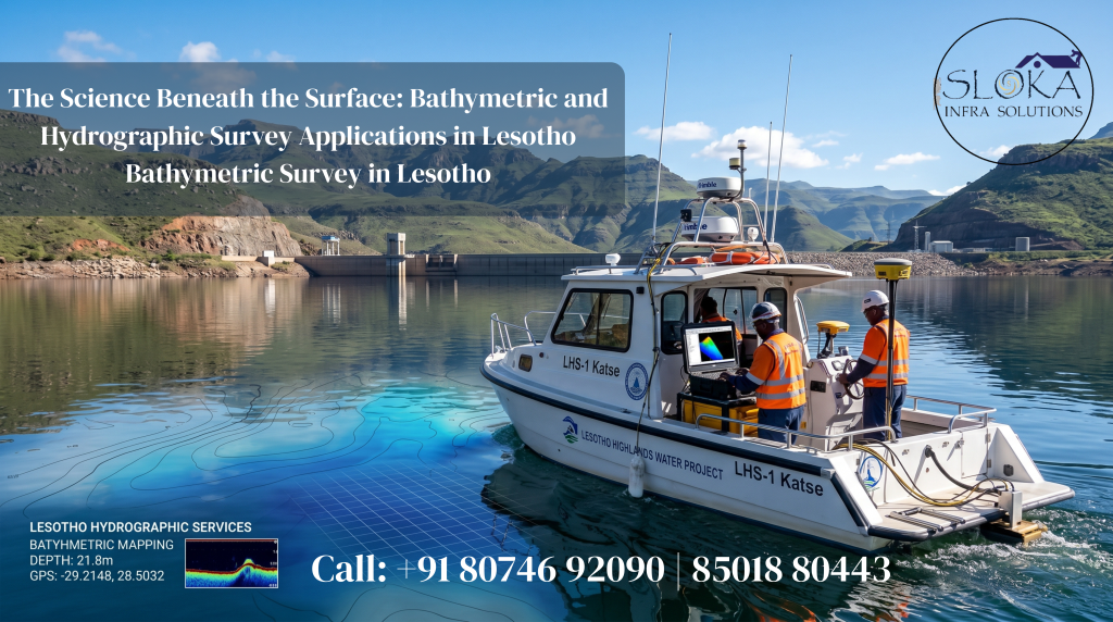
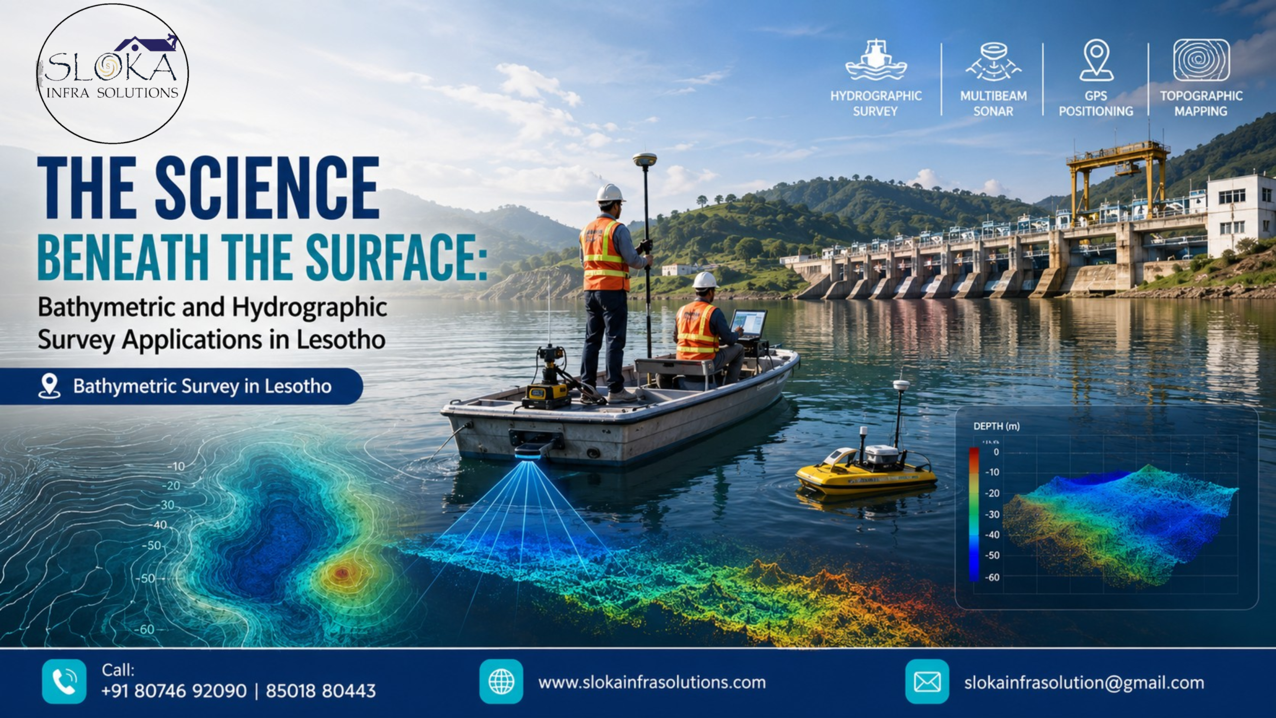
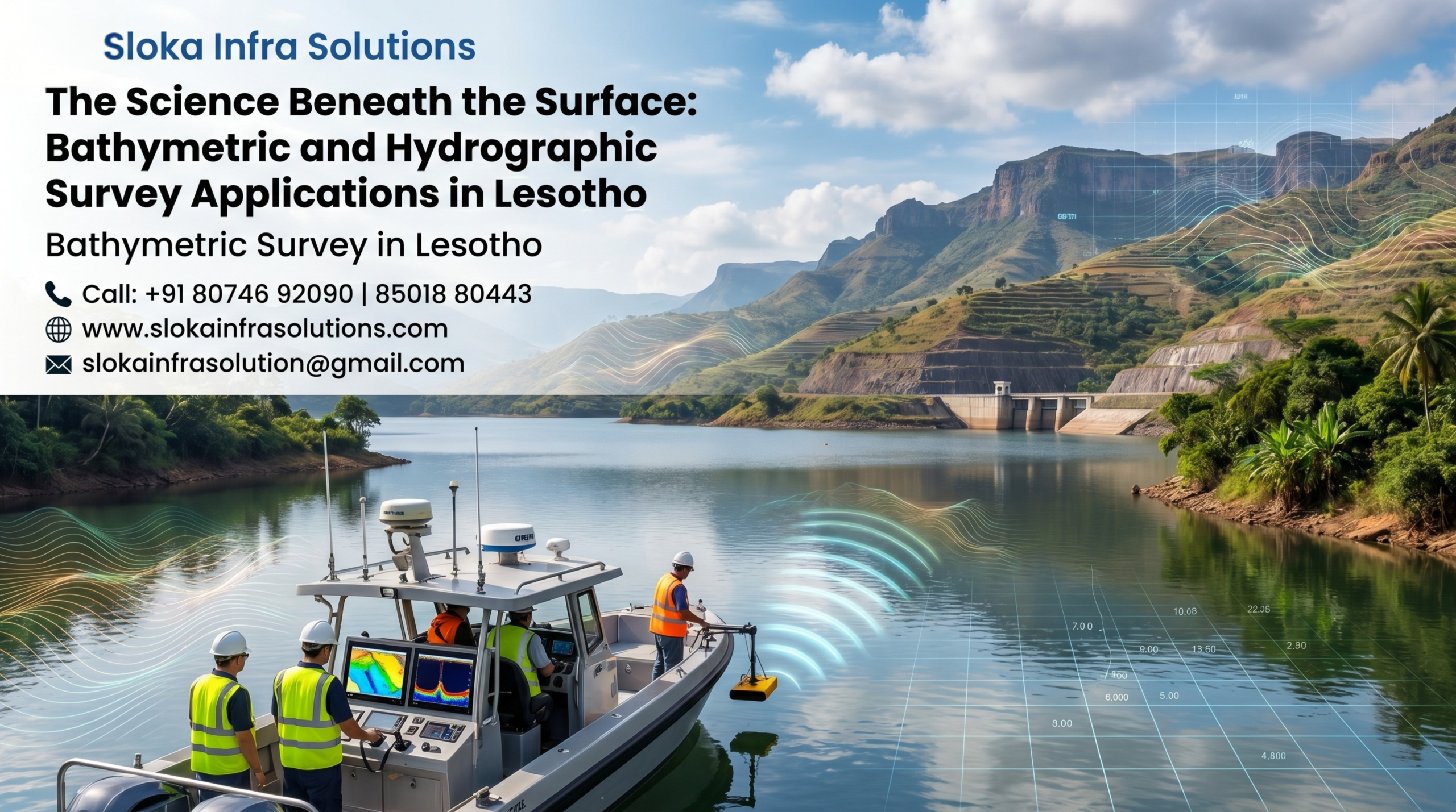
Bathymetric Survey in Lesotho
The Science Beneath the Surface: Bathymetric and Hydrographic Survey Applications in Lesotho
Call: +91 80746 92090
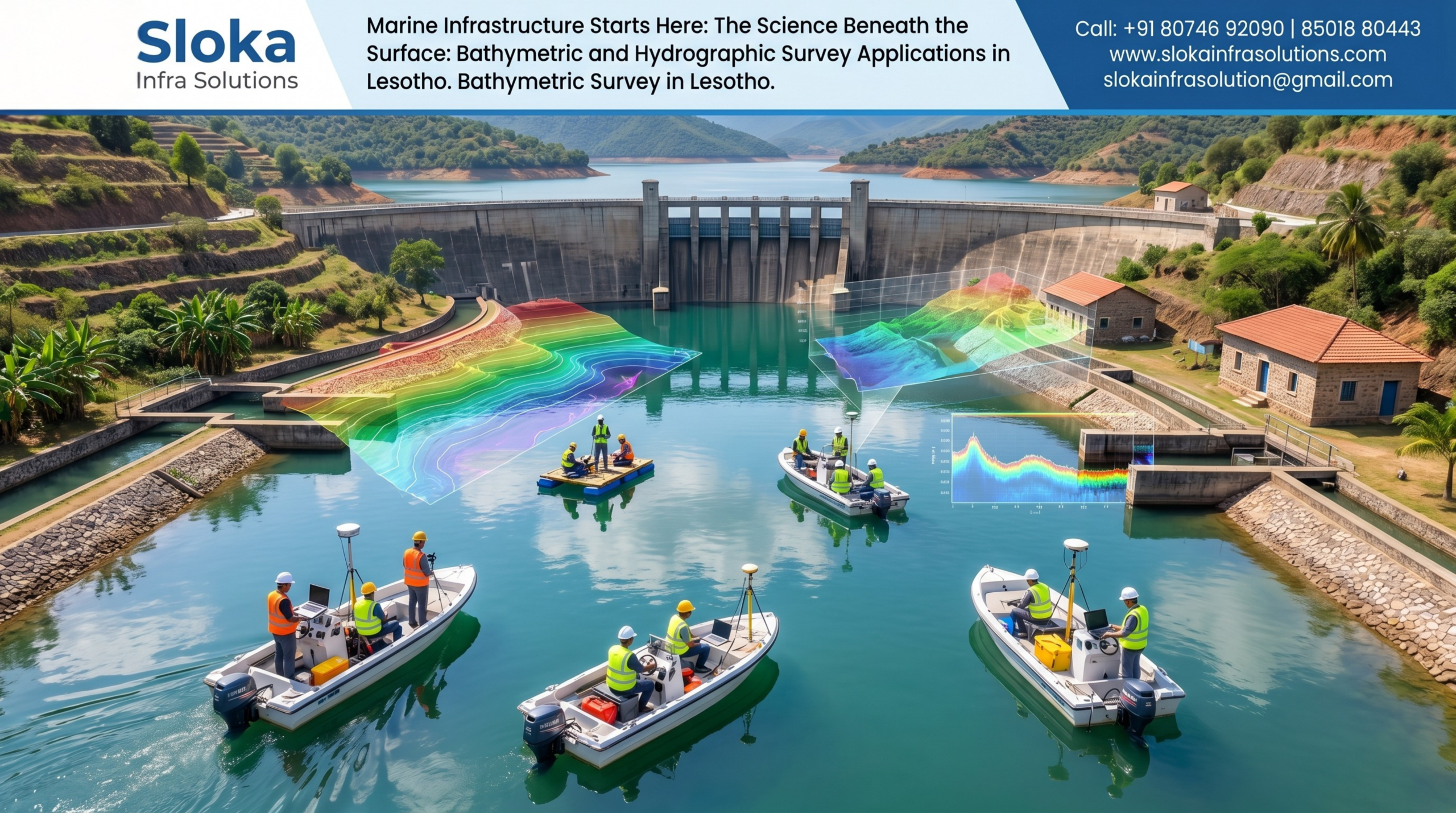
Bathymetric Survey in Lesotho plays a critical role in understanding the underwater characteristics of the nation’s rivers, reservoirs, dams, and water infrastructure systems that support economic development, environmental sustainability, and water resource management. As one of Africa’s most unique countries, Lesotho is entirely landlocked and situated at a high elevation, earning the title “Kingdom in the Sky.” Its mountainous landscape, extensive river systems, and strategically important reservoirs make underwater mapping an essential activity for government agencies, engineers, environmental scientists, and infrastructure developers.
Hydrographic Survey in Lesotho
Hydrographic Survey in Lesotho is equally important for collecting accurate information about water depths, underwater terrain, sediment accumulation, flow characteristics, and submerged features within rivers and reservoirs. The country’s growing dependence on water-related infrastructure, including dams associated with the Lesotho Highlands Water Project, requires precise hydrographic data to support maintenance, expansion, environmental assessments, and long-term planning. By understanding underwater conditions, stakeholders can make informed decisions that improve safety, efficiency, and sustainability.
Lesotho’s Water Resources: A National Asset:-
Although Lesotho is relatively small in size, it possesses some of Southern Africa’s most significant freshwater resources. The country forms the source region for the Senqu River, which eventually becomes the Orange River, one of the most important river systems in Southern Africa.
Several major water bodies influence the need for detailed underwater investigations, including:
- Katse Dam Reservoir
- Mohale Reservoir
- Polihali Dam development areas
- Senqu River
- Malibamat’so River
- Matsoku River
- Makhaleng River
- Quthing River
- Numerous mountain streams and catchment reservoirs
These water resources support hydropower generation, water transfer projects, agriculture, environmental conservation, and domestic consumption. Accurate underwater mapping enables authorities to monitor these assets effectively and ensure long-term operational efficiency.
Why Bathymetric and Hydrographic Surveys are Essential in Lesotho?
Water stands among Lesotho’s most important natural assets. With increasing demand for water management, hydropower production, dam maintenance, and environmental protection, detailed underwater data has become more important than ever.
Bathymetric and hydrographic surveys help stakeholders:
- Measure reservoir storage capacity
- Monitor sedimentation levels
- Assess dam safety
- Plan dredging activities
- Study river morphology
- Support hydrological modeling
- Improve flood risk management
- Monitor environmental changes
- Assist engineering and construction projects
- Enhance water resource planning
The mountainous terrain of Lesotho presents unique challenges. Rivers often flow through steep valleys, while reservoirs can experience sediment accumulation over time. Modern survey technologies provide accurate data that cannot be obtained through visual inspection alone.
Guiding Future Infrastructure Development with Precision Hydrographic Insights:-
The country’s extensive water transfer and hydropower systems require continuous monitoring. Reservoirs gradually lose storage volume due to sediment deposition, while river channels can change because of seasonal flow variations.
Survey data is commonly used for:
Reservoir Capacity Assessments
Accurate depth measurements help determine the current storage capacity of reservoirs. This information supports operational planning and future water management strategies.
Dam Monitoring
Engineers use underwater surveys to identify changes in reservoir beds, sediment accumulation patterns, and potential concerns around dam infrastructure.
Environmental Studies
Aquatic habitats are directly influenced by underwater topography. Survey information helps environmental specialists evaluate ecosystem conditions and implement conservation measures.
Infrastructure Development
Bridges, intake structures, pipelines, and hydropower facilities require detailed underwater mapping before design and construction activities begin.
1.Single Beam Echo Sounder Survey
A Single Beam Echo Sounder (SBES) Survey remains one of the most reliable and widely used methods for collecting bathymetric data in rivers, reservoirs, and inland water bodies throughout Lesotho. The system works by transmitting a sound pulse directly beneath the survey vessel and measuring the time required for the signal to travel to the bottom and return.
This method produces highly accurate depth measurements along a specific survey line. By collecting numerous survey lines across a water body, surveyors can generate a comprehensive model of underwater terrain.
In Lesotho, Single Beam Echo Sounder surveys are particularly valuable in narrow river channels, mountain reservoirs, and areas where targeted depth information is required. Reservoirs associated with the Lesotho Highlands Water Project frequently benefit from this technique because it allows engineers to assess sediment deposition and monitor long-term changes in storage capacity.
Advantages of Single Beam Echo Sounder surveys include:
- High depth measurement accuracy
- Cost-effective operations
- Reliable performance in inland waters
- Efficient data collection for reservoir studies
- Suitable for shallow and deep-water environments
The resulting information supports dam management, hydrological studies, flood analysis, and engineering projects. For many routine monitoring programs, SBES surveys continue to provide an effective balance between accuracy and operational efficiency.
2.Multibeam Echo Sounder Survey
When complete underwater coverage is required, Multibeam Echo Sounder (MBES) technology offers a superior solution. Unlike a single beam system that measures depth directly below the vessel, a multibeam system emits numerous sound beams simultaneously across a wide swath of the waterbed.
This capability allows surveyors to capture a detailed three-dimensional representation of underwater terrain with exceptional accuracy and density. Every survey pass collects thousands of depth points, creating a highly detailed digital model of the riverbed or reservoir floor.
For large reservoirs such as Katse and Mohale, MBES surveys provide invaluable information regarding:
- Sediment distribution
- Submerged structures
- Reservoir morphology
- Erosion patterns
- Geological features
- Infrastructure inspection zones
The technology significantly improves survey efficiency while delivering comprehensive coverage. Engineers can identify underwater anomalies, assess storage capacity changes, and support future development planning with confidence.
The additional detail provided by multibeam surveys makes them particularly useful for major infrastructure projects, hydropower developments, and environmental monitoring initiatives. As Lesotho continues investing in water resource management, multibeam technology is becoming increasingly important for obtaining accurate underwater intelligence.
3.ADCP Survey
Acoustic Doppler Current Profiler (ADCP) surveys provide critical information about water movement, discharge rates, and flow dynamics within rivers and reservoirs. Unlike traditional bathymetric equipment that primarily measures depth, ADCP technology focuses on understanding how water moves throughout a system.
The instrument operates by emitting acoustic signals into the water column. By analyzing changes in the reflected sound waves, the system calculates water velocity at multiple depths simultaneously. This enables surveyors to develop a complete profile of flow conditions.
In Lesotho, ADCP surveys are particularly valuable because of the country’s mountainous river systems and strategic water transfer infrastructure. Rivers such as the Senqu experience varying flow conditions throughout the year, making accurate flow measurements essential for water management.
ADCP surveys support:
- River discharge calculations
- Flood forecasting studies
- Hydropower assessments
- Water transfer management
- Environmental monitoring
- Sediment transport investigations
- Hydraulic modeling projects
One major advantage of ADCP technology is its ability to collect large amounts of flow data rapidly. Survey teams can obtain accurate measurements without installing permanent monitoring equipment across difficult terrain.
For dam operators and water resource managers, ADCP data helps improve understanding of reservoir inflows, river behavior, and seasonal water availability. This information ultimately contributes to more effective water allocation and infrastructure management throughout Lesotho.
4.Side Scan Sonar Survey
Side Scan Sonar is one of the most powerful tools available for detecting and imaging underwater features. Rather than focusing solely on depth measurements, the technology produces detailed acoustic images of the waterbody floor and any objects resting on it.
The system emits sound pulses to both sides of the survey platform. Reflected signals are processed into imagery that reveals underwater characteristics with remarkable clarity. Surveyors can identify natural features, debris, sediment patterns, and man-made structures.
In Lesotho, Side Scan Sonar surveys are particularly useful for reservoir inspections, dam investigations, environmental studies, and infrastructure projects. Large reservoirs often contain submerged features that may not be visible through conventional depth surveys alone.
Applications include:
- Locating submerged objects
- Identifying underwater obstructions
- Pipeline route investigations
- Dam safety inspections
- Habitat mapping
- Sediment characterization
- Infrastructure monitoring
The technology is highly effective for detecting features such as submerged trees, rock outcrops, abandoned structures, and erosion zones. Engineers frequently combine Side Scan Sonar with bathymetric surveys to obtain both imagery and depth information.
Because Lesotho’s reservoirs play a significant role in regional water supply and hydropower generation, Side Scan Sonar contributes valuable information for maintenance planning and operational safety. The detailed imagery allows decision-makers to better understand underwater conditions before undertaking costly engineering activities.
5.Sub Bottom Profiler Survey
While bathymetric surveys map the surface of the underwater terrain, Sub Bottom Profilers investigate what lies beneath it. This specialized technology penetrates the sediment layers below the waterbed and reveals subsurface geological conditions.
The system emits low-frequency acoustic pulses capable of penetrating sediment deposits. Reflected signals are then analyzed to create a profile showing layers beneath the bottom surface.
In Lesotho, Sub Bottom Profilers provide valuable information for reservoir management, geotechnical investigations, and engineering design. Reservoirs often experience sediment accumulation over many years, and understanding these deposits is crucial for long-term planning.
Key applications include:
- Sediment thickness determination
- Geological investigations
- Reservoir sedimentation studies
- Dam development projects
- Foundation assessments
- Pipeline route evaluations
- Environmental studies
For major water infrastructure projects, knowledge of subsurface conditions helps engineers reduce risks and improve design decisions. Sub Bottom Profilers can identify buried channels, sediment layers, rock formations, and geological transitions that are invisible from surface measurements.
As Lesotho continues expanding and maintaining critical water infrastructure, subsurface information becomes increasingly important for sustainable project development and asset management.
Environmental and Climate Benefits:-
Beyond engineering applications, bathymetric and hydrographic surveys contribute significantly to environmental protection.
Benefits include:
- Monitoring aquatic habitats
- Tracking erosion patterns
- Assessing sediment transport
- Supporting biodiversity studies
- Evaluating climate impacts
- Improving watershed management
As climate variability continues to influence rainfall and river flow patterns across Southern Africa, reliable underwater data becomes increasingly valuable for adaptation planning and sustainable resource management.
The Future of Water Resource Mapping in Lesotho:-
The importance of accurate underwater surveying will continue growing as Lesotho strengthens its role as a major water supplier within Southern Africa. As Lesotho expands its dams, reservoirs, hydropower projects, and water networks, accurate data becomes essential for smarter planning.
Modern technologies including:
- GNSS positioning systems
- Autonomous survey platforms
- Multibeam sonar systems
- ADCP instruments
- Side Scan Sonar
- Sub Bottom Profilers
- Advanced data processing software
are transforming how underwater environments are mapped and monitored.
The continued adoption of these technologies will improve water security, environmental protection, infrastructure resilience, and economic development throughout the country.
Empowering Water Security with Modern Survey Technologies:-
The strategic importance of Lesotho’s rivers, dams, and reservoirs makes underwater surveying an essential component of national development. Whether supporting hydropower operations, monitoring reservoir capacity, evaluating sedimentation, or planning future infrastructure, accurate underwater data provides the foundation for informed decisions.
As demand for reliable water resources continues to increase, Bathymetric Survey in Lesotho services will remain indispensable for understanding underwater environments and ensuring the sustainable management of the nation’s valuable freshwater assets. Likewise, Hydrographic Survey in Lesotho operations will continue supporting engineering excellence, environmental stewardship, and long-term water resource planning across the Kingdom in the Sky.