
Bathymetric Survey in Odisha
call: 8074692090
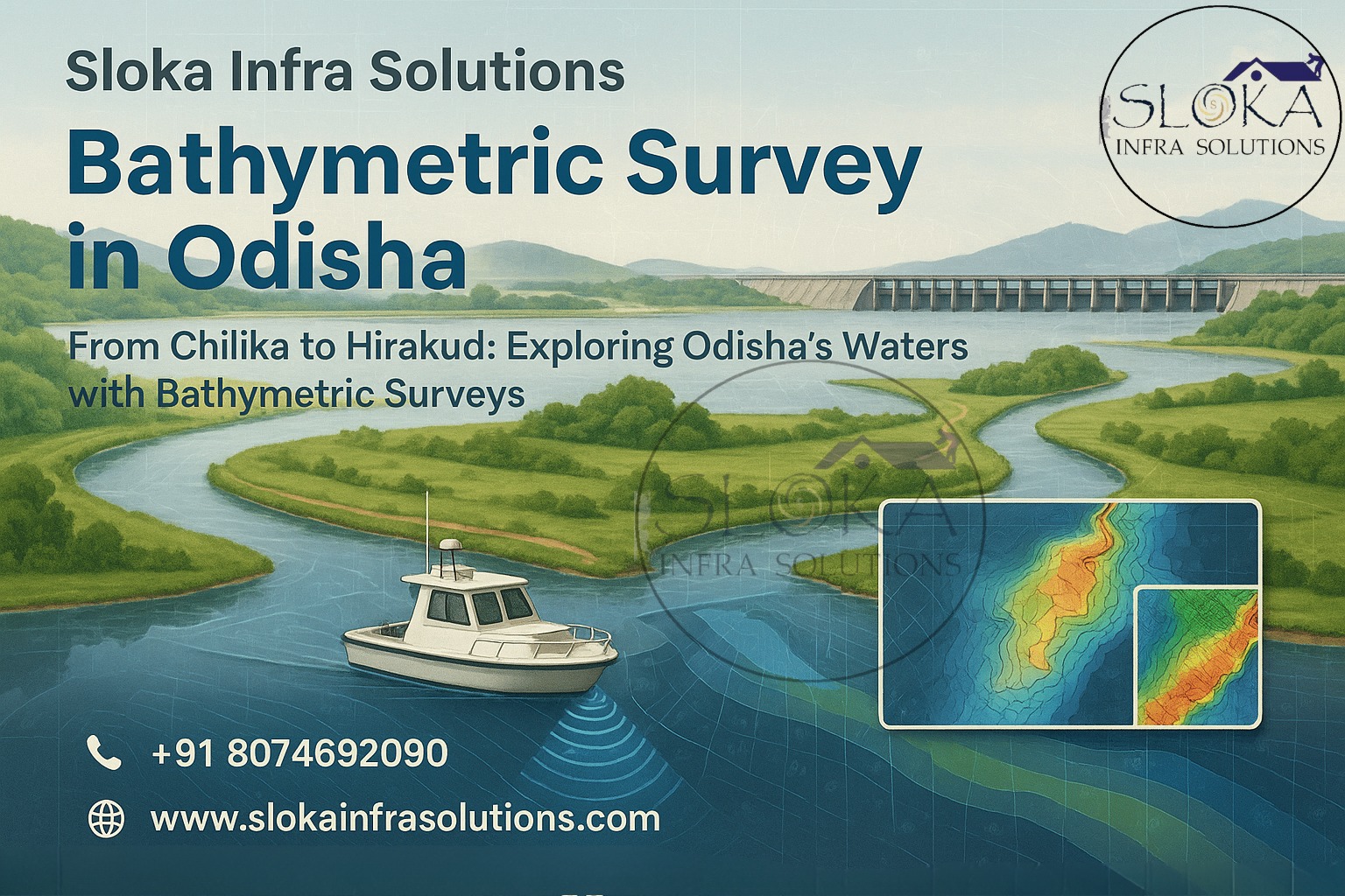
From Chilika to Hirakud: Exploring Odisha’s Waters with Bathymetric Surveys
Bathymetric Survey in Odisha is rapidly becoming an indispensable practice for understanding, managing, and protecting the state’s vast and ecologically rich water systems. With a unique geography that encompasses coastal belts, mighty rivers like the Mahanadi and Brahmani, deltas, reservoirs, and crucial wetlands like Chilika Lake, the application of bathymetric surveys plays a pivotal role in infrastructure development, flood forecasting, aquatic biodiversity conservation, and sustainable inland navigation.
Top Bathymetric Survey and Surveyor in Odisha
Top Bathymetric Survey and Surveyor in Odisha are helping transform decision-making through precise, real-time hydrographic mapping that provides insights into underwater terrain, sedimentation levels, and submerged infrastructure. Equipped with advanced technologies such as multi-beam sonar, GPS-integrated sensors, unmanned surface vehicles (USVs), and sub-bottom profilers, these professionals are setting new benchmarks in underwater survey accuracy and efficiency across Odisha’s dynamic aquatic landscape.
Understanding Bathymetry: Mapping the Underwater World
Bathymetry, often referred to as the underwater equivalent of topography, involves measuring the depths and contours of lakebeds, river channels, coastal seabeds, and reservoirs. The outcome is a detailed Digital Terrain Model (DTM) that reveals critical information for planning flood control systems, dredging operations, port expansions, and ecological studies.
Unlike traditional depth soundings, modern bathymetric surveys use echo sounders, LiDAR, and satellite positioning systems to generate detailed 3D visualizations of the underwater world. These data sets support geospatial planning, climate resilience programs, and environmental restoration in areas like Chilika Lagoon and the Mahanadi basin.
Why Bathymetric Surveys Matter in Odisha?
1. Mapping River Pathways and Evaluating Flood Hazards
The Mahanadi, Baitarani, Brahmani, Subarnarekha, and Rushikulya rivers frequently cause severe flooding, particularly during the monsoon season. Bathymetric surveys help:
Map sediment build-up and erosion-prone zones.
Design embankments, levees, and flood diversion canals.
Monitor dynamic river morphology and channel migration.
2. Coastal and Estuarine Studies
Odisha’s 480 km long coastline along the Bay of Bengal is home to fragile estuarine ecosystems and critical economic infrastructure like Paradip Port and Gopalpur Port. Bathymetric data enables
Coastal erosion tracking and shoreline management.
Dredging support for safe vessel navigation.
Disaster preparedness, especially against cyclones and tsunamis.
3. Wetland and Lagoon Rejuvenation
Wetlands like Chilika Lake (Asia’s largest brackish water lagoon) and Ansupa Lake are vital ecological hubs. Bathymetric surveys aid:
Siltation assessment for lake restoration projects.
Biodiversity mapping and habitat conservation.
Water circulation and salinity modeling for fisheries.

4. Dam, Barrage, and Reservoir Sediment Monitoring
Major reservoirs such as Hirakud, Indravati, Kolab, and Rengali serve irrigation, hydroelectric, and drinking water needs. Sediment accumulation reduces capacity and efficiency. Bathymetry helps:
Quantify sedimentation layers for desilting plans.
Evaluate reservoir capacity and hydroelectric performance.
Ensure long-term sustainability of dam infrastructure.
5. Inland Waterway Development
As part of National Waterway-5, Odisha is central to India’s inland water transport strategy. Bathymetric mapping ensures:
Safe navigability for cargo and passenger vessels
Identification of sandbars, obstructions, and optimal dredging sites.
Terminal and jetty placement for economic growth.
Major Water Bodies in Odisha That Demand Bathymetric Mapping:-
- Mahanadi River: Vital for agriculture and prone to massive sedimentation.
- Chilika Lake: UNESCO-recognized wetland with high ecological sensitivity.
- Hirakud Reservoir: One of Asia’s longest earthen dams, facing siltation.
- Brahmani and Baitarani Rivers: Carrying heavy sediment loads and critical for navigation.
- Rengali, Kolab, Indravati Reservoirs: Important for hydroelectricity and irrigation.
- Rushikulya Estuary: Turtle nesting habitat needing conservation planning.
Sub Bottom Profilers: Uncovering Hidden Layers
Sub Bottom Profilers are crucial tools in modern bathymetric surveys that go beyond just measuring surface depths. These instruments emit low-frequency acoustic waves that penetrate the sediment layers beneath water bodies, revealing geological structures and historical deposition patterns.

Applications in Odisha’s Water Bodies:
- Hirakud and Rengali Reservoirs: Identify deep sediment accumulation zones for targeted dredging.
- Chilika Lake: Reveal sub-surface salinity barriers and organic matter build-up affecting aquatic life.
- Coastal Estuaries: Assist in understanding sub-surface changes due to sea-level rise and tidal action.
Benefits of Sub Bottom Profiling:
Support design of stable underwater foundations for bridges and jetties.
Aid archaeological and geological studies in submerged ancient settlements.
Analyze sediment quantity and composition for reuse opportunities or disposal needs.
With increasing emphasis on sustainable dredging and infrastructure longevity, the use of sub-bottom profilers by top bathymetric survey and surveyor in Odisha is transforming the accuracy and value of underwater investigations.
Side Scan Sonar: Visualizing the Submerged Terrain
Side Scan Sonar is a powerful imaging tool used in bathymetric surveys to produce photo-like visuals of the riverbed, lake floor, or seabed. Unlike echo sounders that provide depth points, side scan sonar offers broad coverage and high-resolution imagery.

Strategic Use Cases in Odisha:
Port Areas (Paradip, Dhamra): Detect submerged containers, wrecks, or navigational hazards.
Chilika and Ansupa Lakes: Identify aquatic vegetation patterns and anthropogenic debris.
Subarnarekha and Rushikulya Rivers: Identify submerged barriers that hinder smooth inland navigation.
Advantages of Side Scan Sonar:
- Precise identification of sediment textures (mud, sand, rock).
- Identification of unauthorized sand excavation zones and hidden underwater structures.
- Quick coverage of large water areas with minimal boat passes.
Given the frequent cyclonic events and riverine sediment volatility in coastal Odisha, Side Scan Sonar technology proves essential for proactive disaster response and sustainable aquatic management.
Technologies Used by Top Bathymetric Survey and Surveyor in Odisha
- Single Beam Echo Sounders (SBES) – Ideal for narrow rivers and canals.
- Multi-Beam Echo Sounders (MBES) – Deliver high-resolution 3D seabed maps.
- Acoustic Doppler Current Profilers (ADCP) – Measure sediment flow and current speed.
- RTK-GPS & GNSS Systems – Offer high precision for accurate geo-referencing.
- Unmanned Surface Vehicles (USVs) – Operate safely in remote or dangerous waters.
- Sub Bottom Profilers – Analyze deep sediment strata and support structural studies.
- Side Scan Sonar – Produce high-detail visuals for navigation and debris detection.
Methodology of Bathymetric Survey in Odisha
1.Objective Definition – Sediment mapping, flood forecasting, or habitat restoration.
2.Survey Planning – Route mapping and logistical deployment.
3.Sensor Calibration – Echo sounders, GPS, and sonar system alignment.
4.Data Acquisition – Real-time collection via boats, drones, or USVs.
5.Post Processing – Filtering errors, correcting for sound velocity, tidal changes.
6.Reporting – Generation of maps, DTMs, CAD models, and volume estimates.

Challenges of Bathymetric Surveys in Odisha:-
- Monsoonal Variability: Rapidly fluctuating water levels in rivers and reservoirs create inconsistent survey conditions between pre- and post-monsoon seasons.
- High Sediment Load: Rivers like the Mahanadi carry heavy silt during rains, scattering acoustic signals and necessitating frequent re-calibration.
- Accessibility Constraints: Marshy backwaters, dense mangrove channels in Bhitarkanika, and shallow tidal flats demand tailored deployment of USVs and amphibious platforms.
- Regulatory Clearances: Surveys in protected areas—Chilika Sanctuary, Bhitarkanika National Park—require multi-agency permits and sensitive operational planning.
- Logistical Coordination: Synchronizing vessels, equipment technicians, and local authorities across remote districts involves meticulous scheduling.
Case Studies and Real-World Applications
Chilika Lake Restoration
Bathymetric surveys helped plan eco-sensitive dredging, restoring fish migration routes and improving tidal water exchange near Satapada and Gabakund.
Hirakud Reservoir Sediment Profiling
Multi-beam sonar and sub-bottom profilers quantified silt volume, enabling targeted dredging and capacity recovery.
Flood Management in Mahanadi Delta
Integrated bathymetric and ADCP data aided in predicting overflow zones and strengthening embankment designs near Cuttack.
Paradip Port Expansion
Side scan sonar facilitated seabed clearing operations, enabling the safe passage of deep-draft vessels as part of port upgrade initiatives.
What Makes the Leading Bathymetric Survey and Surveyor in Odisha the Right Choice?
✅ Local Expertise: Deep knowledge of Odisha’s hydrology and seasonal patterns ensures survey designs that account for monsoon surges and sediment pulses.
✅ Advanced Equipment: Integrated MBES, SBES, ADCP, RTK-GPS, sub-bottom profilers, and side scan sonar guarantee comprehensive data capture.
✅ Regulatory Compliance: Adherence to CWC, WBPCB, Forest & Wildlife guidelines for surveys in sensitive zones.
✅ Custom Deliverables: GIS-ready files, interactive 3D models, sediment volume reports, and animated flood simulations tailored to stakeholder needs.
✅ Turnkey Solutions: End-to-end services—planning, execution, data processing, and visualization—minimize client coordination burdens.

Benefits of Bathymetric Survey in Odisha:-
- Enhanced Flood Resilience: Accurate terrain models guide embankment design and early warning systems.
- Optimized Infrastructure Investment: Prevent over- or under-design of hydraulic structures by basing decisions on real-world underwater topography.
- Aquaculture & Fisheries: Habitat mapping supports site selection for cage farming and nursery grounds.
- Safe Inland Navigation: Reduce vessel groundings and dredging costs through precise depth monitoring.
- Biodiversity Conservation: Track morphological changes in wetlands, lagoons, and estuaries critical for migratory birds and aquatic species.
- Climate Adaptation Planning: Monitor coastal and riverine changes over time to inform adaptive management strategies.
Conclusion
Bathymetric Survey in Odisha is not merely a technical process—it’s a vital enabler of environmental conservation, disaster resilience, infrastructure development, and economic planning. As Odisha balances its ecological wealth with developmental aspirations, unlocking underwater insights is no longer optional—it is essential. By partnering with the Top Bathymetric Survey and Surveyor in Odisha, stakeholders gain access to a spectrum of hydrographic intelligence that ensures every river, reservoir, lake, and estuary is understood, preserved, and optimized for generations to come.