• +91 8074692090
  • slokainfrasolution@gmail.com

Bathymetric Survey

Bathymetric Survey

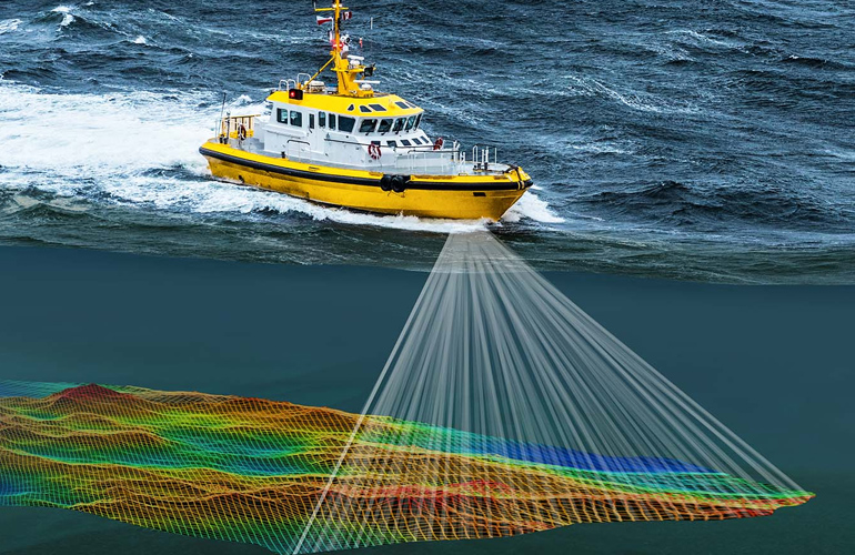
Our bathymetric surveys provide precise measurements of water depth and the contours of the seafloor. Utilizing the latest sonar and GPS technology, Sloka Infra Solutions delivers detailed maps that are vital for dredging operations, underwater construction, and marine research. Bathymetric data helps in understanding the underwater landscape, identifying sediment accumulation, and planning for safe navigation routes. We offer customized solutions tailored to the specific needs of your project, whether it’s for port development, offshore drilling, or habitat mapping. Our experienced team ensures that all data collected is accurate, comprehensive, and delivered in a user-friendly format. With our bathymetric surveys, you gain the insights necessary to plan and execute your marine projects with confidence.

Bathymetric Survey

Professional bathymetric surveys using Single Beam and Multibeam Echo Sounders for accurate underwater mapping, reservoir studies, dredging projects, and engineering applications.

01

Reservoir Capacity Assessment

Evaluate reservoir storage capacity with precise underwater measurements.

02

Sedimentation Analysis

Measure sediment deposition and monitor changes in reservoir bed profiles.

03

Dam Safety Studies

Support dam inspection and structural monitoring with accurate bathymetric data.

04

Floating Solar Projects

Survey water bodies for planning and installation of floating solar systems.

05

Navigation Channel Surveys

Ensure safe navigation through detailed depth mapping of waterways.

06

Dredging Quantity Estimation

Calculate dredging volumes accurately for planning and project execution.

07

River Engineering

Collect reliable riverbed data for hydraulic and civil engineering projects.

08

Water Storage Analysis

Assess available water storage and support long-term water resource planning.

Bathymetric Survey

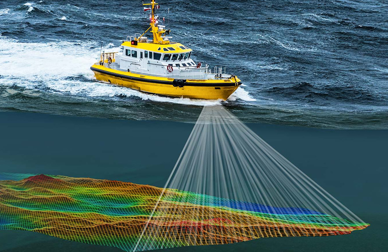
Our bathymetric surveys provide precise measurements of water depth and the contours of the seafloor. Utilizing the latest sonar and GPS technology, Sloka Infra Solutions delivers detailed maps that are vital for dredging operations, underwater construction, and marine research. Bathymetric data helps in understanding the underwater landscape, identifying sediment accumulation, and planning for safe navigation routes. We offer customized solutions tailored to the specific needs of your project, whether it's for port development, offshore drilling, or habitat mapping. Our experienced team ensures that all data collected is accurate, comprehensive, and delivered in a user-friendly format. With our bathymetric surveys, you gain the insights necessary to plan and execute your marine projects with confidence.