
Multibeam Echo Sounder Bathymetric Survey in India
Call: +91 80746 92090
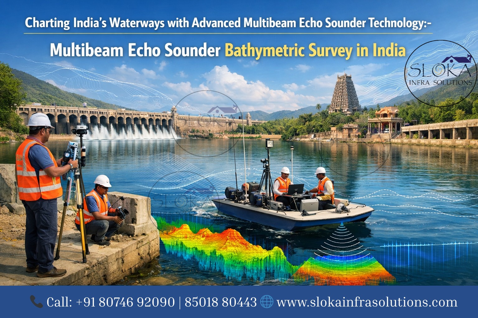
Multibeam Echo Sounder Bathymetric Survey in India begins with an understanding that modern seafloor mapping is no longer a niche science — it’s a strategic tool used by ports, coastal managers, engineers, researchers, and defence planners across the country’s huge and varied maritime landscape. From the shallow backwaters of Kerala and the tidal flats of Gujarat to the deep continental slope off the eastern coast, multibeam echosounders (MBES) deliver the detailed, three-dimensional seafloor data that India needs for safe navigation, infrastructure projects, environmental monitoring and resource management.
Multibeam Echo Sounder Bathymetric Surveyor in India
Multibeam Echo Sounder Bathymetric Surveyor in India are the professionals and teams who plan, acquire, and process MBES data — from vessel masters and surveyors to hydrographic engineers and GIS specialists. They are responsible not only for operating the hardware but also for ensuring survey design, calibration, sound-velocity management, processing and final delivery meet international and national standards used by agencies such as the Indian Naval Hydrographic Department.
Why multibeam?
Multibeam echosounders emit a fan or swath of sound pulses and use beamforming to measure the travel time and direction of returned echoes, creating thousands of depth soundings per ping. Compared with single-beam systems, MBES covers far greater width per pass and produces dense point clouds that can be processed into high-resolution digital terrain models (DTMs), backscatter mosaics and water-column imagery — all of which enable safer navigation, accurate dredge planning, habitat mapping and much more.

Types of multibeam systems — what you’ll meet on the market:-
Broadly speaking, commercially available swath bathymetry systems fall into two main groups:
Beam-forming (traditional multibeam) systems — made by manufacturers such as Kongsberg, Teledyne, Norbit and R2Sonic, these systems form many narrow beams across a wide swath, producing very dense, high-quality bathymetric data suitable for both shallow and deep surveys. They are the workhorses of hydrographic and offshore engineering surveys.
Interferometric systems — examples include systems historically marketed by EdgeTech and GeoAcoustics or hybrid designs. These often excel in rapid shallow-water mapping with strong range performance but have particular processing and integration needs because of their sensor geometry and backscatter characteristics. They can be very effective for coastal tasks where speed and wide coverage matter.
Knowing the differences helps clients and surveyors select a system that matches water depth, resolution needs and budget.
Core technical parameters and how they affect your survey:-
When choosing a system or evaluating proposals from survey firms, the following technical parameters drive data quality and cost:
1.Frequency — higher frequencies (e.g., 200–700 kHz) give finer detail but shorter range; lower requencies (e.g., 40–100 kHz) penetrate to greater depth but with less spatial detail. Many modern MBES allow on-the-fly frequency selection or broadband operation to balance range and resolution.
2.Beamwidth & Number of Beams — narrow beamwidth and larger numbers of beams increase across-track resolution. For high-detail shallow work (ports, wrecks, underwater archaeology), expect very narrow beam patterns and hundreds to thousands of beams per ping.
3.Swath Coverage — typically expressed as an angular sector (e.g., up to 140°) or as multiples of water depth (e.g., 3× to 7× depth). Wider swaths increase productivity but reduce grazing-angle quality at outer sectors, which can affect sounding reliability.
4.Pulse Length & Pulse Type — short pulses produce higher vertical resolution; longer or coded pulses improve range performance. Modern systems use adaptive pulse lengths and broadband modulation to optimize SNR and resolution.
5.Operating Depth & Platform — deep-water work commonly requires low-frequency, stabilized head systems; shallow, high-resolution surveys benefit from high-frequency hullmounted heads, AUV/ROV mounts, USVs or towfish depending on access and sea state.
6.Ancillary Sensors — high-quality positioning (GNSS/RTK), attitude (IMU), motion sensors and sound-velocity profiling are essential. MBES quality is only as good as these ancillary measurements and the integration between them. Best practice includes regular SV casts and patch tests to determine installation offsets.
Planning a successful MBES survey in India: –
India’s maritime and inland water environments are diverse — the Arabian Sea and Bay of Bengal coasts, estuaries and deltas (like the Ganges-Brahmaputra and Godavari), backwaters, reservoirs, river systems, and the Andaman & Nicobar and Lakshadweep island groups. Survey planning should reflect that diversity:
1.Define the objective and deliverables — navigation charting, dredge volumes, cable routing, habitat mapping, or research all require different survey densities, tide corrections and ancillary data.
2.Choose the right platform — a deep-sea survey vessel for EEZ and continental slope work; a shallow-draft catamaran, USV or small launch for estuaries and backwaters; AUV/ROV for high-resolution inspections under structures or in constrained locations.
3.Schedule around Indian weather windows — monsoons (southwest ~June–September and northeast in parts of the northeast) can severely affect sea state and visibility. Plan coastal work in calmer months and allow contingency days.
4.Obtain permissions and coordinate — surveys in Indian waters may require coordination with the Indian Naval Hydrographic Department, port authorities or state agencies; clearances are necessary for restricted zones, offshore installations and environmental sensitive areas.
5.Tide and vertical datum control — tide gauging and datum transformation to local chart datums (e.g., Mean Lower Low Water) are essential for any navigational deliverable.

Platforms: where MBES lives:-
Hull-mounted MBES — the default for large vessels; provides continuous, stabilized datasets when vessel motion is compensated.
Towfish & Side-scan/tow configurations — used where hull mounting is impractical or when shallow draft is needed.
Uncrewed Surface Vessels (USVs) & Small survey launches — increasingly popular for port, harbor and inland water surveys. Some modern USVs are fitted with both single and multibeam sensors. (Example USV systems and specs are used widely in Indian commercial surveys.)
AUVs & ROVs — ideal for very high-resolution surveys, wreck inspections and close-look seafloor mapping; because they operate close to the seabed, they can use high frequencies even in deep water to produce exceptional detail.
Data types you will receive and why each matters:-
Bathymetric point cloud — raw soundings corrected for motion, position and sound speed; basis for all derived products.
Gridded DTM / DEM — a cleaned, interpolated surface used for visualization, volume calculations and engineering design.
Backscatter mosaic — a georeferenced image produced from the strength of returned echoes; used to infer substrate type (sand, rock, mud) and for habitat mapping. Backscatter interpretation complements bathymetry for environmental and geological studies.
Water-column data — MBES also captures energy reflected from within the water column; this is now used routinely to detect gas seeps, fish schools, and even to identify plumes or leaks.
Ancillary layers — tide corrections, sound velocity profiles, survey logs, metadata and QA reports.
Calibration, QA/QC and standards — how to trust MBES data?
Trust in MBES data comes from disciplined calibration and QA:
Patch tests (to resolve timing and alignment among transducer, GNSS antenna, motion sensors and compass) are mandatory. The International community’s best practices document these tests and logging requirements.
Sound velocity management — regular SV profiles (CTD or probe casts) or moving-vessel SV profiling reduce refraction errors. In shallow, strongly stratified Indian estuaries, frequent SV checks are critical.
IHO and national standards — surveys intended for navigation or official charts should meet standards such as IHO S-44 levels of positional and depth accuracy; India’s hydrographic authorities also prescribe required deliverables for charting and navigational safety.
Processing QC — data must be cleaned of spikes and artifacts, crossline comparisons made, vertical error estimates provided and deliverables validated against independent checks where possible.
Processing workflow — from pings to maps:-
A typical processing pipeline includes:
- Raw data ingestion — MBES raw files, navigation, IMU, SV profiles and other sensor logs into processing software (CARIS, QPS, Hypack/ HYPACK-and-QINSy environments).
- Time & position alignment — apply sensor offsets, clock corrections and patch test values.
- Sound velocity correction & ray-tracing — correct each beam for refraction using measured SV profiles.
- Cleaning & filtering — remove spikes, multipath, false returns and apply angle/depth-dependent filters.
- Gridding / DTM generation — apply appropriate cell size and interpolation method; preserve high-resolution features where required.
- Backscatter processing — normalize angular dependence (gamma-compensation), mosaic and tone-match tiles to create continuous seabed reflectance imagery.
- Derived products — raster bathymetry, hillshades, contouring, volume calculations, habitat classification and water-column anomaly reports.
- QA reports & metadata — include error budgets, processing steps and data lineage so users can assess fitness for purpose. Many Indian clients now expect this documentation as standard.
Applications across India’s waterbodies — real-world use cases:-
Port and harbor maintenance — precise dredge volumes and bathymetric baselines for Chennai, Mumbai, Kandla and other ports; MBES surveys help manage shoaling and plan maintenance dredging.
Pipeline & cable route surveys — offshore energy and telecom routes across the Arabian Sea and Bay of Bengal need seafloor profiling and route clearance studies; MBES helps identify hazards and burial requirements.
Coastal erosion & shoreline change — integrated MBES + UAV (topo-bathymetric) datasets are increasingly used to quantify coastal erosion, accretion and morphodynamic processes in regions like the Gujarat coast and the Sundarbans. (Combining UAV photogrammetry for exposed shallow areas and MBES for submerged zones produces integrated elevation models.)
Environmental & habitat mapping — backscatter + bathymetry informs coral, seagrass and benthic habitat mapping in the Andaman & Nicobar Islands and Lakshadweep, providing baseline data for conservation and impact assessments.
Hydraulic and river engineering — MBES from USVs and launches is used for river cross-sections, sediment studies and bridge/jetty foundation planning in major river systems.
Underwater archaeology & wreck detection — high-resolution MBES can reveal wrecks, submerged cultural sites and palaeochannels, which is of growing interest for India’s coastal heritage work.
Fisheries and biomass studies — water-column returns and seafloor mapping support habitat assessments and fisheries management.
Challenges in Indian operations & practical mitigations:-
Monsoon and seasonal turbidity — heavy monsoonal rivers create high turbidity, sometimes reducing acoustic penetration and affecting SVs. Mitigation: schedule shallow surveys in drier windows; use frequent SV profiling and adaptive processing.
Shallow, complex bathymetry — deltaic and tidal flats need specialized shallow-water MBES or interferometric systems, or AUV solutions, to avoid bottom contact and obtain high resolution.
Logistics & permissions — varied jurisdiction across central, state and navy authorities; early engagement with INHD and port authorities smooths approvals.
Data volume & processing capacity — MBES produces large datasets; ensure that your surveyor has both computing resources and staff experienced in long processing workflows and metadata management.
Typical costs & tender considerations:-
Costs vary widely depending on scope:
Simple harbor or reservoir surveys (few days, small vessel/USV): relatively low cost; priced per survey day plus mobilization.
Large coastal or offshore surveys (EEZ, long route surveys): significant mobilization, vessel charter and processing costs; tenders must clearly define accuracy specifications, data formats and QA deliverables.
When issuing tenders, specify performance metrics (vertical & horizontal accuracies, reference datum, required grids and metadata), acceptance tests (crosslines, reference checks), and penalties for missed deliverables or poor QA.
Deliverables — what to expect at project close:-
A complete MBES contract typically ends with:
- Raw data archives (all raw MBES files, navigation, IMU, SV profiles)
- Processed soundings and gridded bathymetry (with cell size and pass metrics)
- Backscatter mosaics and interpretation notes
- Water-column anomaly reports, if required
- Tide and datum reports and transformation parameters
- Patch test and calibration reports
- Metadata and QA/QC reports (error budgets)
- Visual products (hillshades, contours, 3D models) and GIS layers ready for client us
- Clients should insist on a clear data delivery checklist in the contract.
Short case snapshot: combining MBES + UAV for integrated models
A growing approach in coastal India is to combine UAV photogrammetry over shallow, intertidal and exposed areas with MBES dense point clouds offshore to create an integrated topography-bathymetry model. This workflow yields very high spatial resolution (centimetre-level in aerial areas and decimetre to sub-decimetre offshore where MBES operates close to the seabed), ideal for tourism signage, channel planning and erosion monitoring. Recent academic and applied projects have used MBES for submerged validation of UAV bathymetry and to produce final integrated 3-D models for visualization and analysis.
How to evaluate and engage a surveyor: —
Request a sample dataset — ask bidders to provide anonymized examples of processed MBES datasets and QA reports from similar projects.
Ask for patch test logs and processing steps — transparency in processing increases confidence.
Confirm data transfer and storage methods — MBES datasets can be very large; clarify delivery media and file integrity checks (MD5/sha256).
Plan handover sessions — require the surveyor to provide a walk-through of the deliverables with your team, including how to interpret and use the data.
Final thoughts & strategic outlook for India:-
Multibeam echo sounder bathymetric surveys have transformed how India understands and manages its underwater landscapes. From bustling ports and offshore energy fields to sacred rivers and massive reservoirs, accurate seabed mapping supports infrastructure, commerce, research, and environmental protection.
As technology evolves and infrastructure demands expand, Multibeam Echo Sounder Bathymetric Survey in India will continue to drive precision, safety, and sustainable development across marine and inland water environments.
And with experienced professionals delivering reliable results, the role of a skilled Multibeam Echo Sounder Bathymetric Surveyor in India remains central to shaping the nation’s maritime and hydrographic future.