Bathymetric Survey in Madhya Pradesh
Charting the Unseen: Why Bathymetric Surveys Matter in Madhya Pradesh’s Development
📞 Call : +91 8074692090
Bathymetric Survey in Madhya Pradesh is essential for uncovering the hidden underwater landscapes across the state’s varied rivers, lakes, and reservoirs. From the vast Upper Lake in Bhopal to the Narmada River basin, Madhya Pradesh’s aquatic landscape is both ecologically vital and economically significant. Whether it’s for restoring urban lakes, managing dam sedimentation, or enabling sustainable irrigation planning, bathymetric surveys provide the data backbone that powers informed civil engineering and environmental decisions.
Top Bathymetric Survey and Surveyor in Madhya Pradesh
Top Bathymetric Survey and Surveyor in Madhya Pradesh services specialize in accurately mapping the underwater terrain of lakes, reservoirs, rivers, and ponds that are critical to the state’s agricultural, urban, and ecological systems. With the increasing need for effective water management, these professionals utilize advanced sonar systems, RTK GPS, USVs, and post-processing software to deliver actionable insights for government bodies, civil engineers, and environmental consultants.

Understanding Bathymetry: What Is a Bathymetric Survey?
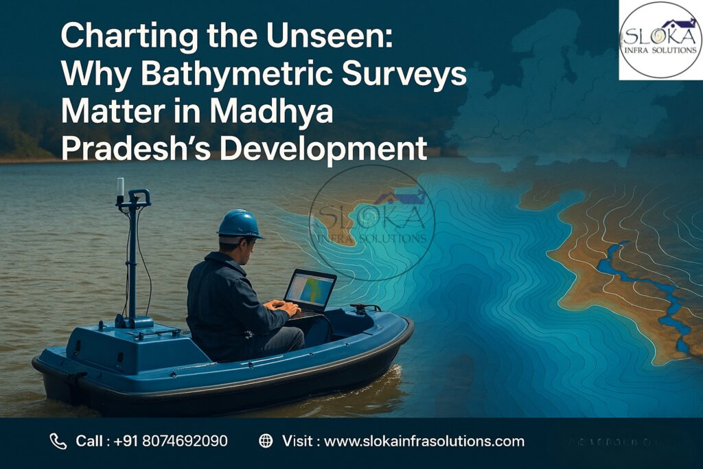
A bathymetric survey is a technique used to map and measure the depth and underwater contours of landforms lying beneath oceans, lakes, rivers, and other water bodies. Just as topographic surveys chart hills and valleys on land, bathymetric surveys reveal the underwater terrain—riverbeds, lake floors, reservoirs, and submerged channels. The technology typically involves sending acoustic pulses (sonar) from vessels or USVs and analyzing their return time to determine water depth. Once analyzed, the collected data is transformed into digital terrain models (DTMs), three-dimensional maps, and hydrographic charts that are vital for effective planning, infrastructure development, and environmental preservation.
Why Madhya Pradesh Needs Bathymetric Surveys
Madhya Pradesh, located in the heart of India, is dotted with natural and manmade water bodies—Narmada, Chambal, Betwa, Tawa, and numerous reservoirs and tanks that play key roles in agriculture, urban water supply, and hydroelectric power. Here’s why bathymetric surveys are vital for the state:
1. Reservoir and Dam Sedimentation Management
Madhya Pradesh is home to major dams such as Bargi, Tawa, Indirasagar, Gandhi Sagar, and Bansagar. Over time, these reservoirs accumulate silt, reducing their storage capacity and compromising dam safety. Bathymetric surveys:
Quantify sedimentation levels
Guide desilting operations
Help in dam life-cycle planning
2. Urban Lake Restoration
Lakes like Upper Lake and Lower Lake in Bhopal, and Shahpura Lake, are urban lifelines. Bathymetric mapping:
Aids in lake restoration projects
Identifies silt pockets
Supports eco-restoration and sewage management efforts
3. Riverbank Erosion and Flood Control
The Narmada, Chambal, and Betwa rivers experience seasonal fluctuations. Bathymetric data:
Assists in flood modeling
Helps in designing embankments and check dams
Provides input for riverfront development projects
4. Inland Navigation and Irrigation Planning
Bathymetric data enables:
Design of canal intakes
Navigation route feasibility under the National Waterway proposals
Optimization of irrigation schemes in regions like Malwa and Bundelkhand
5. Water-Based Infrastructure Development and Surrounding Projects
Planning water-based infrastructure such as harbors, pump houses, and intake wells depends on accurate bathymetric data. This is especially important in deep water construction in dam backwaters and large lakes.
Key Water Bodies in Madhya Pradesh Where Bathymetric Surveys Matter
Narmada River – The lifeline of the state, housing projects like Indirasagar and Omkareshwar.
Chambal River – An important freshwater resource and a region of ecological significance.
Upper Lake (Bhojtal) – One of Asia’s oldest manmade lakes.
Tawa Reservoir – Known for irrigation and ecological significance.
Bansagar Dam – Multi-state utility for irrigation and hydro-power.
Gandhi Sagar Reservoir – Large backwater zone used for hydroelectric generation.
Tools and Technologies Used by Top Bathymetric Survey and Surveyor in Madhya Pradesh
1. Single-Beam Echo Sounders (SBES)
Ideal for small and shallow lakes, SBES devices offer direct depth readings and are often used for sediment analysis in ponds and tanks.
2. Multi-Beam Echo Sounders (MBES)
MBES technology produces high-resolution, three-dimensional maps of underwater terrain with exceptional detail. They are essential in large reservoirs like Indirasagar and Gandhi Sagar.
3. Acoustic Doppler Current Profilers (ADCP)
Used in flowing rivers like Chambal or Narmada, these systems measure water velocity, sediment load, and flow turbulence.
4. RTK GPS and GNSS Integration
These provide high-precision horizontal and vertical positioning, essential for accurate charting in dam and riverbed surveys.
5. Unmanned Surface Vehicles (USVs)
These autonomous or remote-controlled boats equipped with echo sounders are ideal for surveying inaccessible or hazardous areas.
6. Sound Velocity Profilers (SVPs)
They measure changes in water temperature, pressure, and salinity that can affect sonar signals, ensuring more precise depth readings.
Step-by-Step Methodology of a Bathymetric Survey
1. Project Scoping
Define goals—restoration, sediment assessment, planning infrastructure. Identify waterbody type, expected depth, and area.
2. Equipment Selection
Choose sonar system based on resolution needs and water depth. Equip with GPS, IMU, and SVPs.
3. Line Plan Design
Design a network of parallel and perpendicular survey lines to achieve thorough and consistent area coverage.Adjust spacing based on sonar swath and terrain complexity.
4. Equipment Calibration
Sensors are tested and aligned. Multibeam systems undergo patch testing; single-beam systems may use bar check calibration.
5. Field Survey Execution
The vessel or USV follows the predefined line plan. Technicians oversee sonar signals and assess data accuracy as it is being collected in real time.Tidal corrections and vessel motion data are recorded simultaneously.
6. Post-Processing
Raw data is filtered, corrected for tide, motion, and sound velocity variations using tools like Hypack, QINSy, or CARIS. Output is transformed into usable models and contour charts.
7. Reporting & Deliverables
Final outputs include:
- Digital Terrain Models (DTMs)
- Contour and sedimentation maps
- Cross-sections
- Metadata and methodology documentation
- GIS-compatible files (GeoTIFF, XYZ, DXF)

Challenges Faced in Madhya Pradesh’s Bathymetric Surveys
Monsoon Dependency: Water levels in reservoirs and rivers change drastically between seasons, impacting scheduling.
Sediment Turbidity: High turbidity levels in rivers like Narmada affect sonar penetration.
Ecological Sensitivity: Many lakes are home to migratory birds and require low-impact surveying.
Access to Remote Sites: Some reservoirs in hilly or forested areas demand drone-assisted or USV-enabled surveys.
Coordination with Authorities: Permissions from irrigation and forest departments are often needed.
Real-World Applications and Case Studies
Upper Lake (Bhojtal), Bhopal
Bathymetric surveys helped map silt accumulation, guiding a multi-crore lake rejuvenation plan that included dredging and stormwater management.
Indirasagar Reservoir
MBES and ADCP were used to study sediment inflow and aid in long-term desilting strategies, extending the operational life of the hydroelectric plant.
Tawa Dam
Survey data was used to design an intake structure for a micro-irrigation scheme and study sediment build-up affecting water storage.
Flood Mapping for Betwa Basin
In 2023, bathymetric profiling helped simulate monsoon flood scenarios and identify vulnerable riverbank zones for embankment strengthening.
The Power of Sub Bottom Profiling:-
Sub bottom profiling is a breakthrough technique that allows surveyors to look far beyond just the surface of a lake or river. By sending low-frequency acoustic pulses deep into the earth beneath water bodies, this technology uncovers geological layers that tell the story of sedimentation, erosion, and even hidden objects buried under layers of soil and rock.
For a state like Madhya Pradesh, with vast reservoirs like Tawa and Bargi or ecologically sensitive rivers like Chambal, sub bottom profiling brings unmatched insight. It reveals the stratigraphy—layered makeup—beneath the riverbeds or reservoir floors, helping civil engineers plan more stable foundations for underwater structures like pump houses, intake wells, and bridge piers.
Uncovering Geological Histories and Hidden Hazards
Whether it’s identifying old shipwrecks or natural sediment formations, sub bottom profilers act as time machines—shedding light on what lies beneath centuries of sediment. This is invaluable for flood risk analysis, archaeological preservation, and predicting potential geohazards. Engineers and environmental planners use this data to assess seabed or lakebed stability, a critical step before starting any large-scale water infrastructure projects.
High-Tech Profiling for Smarter Planning
Modern sub bottom profilers come equipped with advanced software that transforms raw acoustic data into detailed, layered visuals. These systems are often paired with multibeam sonar or GPS tools to create comprehensive subsurface models. This multi-tech integration ensures that water resource departments and consultants in regions like Madhya Pradesh get precise, actionable data for planning dredging, dam maintenance, or aquifer studies.
Side Scan Sonar: Scanning the Seabed with Unmatched Clarity
While sub bottom profilers look beneath the surface, side scan sonar reveals the terrain of the seafloor itself. Using fan-shaped sonar beams projected from either side of a boat or USV (Unmanned Surface Vehicle), this system produces crisp, wide-coverage images of the underwater landscape—ideal for mapping large lakes, reservoirs, and riverbeds across Madhya Pradesh.
What makes side scan sonar truly remarkable is its panoramic scanning ability. Rather than just taking point-by-point depth readings, it captures a continuous image of the seafloor. This means submerged objects—like rocks, debris, sunken boats, or even structural remnants—are quickly and clearly visible.
Versatile, Fast, and Ideal for Complex Terrains
Side scan sonar shines in all kinds of environments, from shallow ponds to deep dams. In a state rich with varied water bodies, this flexibility makes it ideal for civil and environmental surveys alike. Whether it’s a rapid assessment after monsoon floods or a detailed inspection before dam construction, side scan sonar provides the clarity and speed needed for time-sensitive decision-making.
Next-Level Imaging with Real-Time Results
Today’s systems feature real-time processing and advanced visualization software, enabling survey teams to make quick calls right on site. In critical scenarios—like post-flood rehabilitation or emergency dredging—this rapid turnaround can make all the difference.
By capturing the shape and condition of the underwater surface in stunning detail, side scan sonar empowers engineers, conservationists, and surveyors to take informed actions. From mapping silted reservoirs to supporting urban lake rejuvenation projects, it plays an indispensable role in bathymetric survey operations across Madhya Pradesh.
Emerging Trends in Bathymetric Surveying in Madhya Pradesh
Drone + Sonar Integration: Useful in smaller or hard-to-access urban lakes.
Cloud-Based Data Sharing: Real-time collaboration with stakeholders.
Artificial Intelligence: For automating sediment classification and detecting anomalies.
Community Participation: Equipping local surveyors and NGOs with portable sonar for grassroots mapping efforts.
Why Choose the Top Bathymetric Survey and Surveyor in Madhya Pradesh?
✅ Regional Expertise: Understanding of MP’s seasonal, geographical, and ecological nuances.
✅ Advanced Equipment: Multi-sensor integration ensures precision.
✅ Compliance & Safety: Following MoEF, CWC, and Water Resource Department norms.
✅ Custom Solutions: Deliverables tailored to lake restoration, dam inspection, or river modeling.
✅ Faster Turnaround: Efficient workflows from survey to report delivery.
Benefits of Bathymetric Survey in Madhya Pradesh
Enables informed planning of infrastructure around water bodies
Identifies sedimentation issues to prolong reservoir life
Assists in flood mitigation and disaster preparedness
Supports ecological conservation efforts
Facilitates urban lake rejuvenation projects
Essential for navigation and waterway development
Delivers foundational information essential for developing sustainable long-term water management plans.
Conclusion
With growing water management needs and a renewed focus on environmental sustainability, Bathymetric Survey in Madhya Pradesh is not just a technical process—it’s a strategic necessity. From improving dam safety to restoring city lakes and forecasting floods, bathymetric data empowers the state to plan better and build smarter.
Choosing the Top Bathymetric Survey and Surveyor in Madhya Pradesh ensures you receive not just depth measurements but insightful analytics, cutting-edge visuals, and a partner who understands Madhya Pradesh’s hydrological and ecological complexity. As water challenges grow, so does the importance of mapping what lies beneath.