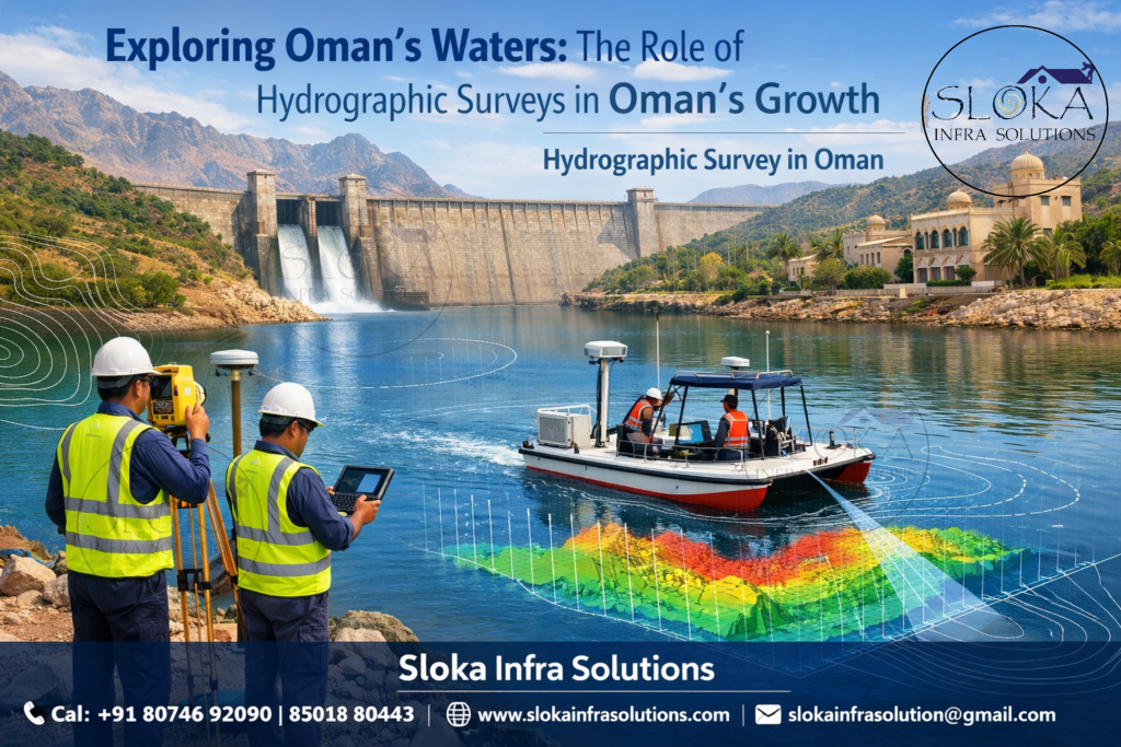
Hydrographic Survey in Oman
Call: +91 80746 92090
Exploring Oman’s Waters : The Role of Hydrographic Surveys in Oman’s Growth:-
Hydrographic Survey in Oman plays a vital role in unlocking the true potential of the nation’s vast and diverse marine environment. Nestled along the southeastern coast of the Arabian Peninsula, Oman is blessed with an extensive coastline stretching over 3,000 kilometers along the Arabian Sea, the Gulf of Oman, and strategically near the Strait of Hormuz. This unique geography makes hydrographic surveying not just a technical necessity but a cornerstone for economic growth, maritime safety, and environmental sustainability. From busy commercial ports like Sohar and Salalah to serene coastal lagoons and fisheries, hydrographic surveys provide accurate underwater data that supports navigation, infrastructure development, offshore exploration, and coastal management.
Top Hydrographic Survey & Surveyors in Oman
Top Hydrographic Survey & Surveyors in Oman are the teams that turn complex water conditions into clean, usable seabed intelligence for engineers, port operators, offshore planners, and public agencies. In a country with major seaports, special economic zones, busy shipping lanes, deep coastal approaches, coral-rich waters, and rapidly developing industrial zones, hydrographic work is not only about measuring depth; it is about understanding change, risk, and opportunity in the marine environment.
Hydrography, as defined by the International Hydrographic Organization, is the measurement and description of oceans, seas, coastal areas, lakes, and rivers, along with how those features change over time. The same source also explains that hydrography exists primarily to support safe navigation, but it also underpins economic development, security, scientific research, and environmental protection. That definition matters in Oman because the country’s coastline is tied to trade, port logistics, tourism, fisheries, and offshore activity all at once.
Why Oman demands precise hydrographic work?
Oman’s maritime geography creates a natural need for reliable survey data. Musandam sits at the northern tip of the country and overlooks the Strait of Hormuz, one of the world’s most sensitive shipping gateways, while Salalah is positioned on the Arabian Sea and serves as a major logistics point on the only part of the Arabian Peninsula touched by the Indian Ocean. Duqm, meanwhile, has become a major southeast-coast development area with a coastline of roughly 170 km, and the country’s port network includes Sohar, Salalah, Duqm, and Port Sultan Qaboos. Each of these places has different seabed shapes, access channels, tidal behavior, and operational priorities.
That variety is exactly why hydrographic surveying in Oman is more than a technical exercise. It is a planning tool. A port authority may need under-keel clearance data, a marine contractor may need an accurate seabed model before dredging, a pipeline designer may need route intelligence, and an environmental team may need to understand the bottom type before work starts. Hydrographic data helps all of them reduce uncertainty before money, time, and safety are put at risk. The IHO’s standards for hydrographic surveys exist to support that exact objective.
Understanding Oman’s water landscape before surveying begins!
A strong hydrographic survey starts with geography, not equipment. Oman’s north is shaped by the Musandam Peninsula and the Strait of Hormuz, while the east and southeast open toward the Sea of Oman and the Arabian Sea. Official government pages also describe Oman as surrounded by sea on two sides and highlight the country’s direct ocean-facing position. That matters because tidal flow, sediment movement, seabed slope, and charting priorities can differ sharply between the sheltered northern passages and the more exposed southern and southeastern coasts.
This also means survey teams must think in zones. In one place, a team may be checking narrow navigational corridors near busy ship traffic; in another, it may be mapping an industrial coastline with future port expansion in mind; elsewhere it may be working near reefs, coastal habitats, or tourism-heavy waters. Musandam is noted by official sources for its vivid marine environment, while Duqm’s coast and Salalah’s strategic location both show how strongly Oman’s economy is tied to the sea. Good hydrography respects that diversity instead of treating the entire shoreline as one uniform project area.
What a modern Hydrographic Survey actually delivers?
A modern hydrographic survey does much more than collect depth points. Depending on the project, it may deliver bathymetry, seabed imagery, object detection, bottom-type interpretation, least-depth confirmation, and current information. NOAA’s hydrographic survey guidance notes that survey data can include depths, rocks, wrecks, navigation aids, shoreline identification, and bottom type. The IHO also emphasizes that hydrography is about describing the physical features of water bodies and how they change over time. In practical terms, that means the final output is a decision-making package, not just a raw dataset.
In Oman, that package is especially valuable because marine projects often need to move from concept to execution quickly. A port expansion may require updated seabed contours. A dredging contractor may need a before-and-after comparison. An offshore developer may need route clearance. A coastal authority may need a baseline record before climate-linked changes, construction, or navigation adjustments. The best survey work makes the underwater world visible enough that engineers can plan with confidence instead of relying on assumption.
The role of advanced technologies in modern Hydrographic surveys:-
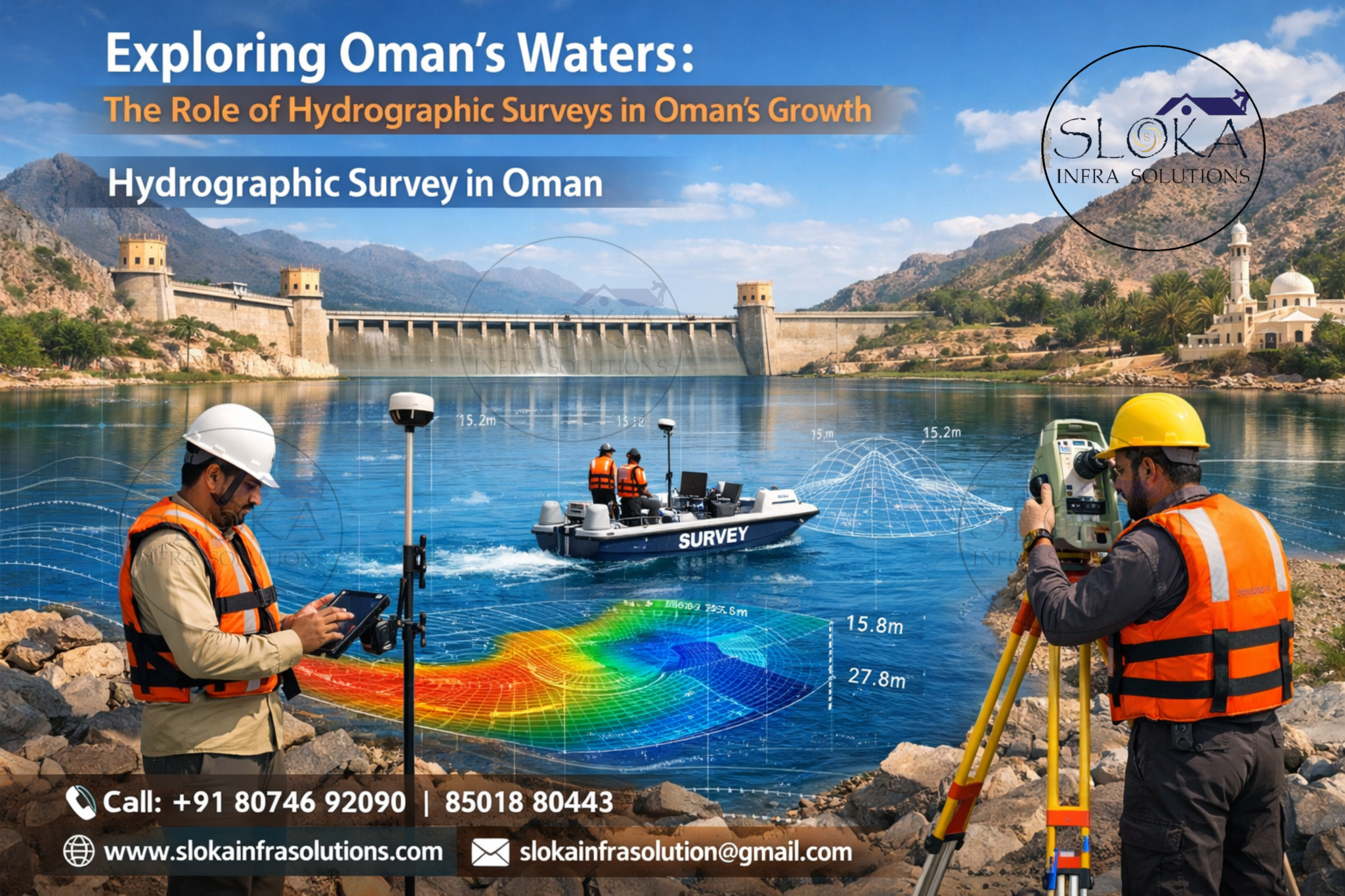
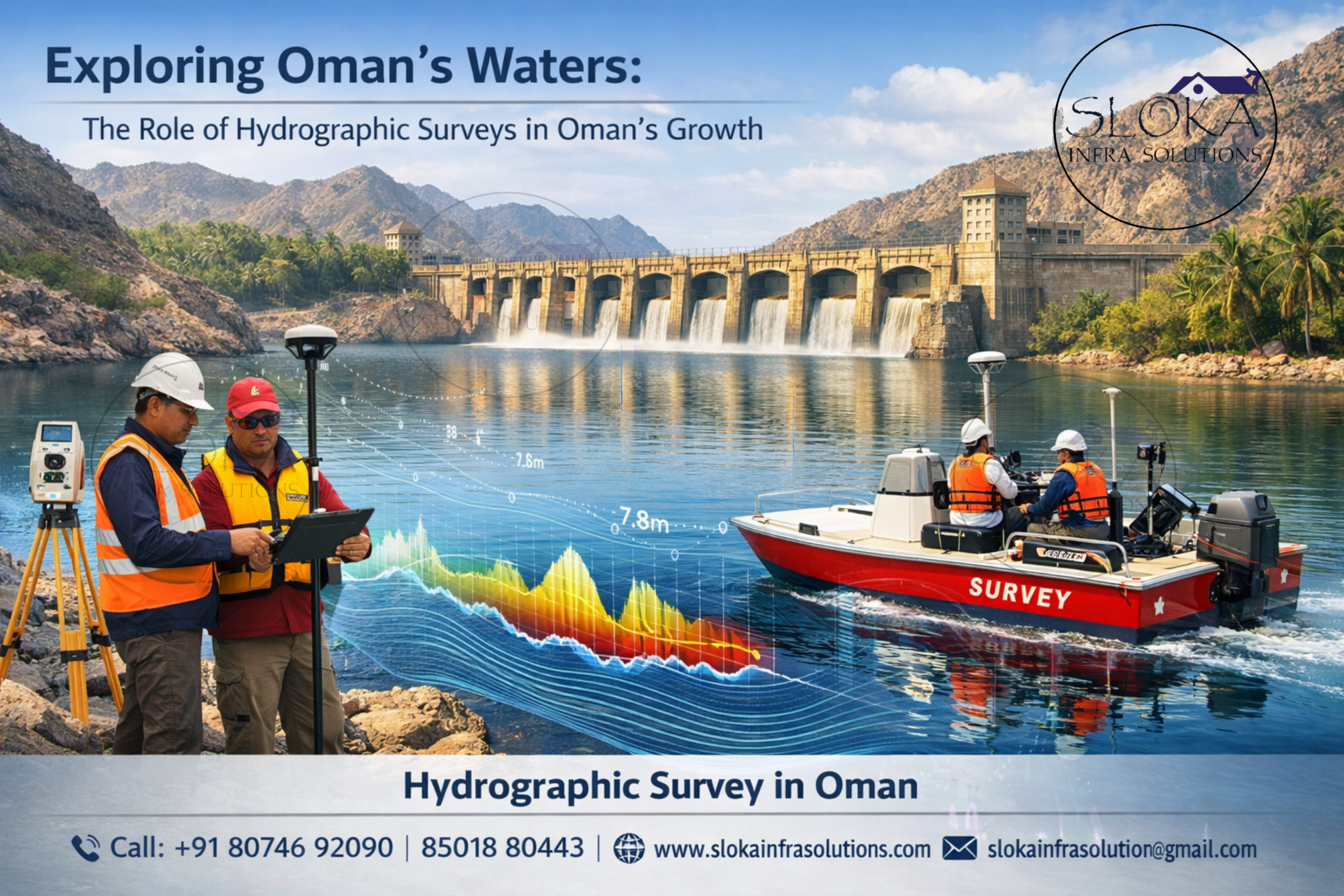
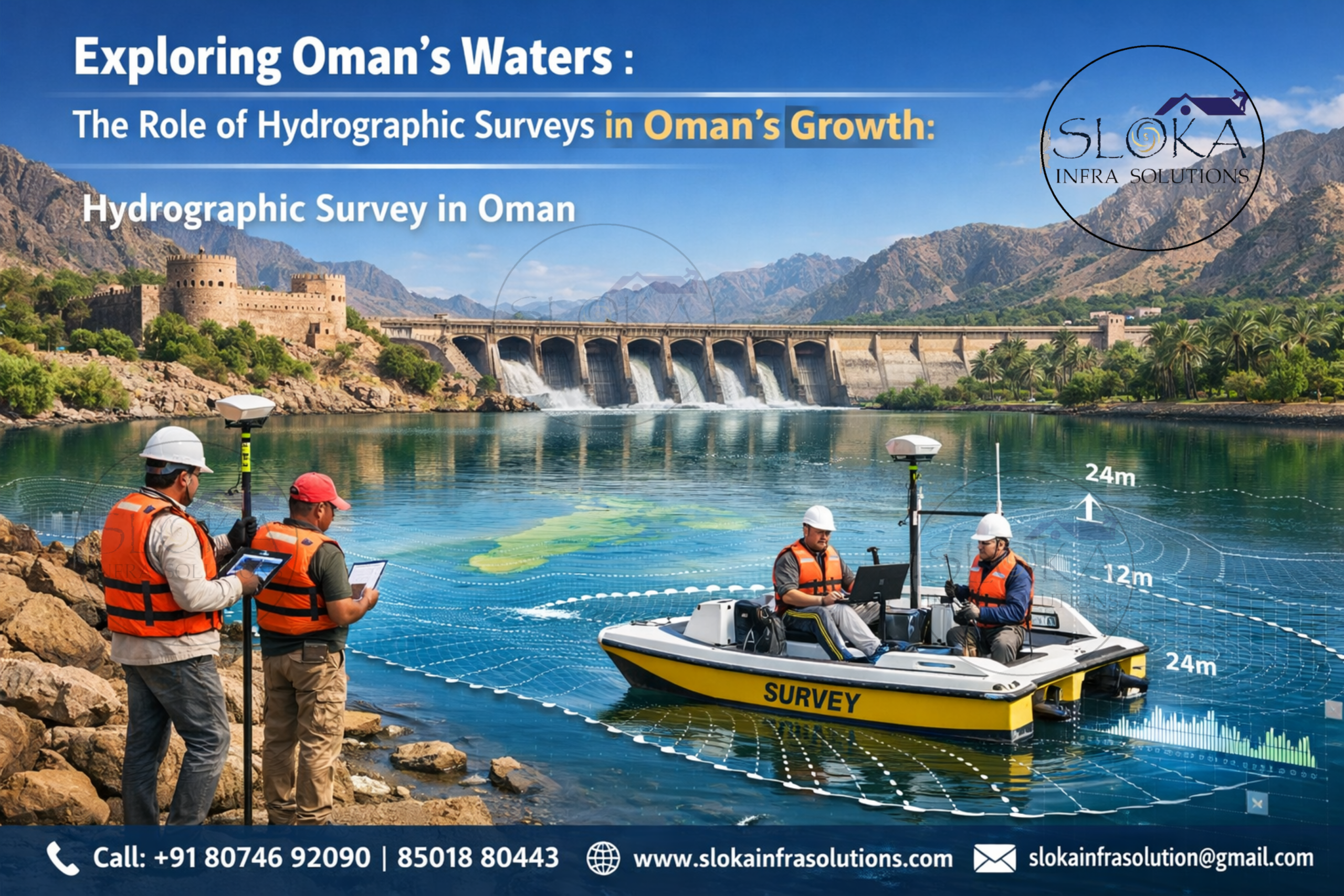
Hydrographic surveying has evolved from traditional manual methods to highly sophisticated digital systems. In Oman, modern survey projects rely on cutting-edge tools such as GPS positioning systems, sonar technologies, and autonomous survey vessels. These technologies ensure high accuracy, efficiency, and coverage even in challenging marine conditions.
Surveyors now use integrated systems that combine depth measurement, seabed imaging, and current analysis into a single workflow. This not only improves data quality but also reduces survey time and operational costs. The adoption of advanced technologies is particularly important in Oman due to varying seabed conditions and water depths.
Single Beam Echo Sounder Survey:-
A Single Beam Echo Sounder (SBES) survey is one of the most fundamental techniques used in hydrographic surveying. It involves transmitting a single acoustic pulse directly beneath the survey vessel and measuring the time it takes for the sound wave to travel to the seabed and return. This time is then converted into depth measurements.
In Oman, SBES surveys are widely used for preliminary assessments, inland water studies, and smaller coastal projects. They are especially effective in shallow waters such as lagoons, estuaries, and nearshore zones where detailed mapping is required but full coverage is not necessary. The simplicity and cost-effectiveness of SBES make it a preferred choice for routine surveys and monitoring.
Despite its advantages, SBES provides data only along the survey line, meaning it does not cover the entire seabed. However, when combined with precise positioning systems, it can still deliver reliable depth profiles. In Oman’s context, SBES is often used for sediment transport studies, coastal erosion analysis, and maintenance dredging projects.
Multibeam Echo Sounder Survey:-
A Multibeam Echo Sounder (MBES) survey represents a significant advancement over traditional methods. Unlike SBES, MBES systems emit multiple acoustic beams in a fan-shaped pattern, covering a vast swath of the seabed in a single pass. This allows for comprehensive and high-resolution mapping of underwater terrain.
In Oman, MBES surveys are extensively used for port development, offshore oil and gas exploration, and seabed classification. The ability to generate detailed 3D models of the seabed makes MBES invaluable for engineering and planning purposes. It helps in identifying underwater features such as trenches, ridges, and man-made structures with remarkable precision.
The use of MBES is particularly important in deeper waters and high-traffic zones where safety and accuracy are critical. With Oman investing heavily in maritime infrastructure, MBES surveys play a crucial role in ensuring that projects are executed efficiently and safely.
Side Scan Sonar:-
Side Scan Sonar is a powerful tool used to create detailed images of the seabed. Unlike echo sounders that focus on depth measurement, side scan sonar provides a visual representation of underwater features. It works by emitting sound waves to both sides of the survey vessel and capturing the signals to produce high-resolution images.
In Oman, side scan sonar is widely used for detecting underwater objects such as shipwrecks, pipelines, cables, and debris. It is particularly useful in search and recovery operations, archaeological studies, and environmental monitoring. The technology can reveal textures and patterns on the seabed, helping surveyors distinguish between different types of materials.
One of the key advantages of side scan sonar is its ability to cover large areas while maintaining image clarity. This makes it ideal for surveying Oman’s extensive coastline and offshore regions. It is often used in combination with other survey methods to provide a comprehensive understanding of the underwater environment.
Sub Bottom Profilers:-
Sub Bottom Profilers (SBP) are specialized instruments used to study the layers beneath the seabed. They emit low-frequency sound waves that penetrate the seabed and reflect off subsurface layers. This allows surveyors to analyze sediment composition, thickness, and geological structures.
In Oman, SBP surveys are crucial for offshore construction projects, pipeline installations, and geological research. The country’s seabed often consists of complex sediment layers, making it essential to understand subsurface conditions before undertaking any major project. SBP data helps engineers design stable foundations and avoid potential hazards.
Additionally, SBP surveys play a role in environmental studies by identifying sediment movement and historical deposition patterns. This information is valuable for coastal management and conservation efforts. With Oman focusing on sustainable development, the use of SBP technology is becoming increasingly important.
ADCP Survey:-
An Acoustic Doppler Current Profiler (ADCP) survey is designed to track how water moves at different depths, capturing both the speed and direction of currents across the entire water column. It operates by sending out sound waves and interpreting the changes in frequency as they bounce back from tiny particles drifting in the water, allowing experts to build a clear picture of underwater flow patterns.
In Oman, ADCP surveys are essential for understanding ocean dynamics, tidal patterns, and sediment transport. These insights are critical for port operations, offshore engineering, and environmental management. For instance, knowing current patterns helps in designing efficient shipping routes and preventing sediment buildup in harbors.
ADCP data is also used in climate studies and marine ecosystem research. Oman’s coastal waters are influenced by seasonal monsoons, which affect currents and water temperatures. By analyzing ADCP data, scientists and engineers can make informed decisions that support both economic activities and environmental protection.
Applications across Oman’s marine landscape:-
Hydrographic surveys in Oman are not limited to a single industry. They support a wide range of applications, including:
- Port Development: Ensuring safe navigation and efficient operations in major ports.
- Oil & Gas Exploration: Mapping seabed and subsurface conditions for offshore drilling.
- Coastal Engineering: Supporting construction of breakwaters, jetties, and seawalls.
- Environmental Monitoring: Assessing marine habitats and pollution levels.
- Fisheries Management: Understanding seabed conditions and fish habitats.
The versatility of hydrographic surveying makes it indispensable for Oman’s economic and environmental goals.
Challenges survey teams must respect:-
Conducting hydrographic surveys in Oman is not without its challenges. The region’s varied marine landscapes demand a mix of specialized methods and equipment to get accurate results. Powerful currents, shifting seasonal conditions, and constantly changing water depths can all influence how efficiently and precisely surveys are conducted.
Additionally, remote offshore locations may pose logistical challenges, requiring specialized vessels and equipment. Despite these obstacles, advancements in technology and skilled professionals continue to overcome these challenges effectively.
Sustainable Surveying: Protecting Oman’s marine ecosystems:-
The future of hydrographic surveying in Oman looks promising. With increasing investments in maritime infrastructure, renewable energy, and offshore exploration, the demand for accurate marine data is expected to grow significantly.
Emerging technologies such as autonomous survey vessels, artificial intelligence, and real-time data processing are set to revolutionize the industry. These innovations will enhance efficiency, reduce costs, and improve data accuracy.
Hydrographic Survey in Oman will continue to play a pivotal role in supporting the nation’s vision for sustainable development and economic diversification. Similarly, Top Hydrographic Survey & Surveyors in Oman will remain at the forefront of delivering high-quality services that meet global standards.
From data to decisions: The true value of Hydrographic insights:-
Hydrographic surveying is more than just mapping the seabed—it is about understanding and managing one of Oman’s most valuable resources: its marine environment. From ensuring safe navigation to supporting large-scale infrastructure projects, hydrographic surveys provide the data needed to make informed decisions.
As Oman continues to expand its maritime capabilities and explore new opportunities, the importance of hydrographic surveying will only grow. With advanced technologies, skilled professionals, and a commitment to sustainability, Oman is well-positioned to harness the full potential of its waters for generations to come.