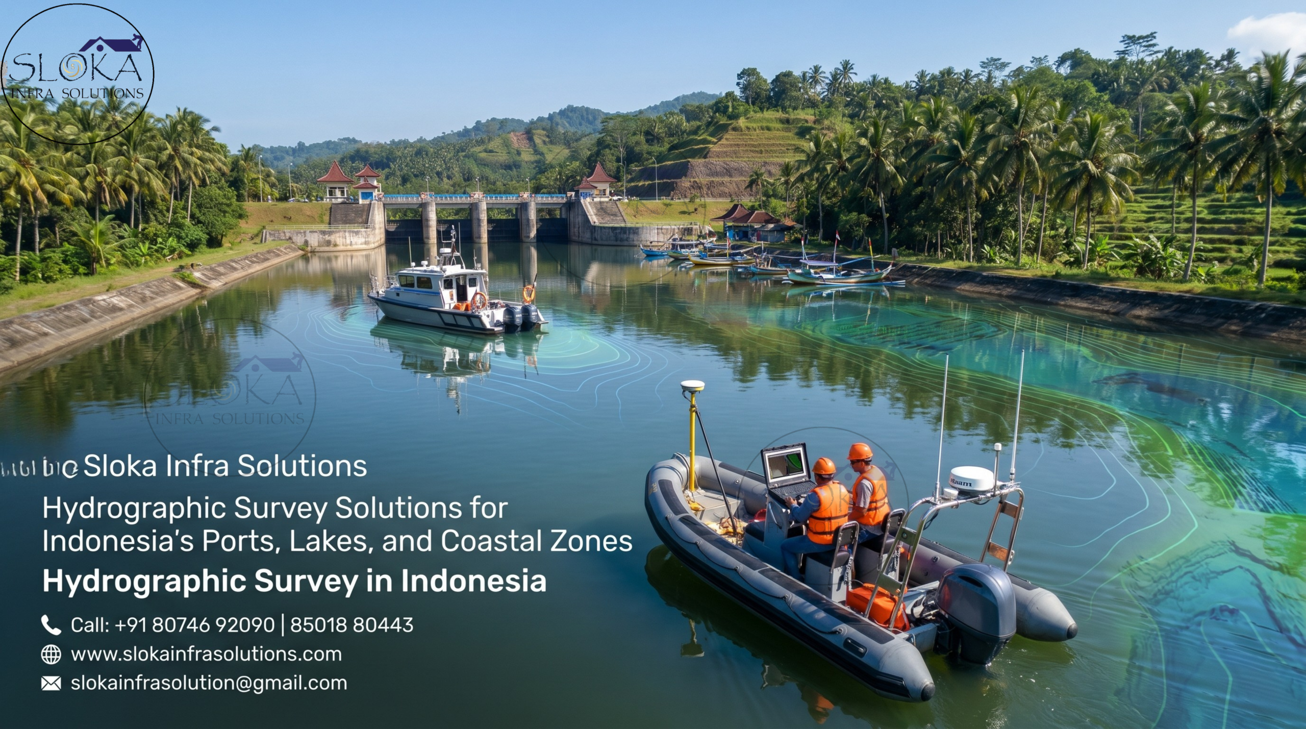
Hydrographic Survey in Indonesia
Call: +91 80746 92090
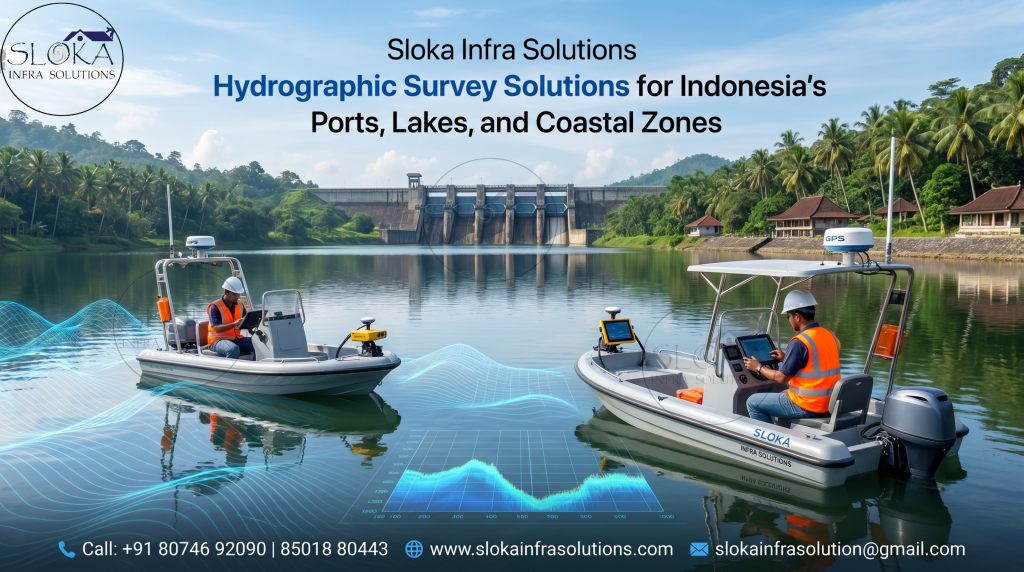
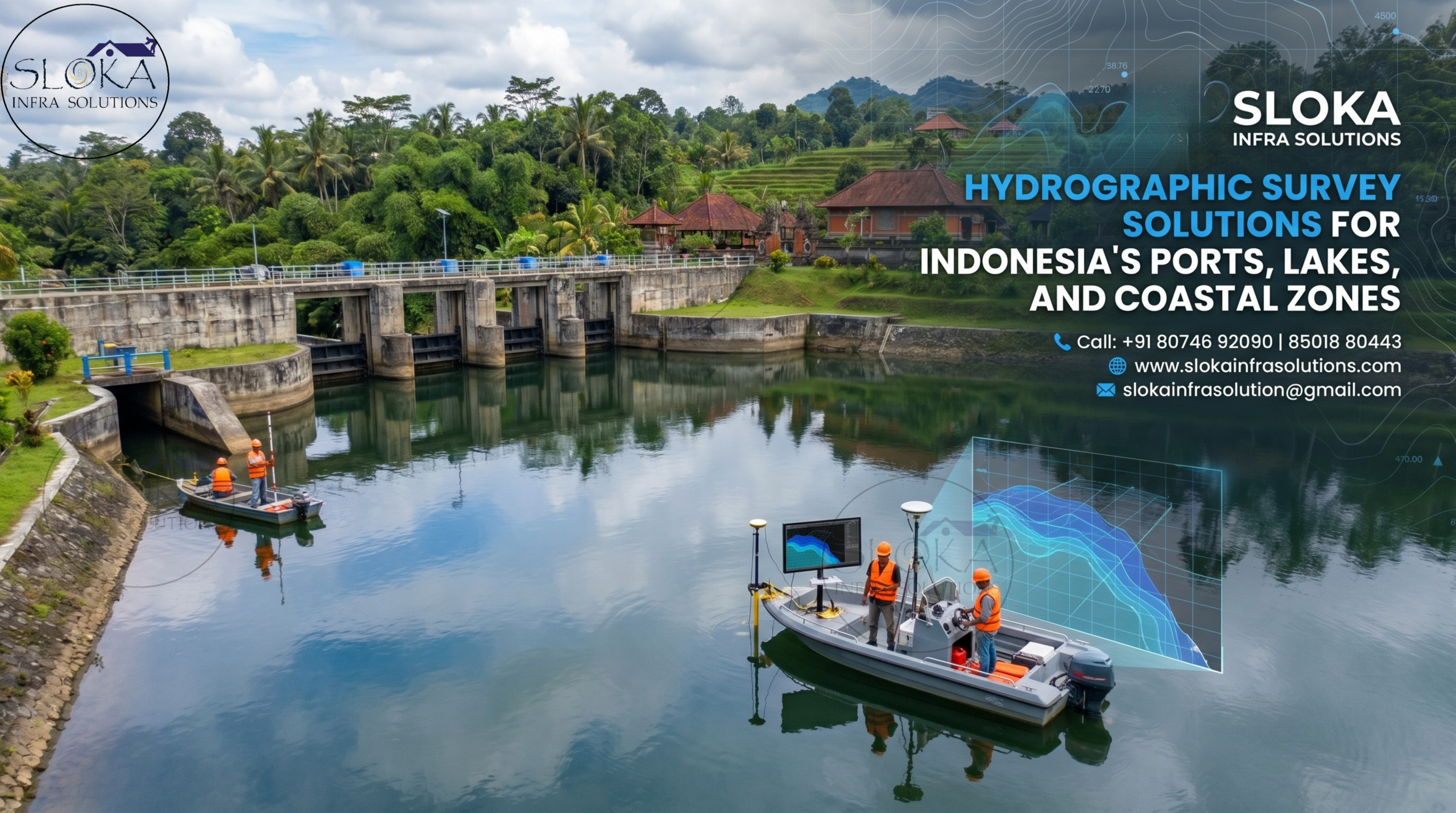
Hydrographic Survey Solutions for Indonesia’s Ports, Lakes, and Coastal Zones
Hydrographic Survey in Indonesia is essential for understanding, measuring, and managing the country’s vast and highly dynamic water environments. Indonesia is an island nation shaped by seas, straits, rivers, lakes, reservoirs, estuaries, coastal villages, ports, coral areas, and marine parks. Because underwater conditions change due to tides, waves, sediment movement, floods, erosion, dredging, and development activities, accurate hydrographic data becomes important for safe navigation, coastal planning, water-resource management, port development, environmental protection, and infrastructure projects. A well-planned hydrographic survey turns hidden underwater features into clear maps, helping decision-makers work with confidence instead of guesswork.
Hydrographic Surveyor in Indonesia
Hydrographic Surveyor in Indonesia plays a major role in collecting, checking, processing, and presenting reliable waterbody data for different project needs. A surveyor working near a port may focus on safe vessel movement, dredging levels, seabed clearance, and navigation risks. A surveyor working in a river may study depth, flow, sedimentation, erosion, and flood behaviour. In lakes, reservoirs, coastal zones, and remote islands, surveyors help planners understand water depth, bottom conditions, current patterns, and underwater hazards. Their work supports engineers, port authorities, marine planners, environmental teams, village development programs, and water-resource managers.
How Do Hydrographic Surveys Help Indonesia Plan Smarter Water Projects?
Indonesia’s geography makes hydrographic surveying more than a technical requirement. The country depends strongly on maritime routes, coastal livelihoods, fisheries, tourism, ports, offshore activities, inland water systems, and community water resources. Every waterbody has a different purpose and challenge. Some areas have shallow reefs, while others have deep channels. Some rivers carry heavy sediment, while some reservoirs lose storage capacity because of siltation. Some ports need regular depth monitoring, while some coastal zones need careful environmental mapping.
A hydrographic survey helps answer practical questions. Is the channel safe for vessels? Has sediment reduced reservoir capacity? Is dredging required? Are there underwater obstructions? How fast is the water flowing? What type of seabed is present? Can a bridge, jetty, intake well, pipeline, or coastal structure be safely planned? These answers make projects safer, smarter, and more cost-effective.
Major Waterbodies and Survey Needs:
- Seas and shipping routes: Hydrographic data supports safer vessel movement, route planning, and updated marine charts.
- Ports and harbors: Regular surveys help monitor berth depth, access channels, turning areas, and dredging requirements.
- Rivers and estuaries: Surveys reveal water depth, changing riverbeds, erosion patterns, sediment build-up, flood risks, and natural flow movement.
- Lakes and reservoirs: Bathymetric surveys support storage calculation, sediment monitoring, irrigation, drinking water planning, and dam-related studies.
- Coastal villages: Surveys help understand tidal influence, drainage, shoreline change, and water access challenges.
- Marine parks and coral zones: Mapping supports conservation, tourism safety, fishing management, and sustainable zoning.
Hydrographic Survey as a Planning Tool:-
Hydrographic surveying is not only about measuring depth. It is a planning tool that connects navigation, engineering, environment, and community needs. In Indonesia, water supports transport, food, tourism, livelihoods, energy, agriculture, and settlement growth. When underwater information is missing or outdated, projects may face delays, safety issues, environmental damage, or cost increases.
For example, a port expansion needs accurate seabed levels before dredging. A river bridge needs data on scour and bed movement. A reservoir authority needs capacity information to understand sediment loss. A coastal planner needs depth, seabed, and current data before approving development. A marine conservation team needs maps that show sensitive bottom features. This is why hydrographic surveys create value beyond maps; they guide real decisions.
Key Outputs of a Good Survey
- Bathymetric maps showing depth, contours, slopes, channels, and shallow areas.
- Digital terrain models presenting underwater surfaces in detailed form.
- Cross-sections and profiles useful for rivers, bridges, canals, ports, and engineering alignments.
- Dredging volume reports showing how much material must be removed or checked.
- Seabed imagery identifying bottom texture, objects, debris, reefs, or obstructions.
- Current and discharge data explaining how water moves through a section.
- Subsurface profiles showing sediment layers below the bed.
- Technical reports explaining methods, equipment, corrections, findings, and recommendations.
1.Single Beam Echo Sounder Survey:-
Single Beam Echo Sounder Survey is a practical method used to measure water depth along planned survey lines. It sends a sound pulse from the transducer to the waterbed and measures the time taken for the echo to return. After applying corrections, this information is converted into depth data. In Indonesia, this method is useful for rivers, lakes, reservoirs, canals, small ports, village ponds, and sheltered coastal areas where reliable depth profiles are required.
Its biggest strength is simplicity. It can be used on small boats and is suitable for places where large survey vessels cannot operate. In reservoirs, it helps estimate storage capacity and sediment build-up. In rivers, it supports cross-sections, shallow-zone identification, flood studies, and bridge planning. For small harbors, it helps check approach channels and berth depths.
However, it measures only along survey lines, not the full seabed between them. So, proper line spacing, positioning, cross-checking, and water-level correction are important for dependable results.
2.Multibeam Echo Sounder Survey:-
Multibeam Echo Sounder Survey is used when high-resolution and full-bottom coverage is required. Unlike single beam systems, a multibeam echo sounder sends many sound beams across a wide swath below the survey vessel. This helps surveyors capture detailed underwater terrain and create accurate bathymetric models, contour maps, seabed surfaces, and dredging outputs.
In Indonesia, this method is valuable for ports, shipping channels, strategic straits, offshore construction areas, bridge approaches, coastal engineering zones, and complex seabed environments. It can detect sand waves, sudden depth changes, scouring, rock outcrops, reefs, debris, wrecks, and dredging irregularities. This level of detail is highly useful where navigation safety and engineering accuracy are important.
A multibeam survey needs proper integration of positioning systems, motion sensors, heading sensors, sound velocity data, tide correction, and calibration. The quality of results depends on both equipment and surveyor skill. When processed carefully, Multibeam Echo Sounder Survey supports safer navigation, port development, dredging control, marine construction, and environmental planning.
3.Side Scan Sonar:-
Side Scan Sonar is used to create detailed images of the seabed, riverbed, or lakebed surface. While echo sounders mainly measure depth, side scan sonar focuses on bottom texture, objects, and surface features. It sends sound waves sideways across the waterbed and captures the returning echoes to reveal surface details clearly. Hard objects, soft sediment, rocks, coral areas, wrecks, anchors, cables, pipelines, and debris can often be identified from the sonar image.
In Indonesia, Side Scan Sonar is useful for ports, dredging zones, coastal waters, marine parks, pipeline routes, cable corridors, and navigation-risk areas. It helps identify underwater obstructions before construction or dredging. It also supports habitat mapping, reef-zone planning, tourism safety, and marine conservation. Around river mouths or estuaries, it can detect submerged logs, sediment patterns, or objects that may create operational risks.
Side scan sonar does not directly provide accurate depth, so it is often used with single beam or multibeam surveys. Its strength lies in making underwater surfaces easier to understand.
4.ADCP Survey:-
ADCP, or Acoustic Doppler Current Profiler, uses sound waves to track tiny particles moving with the water, helping measure flow speed and direction at different depths. This makes it useful for understanding how water moves above the seabed, riverbed, or reservoir bed. While bathymetry shows the bottom shape, ADCP Survey explains the movement of water over that surface.
In Indonesia, ADCP surveys are useful for rivers, estuaries, tidal channels, reservoirs, ports, and straits. The data supports flood studies, sediment transport analysis, bridge design, port planning, dredging impact studies, hydropower projects, and water-resource management. In rivers, ADCP helps measure discharge more safely and quickly than many traditional manual methods. In tidal areas, it helps understand how seawater and river water interact.
ADCP systems can be used from boats, bridges, floating platforms, or unmanned survey vehicles. When field planning, instrument settings, transects, and positioning are handled properly, ADCP Survey provides valuable flow information for safer and more resilient water projects.
5.Sub Bottom Profilers:-
Sub Bottom Profilers are used to understand what lies beneath the seabed, riverbed, or lakebed surface. While bathymetry shows the top surface of the underwater bottom, sub bottom profiling reveals buried layers below it. The system sends acoustic signals into the bed, and different sediment layers reflect the signals differently. This helps identify sediment thickness, buried channels, soft layers, hard strata, shallow gas, buried objects, or possible geological risks.
In Indonesia, sub bottom profiling is important for port development, dredging planning, offshore construction, pipeline routes, cable corridors, reservoirs, coastal structures, and marine engineering works. Before building a jetty, breakwater, bridge foundation, or offshore structure, engineers need to know more than just water depth. They must understand whether the bottom is soft mud, sand, clay, rock, or layered material.
For dredging projects, Sub Bottom Profilers help estimate the depth and type of material to be removed. When combined with multibeam bathymetry, side scan sonar, sediment sampling, and geotechnical investigation, this method supports safer underwater planning.
Role of Modern Survey Technology:-
Modern hydrographic technology is changing how surveys are performed in Indonesia. Traditional surveys can be slow, difficult, and risky, especially in remote areas, shallow waters, polluted ponds, strong-current zones, or rough coastal conditions. Today, tools such as unmanned surface vehicles, RTK positioning, integrated echo sounders, ADCP systems, drone mapping, satellite data, and automated route planning are making surveys safer and more efficient.
Unmanned survey boats can follow pre-planned routes, collect depth or current data, and reduce the need for people to work in risky locations. They are useful in reservoirs, ponds, canals, small lakes, shallow waters, and areas where crewed boats are difficult to operate. Real-time data review also helps surveyors identify gaps quickly and improve field efficiency.
Benefits of Modern Survey Methods:-
- Better safety: Reduces human exposure to risky water conditions.
- Faster fieldwork: Automated routes and integrated sensors save time.
- Higher accuracy: Modern positioning and sensor systems improve data quality.
- Repeat monitoring: Same routes can be surveyed again for comparison.
- Remote access: Compact systems can work in difficult or narrow waterbodies.
- Smarter decisions: Real-time data helps teams correct issues during fieldwork.
Hydrographic Risk Assessment in Indonesia:-
A large maritime country cannot survey every waterbody at the same urgency. Hydrographic Risk Assessment helps identify which areas need priority attention. In Indonesia, high-risk areas may include busy shipping routes, strategic straits, ports, ferry routes, shallow channels, reef areas, old chart zones, and locations with heavy economic or environmental value.
This approach helps authorities and project owners use survey resources more effectively. Areas with dense vessel traffic and outdated data need faster attention. Ports with regular sedimentation need repeated monitoring. River mouths that shift after floods may need seasonal surveys. Conservation areas need careful mapping before tourism or development activities. A risk-based survey plan improves safety, reduces uncertainty, and supports better marine governance.
Practical Uses for People and Nature
- Safer local navigation for fishing boats, ferries, and tourism vessels.
- Better zoning maps for fishing, tourism, conservation, and development.
- Reduced conflict between communities, authorities, and project owners.
- Improved reef and habitat protection through accurate seabed information.
- Stronger flood and drainage planning for vulnerable coastal and river areas.
- Better village water planning through mapping of ponds, drainage, and low-lying zones.
Building Safer Projects with Reliable Hydrographic Data:-
The future of Hydrographic Survey in Indonesia will depend on accurate data, skilled professionals, safer technology, environmental care, and community participation. As ports expand, maritime traffic grows, coastal development increases, and climate-related risks become more serious, Indonesia will need reliable hydrographic surveys more than ever. From single beam surveys in reservoirs to multibeam mapping in ports, from side scan sonar in seabed inspection to ADCP flow studies and sub bottom profiling, every method has a clear purpose. A skilled Hydrographic Surveyor in Indonesia can bring these methods together to support safe navigation, strong infrastructure, sustainable water management, and better protection of Indonesia’s unique aquatic environment.