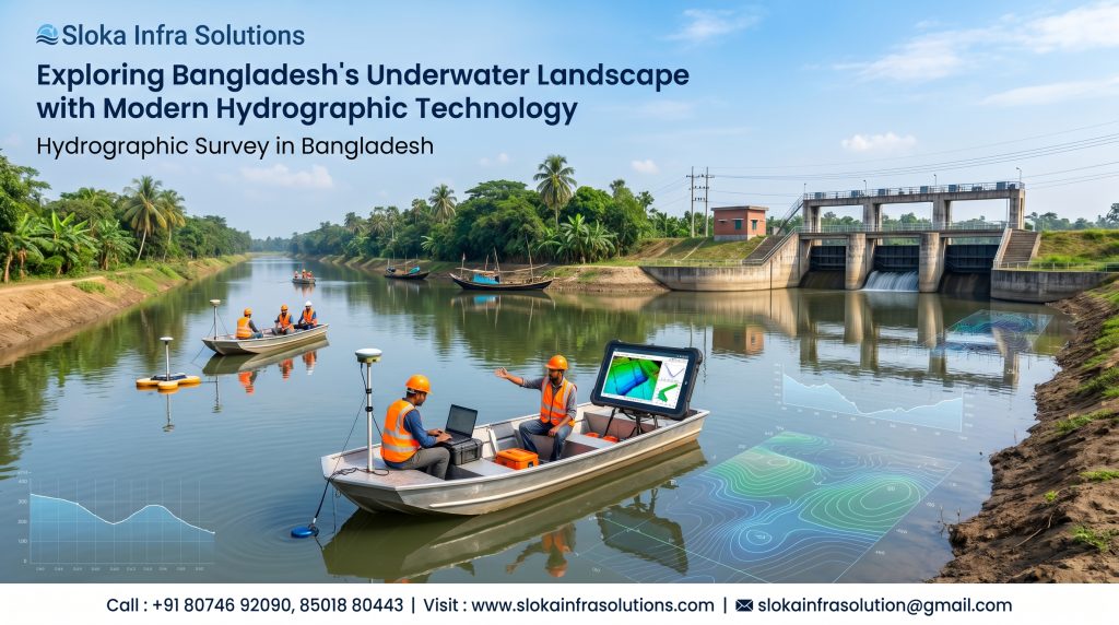
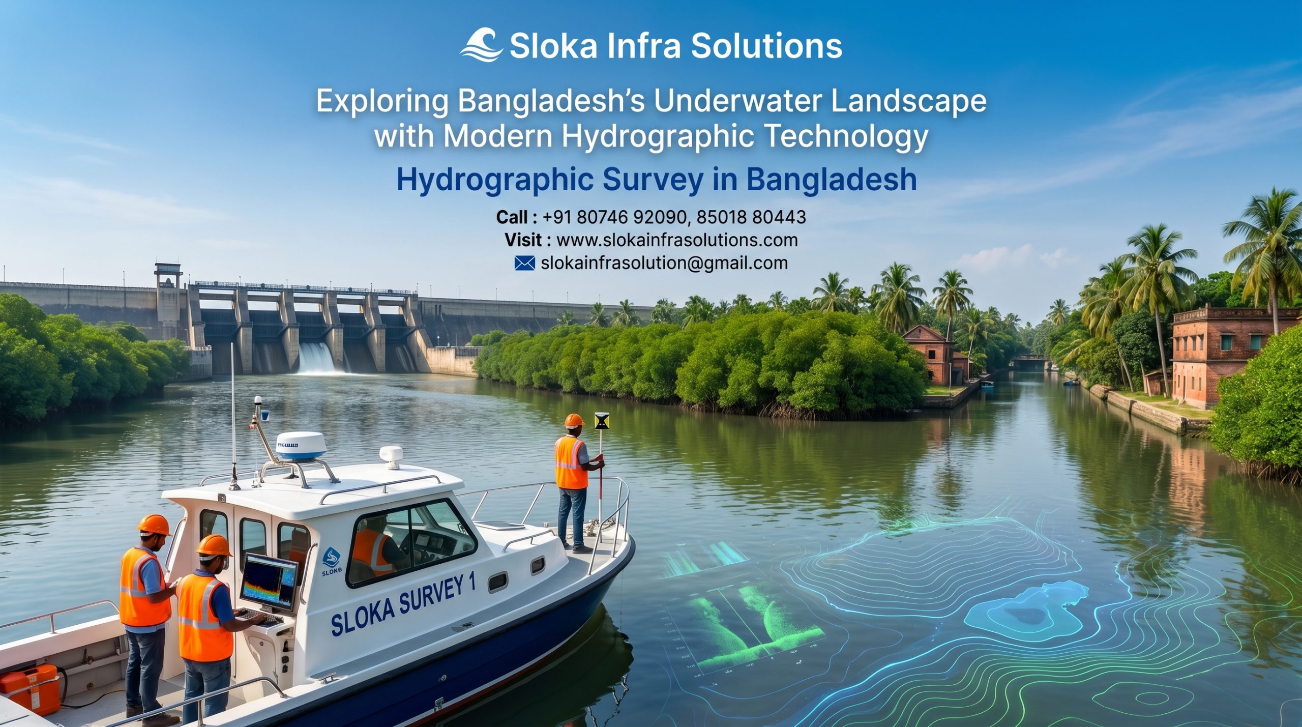
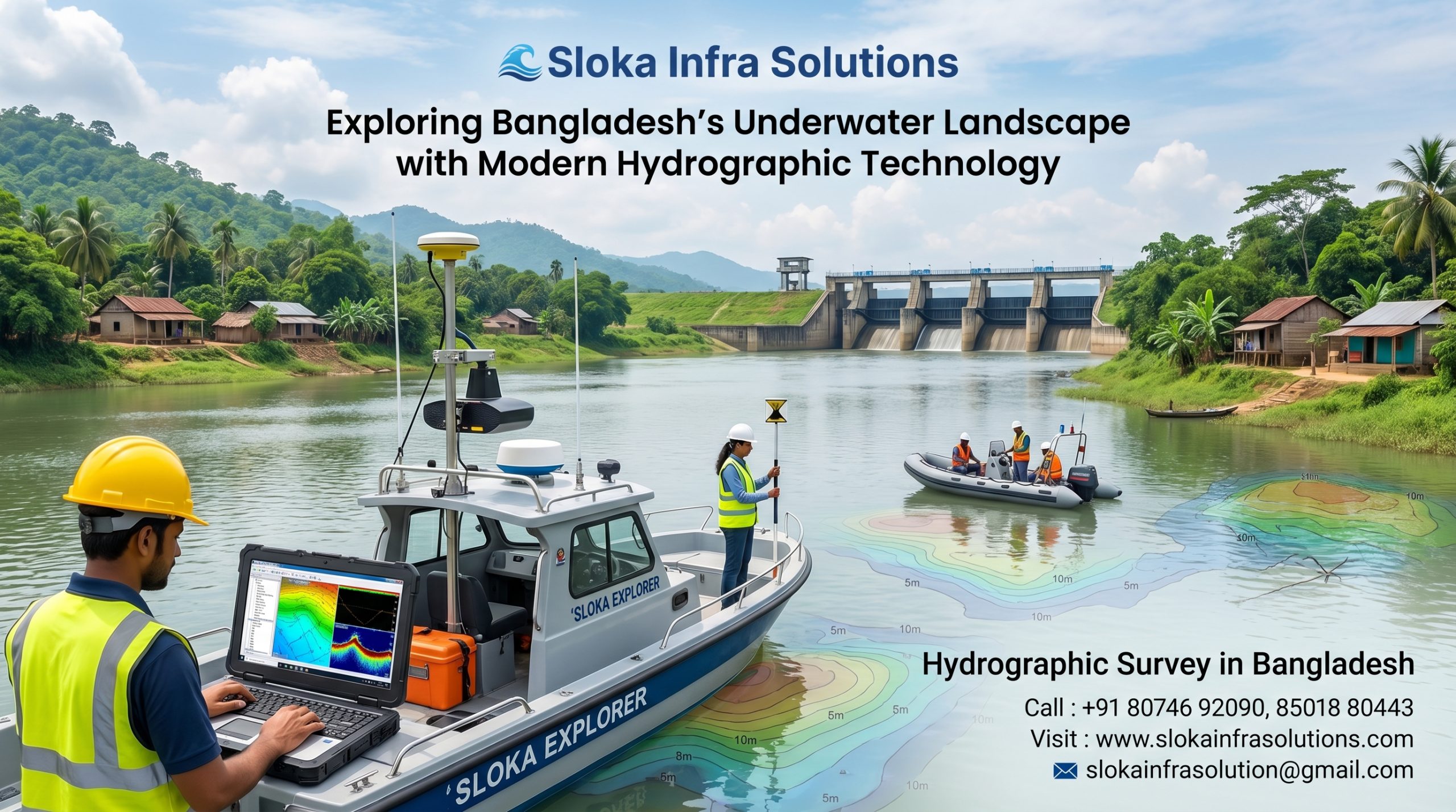
Hydrographic Survey in Bangladesh
Call: +91 80746 92090
Exploring Bangladesh’s Underwater Landscape with Modern Hydrographic Technology
Hydrographic Survey in Bangladesh has become one of the most important foundations for maritime development, inland waterway management, coastal protection, and sustainable resource utilization. As a nation shaped by thousands of rivers, extensive floodplains, estuaries, wetlands, reservoirs, and the vast Bay of Bengal, Bangladesh depends heavily on accurate hydrographic information to support navigation, infrastructure development, environmental conservation, and economic growth. From maintaining navigable river channels to enabling offshore exploration and supporting port operations, hydrographic surveys provide critical data that helps government agencies, port authorities, engineers, environmental experts, and maritime stakeholders make informed decisions.
Hydrographic Surveyor in Bangladesh
Hydrographic Surveyor in Bangladesh plays a vital role in collecting, analyzing, and interpreting underwater data across the country’s diverse aquatic environments. These professionals utilize advanced surveying technologies to measure water depths, map seabed features, monitor sediment movement, identify underwater hazards, and support engineering and environmental projects. The demand for skilled hydrographic experts continues to rise as Bangladesh expands its maritime economy, develops coastal infrastructure, improves inland water transportation, and strengthens its blue economy initiatives.
Bangladesh’s Unique Geography and the Need for Hydrographic Surveys:-
Bangladesh is one of the world’s largest river delta systems, formed by the mighty Ganges, Brahmaputra, and Meghna rivers. The country possesses more than 24,000 kilometers of rivers and waterways that support transportation, agriculture, fisheries, trade, and daily livelihoods. These waterways constantly change due to sediment deposition, erosion, flooding, tidal influences, and seasonal variations.
The Bay of Bengal further adds strategic importance to Bangladesh’s hydrographic requirements. The country’s seaports, offshore resources, fishing zones, and coastal communities all depend on accurate marine data for safe and sustainable operations.
Hydrographic surveys provide essential information that helps:
- Maintain navigable waterways.
- Improve maritime safety.
- Support dredging operations.
- Facilitate port development.
- Monitor environmental changes.
- Assist offshore exploration.
- Enhance disaster preparedness.
- Strengthen coastal management.
- Promote blue economy initiatives.
- Support scientific research.
Decoding Underwater Environments Through Modern Survey Techniques:-
A hydrographic survey is the process of measuring and mapping physical characteristics beneath water bodies. Unlike traditional land surveys that focus on terrain above ground, hydrographic surveys explore underwater environments to collect detailed information about water depths, seabed conditions, underwater structures, currents, and sediment patterns.
These surveys are conducted in:
- Rivers
- Canals
- Lakes
- Reservoirs
- Harbors
- Coastal waters
- Estuaries
- Offshore regions
- Navigation channels
- Dredging zones
Reliable hydrographic data serves as the backbone of safe navigation, marine infrastructure development, environmental studies, and effective management of aquatic resources.
The Growing Importance of Hydrographic Surveys in the Bay of Bengal:-
The Bay of Bengal serves as a major economic gateway for Bangladesh and neighboring countries. International shipping routes, offshore energy projects, fisheries, and port activities depend on safe and efficient maritime operations.
Accurate hydrographic information supports:
- Safe vessel navigation.
- Port expansion projects.
- Offshore oil and gas exploration.
- Marine infrastructure development.
- Fisheries management.
- Coastal protection programs.
- Underwater cable installations.
- Environmental monitoring initiatives.
As maritime activities continue to increase, the importance of regular hydrographic surveys becomes even more significant.
The Digital Evolution of Hydrographic Surveying and Seabed Exploration:-
Modern hydrographic surveying relies on sophisticated technologies that provide highly accurate and reliable underwater information. These advanced systems allow surveyors to collect comprehensive datasets that support engineering, navigation, environmental management, and scientific research.
Among the most widely used technologies are:
- Single Beam Echo Sounders
- Multibeam Echo Sounders
- Side Scan Sonar
- ADCP Systems
- Sub Bottom Profilers
- GNSS Positioning Systems
- Survey Drones
- Remotely Operated Vehicles (ROVs)
Each technology serves a unique purpose and contributes to a complete understanding of underwater environments.
1.Single Beam Echo Sounder Survey:-
A Single Beam Echo Sounder Survey remains one of the most commonly used hydrographic survey methods in Bangladesh, particularly for river surveys, reservoir assessments, channel maintenance projects, and dredging operations.
The system works by transmitting a sound pulse vertically toward the seabed. When the acoustic signal strikes the bottom surface, it reflects back to the transducer mounted on the survey vessel. The travel time of the sound wave is measured and converted into depth information.
Single beam surveys offer several practical advantages. They are cost-effective, relatively easy to operate, and capable of producing accurate depth measurements. Because many rivers in Bangladesh require frequent monitoring due to rapid sedimentation and shifting channels, single beam systems remain highly valuable for routine hydrographic work.
Applications include:
- River channel monitoring.
- Dredging support surveys.
- Reservoir mapping.
- Bridge construction projects.
- Inland navigation assessments.
- Water resource management.
Although single beam systems provide highly accurate depth data, they only measure directly beneath the vessel. As a result, multiple survey lines are required to achieve adequate coverage across larger areas.
Despite advancements in newer technologies, single beam surveys continue to be an essential component of hydrographic operations throughout Bangladesh because of their efficiency, affordability, and reliability.
Why Accurate Hydrographic Data Matters?
Accurate underwater information contributes directly to national development. Reliable hydrographic data helps reduce risks, improve planning, and support sustainable resource management.
The benefits extend across multiple sectors including transportation, infrastructure, fisheries, environmental conservation, and disaster management.
Without regular hydrographic surveys, navigation channels may become unsafe, dredging operations may become inefficient, and infrastructure projects could face significant challenges due to insufficient underwater information.
2.Multibeam Echo Sounder Survey:-
A Multibeam Echo Sounder Survey represents one of the most advanced methods used in modern hydrographic mapping. Unlike single beam systems that collect data from a single point beneath the vessel, multibeam systems generate thousands of depth measurements simultaneously across a wide swath of the seabed.
This technology uses multiple acoustic beams transmitted at different angles to create highly detailed bathymetric maps. The resulting data provides a comprehensive representation of underwater terrain, making multibeam surveys ideal for large-scale marine projects.
Advantages of multibeam surveys include:
- Full seabed coverage.
- High-resolution bathymetric mapping.
- Faster survey completion.
- Enhanced hazard detection.
- Improved dredging calculations.
- Detailed underwater terrain analysis.
In Bangladesh, multibeam surveys are widely used for:
- Port development.
- Harbor maintenance.
- Offshore exploration.
- Coastal engineering projects.
- Navigation channel assessments.
- Environmental monitoring.
The technology is particularly valuable in dynamic environments where sedimentation and seabed changes occur frequently. Detailed bathymetric models generated through multibeam surveys enable planners and engineers to make informed decisions regarding marine infrastructure and navigation safety.
As Bangladesh continues to expand its maritime capabilities, multibeam technology is becoming increasingly important for supporting long-term economic growth and sustainable marine development.
3.Side Scan Sonar:-
Side Scan Sonar is a powerful hydrographic tool used to create detailed acoustic images of the seafloor and underwater objects. Unlike echo sounders that primarily measure depth, side scan sonar focuses on imaging underwater features with remarkable clarity.
The system emits sound pulses sideways from a sonar unit. As these acoustic signals interact with the seabed and submerged objects, they create detailed images that reveal textures, shapes, and potential hazards.
Side scan sonar is widely used for:
- Shipwreck detection.
- Underwater obstacle identification.
- Pipeline route surveys.
- Cable route inspections.
- Port development projects.
- Search and recovery operations.
- Environmental assessments.
- Seabed characterization studies.
In Bangladesh, side scan sonar plays a crucial role in ensuring navigation safety across rivers, ports, and coastal waters. With many waterways experiencing constant sediment movement and changing underwater conditions, the ability to identify submerged hazards is essential.
One of the major advantages of side scan sonar is its ability to detect objects that may not be easily identified through depth measurements alone. The technology produces high-resolution images that help surveyors distinguish between natural seabed features and man-made objects.
Modern side scan sonar systems provide real-time imaging, enhanced resolution, and advanced data processing capabilities. When combined with other hydrographic technologies, side scan sonar contributes significantly to comprehensive underwater investigations and marine infrastructure planning throughout Bangladesh.
4.ADCP Survey:-
An ADCP Survey (Acoustic Doppler Current Profiler Survey) is a specialized hydrographic technique used to measure water current velocities, flow directions, and discharge characteristics. This technology has become increasingly important in Bangladesh because of the country’s extensive river networks and complex hydrodynamic environments.
The ADCP system works by transmitting acoustic signals into the water column. As these sound waves interact with suspended particles moving with the current, the Doppler effect allows the instrument to calculate water velocity at various depths.
ADCP surveys provide critical information for:
- River flow analysis.
- Flood forecasting.
- Hydraulic modeling.
- Bridge design projects.
- Sediment transport studies.
- Navigation planning.
- Water resource management.
- Coastal engineering projects.
Bangladesh experiences significant seasonal variations in river discharge due to monsoon rainfall and upstream water flows. Understanding these dynamic conditions is essential for effective flood management and infrastructure planning.
ADCP technology allows surveyors to measure flow characteristics throughout the entire water column rather than only at the surface. This capability provides a detailed understanding of river behavior and current patterns.
The data collected through ADCP surveys supports engineers, environmental scientists, and policymakers in making informed decisions regarding river management, erosion control, and flood mitigation strategies.
As climate change continues to influence hydrological patterns, ADCP surveys are becoming an increasingly valuable tool for managing Bangladesh’s complex water systems.
5.Sub Bottom Profilers:-
Sub Bottom Profilers are advanced hydrographic instruments designed to investigate geological layers beneath the seabed or riverbed. Unlike conventional sonar systems that focus on surface features, sub bottom profilers penetrate sediments to reveal hidden subsurface structures.
The technology works by transmitting low-frequency acoustic signals into the seabed. These signals travel through sediment layers and reflect back when they encounter changes in material composition or geological boundaries.
Sub bottom profiling is commonly used for:
- Geological investigations.
- Marine construction planning.
- Pipeline route assessments.
- Cable route studies.
- Sediment thickness measurements.
- Offshore exploration projects.
- Dredging assessments.
- Environmental studies.
In Bangladesh, sub bottom profilers are particularly useful because many coastal and riverine areas contain significant sediment deposits. Understanding subsurface conditions helps engineers evaluate construction feasibility and identify potential risks.
The technology provides valuable information regarding:
- Sediment accumulation patterns.
- Buried channels.
- Geological formations.
- Historical river systems.
- Foundation suitability.
For offshore construction and development projects, sub bottom profiling helps pinpoint secure and suitable seabed locations, providing the confidence needed for safe and long-lasting infrastructure installation. It also assists in understanding long-term geological processes that may affect project performance.
As maritime development continues to expand across the Bay of Bengal, sub bottom profilers are becoming increasingly important for supporting safe and efficient engineering decisions.
Hydrographic Surveys and Environmental Sustainability:-
Hydrographic surveys contribute significantly to environmental protection and sustainable resource management. Accurate underwater data helps authorities monitor ecosystem changes, assess environmental impacts, and develop conservation strategies.
Environmental applications include:
- Habitat mapping.
- Wetland monitoring.
- Coastal erosion studies.
- Sediment management.
- Fisheries assessments.
- Pollution investigations.
- Climate adaptation planning.
- Biodiversity conservation.
By providing reliable information about aquatic environments, hydrographic surveys support balanced development while protecting natural ecosystems.
Addressing the Real-World Obstacles of Underwater Data Collection:-
Hydrographic survey teams in Bangladesh encounter numerous operational challenges due to the country’s unique environmental conditions.
Common challenges include:
- Rapid sediment deposition.
- Seasonal flooding.
- Strong river currents.
- Cyclone impacts.
- Coastal erosion.
- Limited survey windows.
- Dynamic river morphology.
- Tidal influences.
These factors require continuous monitoring and regular updates to hydrographic databases to maintain accuracy and reliability.
Driving Sustainable Development with Accurate Marine and Waterway Data:-
Bangladesh’s vision for economic growth, maritime expansion, and blue economy development depends heavily on accurate hydrographic information. As investments continue in ports, shipping, offshore energy, fisheries, and coastal infrastructure, the need for advanced hydrographic services will continue to grow.
Comprehensive seabed mapping, updated navigation data, and detailed hydrological information will play an increasingly important role in supporting national development goals. Through continued investment in modern survey technologies, professional expertise, and data management systems, Bangladesh can strengthen its maritime capabilities while ensuring sustainable utilization of its valuable aquatic resources.
The Lasting Value of Hydrographic Surveys in National Growth:-
Hydrographic Survey in Bangladesh continues to play a vital role in supporting the nation’s waterways, maritime infrastructure, environmental sustainability, and economic progress. From navigating complex river networks to unlocking opportunities across the Bay of Bengal, accurate underwater data helps drive safer operations, smarter planning, and more efficient resource management. Advanced technologies such as Single Beam Echo Sounders, Multibeam Echo Sounders, Side Scan Sonar, ADCP systems, and Sub Bottom Profilers are transforming the way underwater environments are understood and managed.
At the heart of these efforts is every Hydrographic Surveyor in Bangladesh, whose expertise helps deliver the precise information needed for navigation safety, coastal development, offshore projects, and environmental protection. As Bangladesh continues to strengthen its maritime capabilities and expand its blue economy, hydrographic surveying will remain a key force behind sustainable growth, informed decision-making, and the responsible development of the country’s valuable water resources.