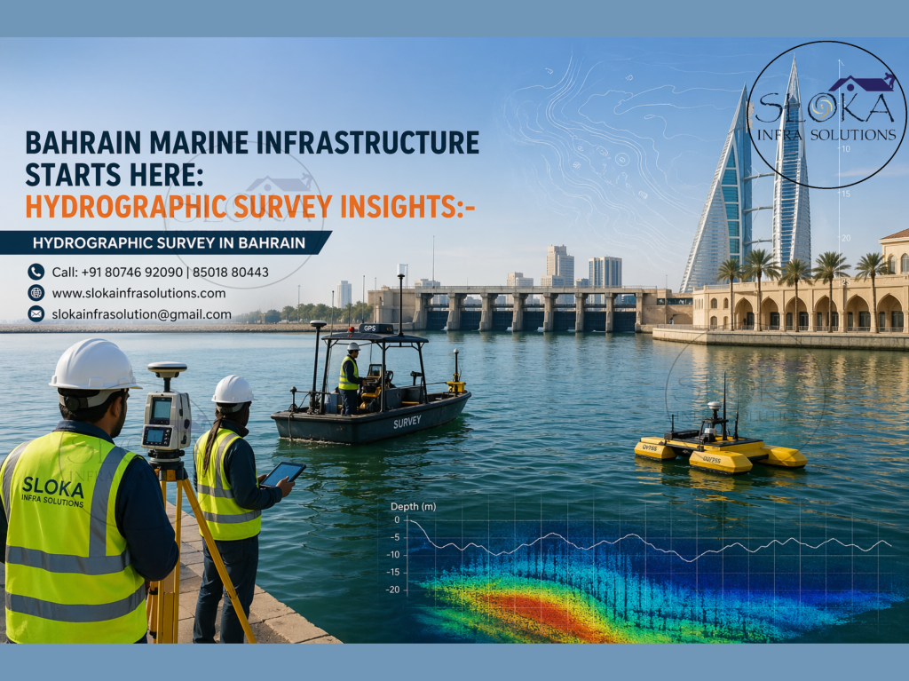
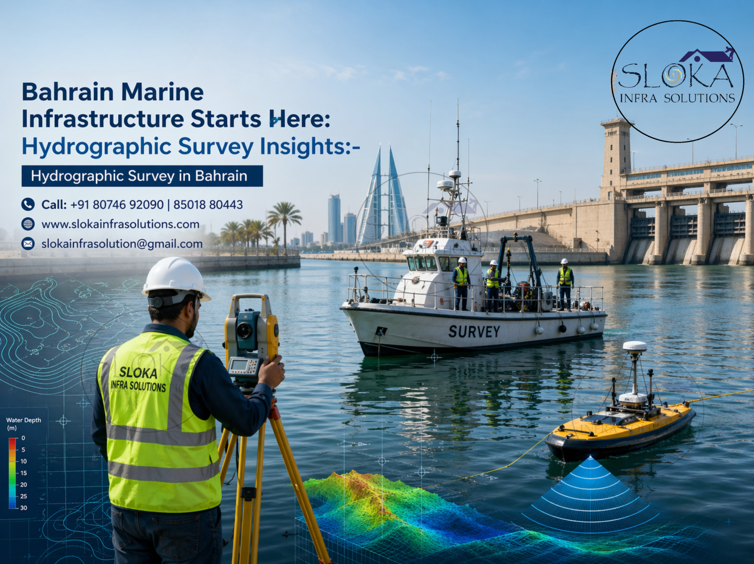
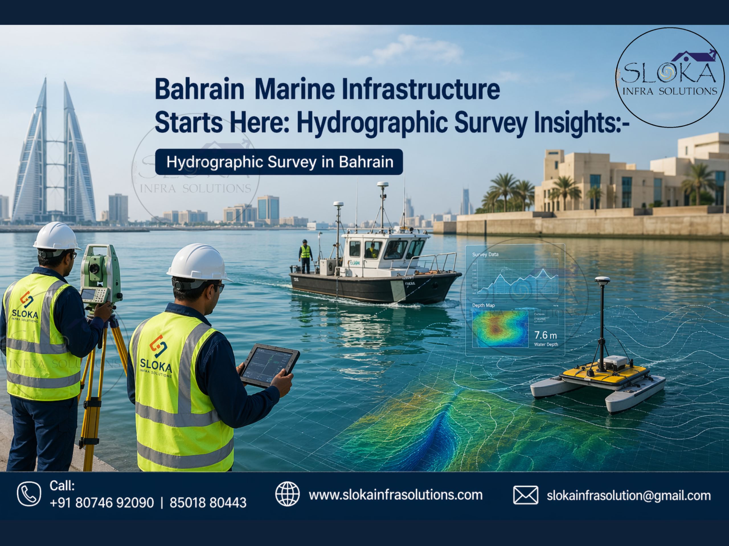
Hydrographic Survey in Bahrain
Call: +91 80746 92090
Bahrain Marine Infrastructure Starts Here: Hydrographic Survey Insights:-
Hydrographic Survey in Bahrain plays a critical role in supporting one of the Gulf region’s most strategically located island nations. Bahrain, an archipelago in the Arabian Gulf, depends heavily on safe marine navigation, port efficiency, coastal development, offshore energy infrastructure, environmental management, and maritime security. With shallow waters, coral reef zones, reclaimed coastlines, industrial harbors, approach channels, and busy shipping routes, hydrographic surveying is not just a technical requirement—it is a national necessity. Bahrain’s official hydrographic authorities publish nautical charts, tide tables, tidal stream atlases, and bathymetric data to support marine operations and decision-making. The country’s waters include navigation-sensitive zones near Manama, Muharraq, Sitra, Hidd, and Khalifa Bin Salman Port, where accurate seabed intelligence is essential for vessel movement and infrastructure planning.
Top Hydrographic Survey & Surveyors in Bahrain
Top Hydrographic Survey & Surveyors in Bahrain are increasingly important as the Kingdom expands maritime trade, coastal real estate, dredging programs, offshore utilities, reclamation works, and environmental monitoring. Survey specialists in Bahrain use advanced systems such as single beam echo sounders, multibeam sonar, ADCP instruments, side scan sonar, GNSS positioning systems, motion sensors, tide gauges, and digital processing software. Their services are valuable for harbor maintenance, channel design, seabed modeling, subsea cable routing, breakwater engineering, marine construction, sediment tracking, and coastal resilience planning. Because Bahrain consists of shallow Gulf waters with reefs, sandbanks, and reclaimed shorelines, hydrographic professionals require high precision methods suited to dynamic marine conditions.
Why Bahrain needs Hydrographic Surveys more than ever?
Bahrain’s marine geography creates unique operational challenges. It is surrounded by shallow waters in the Gulf of Bahrain, with coral reefs, mudflats, navigation channels, industrial waterfronts, causeways, and areas influenced by dredging and reclamation. This means underwater conditions can change over time due to sediment movement, development, storms, and port activity.
Hydrographic surveys help Bahrain in the following ways:
- Safe entry and exit of commercial vessels
- Port expansion and dredging design
- Offshore oil, gas, and utility corridor planning
- Coastal construction and reclamation assessment
- Pipeline and cable route investigations
- Environmental baseline mapping
- Flood and shoreline vulnerability studies
- National maritime chart updates
- Search, rescue, and wreck location work
- Defense and security marine intelligence
With Bahrain’s growing logistics and trade role in the Gulf, accurate seabed data directly supports economic growth.
Bahrain’s Key water bodies requiring survey attention:-
Hydrographic work in Bahrain is especially valuable across these marine zones:
1.Gulf of Bahrain
A shallow marine basin with ecological importance, salinity variation, coral zones, and active coastal development.
2.Port and Harbor Waters
Commercial zones near Mina Salman, Khalifa Bin Salman Port, and industrial marine terminals require frequent depth checks.
3.Causeway Corridors
Marine areas near bridges and connecting routes need sediment and scour monitoring.
4.Reclaimed Coastal Areas
Land expansion projects require pre- and post-construction bathymetric surveys.
5.Offshore Energy and Utility Areas
Subsea infrastructure corridors need route clearance and periodic inspection.
6.Hawar and Peripheral Island Waters
Ecologically sensitive and navigation-relevant marine areas benefit from habitat and depth mapping.
Single Beam Echo Sounder Survey:-
Single Beam Echo Sounder (SBES) surveys remain highly practical for many Bahrain marine projects. This method uses a sonar pulse transmitted vertically beneath the survey vessel to measure water depth directly below the boat. As the vessel moves along planned survey lines, continuous depth readings are collected to generate seabed profiles.
In Bahrain, SBES is often chosen for:
- Marina surveys
- Small harbor maintenance checks
- Pipeline crossings
- Channel centerline surveys
- Lagoon and basin depth verification
- Pre-dredging quantity estimates
- Post-dredging confirmation work
- Cost-effective shallow water mapping
Because Bahrain has many operational nearshore zones and protected waters, SBES offers a reliable and economical option where full swath coverage is not always required. It is especially useful in calm harbor waters and repetitive maintenance surveys.
The survey is commonly integrated with GNSS positioning and tide correction data. Final outputs may include contour maps, depth grids, volume calculations, and navigation support charts.
Although SBES captures only a narrow line beneath the vessel rather than full seabed coverage, it remains valuable where budgets, project scale, and turnaround speed are priorities. For Bahrain municipalities, marinas, contractors, and industrial users, SBES continues to be an efficient hydrographic solution.
Multibeam Echo Sounder Survey:-
A Multibeam Echo Sounder Survey takes hydrography from a line to a surface. NOAA’s ocean mapping protocol explains that multibeam systems spread sound in a wide swath, collect data directly beneath the vessel and out to both sides, and produce both bathymetry and backscatter. That means the survey is not just measuring depth; it is building a high-resolution seabed picture that can show features, slope changes, and surface character across a broad corridor at once.
For Bahrain, this is a powerful advantage. The country’s waters are shaped by port development, reclaimed shorelines, protected marine zones, and shallow coastal complexity, so high-density coverage is often the safest route to good decision-making. Multibeam is ideal for approach channels, berth areas, dredging campaigns, reclamation planning, reef-adjacent routes, and engineering studies where a small missed feature could matter a great deal.
The real strength of multibeam is context. It can reveal whether a seabed is smooth, undulating, scoured, or interrupted by isolated features, and that matters when a designer is deciding how to place pipelines, cables, piles, or marine structures. In a port-facing country like Bahrain, that data can reduce surprises, improve maintenance planning, and help teams understand how seabed morphology shifts around human-made structures and tidal flows.
Multibeam also supports modern charting standards because the data density is so much richer than a sparse depth line. When survey quality is the priority, the method can reduce guesswork and give stakeholders a cleaner visual model of the underwater terrain. In practical terms, it is often the method that turns a project from “we measured the water” into “we understand the seabed.”
ADCP Survey:-
An ADCP Survey focuses on movement rather than shape. An Acoustic Doppler Current Profiler measures the speed and direction of currents through the water column by using sound and the Doppler effect, and NOAA describes it as a tool for measuring currents throughout the water column. WHOI adds that it can capture flow at multiple depths, making it valuable for understanding how water moves from the seabed toward the surface.
That matters in Bahrain because current behavior influences almost everything near the coast: sediment transport, dredging stability, berth conditions, navigation safety, and the long-term performance of reclaimed or engineered shorelines. In tidal and shallow-water environments, a strong current reading can explain why sand migrates, why a channel silts faster than expected, or why a particular marine structure experiences unusual forces.
An ADCP Survey is especially valuable when a project needs more than bathymetry. It helps survey teams understand the hydrodynamic layer that sits above the seabed and affects how the seabed behaves. That is particularly relevant around Bahrain’s bays, port approaches, and protected coastal zones, where water movement interacts with reclamation edges, natural tidal habitats, and navigation routes all at once.
In practice, ADCP data often becomes the hidden logic behind a successful project. It can guide dredging strategy, explain seasonal changes, support flood or circulation studies, and help engineers judge whether a channel design will remain stable. If bathymetry is the map of where the water is, ADCP is the story of how that water behaves after the map is drawn.
Side Scan Sonar:-
Side Scan Sonar is the preferred tool when the objective is to “see” the seabed rather than simply measure depth. It emits acoustic pulses sideways from a towfish or hull-mounted system, producing image-like mosaics of bottom features.
In Bahrain, side scan sonar is highly useful for:
- Wreck detection
- Lost object searches
- Pipeline exposure checks
- Cable route inspections
- Debris detection in port waters
- Boulder or obstruction mapping
- Anchor hazard surveys
- Habitat texture studies
This technology is particularly effective in busy marine zones where underwater objects can create hazards for vessels or construction works.
For Bahrain ports and industrial waterfronts, side scan sonar can identify debris, discarded anchors, rock clusters, or structural remnants that may not be obvious from depth data alone.
It is also valuable before dredging, allowing contractors to understand bottom conditions and avoid unexpected obstacles.
When combined with multibeam bathymetry, side scan sonar creates a powerful package: one system measures shape, the other reveals texture and objects. That combination is especially useful in Bahrain’s shallow commercial waters and infrastructure corridors.
Sub Bottom Profilers:-
Sub Bottom Profilers take the survey below the visible seabed. NOAA explains that a sub-bottom profiler is a sonar-based geophysical tool that sends low-frequency sound into the seafloor so that reflections from subsurface sediment can be recorded. In simple terms, it helps surveyors see buried layers, not just the surface skin of the seabed.
That is extremely useful in Bahrain, where coastal engineering often meets sediment dynamics, reclamation, dredging, and port expansion. When a developer or engineer needs to know what lies beneath the top layer of seabed material, sub-bottom profiling can reveal soft sediments, buried channels, layering changes, or subsurface irregularities that influence foundation design and excavation planning.
It is also an important environmental tool. Bahrain’s coast supports protected bays and ecologically valuable areas, and understanding sediment structure helps teams evaluate how a project may affect stability, habitat conditions, or future silt movement. In sensitive waters, what lies under the seabed can be just as important as what sits on it.
Sub-bottom profiling becomes especially powerful when paired with multibeam and side-scan results. Multibeam shows the surface shape, side-scan highlights targets and texture, and sub-bottom profiling shows what is buried beneath. Together, they form a three-layer understanding of the marine environment, which is exactly what complex Bahrain projects need when seabed stability and long-term performance are on the line.
In Bahrain, this is highly relevant for:
- Reclamation foundation studies
- Jetty and quay wall design
- Pipeline trench planning
- Geotechnical screening
- Sediment thickness assessment
- Buried obstruction detection
- Coastal engineering investigations
- Historical seabed evolution studies
Choosing the right Hydrographic Survey team in Bahrain:-
When selecting a survey provider, consider:
- Gulf shallow water experience
- Certified equipment and calibration standards
- Local tide and current knowledge
- Deliverable quality and CAD/GIS outputs
- Marine HSE capability
- Fast mobilization
- Proven port and offshore references
- Multi-sensor integration expertise
Strong local understanding matters just as much as advanced instruments.
Future outlook for Bahrain’s marine survey industry:-
As Bahrain advances logistics, smart ports, coastal assets, tourism waterfronts, and offshore utilities, hydrographic demand is expected to grow steadily. Every marine investment depends on knowing what lies underwater. That makes hydrographic surveying one of the most valuable invisible services behind visible development.
Hydrographic Survey in Bahrain will continue supporting navigation safety, environmental stewardship, and infrastructure growth. At the same time, Top Hydrographic Survey & Surveyors in Bahrain will play a central role in transforming marine data into confident decisions for the Kingdom’s future.