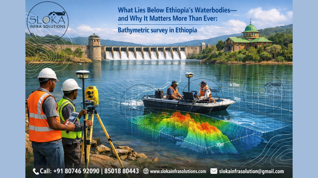
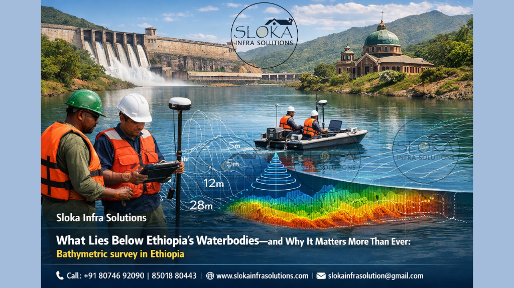
Bathymetric survey in Ethiopia
What Lies Below Ethiopia’s Waterbodies—and Why It Matters More Than Ever:-
Call: +91 80746 92090
Bathymetric survey in Ethiopia plays a foundational role in understanding, protecting, and sustainably managing the nation’s vast and diverse water resources. From the highland lakes of the Ethiopian Plateau to Rift Valley lakes, seasonal reservoirs, and major river systems feeding the Nile Basin, bathymetric surveys provide the unseen knowledge beneath the water surface. In a country where water supports agriculture, energy, ecosystems, and livelihoods, mapping underwater terrain is not merely a scientific exercise—it is a national necessity.
Ethiopia’s geography is unique in Africa. Elevations range from deep depressions below sea level to some of the continent’s highest mountains. This dramatic relief creates a complex hydrological network of rivers, lakes, wetlands, and man-made reservoirs. Bathymetric surveys allow decision-makers to visualize underwater shapes, depths, and sediment patterns, forming a reliable base for planning irrigation schemes, managing reservoirs, conserving lakes, and safeguarding water quality for future generations.
Bathymetric surveyor in Ethiopia
Bathymetric surveyor in Ethiopia operates at the intersection of geography, water science, and sustainable development. Working across lakes, reservoirs, and rivers, surveyors translate raw depth measurements into meaningful insights that support agriculture, hydropower, flood control, and environmental protection. Their role has become increasingly important as population growth, land-use change, and climate variability place greater pressure on water bodies.
Surveyors must adapt their approach to Ethiopia’s varied environments. Shallow crater lakes, expansive floodplains, deep natural lakes, and sediment-laden reservoirs each present different challenges. In many regions, surveys are conducted in remote settings where logistics, seasonal water level changes, and weather conditions influence fieldwork. Despite these challenges, the information produced by bathymetric surveyors forms the backbone of water resource planning and long-term resilience strategies.
Ethiopia’s geographic diversity and its influence on bathymetric surveys:-
Ethiopia’s geography is one of the most complex in Africa. The central highlands rise above 2,000 meters above sea level, surrounded by lowlands and rift systems. This variation directly affects how bathymetric surveys are conducted and why they are needed.
In the highlands, intense rainfall during the wet season causes significant soil erosion. Sediment carried by rivers eventually settles in lakes and reservoirs, reducing depth and storage capacity. Bathymetric surveys help quantify this sedimentation and guide watershed management efforts. In contrast, Rift Valley lakes are often influenced by volcanic geology and tectonic activity, resulting in irregular basin shapes and varying depth profiles that require careful mapping.
Lowland areas, particularly in the east and southeast, experience arid and semi-arid conditions. Here, reservoirs are lifelines for pastoral and agricultural communities. Because inflows are seasonal and sediment loads can be high, bathymetric surveys are essential for monitoring how quickly these reservoirs fill with sediment and lose effectiveness.
Major Ethiopian waterbodies and the need for bathymetric surveys:-
1.Lake Tana
Lake Tana, the largest lake in Ethiopia and the source of the Blue Nile, is central to the country’s hydrology, culture, and economy. Bathymetric surveys of Lake Tana have revealed relatively shallow maximum depths compared to its large surface area. This shallow nature makes the lake particularly sensitive to sediment mixing and nutrient dynamics.
Bathymetric information has been crucial for understanding how sediment resuspension affects water quality and the spread of aquatic plants such as water hyacinth. Shallow zones identified through depth mapping often correspond to areas where aquatic weeds thrive, impacting fisheries, navigation, and local livelihoods.
2.Rift Valley Lakes
The chain of Rift Valley lakes presents a wide range of bathymetric characteristics. Some lakes are shallow and alkaline, while others are deeper and fresher. Bathymetric surveys support ecological studies, tourism planning, and water resource management. Depth data helps identify suitable zones for fishing, conservation areas, and potential risks such as sudden water-level changes.
3.Reservoirs and micro-dams
Across regions like Tigray, Amhara, Oromia, and Southern Ethiopia, hundreds of reservoirs and micro-dams have been constructed to support irrigation and domestic water supply. These structures are highly vulnerable to sedimentation due to upstream land degradation. Bathymetric surveys are often the most reliable way to assess how much storage capacity remains and whether rehabilitation measures are needed.
Lake Morphometry and Water Quality:-
One of the most important applications of bathymetric surveys in Ethiopia is the study of lake morphometry—the shape, depth distribution, and volume of lakes. Morphometry strongly influences water quality, circulation patterns, and ecological health.
Shallow lakes are more vulnerable to wind-driven mixing, which can resuspend bottom sediments into the water column. This process affects nutrient availability, particularly phosphorus, which plays a central role in algae and aquatic plant growth. Bathymetric data helps researchers identify shallow zones, deeper basins, and transitional areas where such processes are most active.
Understanding these underwater features allows water managers to predict where water quality issues may emerge and to design targeted interventions that address root causes rather than symptoms.
Sedimentation in Reservoirs:-
Reservoir sedimentation is a widespread challenge in Ethiopia. Soil erosion from upstream catchments transports sediment into reservoirs, gradually reducing their storage capacity. Over time, this process can compromise irrigation reliability, drinking water supply, and hydropower generation.
Bathymetric surveys provide a direct and reliable way to measure how much sediment has accumulated. By comparing current underwater maps with earlier surveys or original design data, planners can estimate capacity loss and predict the remaining useful life of a reservoir. This information is critical for prioritizing maintenance, catchment management, and future infrastructure investments.
Supporting Agriculture and Food Security:-
Agriculture remains central to Ethiopia’s economy and livelihoods. Many farming systems depend on small to medium-sized reservoirs for dry-season irrigation. Bathymetric surveys support agriculture in several ways:
- Identifying sediment-filled zones that reduce effective storage
- Helping plan sediment removal or land reclamation projects
- Improving water allocation by accurately estimating available volumes
- Supporting micro-watershed management initiatives
By revealing how reservoirs change over time, bathymetric data helps align water availability with cropping cycles, improving resilience against droughts and rainfall variability.
Bathymetric Surveys and Environmental Protection
Beyond human use, Ethiopia’s water bodies support diverse ecosystems. Fish habitats, aquatic vegetation, and bird populations are all influenced by underwater terrain and depth distribution. Bathymetric surveys contribute to conservation by identifying critical habitats such as spawning grounds, shallow feeding areas, and deeper refuge zones during dry seasons.
In lakes affected by invasive aquatic plants, bathymetric information helps determine where infestations are most likely to occur. Shallow zones with high nutrient availability often provide ideal conditions for rapid plant growth. Mapping these areas supports targeted management actions that are both effective and environmentally sensitive.
Side Scan Sonar in Bathymetric Surveys:-
Side scan sonar has become an increasingly valuable tool in bathymetric surveys, particularly for understanding the character of the lake or reservoir bottom. Unlike depth-focused methods, side scan sonar creates detailed images of the surface beneath the water, much like an aerial photograph taken underwater.
In Ethiopia, side scan sonar is especially useful in reservoirs and lakes where sediment distribution is uneven. It can reveal features such as submerged channels, sediment ripples, rocky outcrops, and areas of dense vegetation. These details add important context to depth measurements, helping surveyors interpret why certain areas accumulate more sediment or behave differently from surrounding zones.
For reservoir management, side scan sonar helps identify zones where sediment removal may be most effective or where infrastructure such as intake structures could be affected by debris. In natural lakes, it supports ecological studies by distinguishing between soft sediment bottoms and harder substrates that are important for fish and invertebrates.
Another advantage of side scan sonar is its ability to cover large areas efficiently. In expansive Ethiopian lakes, where full coverage with traditional methods can be time-consuming, side scan sonar provides a rapid overview that guides more detailed investigations. When depth data is added, it transforms raw numbers into a vivid and easy-to-understand view of what lies beneath the water.
Sub Bottom Profilers and Hidden Layers:-
Sub bottom profilers add a deeper dimension to bathymetric surveys by looking beneath the visible bottom surface. Instead of only mapping the top layer of sediment, these tools provide insight into underlying sediment layers and historical deposition patterns.
In Ethiopian reservoirs, sub bottom profilers are particularly valuable for understanding long-term sedimentation. They can reveal how sediment has accumulated over years or decades, distinguishing between recent deposits and older, more compacted layers. This information supports more accurate estimates of sediment volume and informs decisions about sediment management strategies.
For lakes, sub bottom profiling helps reconstruct environmental history. Changes in sediment layers can reflect shifts in land use, climate, or hydrological conditions within the catchment. By interpreting these layers, researchers gain insight into how current challenges evolved and how future changes might unfold.
Sub bottom profilers also support infrastructure planning. When new reservoirs or water intake structures are considered, understanding the nature of subsurface sediments reduces uncertainty and risk. In Ethiopia’s diverse geological settings, this added layer of knowledge is essential for sustainable and resilient water development.
Single Beam Echo Sounder Survey:-
Single Beam Echo Sounder Survey remains one of the most practical and widely used approaches in Ethiopian bathymetric work, especially across small to medium-sized water bodies. This method measures depth directly beneath the survey vessel, making it well suited for reservoirs, irrigation tanks, crater lakes, and shallow river stretches. In Ethiopia, where many water bodies are seasonal or located in remote terrain, the simplicity and reliability of single beam surveys make them highly valuable.
This approach is particularly effective for monitoring sedimentation trends over time. By repeating surveys along the same paths, changes in depth and storage capacity can be tracked with confidence. For agricultural reservoirs, this information helps determine how much usable water remains during dry seasons. While it does not provide full seafloor coverage, the Single Beam Echo Sounder Survey offers a dependable balance between accuracy, affordability, and operational ease—making it an essential tool in Ethiopia’s ongoing water resource management efforts.
Multibeam Echo Sounder Survey:-
Multibeam Echo Sounder Survey represents a more comprehensive approach to bathymetric mapping, capturing detailed depth information across a wide swath of the waterbody in a single pass. Instead of measuring depth at a single point, this method records thousands of depth measurements simultaneously, creating a high-resolution three-dimensional model of the underwater landscape. In Ethiopia, multibeam surveys are especially valuable in large lakes, major reservoirs, and complex river sections where underwater terrain varies significantly.
This technique allows for precise identification of deep basins, submerged channels, sediment mounds, and erosion zones. Such detailed mapping supports advanced planning for hydropower, water supply intakes, and long-term reservoir management. Although multibeam surveys require careful planning and skilled operation, the depth of insight they provide is unmatched. When applied strategically, Multibeam Echo Sounder Survey enhances Ethiopia’s ability to manage its most critical water bodies with clarity and confidence.
Integration of traditional knowledge and modern surveys:-
While bathymetric surveys rely on modern tools, local knowledge remains important in Ethiopia. Communities living around lakes and reservoirs often have detailed observations of water-level changes, sediment buildup, and seasonal variations. Integrating this knowledge with survey data can improve interpretation and ensure that results are grounded in real-world experience.
For example, fishers may identify shallow zones that expand during dry seasons, while farmers may notice declining reservoir performance over time. Bathymetric surveys provide the quantitative evidence that supports these observations and helps translate them into policy and planning actions.
Technology trends in Ethiopian bathymetry:-
Bathymetric surveying in Ethiopia has evolved significantly over recent years. While traditional boat-based surveys remain important, newer approaches are expanding possibilities. Lightweight platforms and remotely operated surface systems are increasingly used in shallow or hard-to-access waters. These methods improve safety, efficiency, and data coverage.
Satellite-based techniques are also being explored as complementary tools, especially for large or remote lakes. Although they cannot fully replace in-water measurements, they provide valuable preliminary insights and help optimize field survey efforts.
The integration of bathymetric data with geographic information systems allows results to be shared across institutions and used for multiple purposes—from engineering design to environmental monitoring—maximizing the value of each survey.
Challenges and Opportunities:-
Despite its importance, bathymetric surveying in Ethiopia faces challenges. Limited resources, difficult terrain, and seasonal access constraints can restrict survey frequency. In some regions, historical data is sparse, making long-term comparisons difficult.
However, these challenges also present opportunities. Strengthening national capacity, encouraging data sharing, and integrating bathymetric surveys into routine water management can greatly enhance decision-making. As Ethiopia continues to invest in water infrastructure and climate resilience, the demand for accurate underwater information will only grow.
The Next Chapter of Bathymetric Surveying in Ethiopia:-
The future of Bathymetric survey in Ethiopia lies in regular monitoring, integration with watershed management, and stronger links between science and policy. As Ethiopia continues to invest in irrigation, hydropower, and urban water supply, understanding underwater terrain will remain essential.
Repeated surveys will help track changes over time, enabling early intervention before problems become severe. Combining bathymetric data with water quality, land-use, and climate information will support more holistic water management strategies. Education and capacity building for the next generation of surveyors will ensure that skills keep pace with growing needs.
Equally important is the role of the Bathymetric surveyor in Ethiopia, who stands at the intersection of fieldwork, analysis, and decision-making. By producing clear, reliable, and context-aware information, surveyors help ensure that Ethiopia’s lakes, rivers, and reservoirs continue to support people, ecosystems, and development for decades to come.
Closing insights on mapping Eithiopia’s underwater World:-
Bathymetric surveys are more than technical exercises; they are foundational to Ethiopia’s water future. By revealing the hidden shapes of lakes, rivers, and reservoirs, they provide the knowledge needed to manage water wisely in a land of contrasts and challenges. From the highlands to the rift valleys and lowlands, bathymetric surveys support water security, environmental protection, and sustainable development. As pressures on water resources increase, their role will only become more critical, making bathymetric surveying an essential pillar of Ethiopia’s journey toward resilient and informed water management.