Bathymetric Survey for Dams in Telangana
The Underwater Blueprint: Bathymetric Survey Strategies for Telangana Dams
Bathymetric Survey for Dams in Telangana plays a pivotal role in safeguarding the state’s water infrastructure by revealing the unseen underwater landscapes of our reservoirs. As Telangana continues to harness the power of its monsoon-fed rivers and storied dams, understanding the depth profiles, sediment deposition, and submerged hazards becomes essential for effective water management, structural safety, and long-term sustainability.
Best Bathymetric Survey for Dams in Telangana
Best Bathymetric Survey for Dams in Telangana services combine advanced sonar, LiDAR, and GNSS technologies to produce high-resolution 3D maps of reservoir floors, enabling engineers and decision-makers to make data-driven choices. By integrating real-time data acquisition with robust analytical models, these surveys ensure that every curve, contour, and sediment bank is accurately charted for maintenance, dredging, and safety protocols.
1. Telangana’s Geography and Waterbodies: A Critical Backdrop
Telangana, situated on the Deccan Plateau, features a semi-arid climate punctuated by the southwest monsoon, which replenishes its network of rivers and tanks each year. The state’s primary rivers—the Godavari and Krishna—feed a series of major reservoirs such as Nagarjuna Sagar, Sri Ram Sagar (SRSP), Kaleshwaram Lift Irrigation Project’s Medigadda Reservoir, and the Manjeera and Ramadugu dams. These waterbodies serve multiple purposes: irrigation for the fertile paddy belts, drinking water for urban centers like Hyderabad, hydroelectric power generation, and flood management during monsoon peaks. However, decades of sediment accumulation, fluctuating water levels, and shoreline erosion underscore the critical need for systematic bathymetric surveys to maintain and optimize these assets.
2. The Evolution of Dam Surveying in Telangana
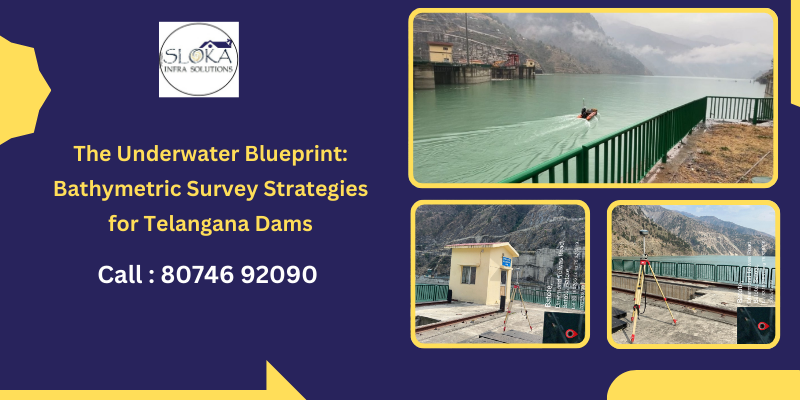
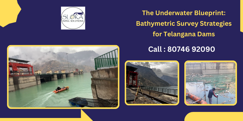
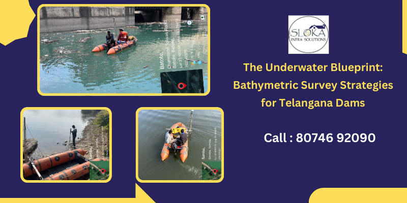
Historically, dam safety inspections in Telangana relied on surface observations and manual depth sounding—a laborious method prone to inaccuracies. The turn of the century ushered in echo sounders and paper-based contour maps, yet true transformation arrived with multi-beam sonar, RTK-GNSS integration, and digital data logging. Today’s bathymetric surveys leverage autonomous underwater vehicles (AUVs) for inaccessible zones, side-scan sonar for hazard detection, and cloud-linked processing platforms that stitch thousands of depth points into coherent, interactive 3D models. This advancement has transformed dam management into a forward-looking practice rather than a reactive one, empowering authorities to predict issues and plan precise interventions.
3. What Is a Bathymetric Survey and Why It Matters
A bathymetric survey measures underwater depths to chart the topography of a reservoir bed. For dams, these surveys reveal:
- Sediment Buildup: Quantifying silt and debris that reduce storage capacity.
- Scouring Patterns: Uncovering erosional features near spillways or intakes.
- Hidden Hazards: Detecting submerged rocks, tree debris, and remnants of man-made structures.
- Foundation Integrity: Detecting irregularities along the dam toe that could signal seepage.
Accurate bathymetric data underpin planning for dredging operations, allow precise calculation of live storage capacity, and are integral to safety assessments—particularly before and after the monsoon season when water dynamics shift dramatically.
4. Core Technologies in Bathymetric Mapping
Modern bathymetric surveys deploy a blend of complementary technologies:
- Multi-Beam Echo Sounders: Emit fan-shaped sound beams for wide-swath depth coverage.
- Single-Beam Echo Sounders: Offer high-precision point measurements in critical areas.
- Side-Scan Sonar: Paints acoustic images of the reservoir bed, highlighting obstacles.
- LiDAR Bathymetry: When water clarity allows, aerial LiDAR sensors capture shallow zones.
- GNSS/RTK Systems: Provide centimeter-level positioning to geo-reference every depth reading.
- Autonomous Underwater Vehicles (AUVs): Navigate tight or hazardous spots without human divers.
Integration of these instruments—through survey-grade software—yields a seamless depth model, typically visualized via GIS platforms that layer bathymetry with shoreline maps, ecological zones, and infrastructure features.
5. Hydrographic Surveys: Complementing Depth with Dynamics
While bathymetry focuses on “what lies beneath,” hydrographic surveys extend the analysis to water movement, quality, and bank morphology. Key components include:
- Acoustic Doppler Current Profilers (ADCPs): Measure flow velocities at various depths to model sediment transport.
- Aerial and UAV Surveys: Map shoreline changes and bank erosion, especially during flood events.
- Water Quality Sensors: Monitor parameters like turbidity, dissolved oxygen, and temperature stratification.
- Terrestrial LiDAR and Total Stations: Record shoreline geometry and seamlessly integrate it with underwater topographic data.
Together, bathymetric and hydrographic data form a holistic view of the reservoir system, illuminating how water levels, flow rates, and sediment interact to influence dam performance.
6. Integrating Data for Proactive Dam Management
Data fusion is the heart of modern dam stewardship. By layering bathymetric depth models over hydrographic flow maps and shoreline surveys in a GIS environment, engineers can:
- Predict Sedimentation Hotspots: Anticipate where silt will accumulate next year.
- Design Targeted Dredging: Optimize dredge routes to restore full storage capacity with minimal cost.
- Model Flood Scenarios: Simulate monsoon inflows to ensure spillway dimensions mitigate overtopping risks.
- Monitor Structural Health: Track gradual changes in underwater slopes that might indicate foundation settlement.
This integrated approach transforms raw survey points into actionable intelligence, guiding everything from emergency preparedness plans to long-term asset renewal strategies.
7. Applications in Telangana’s Dam Network
- Sri Ram Sagar Project (SRSP)
Situated on the Godavari, SRSP’s vast reservoir undergoes heavy sedimentation each year. Bathymetric profiles guide annual dredging, while hydrographic data help adjust release schedules during the monsoon to balance irrigation needs with flood control. - Nagarjuna Sagar Dam
Among the world’s largest masonry dams, its upstream basin has zones of deep scour near spillways. Side-scan sonar and multibeam surveys pinpoint these zones, enabling targeted reinforcement before critical floods. - Kaleshwaram Lift Irrigation Reservoirs
A constellation of small balancing reservoirs uses UAV-LiDAR surveys to monitor embankment stability, while bathymetry maps ensure pumping stations maintain efficient suction depths. - Manjeera and Ramadugu Dams
Serving Hyderabad’s drinking water needs, surveys here combine AUV bathymetry with water quality sensors to manage both volume and potability in the changing climate.
8. Challenges Specific to Telangana
- Seasonal Turbidity: Monsoon runoff spikes turbidity, degrading sonar returns. Survey teams mitigate with specialized filters and repeated passes.
- Rapid Fluctuations: Inflow from upstream projects can abruptly raise or lower water levels, complicating consistent data capture.
- Remote Access: Many minor tanks lie deep in rural districts, requiring mobile survey platforms and drone-assisted logistics.
- Regulatory Coordination: Multiple agencies—State Irrigation, Water Resources, and Urban Development—must align survey objectives, data sharing, and funding cycles.
Overcoming these hurdles requires meticulous planning, sensor fusion strategies, and close stakeholder collaboration.
9. Cutting-Edge Innovations Shaping the Future
- Artificial Intelligence & Machine Learning: Algorithms now detect subtle shifts in bathymetric point clouds that hint at early scouring or sediment compaction.
- Real-Time IoT Monitoring: Embedded pressure and vibration sensors along dam toes feed live data to cloud dashboards, triggering immediate alerts if anomalies arise.
- Swarm Robotics: Coordinated fleets of micro-AUVs can blanket a reservoir in hours, drastically reducing survey time.
- Hyperspectral Remote Sensing: From aircraft or satellites, these sensors assess sediment composition and water quality without onsite deployment.
By adopting these breakthroughs, Telangana can leapfrog into an era of truly predictive and continuously updated dam management.
10. Best Practices and Guidelines
- Rigorous Pre-Survey Planning
Conduct site reconnaissance, stakeholder meetings, and environmental impact screenings. Ensure equipment calibration and safety protocols, especially for AUV deployments. - Sensor Fusion & Redundancy
Combine echo sounders, ADCPs, LiDAR, and UAV photogrammetry. Implement overlapping passes to cross-validate data and flag inconsistencies. - Accurate Geo-Referencing
Employ RTK-GNSS base stations to anchor every depth point within a few centimeters, enabling reliable overlay with terrestrial maps. - Real-Time Quality Control
Use onboard software to inspect data streams for gaps, noise spikes, or positional drift, allowing immediate corrections. - Comprehensive Reporting
Present findings in interactive GIS packages, accompanied by executive summaries, risk matrices, and clear recommendations for dredging, structural fortification, or environmental mitigation.
11. Future Directions for Telangana’s Dam Surveys
- Fully Autonomous Monitoring: Continuous, unmanned bathymetric sweeps every monsoon to track sediment dynamics in near-real time.
- Cloud-Based Collaboration: Shared dashboards where irrigation engineers, urban planners, and disaster managers co-analyze survey outputs.
- Community-Centered Data: Public portals that visualize reservoir health and safety metrics, empowering local stakeholders.
- Green Survey Platforms: Solar-powered drone and boat systems that minimize field-work emissions while maximizing coverage.
By steering towards these frontiers, Telangana can set benchmarks for dam safety and water security nationwide.
12. Conclusion & Key Takeaways
Telangana’s unique topography—marked by Deccan plateau undulations, monsoon rhythms, and a dense network of dams—demands rigorous bathymetric and hydrographic surveying to sustain its water lifeline. Through advanced sonar, UAV-LiDAR, AUVs, and integrated data analytics, engineers can unmask the hidden contours of reservoir floors, anticipate sedimentation patterns, and fortify structural resilience against flood threats.
- Bathymetric Survey for Dams in Telangana reveals underwater topography critical for dredging and capacity planning.
- Best Bathymetric Survey for Dams in Telangana practices couple multi-beam echo sounders with RTK-GNSS to deliver centimeter-accurate depth models.
- Hydrographic data enrich these models by mapping flow dynamics, bank erosion, and water quality—creating a 360° understanding of reservoir environments.
- Predictive maintenance, powered by AI and IoT, transforms dam management from reactive to proactive, ensuring safety through every monsoon cycle.
- Adhering to best practices—pre-survey planning, sensor fusion, real-time QC, and comprehensive reporting—maximizes data reliability and operational impact.
As Telangana charts a course toward resilient water infrastructure, investing in state-of-the-art bathymetric surveys and integrated hydrographic assessments will be the cornerstone of sustainable growth, ecological stewardship, and community well-being.