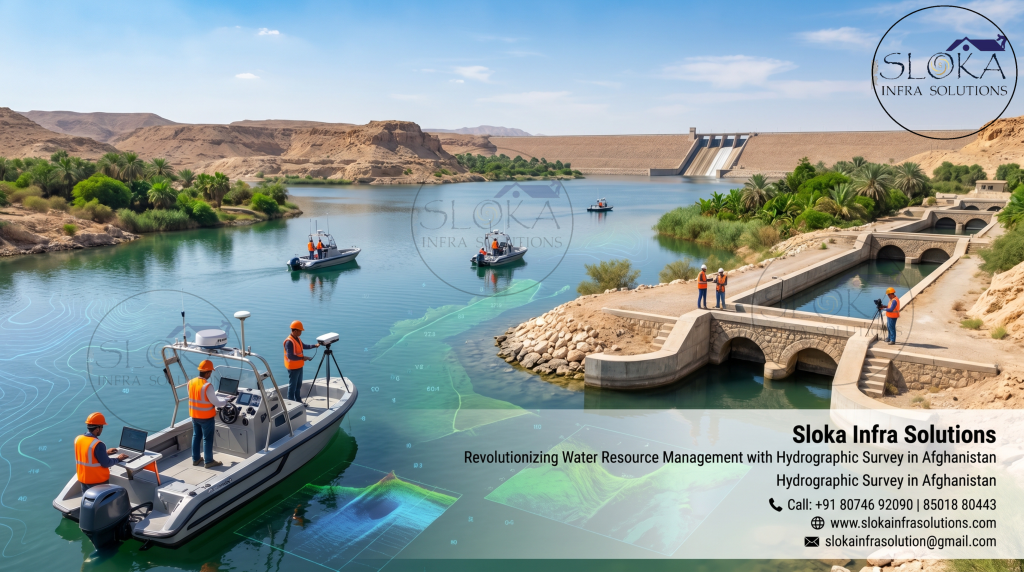
Hydrographic Survey in Afghanistan
Call: +91 80746 92090
Revolutionizing Water Resource Management with Hydrographic Survey in Afghanistan
Hydrographic Survey in Afghanistan
Hydrographic Survey in Afghanistan is becoming increasingly important as the country focuses on improving water resource management, irrigation systems, inland water monitoring, infrastructure development, and environmental sustainability. Although Afghanistan is a landlocked nation, it possesses significant rivers, reservoirs, lakes, dams, and water channels that play a vital role in agriculture, hydropower generation, drinking water supply, and regional development. Accurate hydrographic data helps engineers, planners, environmental authorities, and water management agencies understand underwater terrain, sediment movement, flow characteristics, and structural conditions beneath water bodies.
Top Hydrographic Survey & Surveyors in Afghanistan
Top Hydrographic Survey & Surveyors in Afghanistan are contributing to various projects related to dams, irrigation canals, reservoirs, river systems, hydropower facilities, and flood monitoring programs. Advanced hydrographic technologies are helping surveyors gather highly precise underwater measurements even in challenging terrains and remote regions of Afghanistan. From the Amu Darya River in the north to the Helmand River basin in the southwest, hydrographic investigations are becoming essential for sustainable infrastructure planning and efficient water resource utilization.
Afghanistan’s geography creates unique challenges and opportunities for hydrographic operations. The country is dominated by mountain ranges, rugged valleys, seasonal rivers, glaciers, and inland basins. Major rivers such as the Kabul River, Hari River, Helmand River, Panj River, and Amu Darya River support millions of people through irrigation and agriculture. Lakes including Band-e Amir, Qargha Reservoir, Hamun wetlands, and Kajaki Reservoir also hold ecological and economic significance. Due to climate variability and changing rainfall patterns, hydrographic surveys are increasingly needed to assess water depth, sediment accumulation, erosion zones, and flow conditions across these important water bodies.
Modern hydrographic surveys are not limited to simply measuring water depth. Today’s hydrographic projects combine advanced sonar systems, positioning technologies, underwater imaging tools, and geospatial analysis methods to create highly accurate underwater maps and digital models. These surveys support reservoir management, bridge construction, dredging assessments, flood control planning, hydropower development, and environmental studies.
One of the major reasons hydrographic surveying is gaining importance in Afghanistan is the need for better water infrastructure management. Several dams and irrigation networks require periodic underwater inspection to evaluate sedimentation levels and structural conditions. Rivers carrying glacial meltwater often transport large quantities of sediments that gradually reduce reservoir capacity and affect water flow efficiency. Hydrographic investigations help authorities identify these issues before they become major operational challenges.
Another important application is flood risk management. Seasonal flooding affects several regions of Afghanistan due to snowmelt and heavy rainfall in mountainous areas. Hydrographic surveys help create accurate bathymetric models of rivers and reservoirs, allowing engineers to understand water flow behavior and predict vulnerable flood zones. This information supports disaster preparedness and long-term water management planning.
Hydropower development is also driving demand for hydrographic services. Afghanistan has significant untapped hydropower potential across its river systems. Before constructing dams or power facilities, detailed hydrographic data is required to understand underwater topography, sediment characteristics, and water storage capacity. Accurate underwater mapping improves engineering design and helps reduce future operational risks.
Importance of Hydrographic Technology in Afghanistan’s Water Management
Afghanistan’s agricultural economy heavily depends on irrigation systems connected to rivers and reservoirs. Hydrographic surveys help authorities maintain canals, assess reservoir storage levels, and monitor changes in underwater terrain caused by sediment deposits. In regions where water scarcity is becoming a concern, accurate hydrographic information allows better planning and efficient distribution of available water resources.
Environmental monitoring is another important aspect. Lakes, wetlands, and reservoirs are sensitive ecosystems that require careful observation. Hydrographic technologies help researchers study aquatic habitats, underwater vegetation, erosion patterns, and sediment transport. These insights contribute to conservation efforts and sustainable environmental planning.
Modern hydrographic projects often integrate GPS positioning systems, GIS mapping software, drones, sonar equipment, and real-time data collection platforms. Such technologies enable survey teams to gather precise information even in difficult and remote environments. As Afghanistan continues rebuilding infrastructure and expanding development initiatives, hydrographic surveys are expected to become increasingly essential across multiple sectors.
Afghanistan’s geography and Hydrographic challenges:-
Afghanistan’s geography creates unique challenges and opportunities for hydrographic operations. The country is dominated by:
- Mountain ranges
- Rugged valleys
- Seasonal rivers
- Glaciers
- Inland water basins
Important water bodies such as:
- Band-e Amir
- Qargha Reservoir
- Hamun Wetlands
- Kajaki Reservoir
hold major ecological and economic significance.
Due to climate variability and changing rainfall patterns, hydrographic surveys are increasingly needed to assess:
- Water depth variations
- Sediment accumulation
- Erosion zones
- Flow conditions
- Reservoir performance
1.ADCP Survey:-
Measuring water flow with precision
Acoustic Doppler Current Profiler technology has become a highly valuable tool for measuring water current velocities and flow patterns in rivers, reservoirs, and canals.
In Afghanistan, ADCP surveys help engineers and hydrologists understand:
- Water movement behavior
- River discharge measurements
- Flood monitoring conditions
- Sediment transport patterns
Key applications of ADCP surveys
- River flow monitoring
- Reservoir management
- Dam safety analysis
- Bridge foundation studies
- Hydrological research
Important rivers benefiting from ADCP surveys
- Helmand River
- Kabul River
- Amu Darya River
One major advantage of ADCP technology is its ability to collect large amounts of data quickly without disturbing water flow.
Modern systems can be mounted on:
- Boats
- Floating platforms
- Remote-controlled survey vessels
As Afghanistan strengthens its water infrastructure, ADCP surveys are expected to play a vital role in sustainable water resource management.
2.Side Scan Sonar:-
Side Scan Sonar technology is widely used in hydrographic investigations to produce detailed acoustic images of underwater surfaces. In Afghanistan, this technology can support inspections of reservoirs, dams, riverbeds, submerged structures, and underwater obstacles. The ability to visualize underwater conditions makes Side Scan Sonar an important tool for engineering, environmental, and infrastructure projects.
The system operates by emitting sound pulses sideways from a towfish or sonar device and recording the returning echoes from the underwater surface. The collected data creates highly detailed sonar imagery that reveals underwater objects, debris, sediment patterns, erosion zones, and structural features.
Reservoirs such as Kajaki Dam and other inland water bodies can benefit significantly from Side Scan Sonar investigations. Surveyors use this technology to identify submerged obstructions, monitor sediment accumulation, inspect underwater pipelines, and assess the condition of hydraulic structures. It also supports dredging projects by locating areas where excessive sediment deposition may reduce reservoir capacity.
In river systems, Side Scan Sonar helps analyze channel morphology and detect hazards that could affect bridge construction or navigation operations. Environmental researchers also use the technology to study habitat conditions and underwater geological formations.
One of the biggest strengths of Side Scan Sonar is its ability to cover large survey areas efficiently while providing visually interpretable results. The technology offers valuable underwater insights that traditional depth measurement methods cannot provide alone. As infrastructure modernization continues in Afghanistan, Side Scan Sonar surveys are becoming increasingly useful for underwater inspections and project planning.
3.Sub Bottom Profilers:-
Exploring what lies beneath the waterbed
Sub Bottom Profilers are advanced acoustic instruments designed to investigate sediment layers and geological formations beneath the waterbed.
Unlike traditional sonar systems, these instruments penetrate below the sediment surface and reveal:
- Sediment thickness
- Buried channels
- Rock formations
- Historical deposition patterns
Why sub bottom profilers matter?
- Reservoir sedimentation analysis
- Dam expansion planning
- Hydropower feasibility studies
- Geological investigations
- River evolution research
In Afghanistan, where reservoirs continuously receive mountain sediments, Sub Bottom Profilers help evaluate long-term storage efficiency and maintenance requirements.
This technology is becoming essential for safe and durable infrastructure development.
4.Single Beam Echo Sounder Survey:-
Single Beam Echo Sounder Survey methods remain one of the most widely used hydrographic techniques for measuring water depth. In Afghanistan, this technology is highly useful for river surveys, reservoir monitoring, canal inspections, and bathymetric mapping projects.
A Single Beam Echo Sounder works by transmitting acoustic pulses directly beneath the survey vessel and calculating water depth based on the time taken for the sound waves to return from the bottom surface. Although relatively simple compared to advanced multibeam systems, Single Beam Echo Sounders provide reliable and cost-effective depth measurements.
This surveying method is commonly used in smaller water bodies, irrigation canals, reservoirs, and preliminary hydrographic investigations. In Afghanistan’s water infrastructure projects, Single Beam surveys help monitor sediment buildup, assess channel conditions, and estimate reservoir storage capacity.
Survey teams often combine Single Beam Echo Sounder data with GPS positioning systems to create accurate bathymetric profiles. The collected information supports engineering design, dredging analysis, flood management planning, and environmental studies.
One major advantage of Single Beam Echo Sounder systems is their operational simplicity and affordability. They can be deployed in remote or shallow areas where larger survey systems may be difficult to operate. This makes them particularly practical for developing infrastructure projects in rugged regions of Afghanistan.
Despite the emergence of advanced sonar technologies, Single Beam Echo Sounder surveys continue to play a valuable role in hydrographic investigations due to their reliability, efficiency, and adaptability.
5.Multibeam Echo Sounder Survey:-
Advanced 3D underwater mapping technology
Multibeam Echo Sounder Survey technology represents one of the most advanced methods used in modern hydrography.
Unlike Single Beam systems, Multibeam technology transmits multiple acoustic beams across a wide survey area, creating highly detailed 3D bathymetric maps.
Key advantages of multibeam surveys!
- Extensive underwater coverage
- High-resolution mapping
- Faster survey efficiency
- Precise digital terrain models
What multibeam systems reveal?
- Underwater slopes
- Channels and depressions
- Sediment deposits
- Submerged structures
- Erosion zones
Applications in Afghanistan
- Large reservoir surveys
- Hydropower infrastructure projects
- Dam assessments
- Environmental studies
- Sediment monitoring
Combined with GPS and advanced software systems, Multibeam surveys provide exceptional underwater accuracy for long-term infrastructure planning.
Future growth and innovation in Afghanistan’s Hydrographic survey sector:-
The growing need for accurate underwater data is encouraging the adoption of advanced hydrographic technologies across multiple sectors.Climate change, population growth, and increasing demand for water resources are making scientific water management more important than ever before. Hydrographic surveys provide the foundation for informed decision-making by delivering reliable underwater information for planning and infrastructure development.
Emerging technologies such as autonomous survey vessels, drone-based mapping systems, AI-powered data processing, and real-time hydrographic monitoring are expected to transform future survey operations. These innovations can improve efficiency, reduce operational risks, and support sustainable development initiatives across Afghanistan’s river systems and reservoirs.
The continued growth of Hydrographic Survey in Afghanistan will help strengthen dam safety, improve irrigation efficiency, support hydropower expansion, and enhance environmental conservation efforts. At the same time, Top Hydrographic Survey & Surveyors in Afghanistan are expected to play a major role in strengthening the nation’s water infrastructure by delivering technical excellence, innovative survey solutions, and modern hydrographic technologies for future development projects.
Hydrographic surveying is no longer limited to navigation purposes alone. In Afghanistan, it is becoming a critical component of engineering, environmental science, disaster management, and national development planning. With accurate hydrographic data, the country can better manage its precious water resources while supporting long-term economic and environmental sustainability.