Bathymetric Survey in Yemen
Beneath Yemen’s Waters: The Technology Behind Accurate Bathymetric Surveys:-
Call: 80746 92090
Bathymetric Survey in Yemen plays a crucial role in understanding the underwater landscapes that surround this strategically important country. Positioned along the Red Sea and the Gulf of Aden, Yemen possesses a complex marine environment with extensive coastlines, ports, fishing zones, and underwater geological formations. Mapping these underwater terrains accurately is essential for safe navigation, coastal infrastructure development, marine resource management, and environmental protection.
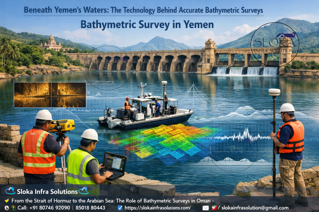
Unlike land surveys that focus on surface terrain, bathymetric surveys reveal what lies beneath the water. Using advanced sonar systems, GPS positioning, and specialized survey vessels or unmanned platforms, professionals measure water depth and map seabed features with remarkable precision. The resulting data provides engineers, port authorities, marine scientists, and government agencies with vital insights into underwater topography.
In Yemen, where maritime activities are closely tied to trade, fisheries, oil transportation, and coastal development, bathymetric surveys support critical planning decisions. Ports such as Aden, Hodeidah, Mukalla, and Mocha rely on accurate seabed information to maintain safe shipping channels and accommodate larger vessels. These surveys also help detect underwater hazards, sediment accumulation, and seabed changes that may affect navigation.
Furthermore, bathymetric mapping supports environmental studies and disaster preparedness. Coastal erosion, sediment movement, and seabed changes can influence flooding and marine ecosystems. By continuously monitoring underwater conditions, bathymetric surveys enable authorities to implement better coastal management strategies.
From harbor construction to offshore exploration, bathymetric surveys serve as the foundation for sustainable marine development in Yemen. As technology continues to evolve, modern sonar systems and autonomous survey platforms are making underwater mapping faster, safer, and more precise than ever before.
Top Bathymetric Survey and Surveyor in Yemen:-
Top Bathymetric Survey and Surveyor in Yemen services are increasingly in demand as the country expands its maritime infrastructure, fisheries sector, and coastal development initiatives. Surveyors working in Yemen must combine advanced technology with strong regional knowledge to successfully map underwater terrains across diverse environments such as coral reefs, deep coastal waters, estuaries, and harbor basins.
Professional bathymetric surveyors provide comprehensive services that go far beyond measuring water depth. Their work typically includes underwater terrain modeling, sediment analysis, navigation channel surveys, offshore pipeline inspections, and environmental monitoring. These services are essential for port authorities, government agencies, engineering firms, oil and gas companies, and marine research institutions.
Survey teams deploy a range of sophisticated equipment including sonar systems, positioning systems, underwater vehicles, and data processing software. Modern survey vessels are often equipped with integrated navigation systems that combine GPS, motion sensors, and sonar technology to produce highly accurate underwater maps.
In Yemen, surveyors frequently operate in challenging conditions due to strong currents, complex seabed formations, and varying water depths. Expertise in operating advanced sonar equipment and interpreting bathymetric data is therefore essential. The collected data is processed into detailed bathymetric charts, 3D seabed models, and cross-sectional profiles that help engineers and planners make informed decisions.
These surveys are particularly important for maintaining shipping safety in major Yemeni ports and ensuring that dredging operations are conducted effectively. As Yemen continues to develop its maritime infrastructure and marine industries, professional bathymetric surveying services will remain a cornerstone for sustainable development along the nation’s coastline.
From Sonar to Seafloor models: How Bathymetric data Is created:-
Bathymetric surveys are often compared to underwater topographic surveys. Just as land surveyors measure hills, valleys, and elevations on land, bathymetric surveyors map underwater features such as seabed slopes, trenches, ridges, and sediment layers.
For Yemen, this information is particularly valuable because the country’s maritime geography is diverse and dynamic. The Red Sea coastline features coral reefs, shallow lagoons, and volcanic seabed formations, while the Gulf of Aden contains deeper waters and strong ocean currents. Accurate seabed data ensures safe maritime navigation and efficient port operations.
Bathymetric surveys support a wide range of applications including:
- Navigation safety and marine charting
- Port and harbor development
- Dredging and sediment monitoring
- Coastal engineering projects
- Offshore oil and gas exploration
- Marine environmental studies
- Pipeline and cable route planning
By mapping underwater terrains in detail, bathymetric surveys help prevent costly mistakes during construction and infrastructure projects. Engineers can identify suitable locations for marine structures, while environmental scientists can monitor the health of coral reefs and marine habitats.
Yemen’s Unique Marine Geography:-
Yemen’s geographical position makes it one of the most strategically significant maritime regions in the world. The country borders two major bodies of water: the Red Sea to the west and the Gulf of Aden to the south. These waters connect to major global shipping routes through the Bab-el-Mandeb Strait, a narrow passage linking the Red Sea to the Indian Ocean.
The Yemeni coastline stretches for more than 2,000 kilometers, featuring a diverse range of marine environments such as:
- Coral reef systems
- Coastal lagoons
- Deep offshore waters
- Volcanic seabed formations
- River mouths and estuaries
Because of these varied environments, conducting bathymetric surveys in Yemen requires advanced technology and experienced survey teams. Accurate seabed mapping ensures that ships can safely navigate shipping lanes while helping governments manage coastal resources effectively.
Technologies used in modern Bathymetric Surveys:-
Modern bathymetric surveying relies on a combination of advanced technologies to gather accurate underwater data. These technologies typically include:
- Sonar systems for depth measurement
- GPS positioning systems for precise location tracking
- Motion sensors to account for vessel movement
- Survey vessels or autonomous vehicles
- Data processing software for 3D modeling
Together, these tools enable surveyors to produce detailed digital maps of underwater terrain. Engineers and marine planners use this data to visualize seabed conditions and design infrastructure accordingly.
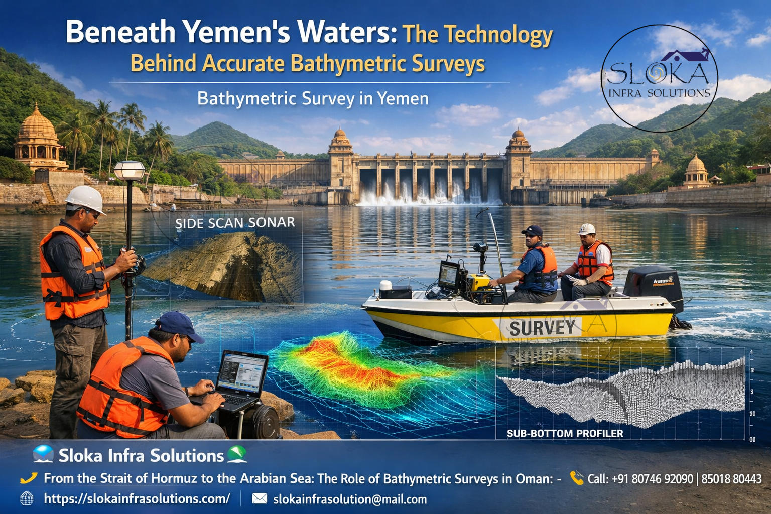
Side Scan Sonar:-
Side scan sonar is one of the most powerful tools used in bathymetric and hydrographic surveys, particularly when surveyors need detailed imagery of the seabed. Instead of simply measuring depth, side scan sonar produces high-resolution acoustic images that reveal the texture and structure of underwater surfaces.
The technology works by emitting sound waves from a sonar device mounted on a vessel or towed behind it. These sound waves travel through the water and bounce off the seabed. The sonar system then records the returning echoes and converts them into detailed images.
In Yemen’s coastal waters, side scan sonar is particularly valuable for detecting underwater objects such as:
- Shipwrecks
- Coral reefs
- Rock formations
- Pipeline routes
- Marine debris
This technology is also widely used during port development and dredging projects. By identifying seabed obstacles before construction begins, engineers can plan safer and more efficient marine operations.
Side scan sonar surveys are often conducted alongside traditional bathymetric surveys to provide both depth measurements and seabed imagery. This combination allows surveyors to produce comprehensive underwater maps that reveal not only the shape of the seabed but also its composition and features.
For marine archaeology and environmental monitoring in Yemen, side scan sonar offers an invaluable method for exploring underwater landscapes without disturbing sensitive ecosystems.

Sub Bottom Profilers:-
Sub bottom profiling technology allows surveyors to look beneath the seabed surface and analyze the layers of sediment and geological structures below. While traditional sonar systems map the top of the seabed, sub bottom profilers reveal what lies underneath.
These systems emit low-frequency sound waves that penetrate the seabed. As the waves travel through different sediment layers, they reflect back at varying strengths depending on the material encountered. The returning signals are processed to create cross-sectional images of subsurface layers.
In Yemen, sub bottom profiling is particularly useful for projects involving offshore infrastructure such as:
- Submarine pipelines
- Underwater communication cables
- Port foundation structures
- Offshore energy installations
Engineers rely on this data to determine seabed stability and sediment thickness. For example, when planning offshore structures, it is important to know whether the seabed consists of stable rock, soft sediments, or layered deposits.
Sub bottom profilers also help scientists study geological processes and sediment transport along Yemen’s coastlines. Understanding how sediments accumulate and shift over time helps authorities manage erosion and protect coastal ecosystems.
The ability to visualize hidden seabed layers makes sub bottom profiling a critical component of modern marine surveying and coastal engineering.
ADCP Survey (Acoustic Doppler Current Profiler):-
An Acoustic Doppler Current Profiler, commonly known as ADCP, is used to measure water current velocities throughout the water column. Unlike sonar systems that focus primarily on the seabed, ADCP instruments analyze the movement of water itself.
The device works by emitting sound pulses into the water and measuring the frequency shift of echoes reflected by suspended particles. This phenomenon, known as the Doppler effect, allows the instrument to determine the speed and direction of water currents.
In Yemen’s coastal regions, ADCP surveys provide essential information for marine engineering projects and environmental studies. Strong currents in the Bab-el-Mandeb Strait and the Gulf of Aden can significantly influence navigation safety and sediment movement.
ADCP data helps engineers design offshore structures capable of withstanding hydrodynamic forces. It is also used to:
- Study tidal patterns
- Monitor sediment transport
- Assess offshore construction conditions
- Improve harbor design
- Support environmental monitoring programs
The collected current data is often combined with bathymetric maps to create a complete picture of underwater dynamics. This integration helps engineers understand how water movement interacts with seabed topography.
For coastal infrastructure projects in Yemen, ADCP surveys are essential for ensuring safe and sustainable marine development.
Single Beam Echo Sounder:-
The single beam echo sounder is one of the earliest and most widely used technologies for measuring water depth. Despite the development of more advanced systems, it remains an essential tool for many bathymetric surveys due to its simplicity, reliability, and cost-effectiveness.
This system operates by sending a single acoustic pulse directly downward from a vessel toward the seabed. The pulse reflects back once it hits the bottom, and the system calculates the depth based on the time it takes for the sound wave to return.
Single beam echo sounders are particularly effective for:
- River surveys
- Small harbor mapping
- Reservoir surveys
- Preliminary marine assessments
In Yemen, this technology is frequently used for monitoring sediment buildup in ports and navigation channels. Regular surveys help port authorities determine when dredging operations are required to maintain safe vessel access.
Although single beam systems collect data along a narrow line beneath the survey vessel, they can still provide highly accurate depth measurements when used in systematic survey patterns. The collected data can be processed into cross-sectional profiles and basic bathymetric maps.
For projects where budget constraints or environmental conditions limit the use of advanced equipment, single beam echo sounding remains a practical and reliable solution.
Multibeam Echo Sounder Surveys:-
Multibeam echo sounder systems represent one of the most advanced technologies used in bathymetric surveying today. Unlike single beam systems that measure depth at a single point, multibeam systems emit multiple sound beams simultaneously, covering a wide swath of the seabed.
As a survey vessel moves across the water, the system collects thousands of depth measurements every second. These measurements are combined to create highly detailed 3D models of underwater terrain.
In Yemen’s coastal waters, multibeam surveys are essential for large-scale mapping projects such as:
- Port expansion planning
- Offshore infrastructure development
- Marine habitat mapping
- Navigation channel design
Multibeam systems provide exceptional detail, allowing surveyors to detect even small seabed features such as ridges, depressions, and underwater obstacles.
The data collected from multibeam surveys is processed using specialized software that generates digital terrain models of the seabed. Engineers and planners can visualize these models in three dimensions, making it easier to understand complex underwater environments.
Because of their high accuracy and efficiency, multibeam surveys are increasingly used for national hydrographic mapping projects and marine resource management programs around the world.

Strengthening Yemen’s Ports and Maritime Infrastructure:-
Bathymetric surveys support numerous industries and infrastructure projects throughout Yemen. Some of the most significant applications include:
1.Port and Harbor Development
Accurate seabed maps are essential for designing safe and efficient port facilities. Bathymetric surveys help engineers determine dredging requirements and identify suitable locations for docks and shipping channels.
2.Offshore Energy Projects
Oil and gas exploration in offshore regions requires precise knowledge of seabed conditions to safely install drilling platforms and underwater pipelines.
3.Coastal Protection
Understanding seabed topography helps engineers design coastal protection structures such as seawalls and breakwaters.
4.Environmental Monitoring
Bathymetric surveys help scientists monitor coral reefs, sediment transport, and marine ecosystems.
5.Disaster Risk Management
Mapping underwater terrain helps identify flood-prone areas and supports coastal resilience planning.
Building a Safer and Smarter Marine Future for Yemen:-
Advancements in marine technology are rapidly transforming how underwater mapping and seabed analysis are performed across the world. In this context, Bathymetric Survey in Yemen is becoming increasingly important for accurately understanding the country’s complex coastal and marine environments. Modern tools such as autonomous surface vessels, underwater drones, advanced sonar systems, and satellite-based positioning technologies are making surveys faster, safer, and far more precise than traditional methods.
The growth of Top Bathymetric Survey and Surveyor in Yemen services will play a crucial role in strengthening the nation’s maritime capabilities. High-quality bathymetric data supports safer navigation, improved port efficiency, better fisheries management, and responsible offshore resource exploration. With Yemen positioned along some of the world’s most strategic shipping routes, accurate seabed mapping will be essential for maintaining maritime safety and supporting long-term coastal development.
Looking ahead, continuous innovation in hydrographic technology will further enhance the accuracy and efficiency of marine surveys. By embracing modern bathymetric solutions, Yemen can unlock new economic opportunities while safeguarding its fragile marine ecosystems. Ultimately, investing in advanced surveying practices will help build a safer, smarter, and more sustainable maritime future for the country.