Hydrographic Survey in Nepal: A Crucial Step Towards Sustainable Water Management
Hydrographic Survey in Nepal is a dynamic field that plays a pivotal role in harnessing and safeguarding the country’s abundant water resources. As Nepal continues its journey towards sustainable development, understanding and managing its extensive network of rivers, lakes, and reservoirs has never been more critical. The art and science of hydrographic surveying not only contribute to safe navigation and infrastructure planning but also bolster environmental conservation and disaster management. This comprehensive blog delves into the significance, technologies, challenges, and future prospects of hydrographic surveys, with a special focus on how they shape water management practices in Nepal.
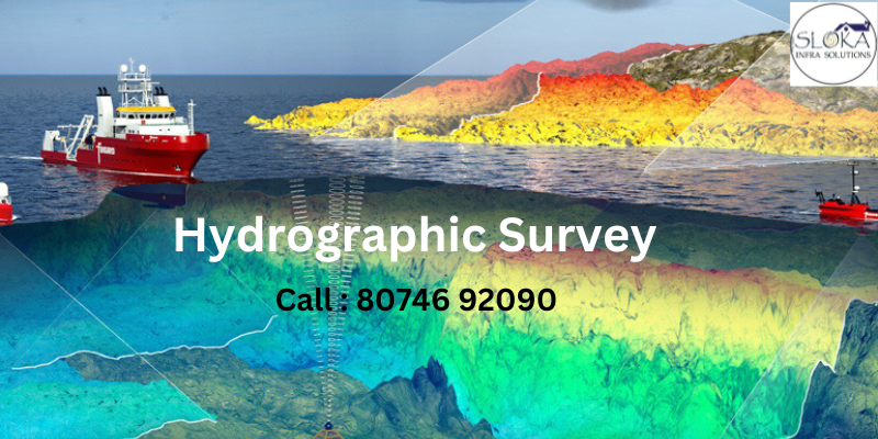
Top Hydrographic Survey & Surveyors in Nepal
Top Hydrographic Survey & Surveyors in Nepal are at the forefront of mapping underwater terrains using cutting-edge technology and innovative techniques. These experts employ a blend of traditional surveying methods and modern tools such as multi-beam sonar, LiDAR, unmanned survey vessels (USVs), and satellite imaging to render accurate and actionable data. Their expertise is essential for urban planning, flood risk assessment, environmental monitoring, and ensuring the structural integrity of infrastructure projects that rely heavily on precise hydrographic data.
Understanding Hydrographic Surveying
Hydrographic surveying is often likened to an “underwater X-ray,” as it offers an intricate glimpse beneath the surface of water bodies. This process involves the measurement and mapping of underwater landscapes, revealing details that are crucial for navigation, construction, and environmental studies. By determining water depths, analyzing seabed compositions, and identifying potential underwater hazards, hydrographic surveys provide a clear picture of the aquatic environment. This information is then used to create detailed nautical charts that guide everything from commercial shipping to local irrigation projects.
Key objectives of hydrographic surveying include:
- Determining Water Depth: This is essential for ensuring safe navigation and managing waterways effectively.
- Analyzing Seafloor Composition: Understanding the underwater substrate helps in planning construction projects such as bridges, dams, and hydroelectric power plants.
- Identifying Submerged Hazards: Locating potential dangers like rocks, shipwrecks, and underwater ridges is crucial for preventing accidents.
- Monitoring Water Properties: Parameters such as salinity, currents, and tidal patterns are studied to support environmental research and management.
These surveys form the backbone of many critical applications, from the creation of navigational charts to the implementation of environmental conservation strategies. By leveraging advanced data analytics and Geographic Information Systems (GIS), surveyors are able to visualize underwater terrains in three dimensions, offering unprecedented insights into the aquatic landscape.
The Role of Hydrographic Surveys in Sustainable Water Management
Hydrographic surveys are indispensable in modern water management strategies, especially in countries like Nepal where water resources are both plentiful and essential to the nation’s development. With the accelerating pace of urbanization and climate change impacts, managing water resources effectively is more important than ever.
Urban Expansion and Infrastructure Development
Nepal is experiencing rapid urban growth, and with it comes the need for robust water management systems. Hydrographic surveys are essential in the planning and execution of infrastructure projects. For example, before constructing bridges, dams, or irrigation channels, engineers rely on detailed underwater maps to assess the feasibility and safety of these projects. This precise mapping minimizes risks associated with construction and ensures that the foundations of such projects are secure and sustainable.
Flood Prevention and Disaster Management
Monsoons and seasonal floods pose significant challenges in Nepal. Hydrographic surveys help in creating flood risk maps that are critical for disaster preparedness. By providing real-time data on water levels and flow patterns, these surveys enable authorities to predict and mitigate flood risks. In areas prone to flooding, detailed underwater mapping aids in the design of effective flood barriers and drainage systems, ultimately reducing the vulnerability of communities and infrastructure.
Enhancing Agricultural Productivity
Agriculture is the backbone of Nepal’s economy, and efficient water management is essential for sustainable farming. Hydrographic surveys contribute to optimizing irrigation systems by accurately mapping water bodies and channels. This ensures that water distribution is efficient, reducing wastage and enhancing crop yields. Detailed underwater assessments also help in monitoring sedimentation levels, which can impact the storage capacity of reservoirs used for irrigation.
Environmental Conservation and Tourism
Beyond industrial and infrastructural benefits, hydrographic surveys play a crucial role in environmental conservation. By monitoring water quality, sedimentation, and aquatic biodiversity, these surveys assist in preserving natural habitats and restoring degraded ecosystems. Well-maintained water bodies not only support biodiversity but also attract tourists, contributing to the local economy. Lakes, rivers, and waterfalls that are managed based on accurate survey data become prime attractions for eco-tourism and recreational activities.
Technologies Shaping Modern Hydrographic Surveys
The evolution of technology has dramatically transformed the field of hydrographic surveying. With a suite of sophisticated tools at their disposal, modern surveyors can gather data with unprecedented accuracy and efficiency.
1. Single-Beam and Multi-Beam Sonar Systems
Sonar technology is the cornerstone of modern hydrographic surveys. Single-beam sonar provides a basic measurement of water depth, while multi-beam sonar systems offer a high-resolution, three-dimensional view of the seabed. Multi-beam systems are particularly useful in complex underwater terrains where detailed mapping is essential. These systems emit sound waves that bounce off the seafloor, and the time it takes for the echoes to return is used to calculate depth. The resulting data is then transformed into detailed maps that illustrate the underwater landscape.
2. LiDAR (Light Detection and Ranging)
LiDAR technology, which uses laser pulses to measure distances, is another critical tool in hydrographic surveys. It is especially effective in shallow waters and coastal areas, where sonar systems might struggle due to interference from the seabed or vegetation. LiDAR provides highly precise topographical maps, which are invaluable for coastal zone management, flood risk assessment, and urban planning.
3. Unmanned Survey Vessels (USVs)
Unmanned Survey Vessels, or USVs, have revolutionized the way hydrographic surveys are conducted, especially in hazardous or hard-to-reach areas. These autonomous boats are equipped with sonar, GPS, and various sensors that allow them to conduct surveys with minimal human intervention. USVs can operate in challenging conditions, significantly reducing risks to survey teams and increasing the efficiency of data collection.
4. Satellite and Aerial Imaging
Remote sensing technologies, including satellite and aerial imaging, offer a broader perspective on water bodies. These tools complement ground-based hydrographic surveys by providing macro-level data that can be integrated with detailed underwater maps. This integration is particularly useful for monitoring large water bodies, assessing environmental changes, and planning large-scale water management projects.
5. Geographic Information Systems (GIS) and Data Analytics
GIS technology plays a vital role in the analysis and visualization of hydrographic data. By integrating various data sets, GIS helps in creating comprehensive maps and models that depict underwater terrains in intricate detail. Advanced data analytics further enhance the usability of this data by identifying patterns, predicting trends, and providing actionable insights for decision-makers. With GIS, authorities and engineers can overlay hydrographic data with other geographical information, creating a holistic view of the environment and facilitating informed decision-making.
Applications of Hydrographic Surveys in Nepal
The practical applications of hydrographic surveys in Nepal are vast and diverse. As the country grapples with challenges ranging from rapid urbanization to climate change, the data provided by these surveys is critical for planning, management, and conservation.
Infrastructure Projects
One of the most significant applications of hydrographic surveys is in the planning and execution of infrastructure projects. Detailed underwater mapping is essential for the construction of bridges, roads, dams, and irrigation systems. In regions with challenging terrain, such as mountainous areas or remote river valleys, accurate hydrographic data ensures that structures are built on solid foundations, minimizing risks of collapse or damage due to unforeseen underwater conditions. Engineers and planners rely on these surveys to identify the best locations for construction, assess potential hazards, and design structures that can withstand environmental stresses.
Flood Risk Assessment and Management
Nepal’s monsoon season brings with it the constant threat of flooding. Hydrographic surveys are instrumental in creating detailed flood risk maps that help predict and mitigate the effects of severe weather events. By monitoring water flow, sedimentation, and changes in water levels, these surveys provide critical information that is used to design flood control measures such as levees, reservoirs, and diversion channels. This proactive approach to flood management not only protects lives and property but also ensures the continuity of essential services in vulnerable regions.
Enhancing Navigation and Waterway Safety
While Nepal is predominantly landlocked, its network of rivers and reservoirs is vital for local transportation and commerce. Hydrographic surveys ensure that these waterways are safe for navigation by providing accurate data on water depth and identifying any underwater hazards that could endanger vessels. For communities that rely on river transport, these surveys reduce the risk of accidents and ensure that navigational routes remain clear and well-maintained. This is particularly important for remote areas where water transportation may be the only viable means of moving goods and people.
Environmental Monitoring and Conservation
The health of aquatic ecosystems is directly linked to the quality of hydrographic data. Surveys enable the continuous monitoring of water bodies, helping to detect changes in sedimentation patterns, water quality, and aquatic biodiversity. Such data is crucial for environmental conservation efforts, as it guides the restoration of polluted or degraded water bodies and informs strategies for sustainable management. In addition, hydrographic surveys assist in tracking the impacts of climate change on water bodies, such as rising water temperatures and altered flow patterns, ensuring that conservation measures are both timely and effective.
Hydroelectric Power Generation
Nepal’s abundant water resources are a significant source of hydroelectric power. For the successful development and maintenance of hydroelectric projects, accurate assessments of riverbeds and reservoir capacities are critical. Hydrographic surveys provide the detailed information necessary for site selection, optimizing reservoir operations, and managing sediment build-up, which can affect the efficiency of power generation. By ensuring that water flow and storage are precisely monitored, these surveys contribute to the reliability and sustainability of hydroelectric power projects—a cornerstone of Nepal’s renewable energy strategy.
Challenges in Conducting Hydrographic Surveys in Nepal
Despite the clear benefits, conducting hydrographic surveys in Nepal comes with its own set of challenges. The unique geographical, climatic, and infrastructural conditions of the country require innovative solutions and persistent efforts from surveyors and engineers alike.
Geographical and Terrain Complexities
Nepal’s diverse landscape includes steep mountains, deep valleys, and rugged terrains. Many water bodies are situated in remote and inaccessible areas, making the logistics of conducting surveys significantly more challenging. Survey teams often have to navigate narrow passages, unpredictable river courses, and variable water conditions. The rugged terrain not only hampers the movement of equipment but also increases the risk for personnel, necessitating the use of specialized vehicles and vessels designed for such conditions.
Adverse Weather Conditions
The monsoon season in Nepal brings heavy rainfall, high winds, and sudden floods that can disrupt survey operations. Inclement weather conditions not only delay the surveying process but also pose serious safety risks for the teams involved. The unpredictable weather requires surveyors to plan meticulously, often working within narrow windows of opportunity when conditions are favorable. Advanced forecasting and real-time weather monitoring systems are increasingly integrated into hydrographic surveying protocols to mitigate these challenges.
Resource Limitations and Infrastructure
While the demand for detailed hydrographic data is growing, the availability of advanced surveying equipment and trained personnel can sometimes be limited. High-quality instruments such as multi-beam sonar systems, LiDAR equipment, and USVs require substantial investment, and not all regions have the financial resources to support large-scale surveys. Additionally, the integration of data from various sources demands robust IT infrastructure and expertise in data analytics, which may be lacking in certain remote areas. This scarcity of resources sometimes forces surveyors to prioritize projects, balancing the need for extensive data collection with available budget and time constraints.
Ensuring Data Accuracy and Consistency
Accurate hydrographic data is essential for making informed decisions, but achieving such precision in the field is often challenging. Factors like water turbulence, sediment disturbance, and instrument calibration can affect the quality of the data collected. Maintaining consistency across different surveys and ensuring that data sets from various sources align seamlessly requires rigorous standards and regular quality control checks. In this regard, international guidelines and best practices provide a framework that Nepalese surveyors continuously strive to adopt and implement.
Best Practices for Selecting Hydrographic Survey & Surveyors
Given the complexity and significance of hydrographic surveys, choosing the right surveyors is critical for obtaining reliable and actionable data. Here are some best practices for selecting a hydrographic survey company or expert in Nepal:
1. Evaluating Experience and Expertise
Look for surveyors with a proven track record in hydrographic surveying. Companies that have successfully completed multiple projects, especially in challenging environments, demonstrate their ability to deliver accurate results. Reviews, case studies, and client testimonials can provide valuable insights into the reliability and performance of a surveyor.
2. Advanced Technological Capabilities
The best surveyors invest in modern, state-of-the-art equipment. Whether it’s multi-beam sonar, LiDAR, or USVs, the use of advanced technology is crucial for capturing high-resolution data. Companies that continually update their technology and stay abreast of the latest industry innovations are more likely to provide superior service.
3. Adherence to National and International Standards
Hydrographic surveying requires strict adherence to standards that ensure data accuracy and safety. Surveyors should follow established protocols and guidelines, both at the national level and from international bodies such as the International Hydrographic Organization (IHO). Compliance with these standards not only enhances the credibility of the data but also facilitates its integration with other regional and global data sets.
4. Cost Efficiency and Timeliness
While accuracy is paramount, cost and efficiency cannot be overlooked. Comparing service providers in terms of their pricing structures, operational efficiency, and turnaround times is essential. A balanced approach that delivers quality data without undue delays or exorbitant costs is ideal for sustainable projects.
5. Client Feedback and Reputation
Word of mouth and industry reputation remain critical factors in the selection process. Engage with past clients to gather feedback on the surveyor’s performance, professionalism, and responsiveness. A reputable surveyor with a history of successful projects is a strong indicator of future reliability.
The Future of Hydrographic Surveys in Nepal
As technology evolves and the need for sustainable water management grows, the future of hydrographic surveying in Nepal looks promising. Innovations and investments in this field are poised to transform the way water resources are managed and preserved.
Technological Advancements
Emerging technologies such as artificial intelligence (AI) and machine learning are beginning to play a role in data analysis and pattern recognition. These tools can significantly enhance the interpretation of hydrographic data, leading to more precise predictive models and improved decision-making processes. Additionally, advancements in remote sensing and sensor miniaturization are likely to make surveys faster, safer, and more cost-effective.
Increased Investment in Water Resource Management
Recognizing the critical importance of water to its development, both the government and private sector are expected to increase their investments in hydrographic surveying. This influx of funding will facilitate the acquisition of advanced equipment, the training of skilled personnel, and the implementation of cutting-edge methodologies. Such investments not only bolster water management practices but also stimulate technological innovation within the country.
Addressing Climate Change Challenges
Climate change is poised to alter water cycles and exacerbate the frequency and intensity of floods. Hydrographic surveys will be instrumental in monitoring these changes and guiding the development of adaptive strategies. By providing timely data on water levels, flow patterns, and sedimentation rates, surveyors can help predict and mitigate the impacts of climate change on Nepal’s water infrastructure. This proactive approach is critical for enhancing community resilience and ensuring long-term environmental sustainability.
Integration with Smart City Initiatives
As urban areas expand, the concept of smart cities—where technology is integrated to improve efficiency and quality of life—will gain prominence. Hydrographic surveys can be seamlessly integrated into smart city frameworks, providing real-time data that supports traffic management, public safety, and resource allocation. For instance, monitoring urban water bodies can inform the management of stormwater systems and reduce the risks associated with urban flooding.
Collaborative Research and Innovation
The future of Hydrographic surveying in Nepal will also be shaped by collaborative efforts between government agencies, academic institutions, and private enterprises. Joint research initiatives can foster innovation, improve surveying techniques, and develop tailored solutions to address local challenges. Such collaboration not only promotes knowledge sharing but also ensures that survey methods remain at the cutting edge of technological progress.
Real-World Success Stories in Nepal
Several projects in Nepal have already demonstrated the transformative impact of hydrographic surveying. These success stories underscore the value of accurate underwater mapping in various sectors.
Urban Planning and Infrastructure
In rapidly expanding cities like Kathmandu and Pokhara, hydrographic surveys have informed the planning of critical infrastructure projects. Detailed underwater maps have guided the construction of bridges over the Bagmati and Gandaki rivers, ensuring that these vital links are built on solid foundations. These projects have not only enhanced connectivity but have also set new benchmarks for urban water management in challenging terrains.
Flood Mitigation Projects
In the Terai region, which is highly susceptible to monsoon-induced flooding, hydrographic surveys have been a game changer. By mapping riverbeds and monitoring sedimentation, engineers have been able to design effective flood barriers and drainage systems. These measures have significantly reduced the risk of flood damage, safeguarding both lives and livelihoods in vulnerable communities.
Hydroelectric Power Developments
Hydrographic surveys have also played a critical role in the development of hydroelectric power projects across Nepal. Accurate assessments of river conditions and sediment loads have enabled engineers to optimize the design of dams and powerhouses, ensuring efficient energy generation. These projects contribute to Nepal’s goal of harnessing renewable energy while minimizing environmental impacts.
Environmental Restoration Initiatives
In several regions, hydrographic surveys have been instrumental in guiding environmental restoration projects. Detailed data on water quality, sediment distribution, and aquatic habitats have allowed environmental agencies to target areas in need of rehabilitation. Efforts to restore polluted lakes and rivers have not only improved local ecosystems but have also enhanced community access to safe and clean water.
The Broader Impact of Hydrographic Surveys
Beyond the immediate benefits for infrastructure and water management, hydrographic surveys have far-reaching implications for economic development and environmental sustainability.
Economic Benefits
Accurate hydrographic data is a valuable asset for economic planning and development. By facilitating the design and maintenance of transportation routes, irrigation systems, and power generation facilities, these surveys contribute directly to economic growth. Furthermore, the tourism sector benefits from well-maintained water bodies, attracting visitors to pristine lakes, rivers, and waterfalls that are celebrated for their natural beauty.
Environmental Stewardship
In an era marked by climate change and environmental degradation, hydrographic surveys are a cornerstone of sustainable development. They provide the empirical data needed to monitor ecological changes, assess the impacts of human activities, and devise restoration strategies. Through informed decision-making, hydrographic surveys support the conservation of biodiversity, the preservation of natural habitats, and the maintenance of ecological balance.
Strengthening National Resilience
Nepal’s susceptibility to natural disasters makes hydrographic surveys an essential tool for enhancing national resilience. By providing critical data for disaster preparedness and emergency response, these surveys help reduce the impact of floods, landslides, and other water-related calamities. In doing so, they play a vital role in safeguarding communities and ensuring that development initiatives are both sustainable and resilient.
Conclusion
Hydrographic surveying is not merely a technical exercise—it is a fundamental element of sustainable development and water management in Nepal. From mapping underwater landscapes and guiding major infrastructure projects to mitigating flood risks and preserving natural ecosystems, the role of hydrographic surveys is indispensable. With rapid urbanization, the pressing challenges of climate change, and the continuous evolution of technology, hydrographic surveys stand at the forefront of ensuring that Nepal’s water resources are managed wisely and efficiently.
As we look to the future, the integration of advanced technologies and innovative methodologies promises to further enhance the accuracy and scope of hydrographic surveying. By investing in modern equipment, fostering collaborative research, and training a new generation of skilled surveyors, Nepal is poised to overcome its unique geographical and logistical challenges. The insights gained from these surveys not only contribute to safe navigation and robust infrastructure but also empower communities to safeguard their environment for future generations.
In embracing the full potential of hydrographic surveys, Nepal is charting a course toward a future where water resources are a source of strength and resilience. The continued efforts of top hydrographic surveyors and the ongoing advancements in survey technology will ensure that the country can meet its water management challenges head-on, paving the way for sustainable growth, enhanced disaster preparedness, and a healthier environment.
By transforming underwater mysteries into actionable data, Top Hydrographic Survey & Surveyors in Nepal illuminate the path towards better planning and sustainable resource management. They are a testament to how science and technology can work hand in hand with nature to build a safer, more prosperous future for all. Whether it is for large-scale infrastructure projects, environmental conservation, or daily water management, the precision and dedication of hydrographic surveyors are key to unlocking the full potential of Nepal’s water resources.
In summary, the field of hydrographic surveying in Nepal encapsulates the convergence of advanced technology, environmental stewardship, and sustainable development. As urban areas continue to expand and climate change imposes new challenges, the expertise and innovation of hydrographic surveyors will remain essential. Their work not only secures the safety and efficiency of water transport and infrastructure but also contributes to a broader vision of ecological balance and economic progress.
The journey of transforming raw underwater data into meaningful insights is both fascinating and critical. With each survey, new chapters of understanding are written, enabling engineers, policymakers, and environmentalists to make informed decisions that benefit society at large. Hydrographic surveying is truly an unsung hero in the narrative of modern water management, and its ongoing evolution promises to bring about transformative changes in the way we interact with and protect our natural water bodies.
As we celebrate the achievements and innovations in hydrographic surveying, it is important to recognize the human ingenuity and technological prowess behind every successful survey. The future holds great promise as emerging technologies, increased investments, and collaborative efforts continue to redefine what is possible in this vital field. In a world where every drop of water counts, hydrographic surveying stands as a beacon of hope, guiding us towards a future of sustainable water management and resilient communities.
Final Thoughts
Hydrographic surveying is more than a technical process—it is a commitment to understanding, protecting, and optimizing our water resources. In Nepal, where water is both a blessing and a challenge, the data provided by hydrographic surveys paves the way for safe navigation, robust infrastructure, and a healthy environment. From the rugged terrains of the Himalayas to the sprawling river valleys of the Terai, the insights gained through these surveys are transforming how water is managed across the country.
The remarkable achievements of hydrographic surveyors, armed with advanced technology and deep expertise, are setting new benchmarks for sustainable development. Their work exemplifies the power of combining scientific precision with innovative thinking, ensuring that Nepal’s water resources remain a source of prosperity and life for generations to come.
By embracing the transformative potential of hydrographic surveys, Nepal is not only addressing current challenges but also laying the foundation for a resilient and sustainable future. The path forward is illuminated by data, innovation, and a steadfast commitment to environmental stewardship—one survey at a time.