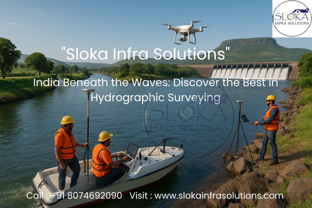
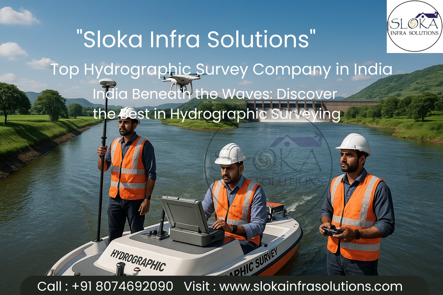
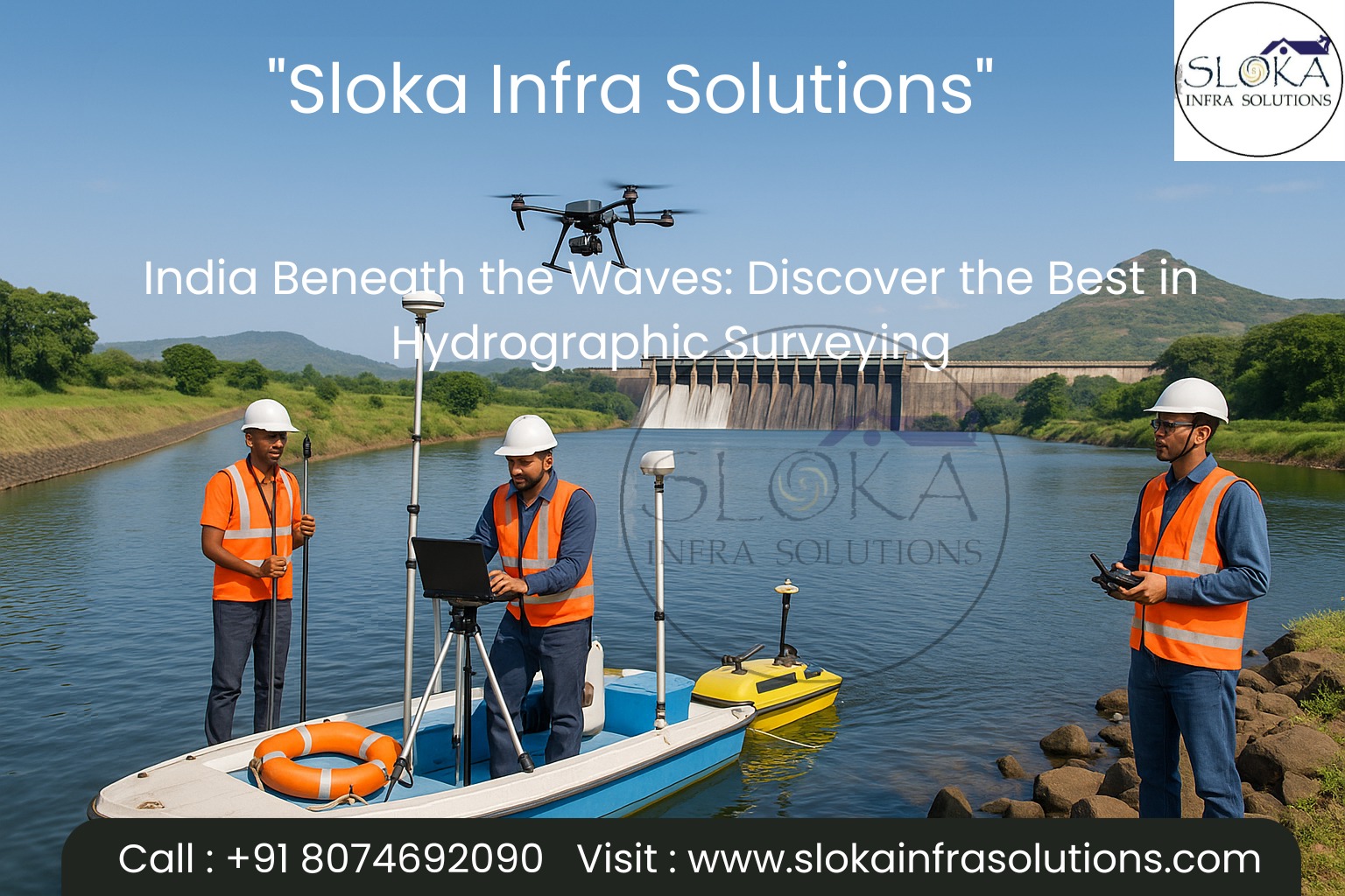
Top Hydrographic Survey Company in India
India Beneath the Waves: Discover the Best in Hydrographic Surveying
Call: 80746 92090
When it comes to mapping the hidden world beneath the surface, Top Hydrographic Survey Company in India must combine unmatched technical capacity, regional expertise, and an understanding of India’s diverse waterways. India’s geography—with its long coastline (over 7,500 km, including islands), vast river systems like Ganga, Brahmaputra, Godavari, backwaters in Kerala, reservoirs, lakes and inland waterways—places a heavy demand on high-precision hydrographic surveys. In this blog, we explore what hydrographic surveying entails, the major players in India, key technologies (like Sub Bottom Profilers and Side Scan Sonar), and the factors that make a surveyor stand out.
Top Hydrographic Surveyor in India
Top Hydrographic Surveyor in India plays a pivotal role in bridging the gap between raw sensor data and practical, actionable maps and charts. The surveyor is the expert who understands bathymetry, geophysics, vessel operations, tidal corrections, data processing, and the conversion of survey data into usable products (nautical charts, dredging plans, coastal models, etc.). In India, being a top surveyor means not only mastering instrumentation and software but also being attuned to local hydrodynamics, monsoon effects, sediment transport, river morphodynamics, and the logistical challenges of working in remote or sensitive coastal zones.
Below is a detailed journey through hydrographic surveying: how it works, its tools, who leads the industry in India, and what to look for when selecting a provider.
What is Hydrographic Surveying?
Hydrographic surveying is the science of measuring and describing features that affect maritime navigation, marine construction, dredging, coastal management, and environmental monitoring. It involves collecting data about the topography of the sea floor (bathymetry), sub-surface layers (sub-bottom profiling), underwater objects (wrecks, pipelines, debris), and relevant tidal, current, and sediment conditions.
Key applications include:
- Nautical charting and updating navigational maps
- Port and harbor development, dredging planning
- Subsea cable, pipeline route surveys
- Offshore infrastructure (wind farms, oil & gas platforms)
- Coastal erosion, sediment transport, coastal zone management
- Inland waterways, riverbed profiling, reservoir siltation studies
- Environmental baseline mapping, habitat mapping
Because India has a mix of coastal, estuarine, riverine, and reservoir environments, any Top Hydrographic Survey Company in India must be versatile across multiple water regimes.
India’s Hydrographic Landscape & Challenges:-
India’s hydrographic context is unique due to:
1.Long and complex coastline with deltas, estuaries, mangroves (e.g. Sundarbans), islands (Andaman & Nicobar, Lakshadweep).
2.Large river networks with dynamic sediment loads (Ganga, Brahmaputra, Mahanadi, Godavari, Krishna, etc.)
3.Seasonal monsoon influence causing drastic changes in water levels, sediment transport, turbidity, and flooding.
4.Diverse inland waterbodies—reservoirs, lakes, canals, irrigation tanks—each demanding different survey strategies.
5.Strategic maritime interests—Exclusive Economic Zone (EEZ) mapping, offshore wind potential, defense needs, and marine spatial planning.
These challenges require high technical competence, local knowledge, flexible operations, and proper risk management (monsoon windows, permissions, vessel logistics).
What Makes a Top Hydrographic Surveyor?
To be considered among the Top Hydrographic Surveyor in India, several qualities must converge:
1.Technical Proficiency
Mastery in deploying, calibrating, and operating sensors (multibeam, side scan, sub-bottom, ADCP, etc.), and handling complex vessel operations (dynamic motion compensation, GPS/RTK corrections, tidal modeling).
2.Data Processing & Interpretation
Raw acoustic returns must be corrected, filtered, cleaned (outlier removal), validated, and interpreted to produce final deliverables. Knowledge of hydrographic software (HYPACK, CARIS, QPS, etc.) is essential.
3.Local Hydrodynamics Insight
Understanding tidal effects, sediment dynamics, river morphology, and monsoon impact helps avoid systematic errors and plan surveys more safely.
4.Project Management & Logistics
Handling vessel mobilization, crew safety, permissions (coastal authorities, naval zones, environmental clearances), fuel, port calls, and contingency in monsoon windows.
5.Quality Assurance & International Standards
Adherence to IHO (International Hydrographic Organization) standards, ISO accuracy levels, proper reporting, and independent verification.
6.Adaptability & Multi-Modal Capability
Ability to work in coastal, deep offshore, riverine, reservoir, and mangrove environments using a mix of survey platforms (boats, USV, ROV, UAV survey integration).
7.Innovation & Integration
Combining hydrographic data with LiDAR, UAV mapping, GIS models, remote sensing, and geophysical layers improves the value of deliverables.
When one finds a firm or individual combining these attributes while delivering reliably across India’s varied water systems, one can truly call them Top Hydrographic Survey Company in India and Top Hydrographic Surveyor in India.
Key Technologies in Hydrogrpahic Survery:-
Sub Bottom Profilers:-
Sub Bottom Profilers (SBP) are acoustic devices used to “see” beneath the seabed/riverbed. Unlike bathymetry, which maps the surface of the bottom, SBP penetrates into subsurface sediment strata to reveal layering, buried objects, geological features, and sediment thickness.
How it works
- An acoustic source emits low-frequency acoustic pulses that travel downward through water, reach the seabed, and then penetrate sediments.
- Some energy reflects off sediment interfaces and buried layers, returning echoes to the receiver.
- Time-delay and signal amplitude analysis let the system reconstruct vertical profiles of subsurface layers.
- Typically, SBP frequencies range from a few kHz to 10s of kHz (lower frequencies penetrate deeper but yield lower resolution).

Applications in Indian context
Subsurface mapping for pipeline and cable routing: To ensure structural integrity when laying underwater cables or oil/gas pipelines, engineers need to know sediment stability, rock layers, and potential obstructions.
Archaeological / wreck detection: Buried shipwrecks or artifacts beneath the seabed can be identified.
Dredging design & sediment thickness estimation: Quantifying how much silt has accumulated helps plan effective dredging and disposal.
Geological / geotechnical investigations: Understanding subsurface stratigraphy assists foundations for offshore structures, port jetties, breakwaters.
Environmental & sediment studies: Revealing past depositional sequences, sediment transport history, and erosion/deposition cycles.
Challenges & best practices
- Acoustic penetration depends on sediment types—soft sediments allow deeper penetration, whereas hard rock layers block signals.
- Calibration of signal strength and filtering of noise is critical.
- Integration with bathymetry, side scan, and ground truthing (e.g. coring, seismic data) enhances reliability.
- Survey planning must account for vessel motion, water column velocity, and signal attenuation by turbidity.
In India’s rivers and coasts, where sediment loads vary drastically across seasons, SBP helps distinguish between recent fluvial deposits and stable substrate. A Top Hydrographic Survey Company in India will integrate SBP data with bathymetry to produce a full subsurface map—critical in dredging, pipeline design, and geological risk assessment.
Side Scan Sonar:-
Side Scan Sonar (SSS) is an acoustic imaging method used to generate high-resolution images of the seabed or riverbed surface, ideal for detecting objects, morphological features, and seabed heterogeneity.
How it works
- The sonar device emits fan-shaped acoustic pulses laterally (to the sides) from a towfish or hull-mounted transducer.
- The returning echoes—reflected from the seabed, objects, or features—are recorded as intensity values, producing a “sonar image” (grayscale) of the seabed.
- The closer a feature is to the transducer axis, the stronger the echo; farther features give weaker returns.
- Overlapping swaths from multiple passes are mosaiced to create a continuous image.
Applications in Indian scenarios
Obstacle and wreck detection: Side scan sonar is excellent at revealing submerged wrecks, debris, pipelines, cables, or hazards hidden from bathymetric data.
Seafloor classification: It can differentiate sand, rock, mud, and boulder patches by their acoustic texture signature.
Habitat mapping and benthic studies: In coastal / estuarine ecosystems, side scan can map reef structures, coral patches, mangrove root zones.
Pipeline and cable route surveys: Ensures proper burying and checks for exposure or threats.
Morphological change detection: Monitoring seabed changes over time (erosion, deposition zones) by comparing images from successive surveys.
Strengths & limitations
Strength lies in imaging high resolution and wide swaths; limitations include lack of depth (vertical) information (you see imagery, not depth).
Requires careful motion compensation, slant-range correction, and mosaic stitching.
Acoustic shadows behind tall features can hide data; care in path planning is required.
Turbidity, multipath echoes, or strong backscatter noise can degrade image quality.
In the context of India’s coastal and inland waters—with murky waters during monsoons, shifting sediments, and frequent shipwrecks in estuarine zones—side scan sonar is indispensable for any robust hydrographic survey. A Top Hydrographic Surveyor in India will combine side scan imagery with bathymetric grids and sub-bottom profiles to deliver a comprehensive underwater model.
(New Structure) Beyond Side Scan: Advanced Integration, Case Insights & Future Trends
After side scan sonar, a new structural flow is helpful to break monotony: first, discuss integrated survey workflows, then illustrate case examples in India, and then look ahead at emerging trends and challenges.
Integrated Survey Workflows in Hydrography
A modern hydrographic survey typically integrates multiple sensors and modes:
Bathymetric acquisition (single-beam / multibeam)
Establish depth grid and seafloor topography.
Side scan imaging
Overlay high-resolution imagery to detect features beyond depth—wrecks, outcrops, hazards.
Sub-bottom profiling
Penetrate subsurface strata to inform geological and engineering decisions.
Water column profiling (ADCP, CTD)
Measure currents, salinity, temperature, sound velocity profiles for correcting acoustic data.
RTK / GNSS / PPP positioning & motion sensors
Provide accurate horizontal/vertical control and motion compensation.
Quality assurance & control
Data cleaning, outlier detection, cross-line checks, validation.
Post-process & deliverables
Generate cartographic outputs, dredging plans, 3D models, GIS layers, navigation charts.
Integration with topographic and remote sensing
For coastal zones, combine LiDAR, UAV surveys, satellite data to create full coastal-terrain–subsea models.
This multi-modal method ensures no single perspective—depth, image, subsurface—is left isolated.
Future Trends, Opportunities & Challenges
Autonomous & Uncrewed Systems: USVs (Unmanned Surface Vehicles), AUVs (Autonomous Underwater Vehicles), and drone-deployed bathymetry will reduce costs, risk, and improve coverage in shallow or hazardous zones.
Real-Time Processing & AI: Onboard processing, AI-based feature extraction (wrecks, anomalies) and auto QA will speed project turnaround.
Crowdsourced / Citizen Hydrography: Using vessels of opportunity, small craft sensors to supplement data in under-surveyed zones.
Coastal Digital Twins: Seamless integration of terrestrial and underwater data to create live, continuously updated coastal models.
Climate & Sea-Level Studies: With rising sea levels and coastal erosion, hydrographic data becomes critical for resilience planning, disaster response, and adaptation.
Data Sharing & National Infrastructure: India may push for a national hydrographic database, open data policies, and regular chart updates as marine traffic and offshore development grow.
Regulatory & Permitting Hurdles: Coastal zone permissions, environmental clearances, restricted military zones can slow deployment.
Monsoon Constraints & Logistics: Seasonal windows remain tight; vessels, crew safety, and high turbidity impose survey constraints.
How to Choose the Right Hydrographic Survey Partner
When evaluating providers, consider the following:
Track record & references — Look for successfully completed projects in similar environments (coastal, river, reservoir).
Sensor inventory & integration skills — Multibeam, side scan, SBP, ADCP, motion sensors, RTK positioning must be part of their toolkit.
Data processing & deliverable capability — Ask for examples of charts, dredging plans, GIS-ready outputs.
Local experience & hydrodynamics knowledge — Familiarity with local tidal regimes, sediment systems, monsoon behavior.
Certifications & standards adherence — IHO standards, ISO accuracy, QA/QC procedures.
Operational logistics & field readiness — Vessel support, mobilization, crew competency, safety protocols.
Cost vs value — Don’t just pick lowest bidder; ensure completeness and reliability.
Scalability & tech adoption — Will they use autonomous platforms or advanced tools when needed?
Conclusion:-
Hydrographic surveying is not just depth measurement—it is a fusion of imaging, subsurface insights, marine physics, and project-level planning. In India, with its rich tapestry of coastal, river, reservoir, and marine environments, the demand for accurate, high-resolution underwater mapping has never been greater.
The Top Hydrographic Survey Company in India must be technically versatile, regionally savvy, integrated, and logistically robust. The Top Hydrographic Surveyor in India is one who brings sensor mastery, data interpretation, local insight, and world-class deliverables to every assignment. When choosing a partner, examine their sensor suite, data output track record, operational capability, and domain experience.
As technology advances—autonomous platforms, AI, real-time processing—the future is bright for hydrographic surveying in India. For those building ports, laying cables, dredging rivers, or charting the seabed, aligning with India’s best survey companies and surveyors is not just smart, it’s essential.