Top Bathymetric Survey in Telangana
Unveiling the Depths: How Bathymetric Surveys Transform Telangana’s Waterbodies
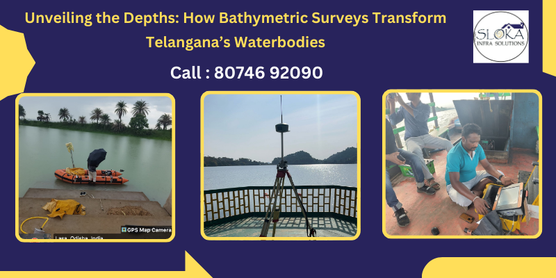
Top Bathymetric Survey in Telangana has emerged as a transformative service for understanding the intricate underwater contours of the state’s lakes, reservoirs, rivers, and canals. Nestled on the Deccan Plateau, Telangana boasts diverse water bodies—from the sprawling Nagarjunasagar Reservoir to the historic Musi River flowing through Hyderabad. Accurate bathymetric data is vital for flood management, navigation safety, irrigation planning, infrastructure development, and ecological conservation. By harnessing state-of-the-art technologies such as multi-beam sonar, LiDAR, and unmanned survey vessels, surveyors can produce highly detailed maps of subaqueous terrain, enabling planners, engineers, environmentalists, and policy makers to make informed decisions.

Top Bathymetric Surveyor in Telangana
Top Bathymetric Surveyor in Telangana often combines deep local expertise with advanced methodologies to deliver precision mapping across the state’s varied hydrological settings. Whether it’s the rocky contours of the Krishna Basin, the sediment-laden channels of the Godavari tributaries, or the shallow wetlands around Bhadradri Kothagudem, certified hydrographic teams deploy customized approaches—single-beam echo sounding for smaller reservoirs, multi-beam mapping for major water-storage projects, and airborne LiDAR for near-shore topography. By repeating best practices learned from past projects and continually refining survey protocols, these professionals ensure repeatability and accuracy, making them the first choice for government agencies, private developers, and environmental NGOs alike.
1. Telangana’s Waterbodies: A Geographical Overview
Telangana’s geography is characterized by undulating hills, plateau tracts, and river valleys. Two principal rivers traverse the state—Godavari in the north and Krishna in the south—each sustained by a web of tributary streams. Key waterbodies include:
- Nagarjunasagar–Srisailam Reservoir: Among the world’s largest masonry dams, it requires ongoing bathymetric surveys to monitor siltation and maintain capacity.
- Musi River: Passing through Hyderabad, historic floods in 1908 led to modern flood-mitigation efforts, now supported by detailed river-bed mapping.
- Pocharam and Malkhed Reservoirs: Serve as critical sources of drinking water and irrigation; periodic surveys help gauge depth and sedimentation.
- KBR National Park Lakes: Urban-park water bodies need ecological monitoring via high-resolution bathymetry to preserve aquatic habitats.
- Kaleshwaram Lift Irrigation Project Canals: Extensive canal networks benefit from echo-sounder surveys to optimize water conveyance.
Understanding these varied hydrological contexts is essential for tailoring survey strategies. Sediment types range from coarse alluvium in hill streams to fine silts in low-lying floodplains, affecting sonar penetration and data fidelity.
2. What Is a Bathymetric Survey?
Bathymetric surveys use hydrographic techniques to chart water depths and detail the shapes of underwater terrain. By emitting acoustic pulses (via single- or multi-beam echo sounders) and recording the time it takes for echoes to return from the bed, surveyors calculate depths at precise geographic coordinates. When combined with Global Navigation Satellite System (GNSS) positioning and vessel motion sensors, this data yields three-dimensional digital elevation models (DEMs) of submerged landscapes. Advanced systems also measure water velocity (using Acoustic Doppler Current Profilers) and sub-bottom stratigraphy (with sub-bottom profilers), enabling insights into sediment layers, erosional features, and channel dynamics.
3. Core Methods Employed
3.1 Multi-Beam Sonar
- Coverage: Scans wide swaths (often hundreds of meters) per pass, producing dense point clouds.
- Applications: Large reservoirs (Nagarjunasagar), dam approach channels, deep-water lakes.
- Advantages: High resolution and real-time visualization; accurate for slope and volume calculations.
3.2 Single-Beam Sonar
- Coverage: Measures directly beneath the survey vessel; suited for small or narrow water bodies.
- Applications: Village ponds, urban park lakes like KBR; budget-conscious projects.
- Advantages: Simpler setup; effective for regular monitoring when high point density isn’t required.
3.3 LiDAR Bathymetry
- Principle: Airborne laser pulses penetrate clear, shallow water (typically up to 50 cm turbidity).
- Applications: Shoreline surveys, wetland mapping around Kawal Wildlife Sanctuary.
- Advantages: Simultaneous topographic and bathymetric mapping; rapid coverage.
3.4 Unmanned Surface Vessels (USVs)
- Features: Remote-controlled boats fitted with echo sounders and RTK-GNSS.
- Applications: Hazardous or environmentally sensitive zones (wetlands, protected lakes).
- Advantages: Reduced human risk; access to shallow or obstructed areas.
3.5 Acoustic Doppler Current Profiler (ADCP)
- Purpose: Measures water current profiles and sediment transport.
Applications: Includes analyzing flow rates in the Godavari’s feeder streams and predicting flood events.
- Advantages: Integrates hydrodynamic data with bathymetry for comprehensive analysis.
4. Applications Across Sectors
4.1 Flood Management and Control
Telangana experiences highly variable monsoon rains. Detailed river-bed mapping allows prediction of flood-prone zones, design of levees, and optimally locating weirs and spillways. Detailed depth mapping of Hyderabad’s Musi River has been vital for reinforcing its embankments ever since the catastrophic 1908 flood.
4.2 Irrigation Planning
With nearly two-thirds of Telangana’s cultivated area reliant on canal irrigation, sediment accumulation can impede flow. Regular surveys in the Bidhwan and Devadula canal networks enable targeted dredging, preserving conveyance efficiency and water availability.
4.3 Navigation and Inland Water Transport
As Telangana explores inland water transport along the Godavari’s navigable stretches, reliable depth maps ensure safe passage for barges and passenger vessels. Survey data guides channel maintenance, marking of sandbars, and installation of navigation aids.
4.4 Infrastructure and Construction
Bridge foundations, dam sites, and quay walls require precise subaqueous profiling. Bathymetric surveys inform foundation depth, scour potential, and construction staging. For example, the Yusuf Sagar bridge upgrade in Hyderabad depended on multi-beam data to assess river-bed stability.
4.5 Environmental and Ecological Monitoring
Urban lake restoration—such as the revitalization of Hussain Sagar—leverages bathymetric data to balance water depths that support fish habitats, aquatic vegetation, and recreational boating. Fine-scale mapping also tracks sedimentation rates, guiding desiltation efforts.
4.6 Hydropower and Renewable Energy
Projects like the Kaleshwaram Lift Irrigation have hydroelectric components that require accurate reservoir volume calculations. Bathymetry enables energy output projections by modeling depth–area–volume relationships under varying water levels.

5. Technology Integration and Data Processing
Modern bathymetric projects integrate a suite of technologies:
- RTK-GNSS: Delivers centimeter-level positioning to ensure geospatial accuracy.
- IMU and Motion Sensors: Compensate for vessel pitch, roll, and heave.
- GIS and CAD Tools: Process point clouds into contour maps, 3D DEMs, and volume calculations.
- Cloud Platforms: Facilitate remote data sharing, collaborative analysis, and version control.
Post-survey workflows include quality control, tidal and transducer offset corrections, and manual editing to remove noise from rock outcrops or floating debris. Final outputs may include bathymetric charts, isobath maps, cross-sections, and volumetric analyses for dredging.
6. Case Study: Reservoir Capacity Assessment
In 2024, a consortium led by Sloka Infra solutions, one of the Top Bathymetric Surveyor in Telangana conducted a multi-beam survey of Pocharam Reservoir to quantify siltation since its commissioning in 1974. The team collected over 50 million data points, revealing a 12% loss in live storage capacity. GIS analysis generated detailed volume–area curves, enabling water managers to schedule targeted desiltation during the dry season—maximizing cost-effectiveness and minimizing ecological disruption.
7. Challenges and Best Practices
- Sediment-Induced Noise: Fine silts in riverine settings can attenuate sonar signals. Operators mitigate this with higher pulse rates and dual-frequency echo sounders.
- Turbidity and Clarity: In monsoon months, suspended sediments limit LiDAR effectiveness; thus, sonar remains primary for deep or turbid waters.
- Data Gaps in Shallow Zones: Shoreline dead zones require supplemental methods (e.g., wading surveys, pole-mounted echo sounders).
- Environmental Permits: Surveys in protected wetlands (e.g., Aleru Bird Sanctuary) necessitate coordination with forest departments and adherence to biodiversity safeguards.
- Skilled Personnel: Ongoing training in equipment calibration, data processing software, and field safety protocols ensures high-quality deliverables.
8. Future Trends in Bathymetric Surveying
- Autonomous Systems: Fully autonomous USVs and underwater drones promise continuous monitoring of reservoir siltation, reducing operational costs.
- Machine Learning: Automated classification of underwater features (e.g., obstacles, habitat zones) from point clouds speeds analysis.
- Real-Time Data Streaming: 5G-enabled vessels will relay survey data live to control centers, allowing immediate decision-making.
- Integrated Environmental Sensors: Simultaneous collection of water quality parameters (e.g., dissolved oxygen, temperature) alongside bathymetry for holistic ecosystem assessments.
9. Selecting the Right Survey Partner
When choosing a service provider, consider:
- Certification and Accreditation: ISO 9001 quality management, ISO/IEC 17025 laboratory accreditation for equipment calibration.
- Local Experience: Familiarity with Telangana’s hydro-climatic conditions, monsoon patterns, and regulatory landscape.
- Technology Portfolio: Capability in multi-beam, LiDAR, USV operations, and GIS deliverables.
- Safety Records: Adherence to INS standards, EHS protocols, and risk-assessment procedures.
- Client References: Successful projects across flood management, urban lake restoration, and hydropower development.
By aligning technical capacity with proven local expertise, agencies and developers ensure robust, defensible bathymetric data for critical decision-making.
10. Conclusion
In a state where water resources underpin agriculture, urban growth, and ecological integrity, Top Bathymetric Survey in Telangana plays a pivotal role. From ensuring safe navigation along the Godavari to optimizing irrigation flow in Krishna-fed canals, these surveys deliver the data backbone for sustainable resource management. As technologies evolve—ushering in autonomous platforms, real-time analytics, and AI-driven interpretation—the precision and efficiency of bathymetric services will only increase, securing Telangana’s water futures for generations to come.