“Echoing Depths: The Role of Single Beam Echo Sounder Surveys in India”
Single beam echo sounder surveys in India have emerged as a crucial tool for underwater mapping and hydrographic surveys. These surveys play a vital role in infrastructure development, environmental monitoring, and maritime navigation. Leveraging advanced sonar technology, single beam echo sounders (SBES) provide a cost-effective and efficient solution for shallow water surveys, ensuring accuracy and reliability.
Single Beam Echo Sounder Survey Company in India
A single beam echo sounder survey company in India specializes in providing cutting-edge hydrographic services. By utilizing SBES technology, these companies cater to industries ranging from shipping to coastal engineering. They help in understanding underwater topography, enabling informed decision-making for projects like port construction, dredging, and underwater pipeline installations.
What is a Single Beam Echo Sounder?
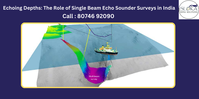
A single beam echo sounder works by emitting sound pulses from a transducer mounted on a vessel. These pulses travel through water, hit the seabed, and bounce back to the transducer. The time taken for the sound waves to return is measured and used to calculate water depth.
Key elements of an SBES system include:
- Transducer: Emits and receives sound pulses.
- GNSS Positioning System: Provides accurate location data.
- Control and Processing Unit: Captures, processes, and visualizes depth information.
Single Beam Echo Sounder Surveying: Simplifying Underwater Mapping
In certain scenarios, Single Beam Echo Sounder (SBES) systems offer significant advantages over Multibeam Systems. While multibeam technology is well-suited for comprehensive seabed mapping, SBES excels in shallow water environments such as lagoons and lakes, where multibeam systems may provide limited additional value. Moreover, SBES serves as a complementary tool for quality control, allowing for cross-verification of data between the two systems.
One notable application of SBES is in mapping and monitoring seagrass areas. By using SBES, surveyors can measure the height, position, and density of vegetation. This proves invaluable for environmental studies, as repeated surveys can reveal changes in seagrass growth or degradation over time. The insights gained from SBES play a crucial role in conservation efforts and habitat assessments.
The Functionality of Single Beam Echo Sounders
SBES systems work by producing an echogram of the seabed directly below the transducer. This digital echogram is more than just a snapshot; it provides raw data that can be post-processed to identify seabed features accurately. Post-processing ensures that the system distinguishes between the actual seabed and other features such as vegetation, suspended sediment, or aeration within the water column.
A key feature of advanced SBES setups is their dual-frequency transducer. These systems typically operate at two frequencies: a high frequency (e.g., 200 kHz) and a low frequency (e.g., 33 kHz). The high frequency is ideal for detecting the seabed and surface features like seagrass or rocks. Meanwhile, the low frequency has penetrating capabilities, enabling it to detect harder layers beneath soft materials such as silt. This dual-frequency approach enhances the versatility and accuracy of SBES systems across diverse environments.
Incorporating RTK GNSS for Precision
To ensure centimetre-level accuracy, modern SBES systems integrate Real-Time Kinematic (RTK) GNSS technology. This integration allows the system to output positional data at a high rate (20 Hz), accounting for the vessel’s heave caused by varying sea states. By compensating for heave, the system eliminates artefacts and enhances the reliability of depth measurements. This level of precision is essential for projects requiring exacting standards, such as dredging operations or habitat mapping.
Versatile Outputs for Comprehensive Analysis
The outputs generated by SBES systems are as diverse as their applications. Common deliverables include:
- Charts: Visual representations of depth and seabed features.
- Contours: Detailed mapping of underwater topography.
- Volumes: Calculations for dredging or material displacement.
- Seagrass Plans: Mapping of seagrass locations, density, and distribution.
- Pre/Post-Dredge Data: Comparisons to assess dredging efficiency and impact.
These outputs cater to a wide range of industries, including environmental conservation, infrastructure development, and marine navigation.
Single beam echo sounder surveys in India have become indispensable for projects in shallow water environments and areas requiring precise environmental assessments. With their ability to deliver accurate and versatile data, SBES systems continue to be a cornerstone of underwater surveying, enabling informed decisions and fostering sustainable practices.
How Single Beam Echo Sounders Work
- Emission and Reflection: The transducer emits sound pulses vertically downward.
- Echo Reception: The reflected sound waves (echoes) are received back by the transducer.
- Depth Calculation: Using the formula: D=C×T2D = \frac{C \times T}{2}D=2C×T where DDD is the depth, CCC is the average speed of sound in water, and TTT is the two-way travel time.
Advantages of Single Beam Echo Sounders
- Cost-Effective: Compared to multibeam systems, SBES setups are significantly less expensive.
- Simplicity: Easy to operate and requires minimal training for personnel.
- Versatility: Ideal for shallow-water surveys and small-scale mapping tasks.
- Efficiency: Faster data collection and simpler post-survey data processing.
Frequency and Beam Characteristics
Frequency Selection:
- High Frequencies (200-400 kHz): Ideal for shallow waters, offering high resolution but limited range.
- Low Frequencies (24-33 kHz): Suitable for deep waters, with greater range but lower resolution.
Beam Width:
- Narrow beams provide high precision for targeting specific features.
- Wide beams are used for general depth measurements over broader areas.
Applications of Single Beam Echo Sounder Surveys in India
- Coastal Zone Management: Monitoring shorelines and seabed changes due to erosion or sediment deposition.
- Port Development: Planning and executing dredging operations.
- Fisheries: Mapping underwater habitats to support sustainable fishing.
- Navigation Safety: Ensuring clear and obstacle-free waterways for vessels.
- Environmental Studies: Assessing the impact of underwater construction projects on marine ecosystems.
Calibration and Accuracy
Calibration is critical for obtaining reliable data. One commonly used method is the bar check, which ensures the accuracy of sound velocity used in depth calculations. During a bar check, a flat plate is lowered to known depths, and the measured values are compared against actual depths. Adjustments are made to the system until the readings align perfectly.
Components of an SBES Kit
A standard SBES kit for hydrographic surveys includes:
- Precision Survey Echo Sounder: For accurate depth measurements.
- GPS Antenna: Ensures precise positional data.
- Transducer: Emits and captures sound pulses.
Challenges in Single Beam Echo Sounder Surveys
- Environmental Factors: Variations in water temperature, salinity, and pressure can affect sound velocity.
- Obstructions: Fish, debris, or vegetation can cause interference.
- Operator Skill: Accurate surveys require trained personnel for setup, calibration, and operation.
The Future of SBES Technology in India
With advancements in sonar technology and data processing, single beam echo sounders continue to evolve. Indian companies are increasingly adopting SBES for diverse applications, from inland waterway projects to deep-sea exploration. The focus on integrating SBES with Geographic Information Systems (GIS) promises enhanced data visualization and decision-making capabilities.
Why Choose a Single Beam Echo Sounder Survey Company in India?
India’s hydrographic survey companies offer unmatched expertise in SBES technology, ensuring precise underwater mapping solutions. They provide end-to-end services, including survey planning, execution, and data analysis. Whether for industrial, environmental, or research purposes, these companies deliver results tailored to project requirements.
Conclusion
Single beam echo sounder surveys in India have become indispensable for underwater exploration and mapping. Their affordability, ease of use, and adaptability make them an excellent choice for various applications. With reliable single beam echo sounder survey companies in India, stakeholders can confidently undertake projects that depend on accurate hydrographic data. As technology advances, SBES is set to remain a cornerstone of hydrographic surveying, supporting sustainable development and innovation.