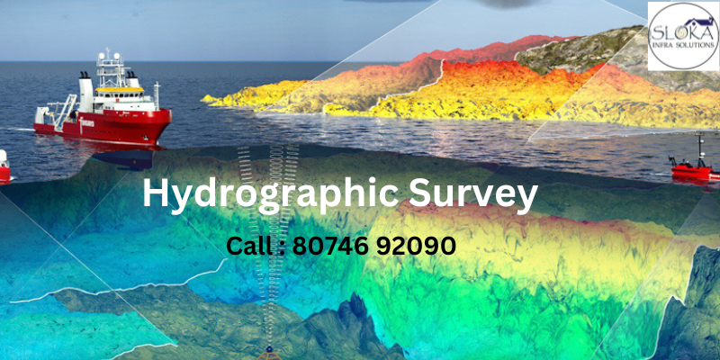
Hydrographic Survey in India: Mapping Waterways for a Better Future
When we talk about understanding and managing water bodies effectively, one term that stands out is “Hydrographic survey in India.” As India grows into a modern metropolis, its water bodies—be it lakes, rivers, or reservoirs—demand meticulous study and monitoring to support sustainable development. Hydrographic surveys play a pivotal role in mapping underwater terrains, assessing water depths, and ensuring safe navigation. This essential service is increasingly relevant in India, given its proximity to various water resources and the city’s ambitious plans for urban and industrial expansion.
What is Hydrographic Surveying?
Hydrographic surveying is akin to taking an underwater X-ray, revealing the physical attributes of water bodies such as oceans, seas, rivers, and lakes. This process captures a detailed picture of the underwater world, offering insights into key aspects like:
Water Depth: A primary focus that ensures safe navigation and reveals the underwater landscape.
Seafloor Composition: Identifying the seabed’s nature—whether sand, rock, or something else—is vital for designing infrastructure and understanding marine habitats.
Hidden Hazards: Locating shipwrecks, underwater ridges, and other submerged obstacles helps guarantee navigational safety.
Water Properties: Surveys can also gather data on salinity, currents, and tides, tailored to the specific project’s needs.
The data collected is often displayed on nautical charts, serving as the “GPS” for maritime journeys. Yet, hydrographic surveying goes beyond navigation. It plays a significant role in environmental studies, marine resource management, civil engineering projects, and conserving delicate ecosystems.
This invaluable underwater mapping lays the foundation for both progress and preservation in the marine world.
Understanding Hydrographic Surveys
Hydrographic surveys involve the precise measurement and description of underwater features. Using specialized equipment like sonar systems, GPS, and depth-sounding instruments, these surveys help determine the physical characteristics of water bodies. The data collected includes water depths, seabed composition, and submerged obstacles, which are crucial for projects like port construction, waterway navigation, and flood risk management.
But why is this important for a city like India? While not a coastal city, India is rich in inland water resources. The Musi River, Osman Sagar, and Hussain Sagar are integral to its ecological balance and urban planning. To utilize and protect these resources effectively, hydrographic surveys have become a cornerstone of development efforts in the region.
Hydrographic Survey Company in India
The Role of a Hydrographic Survey Company in India
A professional hydrographic survey company in India provides cutting-edge expertise for managing the state’s vast network of water resources. These companies utilize advanced technologies, such as multi-beam sonar and unmanned survey vessels, to deliver accurate data for various applications. In Telangana, where agriculture, urban development, and industrialization depend heavily on efficient water management, these services are invaluable.
For instance, mapping reservoirs and irrigation canals in Telangana helps optimize water usage, reduce wastage, and prevent flooding during heavy monsoons. Similarly, assessing riverbed conditions ensures the safe transportation of goods and people, bolstering regional connectivity.
Applications of Hydrographic Surveys
Hydrographic surveys are not limited to a single industry. They serve a multitude of purposes that directly impact both urban and rural areas in India:
Urban Development
Rapid urbanization in India has led to significant pressure on its water bodies. Hydrographic surveys help in identifying water depths and sediment buildup in lakes and reservoirs. This information supports dredging operations, ensuring these water bodies retain their capacity and ecological balance.
Flood Management
India, including India, experiences erratic rainfall patterns. By analyzing river flow patterns and creating detailed flood maps, hydrographic surveys enable authorities to develop effective flood control measures and evacuation plans.
Infrastructure Development
Large-scale infrastructure projects, such as bridges, dams, and ports, rely heavily on hydrographic surveys. Accurate mapping of underwater conditions ensures that such projects are constructed safely and sustainably.
Environmental Conservation
India’s lakes, such as Hussain Sagar, have faced pollution and sedimentation over the years. Hydrographic surveys help monitor these changes, enabling better restoration efforts and ensuring long-term ecological health.
Navigation and Transportation
Although Telangana is a landlocked state, its rivers and reservoirs are used for small-scale navigation and transportation. Hydrographic surveys ensure that these waterways remain safe and navigable, reducing the risk of accidents and enhancing economic opportunities.
Key Technologies Used in Hydrographic Surveys
The modern hydrographic survey is a blend of science, technology, and innovation. Some of the key tools and technologies employed include:
Single-Beam and Multi-Beam Sonar
These tools use sound waves to measure water depth and map the seafloor. Multi-beam sonar provides a comprehensive view of underwater terrains, essential for detailed studies.
LiDAR (Light Detection and Ranging)
LiDAR technology is used for high-resolution mapping of shallow water areas. It combines laser scanning with GPS data to produce accurate topographical maps.
Unmanned Survey Vessels (USVs)
These automated boats equipped with sonar systems allow surveys in hard-to-reach areas, enhancing efficiency and safety.
Satellite and Aerial Imaging
Remote sensing technologies complement traditional surveys by providing a broader perspective of water bodies and their surroundings.
GIS and Data Analytics
Geographic Information Systems (GIS) are used to analyze and visualize survey data, making it easier to plan projects and make informed decisions.
Sub Bottom Profiler
Sub-bottom profiler technology in hydrographic surveys uses sound waves to penetrate the seabed, revealing buried layers and structures beneath. It’s a powerful tool for mapping sediment layers, archaeology, and environmental studies, unlocking the secrets below the surface!
Side Scan Sonar
Side Scan Sonar technology captures detailed underwater images by emitting sound waves across the seafloor. It’s essential in hydrographic surveys for detecting objects, mapping seabed features, and ensuring safe navigation—making the unseen world crystal clear!
ADCP methods
ADCP (Acoustic Doppler Current Profiler) technology measures water current speeds at various depths using sound waves. Widely used in hydrographic surveys, it provides real-time insights into water flow patterns, aiding navigation, sediment transport studies, and marine planning!
The Growing Demand for Hydrographic Surveys in India
The need for hydrographic surveys in India has grown exponentially over the years. Several factors contribute to this trend:
Urbanization: The city’s expanding footprint necessitates the efficient management of water resources.
Water Scarcity: With increasing demand for water, surveys help in optimizing existing resources and exploring new ones.
Climate Change: Unpredictable weather patterns call for better flood management and disaster preparedness.
Tourism: Restoration of lakes and rivers can boost India’s tourism sector, making it a more attractive destination.
Choosing the Right Hydrographic Survey Company in Telangana
Selecting a reliable hydrographic survey company is crucial for achieving accurate and actionable results. Here are some factors to consider:
Experience and Expertise: Look for companies with a proven track record in conducting surveys across various terrains.
Technology: Ensure the company uses the latest tools and methods for precise data collection.
Compliance: Verify that the company adheres to national and international standards for hydrographic surveys.
Cost-Effectiveness: Compare quotes from multiple providers to find the best value for your investment.
Client Reviews: Check testimonials and case studies to gauge the company’s performance and reliability.
Hydrographic Surveying: Unlocking the Mysteries of the Underwater World
Imagine an underwater X-ray that reveals the hidden depths of oceans, rivers, and lakes. That’s essentially what hydrographic surveying does. It’s a specialized practice that maps and measures the physical features of aquatic environments, offering an invaluable understanding of the underwater terrain. This comprehensive data is crucial for safe navigation, environmental research, and countless marine projects.
What Do Hydrographic Surveys Measure?
Hydrographic surveys collect a wealth of information about underwater environments. Let’s dive into some of the key aspects they analyze:
Water Depth: The cornerstone of hydrographic surveys, water depth data is critical for ensuring safe navigation and understanding underwater landscapes.
Seafloor Composition: Knowing whether the seabed is made of sand, rock, or another material is vital for infrastructure planning and understanding marine habitats.
Submerged Hazards: Identifying shipwrecks, underwater ridges, or other obstacles is essential to prevent accidents and ensure smooth maritime operations.
Water Properties: In some cases, surveys also measure salinity, tides, and currents, depending on the project’s specific requirements.
The findings are typically presented in nautical charts—the essential “GPS of the sea.” But the applications of hydrographic data extend far beyond navigation. These surveys play a vital role in environmental research, civil engineering, resource management, and marine ecosystem preservation.
Why Are Hydrographic Surveys So Important?
Without hydrographic surveys, maritime operations would essentially be navigating blind. Here are some key reasons why these surveys are indispensable:
Ensuring Safety: By identifying hazards like submerged rocks or uneven seabeds, hydrographic surveys protect personnel and prevent costly equipment damage.
Optimizing Planning: Detailed underwater maps allow project leaders to chart efficient routes, avoiding delays and unforeseen challenges. This results in streamlined operations and reduced project timelines.
Supporting Diverse Projects: From port development to coastal erosion studies, hydrographic surveys provide the foundational data necessary for a variety of critical initiatives.
Types of Hydrographic Surveys
Hydrographic surveying is not one-size-fits-all. There are several types, each tailored to specific purposes. Here are some of the most common:
General Hydrographic Surveys
These are the bread and butter of hydrographic surveying. They gather data on water depth, coastlines, and seabed features to create nautical charts. These charts are vital for safe navigation and maritime operations.
Coastal Surveys
Focusing on coastal regions, these surveys collect data on shorelines, water depth, and seabed characteristics. The information is used for coastal erosion studies, port development, and even habitat mapping.
Harbor Surveys
Conducted in harbors and ports, these surveys measure water depth, seabed features, and potential hazards. They ensure the safe movement of vessels and help plan maintenance activities like dredging.
Passage Surveys
In areas with heavy maritime traffic, such as shipping lanes, passage surveys identify water depths, hazards, and other navigation-critical features. These surveys are crucial for preventing accidents and maintaining smooth maritime operations.
Wreckage Surveys
Specialized in locating and mapping shipwrecks, these surveys are used for salvage operations, archaeological research, and hazard identification. They offer insights into the past while ensuring safety in the present.
Beyond Navigation: The Broader Impact of Hydrographic Surveys
The scope of hydrographic surveys goes far beyond creating nautical charts. They’re instrumental in:
Environmental Conservation: Understanding underwater ecosystems helps in managing marine resources and protecting delicate habitats.
Civil Engineering: From bridge construction to offshore wind farms, hydrographic data is crucial for planning and executing marine infrastructure projects.
Marine Resource Management: Fisheries and other marine industries rely on accurate data to sustain their operations and support conservation efforts
Conclusion
The role of “Hydrographic survey in India” cannot be overstated in a city where water resources are intertwined with its growth and sustainability. From ensuring safe navigation to supporting infrastructure projects and conserving the environment, hydrographic surveys serve as a vital tool for informed decision-making.
Partnering with a professional hydrographic survey company in India can unlock the true potential of water bodies, paving the way for a balanced and prosperous future. As Hyderabad continues to evolve, the integration of advanced hydrographic technologies will ensure that its water resources are managed efficiently, benefiting both current and future generations.