Bathymetric Survey in UAE
From Ports to Offshore Platforms: The Complete Guide to Bathymetric Survey in UAE:-
Call: +91 80746 92090 | 85018 80443
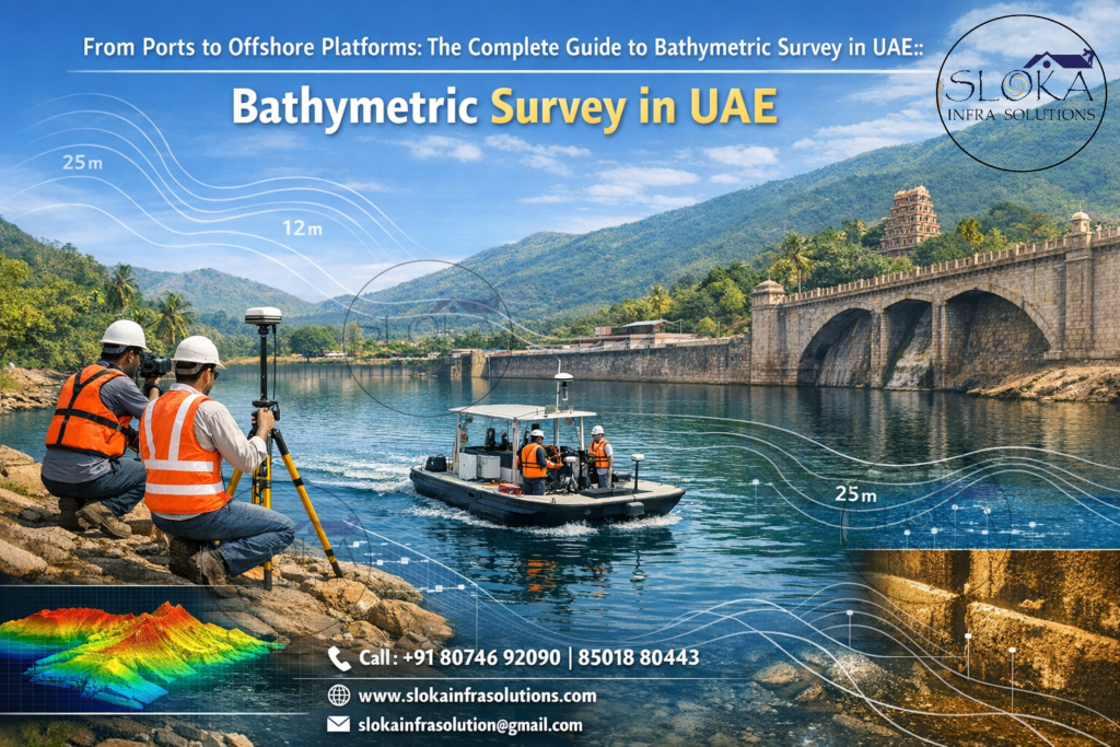
Bathymetric Survey in UAE is more than a technical checklist — it’s the underwater map that powers safe navigation, coastal development, environmental protection, and offshore industry decisions across a nation whose shoreline and seas are central to its economy and identity. From the busy terminals of Abu Dhabi and Dubai to the shallow, biologically rich lagoons and mangrove systems scattered along the coast, understanding what lies beneath the waves is essential. The UAE’s waterbodies are varied: shallow sheltered gulfs, tidal inlets, shipping channels, and offshore zones that host platforms, pipelines, and reclamation works — each demanding precise, up-to-date bathymetry.
Top Bathymetric Survey and Surveyor in UAE
Top Bathymetric Survey and Surveyor in UAE set the standard for how that underwater information is gathered, processed, and delivered — blending modern sonar systems, geodetic positioning, and experienced hydrographers to convert soundings into reliable charts and 3D seabed models. Choosing the right team affects everything from the safety of commercial shipping lanes to the success of dredging, port expansion, coastal defense, and marine habitat studies.
Why bathymetry matters for the UAE?
The waters around the Emirates sit inside a semi-enclosed basin that is largely shallow and dynamic. The Arabian/Persian Gulf is characterized by low average depths, complex tidal exchange through narrow gateways, and sediment-rich coastal environments. Those physical features make precision mapping vital: shallow banks, sandbars, and shifting sediments can quickly create hazards for navigation and construction — and they also influence currents, sediment transport, and coastal erosion. Detailed bathymetry supports port safety, dredging design, environmental assessments for coastal projects, and oil & gas operations.
A snapshot of UAE’s marine landscape?
The UAE coastline — from Ras Al Khaimah and Umm Al Quwain in the north through Sharjah, Dubai, Ajman, and Abu Dhabi — includes protected lagoons, tidal flats, and busy industrial and urbanized shorelines. Offshore, the Gulf’s seafloor is generally shallow (with deeper troughs farther offshore) and often covered by fine sediments; near the Gulf of Oman (east coast), bathymetry becomes steeper and more complex. The Strait of Hormuz acts as the narrow throat connecting the Gulf to the open Indian Ocean, influencing tidal exchange and sediment dynamics along the UAE seaboard. Survey techniques must therefore be tailored to these local conditions: shallow, high-resolution mapping for coastal and lagoon areas, and broader multibeam mapping for deeper approaches and offshore corridors.
Core deliverables of a modern bathymetric survey:-
Clients typically receive:
- Cleaned and corrected XYZ point clouds and grids (e.g., 0.5–10 m resolution depending on survey scope).
- Digital Elevation Models (DEMs) / Digital Terrain Models (DTMs) of the seabed.
- Nautical charts and navigational products showing shoals, wrecks, and hazards.
- Side-scan sonar mosaics and sub-bottom stratigraphic profiles.
- Reports covering methodology, accuracy statements, tides and sound speed corrections, and recommendations for dredging or development.
These outputs are produced after careful corrections for tides, vessel motion (heave/pitch/roll), sound speed profiles, and GPS/RTK positioning — steps that transform raw echo returns into actionable maps.
Single Beam Echo Sounder — focused, cost-effective depth profiling:-
Single beam echo sounders (SBES) remain a workhorse for many surveys: they send a single acoustic pulse straight down and record the travel time to the seabed; with position fixes from GNSS, each ping becomes a precise depth point. SBES surveys are ideal for narrow waterways, small harbor checks, preliminary dredge verification, and shallow inland waterbodies where cost and simplicity matter.
In UAE contexts — such as inner harbor shoal checks, marina bed profiling, or verifying dredge lines — single beam systems shine for their portability and efficiency. A small vessel or an unmanned surface vehicle equipped with SBES can rapidly collect longitudinal transects along shipping channels and berth pockets. Because each ping gives a single depth, survey design emphasizes track spacing: tighter spacing yields better coverage but increases time and cost. Good practice layers SBES lines perpendicular and parallel to project features to catch small anomalies.
Accuracy depends on calibration and corrections: tidal datum must be applied (preferably referenced to local tide gauges), and sound speed profiles should be measured to correct for water column variability — especially in the Gulf, where salinity and temperature gradients can affect acoustic travel time. For projects where vertical accuracy and detailed coverage are not the primary concerns, SBES offers a reliable, low-complexity solution that integrates well with other survey tools.
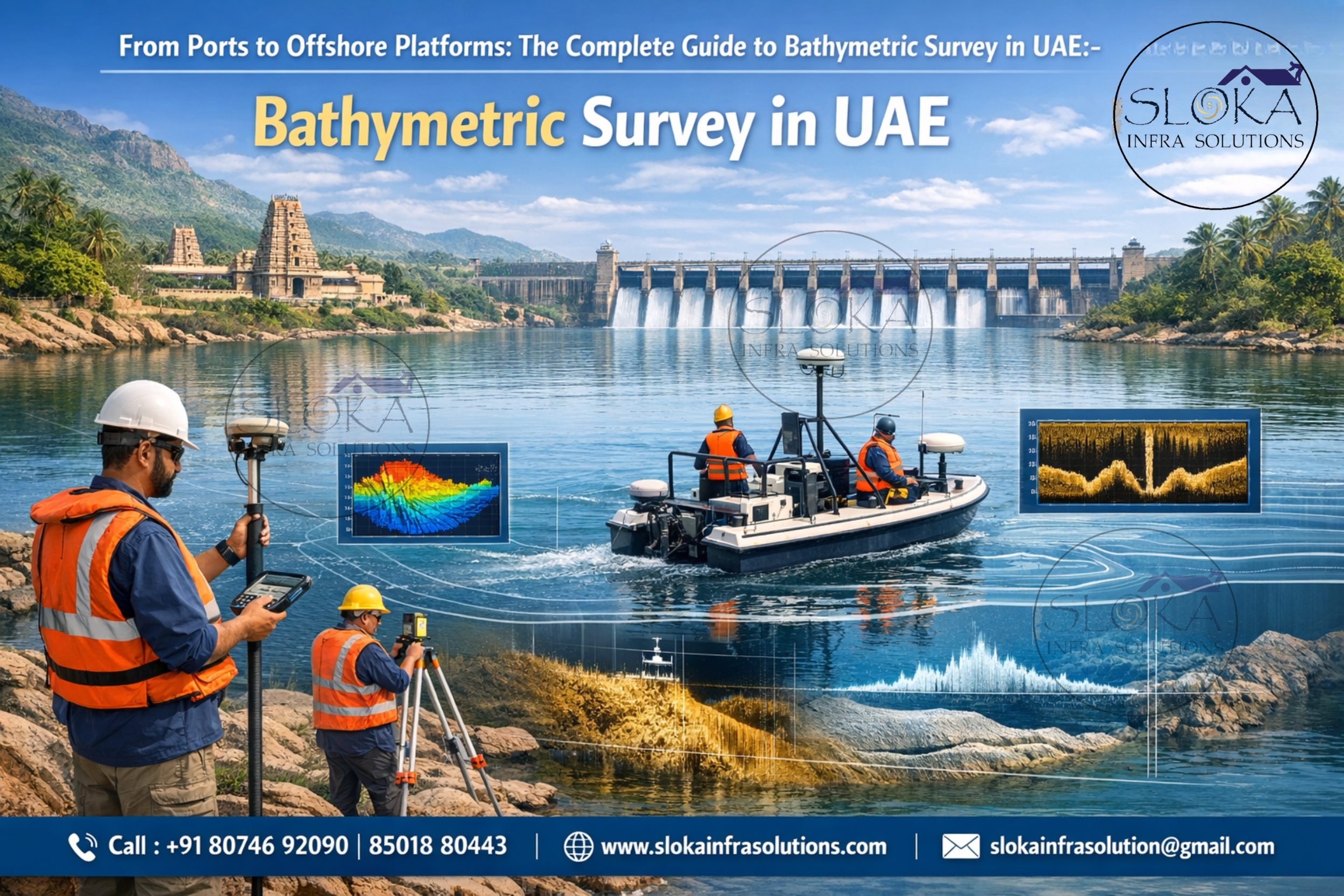
Multibeam Echo Sounder surveys — full-coverage, high-resolution seabed mapping:-
Multibeam echo sounders (MBES) revolutionize bathymetric mapping by emitting many beams across a wide swath, measuring depths simultaneously across the seafloor and delivering dense, spatially continuous point clouds. For UAE coastal projects — port approaches, reclaimed land verification, offshore platform siting, and navigation channel design — multibeam surveys provide the high-resolution seafloor detail decision-makers require.
MBES advantages are clear: complete swath coverage reduces the risk of missing hazards, and when combined with modern motion sensors and accurate GPS/RTK positioning, deliver centimeter-to-decimeter vertical and horizontal precision depending on equipment and water depth. In the UAE’s largely shallow Gulf waters, MBES systems often operate in shallow-water modes or with bathymetric lidars in very shallow zones, ensuring the transition from land to sea is captured.
Multibeam campaigns require careful planning: line spacing, vessel speed, beam angle selection, and tide/sound-speed correction are tuned to meet target resolution and accuracy. Post-processing cleans and filters the massive datasets — removing spikes, refraction artifacts, and multipath noise — then produces gridded DEMs, hillshades, and slope maps. Because MBES data also enable habitat mapping (via backscatter) and volume calculations for dredging or reclamation, they are the go-to for complex coastal engineering and marine infrastructure projects.
Side Scan Sonar — seafloor imagery and object detection:-
Side scan sonar (SSS) paints the seafloor in texture and contrast rather than depth; it produces acoustic mosaics that reveal surface features, clutter, debris, wrecks, and variations in sediment type. SSS is complementary to depth data: while echo sounders tell you “how deep,” side-scan shows you “what the bottom looks like.”
In the UAE, side-scan is widely used for obstruction surveys before dredging, pre-construction site investigations for pipelines and cables, and archaeological or environmental assessments in sheltered lagoons and cultural heritage zones. Operators tow a towfish (or use hull-mounted units on small craft or USVs) and record high-resolution strips that are stitched into a continuous mosaic. High-frequency SSS yields fine detail but shorter range — ideal for harbor and channel inspections; lower-frequency systems reach farther offshore but with less textural detail.
Interpretation of SSS mosaics requires experience: acoustic shadows can indicate raised objects, while continuous bright returns might indicate hard substrate or rubble. Correlating SSS with MBES bathymetry and, when needed, ground-truthing with grab samples or drop-cameras provides the most reliable picture — a standard approach in the UAE when sensitive coastal habitats or critical infrastructure are present.
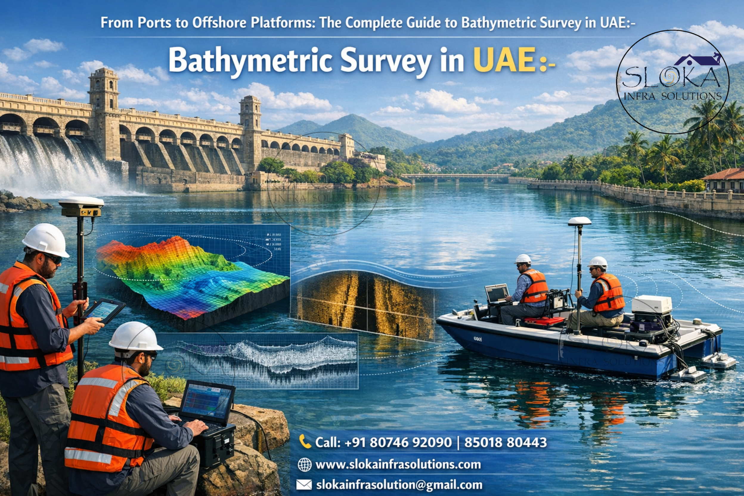
Sub-Bottom Profilers — peek beneath the seabed:-
Sub-bottom profilers (SBP) send low-frequency acoustic energy that penetrates the seafloor to reveal stratigraphy: layers of sediment, buried channels, or old shorelines. They are indispensable for geology, geotechnical planning, and identifying buried hazards like old pipelines or anthropogenic fills.
For UAE projects involving reclamation, pipeline routing, foundation design for offshore platforms, or analyzing sediment stability, SBP data help engineers understand the thickness and consistency of seabed deposits. The profiler records reflections from subsurface interfaces; these reflections are processed to generate profiles showing layering and sometimes buried objects.
In shallow Gulf waters with soft, high-porosity sediments, SBP performance can be excellent for imaging several meters of shallow stratigraphy — enough to guide piling and foundation design or to locate subsurface obstructions. Combining SBP with core samples and geotechnical testing completes the picture: the SBP identifies promising locations and depths, cores confirm sediment properties. For marine archaeology along older coastlines and lagoons, SBP can reveal former river channels or buried cultural features, giving planners and researchers the context they need.
ADCP Survey — Measuring Currents with Precision and Confidence:-
An ADCP (Acoustic Doppler Current Profiler) survey adds a powerful dimension to bathymetric investigations by measuring water current speed and direction throughout the water column — not just at the surface. While traditional bathymetry focuses on mapping the seabed, ADCP surveys help engineers and planners understand how water actually moves above it. In dynamic marine environments like the UAE’s coastal waters, tidal inlets, navigation channels, and offshore zones, this current data is critical for safe design and operational planning.
ADCP systems work using the Doppler effect. The instrument emits acoustic pulses into the water, and as these pulses reflect off suspended particles, the frequency shift reveals how fast the water is moving and in which direction. Mounted on a survey vessel, fixed to a structure, or deployed on the seabed, ADCPs collect continuous current profiles from near-surface to near-bottom levels.
In the UAE, ADCP surveys are widely used for port expansion projects, dredging design, sediment transport studies, pipeline and cable route planning, and environmental impact assessments. Strong tidal exchanges and localized currents can influence vessel maneuverability, scour around marine structures, and sediment deposition patterns. By integrating ADCP data with multibeam bathymetry and sediment analysis, surveyors deliver a complete hydrodynamic picture — enabling smarter engineering decisions, improved safety margins, and long-term infrastructure stability.
Planning a survey in UAE waters — what professionals consider:-
A successful survey begins on paper: scope, deliverables, target accuracy, and operational constraints. In UAE conditions, surveyors typically consider:
- Tidal regime and local vertical datums — accurate tidal planning is essential for correct depth reduction.
- Water visibility and turbidity — affects acoustic performance and sonar settings.
- Vessel choice — from workboats to USVs and small catamarans for shallow lagoons.
- Regulatory permissions — ports and coastal authorities often require permits and notifications.
- Environmental protection — scheduling around protected periods (e.g., for dugongs, turtles, or migratory birds) and minimizing disturbance to sensitive habitats like mangroves.
Modern projects also leverage portable autonomous systems: unmanned surface vehicles (USVs) and drone-supported shallow-water bathymetry accelerate data collection in risky or congested zones. These platforms are becoming popular for their lower operational cost and ability to work in the UAE’s shallow intertidal areas.
Data processing, QA/QC and standards:-
Raw sonar returns are only the start. Processing workflows typically include:
- Applying motion compensation (heave/pitch/roll), sound speed correction, and tidal reduction.
- Filtering and cleaning noise (spikes, multipath), and removing refraction artifacts.
- Generating gridded DEMs and backscatter mosaics, and producing side-scan mosaics for interpretation.
- Performing accuracy checks against control points, static GNSS stations, or ground-truth measurements.
Deliverables must include metadata and an accuracy statement — essential for regulatory acceptance and engineering use. Survey standards (local maritime authorities and international hydrographic standards) guide line spacing, instrument calibration, and reporting formats — all of which underpin trust in the final maps.
Real-world applications across the Emirates:-
Bathymetric data underpin many UAE projects:
Port operations & navigation safety: Regular surveys keep approach channels clear of shoaling and locate unexpected hazards.
Dredging & reclamation: Accurate pre- and post-dredge surveys quantify volumes and guide reclamation contours.
Oil & gas & subsea infrastructure: As pipelines and platforms proliferate, detailed seabed and sub-bottom mapping reduce risk and optimize routing.
Coastal protection & erosion control: Seabed models help engineers design seawalls and breakwaters tuned to local bathymetric gradients.
Environmental monitoring & habitat mapping: Mapping seafloor type and features supports mangrove restoration, fisheries assessments, and Protected Area planning.
For busy ports like Dubai and Abu Dhabi, and for development projects along artificial islands and coastal urbanization, reliable bathymetry is a non-negotiable engineering input.

Choosing the right surveyor — what to ask and expect:-
When you search for the Top Bathymetric Survey and Surveyor in UAE, evaluate teams on these criteria:
1.Equipment fleet: MBES, SBES, SSS, SBP, and GNSS/RTK capability.
2.Experience: local projects, knowledge of tidal behavior and soft-sediment environments in Gulf waters.
3.Data workflows: clear QA/QC procedures, turnaround times, and deliverable formats (XYZ, ASCII, LAS, GeoTIFF, CAD/GIS outputs).
4.Safety & compliance: local permits, port coordination, and environmental mitigation procedures.
5.Case studies: examples of previous work (ports, reclamation, pipeline corridors) and references.
Challenges in UAE bathymetry and practical mitigations:-
1.Shallow, sediment-laden waters. Fine sediments and rapid shoaling can hide hazards and affect acoustic returns. Mitigation: dense MBES overlap, repeated line surveys, and timely post-survey quality checks.
2.Strong tidal flows near straits and channels. Tidal currents can complicate vessel control and data collection. Mitigation: plan operations around slack water windows and use dynamic positioning when available.
3.Urban marine clutter. Shipping lanes and busy harbors require careful coordination and safety protocols. Mitigation: vessel escorts, NOTAMs, and liaison with port authorities.
4.Environmental sensitivity. Mangrove zones, coral patches, and Protected Areas demand low-impact methods and schedule sensitivity. Mitigation: remote sensing options, USVs, and working outside sensitive biological windows.
Good survey teams build these mitigations into their method statements and operational plans so the work proceeds smoothly, safely, and with minimal environmental disturbance.
Emerging tools and trends: drones, USVs, and machine learning:-
Unmanned surface vehicles (USVs) and drone-supported bathymetry are changing the economics of shallow-water mapping. USVs can run MBES and SSS sensors in places where crewed vessels are impractical or costly; airborne lidar bathymetry and photogrammetric methods (for very shallow clear waters) speed nearshore mapping. Machine learning is also being applied to classify backscatter and automate detection of anomalies in SSS mosaics — reducing interpretation time and improving consistency.
For the UAE, these technologies are particularly useful in mangrove restoration monitoring, rapid post-storm inspections, and routine channel checks. They are not panaceas, however: careful calibration and validation remain essential to maintain accuracy.
Cost drivers and timelines:-
Costs depend on vessel mobilization, equipment type, survey area and resolution, permitting and logistics, and post-processing requirements. A small harbor SBES check can be completed in a day or two, while high-resolution MBES + SSS + SBP campaigns over large port approaches may take weeks.
Practical checklist for commissioning a survey in the UAE:-
- Define accuracy and resolution requirements.
- Identify datum and tidal references for depth reduction.
- Specify deliverable formats (point cloud, grids, mosaics, reports).
- Check local permit needs and coordinate with port authorities.
- Request method statements including QA/QC and environmental mitigation.
- Ask for sample deliverables and references from similar local projects.
Following this checklist makes the procurement process faster and the project outcome more reliable.
Turning Depth Data into Confident Decisions:-
Bathymetric Survey in UAE is an investment in safety, efficiency, and environmental stewardship. With a coastline that supports world-class ports, offshore energy, and rapidly evolving coastal developments, reliable seabed maps are the foundation for informed decisions. Whether you need quick channel checks with a single beam, full-coverage multibeam mapping for a port approach, side-scan mosaics to search for objects, or sub-bottom profiles to understand buried sediments — the right mix of technology and local expertise makes the difference between guesswork and certainty.
If you’re planning a marine or coastal project, use this guide to ask the right questions and evaluate potential contractors. And when you search for the Top Bathymetric Survey and Surveyor in UAE, prioritize teams that demonstrate local experience, robust QA/QC, and clear communication — those attributes consistently lead to successful, low-risk projects