
Bathymetric Survey in Oman
From the Strait of Hormuz to the Arabian Sea: The Role of Bathymetric Surveys in Oman:-
Call: 80746 92090
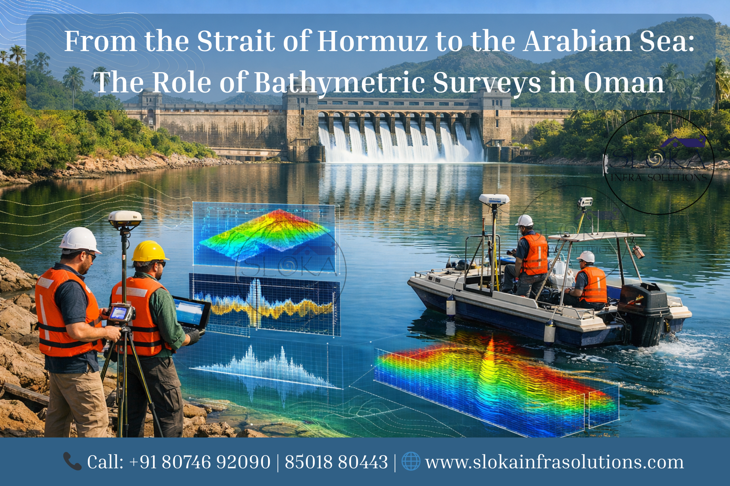
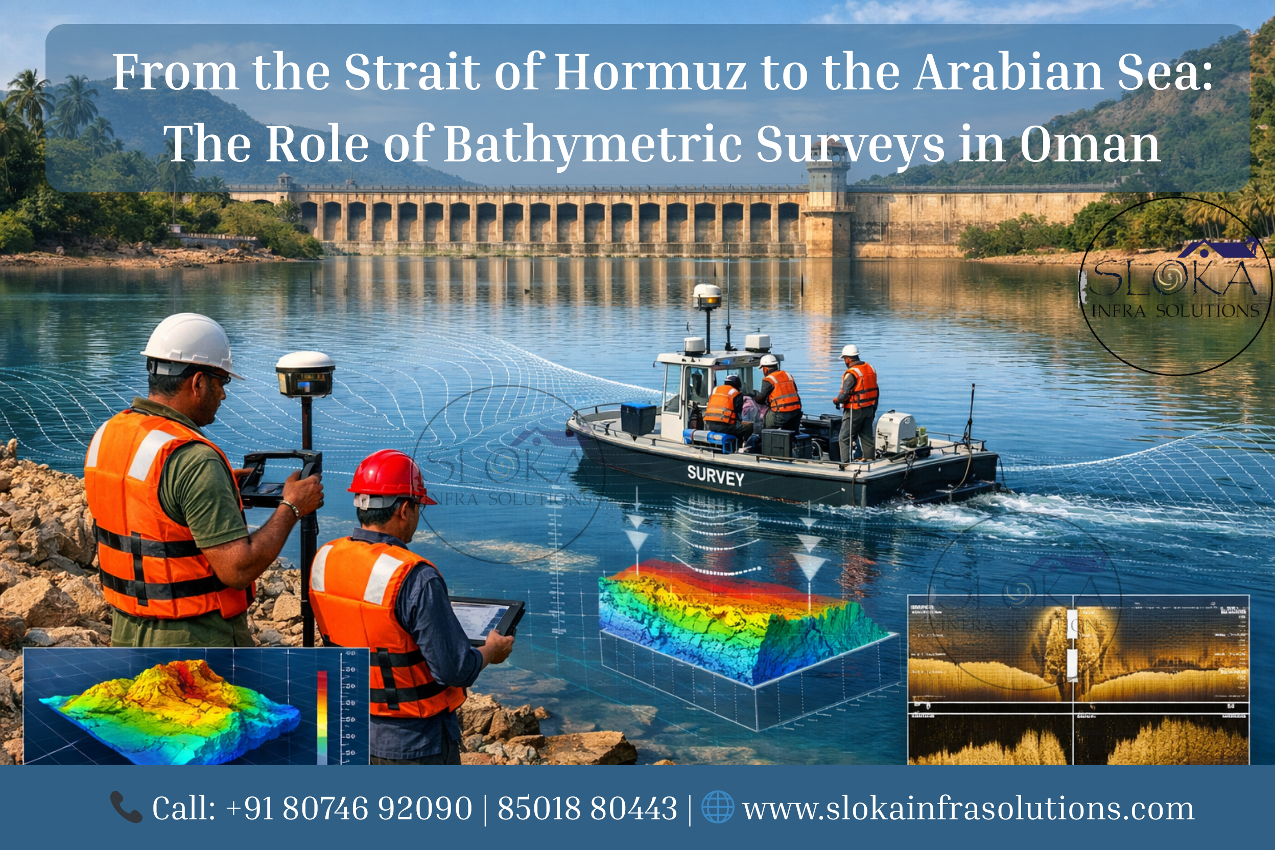
Bathymetric Survey in Oman plays a crucial role in understanding the country’s vast and strategically important marine environment. Oman’s coastline stretches more than 3,000 kilometers along the Arabian Sea, the Sea of Oman, and the Arabian Gulf, creating one of the most diverse maritime landscapes in the Middle East. From busy shipping routes near the Strait of Hormuz to deep offshore waters and coastal tourism developments, accurate mapping of underwater terrain is essential for navigation safety, infrastructure planning, environmental monitoring, and resource management. Bathymetric surveys provide detailed information about seabed depth, underwater structures, sediment patterns, and marine geological formations, enabling engineers, governments, and researchers to make informed decisions about coastal and offshore projects.
Top Bathymetric Survey and Surveyor in Oman
Top Bathymetric Survey and Surveyor in Oman services are increasingly in demand due to rapid coastal development, port expansion, tourism infrastructure, and offshore energy exploration. Modern hydrographic surveyors combine advanced sonar technologies, GPS positioning, geospatial analysis, and specialized marine equipment to generate accurate seabed models. These datasets support a wide range of activities including harbor dredging, marina construction, offshore foundation design, subsea pipeline installation, coastal protection systems, and environmental studies. With Oman positioning itself as a maritime and logistics hub in the Gulf region, bathymetric surveying has become a critical discipline for safe navigation, sustainable coastal development, and effective marine planning.
What exactly is a Bathymetric survey and why does it matter?
A bathymetric survey is the underwater equivalent of a topographic survey. While land surveys measure terrain elevation above sea level, bathymetric surveys measure the depth and shape of the seabed, lakebed, or riverbed beneath water bodies. Using sonar-based equipment and positioning systems, surveyors collect thousands or even millions of depth measurements across the survey area.
These measurements are then processed to create digital terrain models (DTMs), contour maps, and three-dimensional representations of the underwater environment.
Bathymetric surveys are essential for many industries, including:
- Marine infrastructure development
- Port and harbor management
- Offshore oil and gas operations
- Coastal engineering projects
- Environmental monitoring
- Dredging operations
- Underwater cable and pipeline routing
In Oman, these surveys are especially important due to the country’s busy maritime corridors, coral reef ecosystems, and rapidly developing coastal cities.
Why Bathymetric Surveys Are important in Oman?
Oman’s geographic location makes it one of the most strategically important maritime nations in the Middle East. The country borders some of the world’s busiest shipping routes connecting Asia, Africa, and Europe.
Key reasons bathymetric surveys are vital in Oman include:
1. Safe Navigation
Accurate depth data helps vessels navigate safely through ports, harbors, and coastal waters. Updated seabed maps reduce the risk of ship grounding and maritime accidents.
2. Coastal Infrastructure Development
Projects such as resorts, marinas, ports, and seawalls require precise knowledge of seabed conditions before construction begins.
3. Dredging and Reclamation
Ports often require dredging to maintain navigable depths. Bathymetric surveys help calculate dredging volumes and monitor seabed changes.
4. Environmental Protection
Marine ecosystems such as coral reefs, seagrass beds, and fisheries depend on careful monitoring of underwater habitats.
5. Offshore Energy Projects
Subsea pipelines, offshore wind installations, and oil platforms rely heavily on seabed mapping for safe installation.
Key water bodies in Oman requiring Bathymetric surveys:-
Oman has a diverse marine geography that includes coastal waters, islands, bays, and deep offshore regions.
1.Arabian Sea
The Arabian Sea forms Oman’s southern coastline and hosts deep offshore waters used for energy exploration and shipping.
2.Sea of Oman
Located along the northern coast, this region contains major ports such as Sohar and Muscat.
3.Arabian Gulf
The Strait of Hormuz connects the Arabian Gulf to the Sea of Oman and is one of the busiest shipping corridors in the world.
4.Coastal Lagoons and Estuaries
Several coastal wetlands and lagoons require monitoring for sedimentation and environmental protection.
5.Artificial Harbors and Ports
Modern ports such as Duqm, Sohar, and Salalah require regular bathymetric monitoring to maintain navigable depths.
Bathymetric Survey Technologies Used in Oman:-
Modern bathymetric surveys rely on several advanced technologies that work together to map underwater terrain accurately. Each technology has specific advantages depending on the survey objectives and water conditions.
Below are the most commonly used survey methods:-
ADCP Survey:-
An Acoustic Doppler Current Profiler (ADCP) survey is widely used to measure water current velocities and flow patterns in rivers, coastal waters, and offshore environments. While ADCP is primarily designed to measure water movement rather than seabed depth, it plays an essential role in hydrographic surveys by providing valuable hydrodynamic data.
ADCP instruments operate using the Doppler effect. They emit sound waves into the water column, which bounce off suspended particles such as sediment or plankton. By measuring the frequency shift of the returning signal, the instrument calculates the velocity and direction of water currents at multiple depths.
In Oman’s coastal waters, ADCP surveys are particularly useful for understanding tidal flows, sediment transport, and marine circulation patterns. For example, ports located along the Sea of Oman experience strong tidal currents that influence sediment deposition and navigation conditions. ADCP data helps engineers design breakwaters, jetties, and dredging plans more effectively.
These surveys are also essential for offshore construction projects such as subsea pipelines or offshore platforms. Understanding underwater currents helps engineers assess structural stability and avoid erosion or scouring around foundations.
ADCP systems are typically mounted on survey vessels, moored to the seabed, or attached to autonomous underwater vehicles. Data collected from these instruments can be integrated with bathymetric measurements to provide a complete picture of underwater conditions.
The integration of current velocity data with seabed mapping allows marine engineers to model sediment movement, predict erosion patterns, and design resilient coastal infrastructure.
Single Beam Echo Sounder:-
A Single Beam Echo Sounder (SBES) is one of the most widely used instruments for bathymetric surveys. It works by emitting a single acoustic pulse vertically downward from a transducer mounted on a survey vessel. The sound wave travels through the water column, reflects off the seabed, and returns to the sensor.
By measuring the time it takes for the sound pulse to travel to the seabed and back, the system calculates the water depth at that specific location.
Single beam echo sounders are particularly useful for:
- River and lake surveys
- Harbor depth monitoring
- Channel surveys
- Small coastal mapping projects
In Oman, single beam echo sounders are frequently used for surveying shallow coastal waters, fishing harbors, and inland water reservoirs. They provide reliable and cost-effective depth measurements when full seabed coverage is not required.
The survey process typically involves navigating a boat along predefined survey lines. Depth data is recorded at regular intervals and combined with GPS positioning to generate bathymetric maps.
Although SBES systems only capture depth directly beneath the vessel, they can still produce highly accurate results when survey lines are spaced appropriately. Data collected from these systems can be processed using hydrographic software to generate contour maps and digital terrain models of the seabed.
Because of their simplicity, reliability, and affordability, single beam echo sounders remain a fundamental tool in hydrographic surveying around the world.
Multibeam Echo Sounder Surveys
Multibeam Echo Sounder (MBES) technology represents a major advancement in modern hydrographic surveying. Unlike single beam systems that measure depth at a single point, multibeam systems emit hundreds of acoustic beams in a wide fan-shaped pattern beneath the survey vessel.
This allows the system to capture a continuous swath of seabed data, providing nearly 100 percent coverage of the survey area.
Multibeam surveys generate extremely detailed three-dimensional maps of the seabed, revealing underwater features such as:
- Sand waves
- Coral reefs
- Subsea pipelines
- Shipwrecks
- Geological formations
For large-scale projects in Oman—such as port expansion, offshore energy infrastructure, and marine construction—multibeam echo sounders are the preferred survey method.
The technology works by measuring both the travel time and angle of each returning acoustic signal. Advanced processing algorithms convert these measurements into precise depth points, creating dense point clouds that represent the seabed surface.
Modern MBES systems are integrated with several additional sensors, including:
- Motion sensors to correct vessel movement
- GPS systems for accurate positioning
- Sound velocity profilers to account for water conditions
When processed using hydrographic software, the data produces high-resolution digital terrain models that engineers use for planning dredging operations, designing subsea foundations, and assessing environmental impacts.
Multibeam surveys are particularly valuable in Oman’s complex marine environments, where coral reefs, underwater rock formations, and shifting sediments require detailed mapping to ensure safe navigation and construction.
Side Scan Sonar:-
Side scan sonar is a specialized sonar technology used to create detailed images of the seabed rather than measuring depth alone. It works by emitting acoustic pulses sideways from a towed device or vessel-mounted transducer.
These sound waves reflect off objects and seabed textures, producing high-resolution images that reveal underwater features and structures.
Side scan sonar is commonly used for:
- Shipwreck detection
- Pipeline inspections
- Seafloor object identification
- Marine archaeology
- Habitat mapping
In Oman, side scan sonar surveys are valuable for offshore oil and gas operations where subsea pipelines and cables must be inspected regularly. The technology allows engineers to detect debris, obstacles, or structural damage along pipeline routes.
It is also used for environmental monitoring, particularly in coral reef ecosystems along Oman’s coastline. By analyzing seabed imagery, researchers can identify reef structures, sediment distribution, and benthic habitats.
Unlike traditional depth measurement systems, side scan sonar focuses on imaging the seabed surface. When combined with bathymetric data from echo sounders, it provides a comprehensive understanding of both seabed shape and surface characteristics.
This integrated approach helps marine engineers and scientists interpret underwater environments with greater accuracy.
Sub Bottom Profilers:-
Sub bottom profilers are advanced acoustic instruments designed to investigate layers beneath the seabed surface. While traditional bathymetric systems measure the shape of the seafloor, sub bottom profilers penetrate the seabed to reveal buried geological structures and sediment layers.
The system works by transmitting low-frequency acoustic pulses into the seabed. These sound waves travel through sediment layers and reflect back from subsurface boundaries.
The resulting data provides valuable information about:
- Sediment thickness
- Geological strata
- Buried objects or structures
- Historical sediment deposition
Sub bottom profiling is particularly important for offshore construction projects in Oman. Before installing pipelines, offshore wind turbines, or marine foundations, engineers must understand the geological composition beneath the seabed.
For example, soft sediment layers may require specialized foundation designs, while rocky substrates may require drilling or anchoring solutions.
In coastal engineering projects such as breakwaters and harbor structures, sub bottom profiling helps determine whether the seabed can support heavy infrastructure loads.
Additionally, this technology plays an important role in environmental and geological research. By analyzing subsurface sediment layers, scientists can study historical climate changes, sediment transport processes, and seabed evolution.
When combined with bathymetric surveys and sonar imaging, sub bottom profilers provide a complete picture of both the seabed surface and the geological layers beneath it.
Data Processing and Mapping:-
After field data collection, bathymetric survey data undergoes extensive processing. Specialized hydrographic software is used to clean, filter, and analyze the raw data.
The processing workflow typically includes:
- Removal of erroneous data points
- Correction for vessel motion and tides
- Sound velocity adjustments
- Data interpolation
- Surface modeling
Once processed, the data is converted into deliverables such as:
- Bathymetric contour maps
- Digital elevation models
- 3D seabed visualizations
- CAD and GIS datasets
These outputs provide engineers and planners with accurate information for project design and decision making.
Environmental and Scientific Applications:-
Bathymetric surveys are not limited to engineering projects. They also support scientific research and environmental monitoring.
Marine scientists use bathymetric data to study:
- Coral reef ecosystems
- Sediment transport patterns
- Coastal erosion processes
- Ocean circulation dynamics
- Marine habitat distribution
In lakes and reservoirs, bathymetric surveys help estimate water volume, monitor sediment accumulation, and support water resource management.
A new era of Ocean Intelligence for Oman’s maritime growth:-
The future of hydrographic surveying in Oman is closely tied to technological advancements. Autonomous survey vessels, drone-based mapping systems, and satellite-derived bathymetry are transforming how underwater mapping is conducted.
As Oman continues to expand its ports, tourism infrastructure, and offshore energy projects, the demand for high-resolution seabed data will continue to grow.
Emerging technologies such as artificial intelligence and machine learning are also being integrated into hydrographic workflows to improve data processing speed and accuracy.
With its strategic maritime location and growing coastal economy, Oman is expected to remain a key hub for marine surveying and hydrographic innovation.
Why Seabed Knowledge Is Key to Oman’s Maritime Growth!
Bathymetric Survey in Oman plays a vital role in supporting the nation’s expanding maritime economy and ensuring safer, more efficient use of its vast coastal and offshore waters. Accurate seabed mapping provides critical data for navigation safety, port development, offshore engineering, dredging operations, and environmental protection. By using advanced sonar technologies and geospatial analysis, hydrographic professionals can reveal the hidden structure of the seabed, enabling better planning and smarter decisions for marine infrastructure and coastal management.
As Oman continues to strengthen its position as a regional maritime and logistics hub, the demand for reliable hydrographic data is growing rapidly. This is where Top Bathymetric Survey and Surveyor in Oman services become essential—delivering precise underwater measurements that support major projects such as port expansions, coastal resorts, offshore installations, and subsea pipeline routes.
From the strategic waters of the Strait of Hormuz to the developing coastal regions along the Arabian Sea, bathymetric surveys help guide sustainable development while protecting marine ecosystems. With continuous technological advancements and increasing investment in marine infrastructure, detailed seabed knowledge will remain a cornerstone of Oman’s maritime growth and long-term coastal resilience.