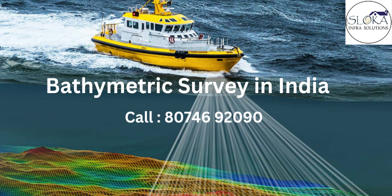
Bathymetric Survey in India: A Deep Dive into Underwater Mapping
The importance of understanding and mapping underwater terrain has never been greater, especially in a city like Hyderabad, where urban growth and water resource management are critical. “Bathymetric Survey in India“ is an indispensable tool for charting the depths of water bodies, providing essential data for navigation, dredging, and infrastructure projects. By employing advanced technologies and methodologies, these surveys ensure that Hyderabad’s lakes, rivers, and reservoirs are utilized effectively while preserving ecological balance.
What is a Bathymetric Survey?
A bathymetric survey is a specialized type of hydrographic survey that focuses on mapping underwater terrain. By measuring the depth and contours of a water body’s floor, it creates detailed maps and models of the submerged landscape. This information is invaluable for flood assessments, navigation, dredging, and various development projects.
The process involves the use of echo sounders, GPS systems, and data processing software. Typically, an echo sounder attached to a survey boat sends out sound waves into the water. These waves bounce back upon hitting underwater features, and the distance to these features is calculated to determine depth. Modern bathymetric surveys also rely on technologies like multi-beam sonar, LiDAR, and unmanned survey vessels for more accurate and comprehensive data collection.
Bathymetric Survey Company in Telangana: Your Partner in Precision Mapping
When it comes to managing water bodies in Telangana, a reliable Bathymetric Survey company in Telangana plays a crucial role. These companies provide cutting-edge services for a variety of applications, from flood management to infrastructure development. With Telangana’s dependence on rivers, reservoirs, and irrigation canals, bathymetric surveys ensure that these resources are managed effectively and sustainably.
For example, these surveys help identify sediment buildup in irrigation canals, allowing for timely dredging and maintenance. They also support urban development projects by offering precise data about the underwater terrain, reducing risks and ensuring the success of projects like bridge construction and floodplain management.
Methods of Bathymetric Surveys
There are several methods used to conduct bathymetric surveys, each suited for specific requirements and environments. Below are some of the most common techniques:
1.Multi-Beam Sonar Survey
This method employs an array of sound beams to scan a wide area of the waterbody’s floor. The data collected is processed to create detailed maps and is often available in real-time during the survey.
2.Single-Beam Sonar Survey
In this method, a single beam is directed straight down to measure the depth of the waterbody. It is ideal for smaller water bodies or when detailed mapping is not required.
Applications of Bathymetric Surveys
Bathymetric surveys serve a wide range of industries and purposes. In Hyderabad and Telangana, these applications are particularly relevant:
1.Flood Management
With erratic monsoon patterns in Telangana, bathymetric surveys help analyze river flow, identify potential flood zones, and develop effective flood control measures.
2.Navigation Safety
Accurate bathymetric data ensures that rivers and reservoirs remain navigable, preventing accidents and supporting transportation and commerce.
3.Dredging Operations
These surveys provide a baseline for dredging activities, helping to determine the amount of material to be removed and the tools required. This ensures that reservoirs and canals maintain their capacity and functionality.
4.Infrastructure Development
Bathymetric surveys are essential for projects like bridges, dams, and urban planning. They provide accurate data to avoid costly errors and ensure safe construction.
5.Environmental Monitoring
By identifying sediment buildup and changes in underwater terrain, bathymetric surveys aid in the conservation of lakes and rivers, supporting biodiversity and ecological balance.
6.Tourism and Recreation
Restoring and maintaining water bodies like Hussain Sagar enhances their aesthetic appeal, boosting tourism and providing recreational opportunities for residents.
Technologies Used in Bathymetric Surveys
Advancements in technology have revolutionized bathymetric surveys, making them more accurate and efficient. Some of the key technologies include:
1.Echo Sounders
These devices, both single-beam and multi-beam, are the backbone of bathymetric surveys. They measure depths and create detailed underwater maps.
2.LiDAR
Light Detection and Ranging (LiDAR) systems are used for high-resolution mapping of shallow water areas, combining laser scanning with GPS data.
3.Unmanned Survey Vessels (USVs)
These vessels are equipped with advanced sonar systems and can operate in hazardous or hard-to-reach areas.
4.Geographic Information Systems (GIS)
GIS tools are used to analyze and visualize survey data, facilitating better planning and decision-making.
5.Satellite and Aerial Imaging
Complementing traditional methods, these technologies provide a broader perspective of water bodies and their surroundings.
Importance of Bathymetric Surveys
The significance of bathymetric surveys cannot be overstated. They play a critical role in:
- Ensuring Navigation Safety: Accurate maps prevent vessels from running aground or colliding with underwater obstacles.
- Supporting Dredging: By identifying sediment accumulation, these surveys guide effective dredging operations.
- Flood Mitigation: Detailed riverbed data helps in predicting and preventing floods.
- Urban Development: Precise underwater terrain data reduces risks in infrastructure projects.
- Ecological Conservation: Monitoring changes in water bodies helps preserve their health and biodiversity.
Business Sectors Benefiting from Bathymetric Surveys
Several industries rely on bathymetric surveys for their operations:
1.Dock and Harbour Engineering
Bathymetric surveys ensure that harbors remain navigable and safe for shipping activities.
2.Flood Management and Prevention
Governments and local authorities use these surveys to plan flood mitigation strategies.
3.River Maintenance
Regular surveys help in maintaining the flow and capacity of rivers, preventing blockages and flooding.
4.Irrigation
Farmers and irrigation departments benefit from accurate data about canal depths and sediment levels.
5.Hydropower Projects
Bathymetric data supports the planning and maintenance of dams and reservoirs.
6.Construction and Urban Planning
Engineers and architects rely on bathymetric surveys for safe and efficient project execution.
Bathymetric Survey in Shallow Water
Bathymetric surveys in shallow water are essential for projects like shoreline stabilization, engineering designs, and infrastructure remediation. However, performing these surveys in such environments poses significant challenges. Shallow waters are often difficult to navigate due to limited accessibility, tight spaces, fast-flowing currents, submerged debris, navigational hazards, and environmentally sensitive areas.
To overcome these obstacles, cutting-edge technologies, such as remote-controlled Unmanned Surface Vessels (USVs), are employed. These state-of-the-art tools ensure precise and efficient data collection while maintaining safety. Among the advanced equipment utilized are Teledyne Z-boats and HyDrone USVs, integrated with either single-beam or multi-beam echosounders. These echosounders, paired with highly accurate RTK-GNSS positioning systems, deliver reliable and detailed bathymetric data even in the most challenging conditions.
In addition to bathymetric data collection, certain projects, such as those involving bridge surveys or nearshore embankments, may also require topographic mapping. For these tasks, hydrographic crews design custom solutions tailored to the specific needs of each project. Advanced tools like small Unmanned Aerial Systems (sUAS) or drones, mobile lidar systems, and terrestrial 3D laser scanners are deployed to capture high-resolution topographic data seamlessly.
By combining innovative technology with expert methodologies, surveys in shallow waters are conducted with unparalleled accuracy and efficiency. This approach not only ensures the safety of the environment and personnel but also delivers precise data critical for successful project execution.
Bathymetric Survey in Deep Water
Bathymetric surveys in deep waters, such as seas and oceans, are crucial for marine construction projects, including dredging and offshore energy development. These surveys require highly specialized equipment and advanced techniques to ensure precise and reliable results. Hydrographic survey vessels are equipped with a range of tools, including single-beam echosounders, side-scan sonar, magnetometers, sub-bottom profilers, and sampling devices. Each piece of equipment serves a specific purpose in mapping and analyzing the underwater environment.
For large-scale deep-water surveys, multi-beam echosounder technology is the preferred method. A multi-beam system, mounted on a custom survey vessel, emits a fan-shaped array of sound waves known as a “swath.” These narrow, adjacent beams cover a wide section of the seafloor, bouncing off the underwater terrain and returning to the echosounder. By calculating the time it takes for the sound waves to return, the system determines the precise distance to the seafloor, creating a detailed map of the underwater topography. Data collected by the multi-beam system can often be processed in real-time aboard the vessel, allowing for immediate analysis and adjustments during the survey.
In smaller bodies of water, single-beam echosounders are commonly used. Unlike the multi-beam system, a single-beam echosounder measures the water depth directly beneath the boat. This method is simpler yet effective for smaller-scale projects or when a high level of detail across wide areas isn’t required.
In addition to mapping the seafloor, understanding water flow and sediment movement is vital for many projects. Acoustic Doppler Current Profilers (ADCPs) play a key role in this aspect of bathymetric surveys. These devices measure water velocity by emitting sound waves that reflect off particles and structures in the water. The collected data provides insights into streamflow and currents, which are essential for enhancing the accuracy of bathymetric mapping and informing project design.
The integration of these advanced technologies allows surveyors to overcome the challenges of deep-water environments, such as extreme depths, strong currents, and complex underwater structures. By using tools like multi-beam and single-beam echosounders, side-scan sonar for detailed imagery, and ADCPs for hydrodynamic data, hydrographic crews can deliver precise, actionable insights for marine construction and development projects. This combination of expertise and innovation ensures the success of projects while maintaining the highest standards of safety and efficiency.
Conclusion
“Bathymetric Survey in Hyderabad” is a vital tool for the city’s sustainable development and water resource management. From aiding navigation and flood control to supporting infrastructure projects and ecological conservation, bathymetric surveys offer unparalleled insights into underwater terrains.
Partnering with a professional Bathymetric Survey company in Telangana ensures access to advanced technologies and expertise, enabling precise data collection and analysis. As Hyderabad and Telangana continue to grow, bathymetric surveys will remain indispensable for maintaining the delicate balance between development and environmental preservation.