
Bathymetric Survey in Congo
Call: +91 80746 92090
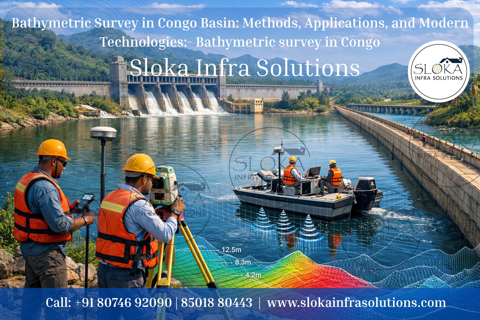
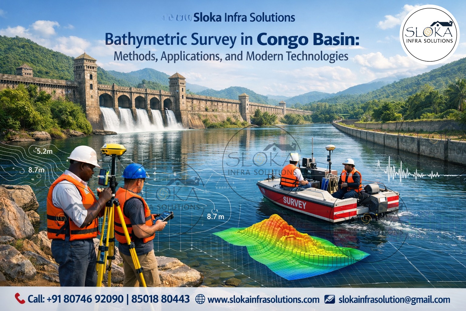
Bathymetric Survey in Congo Basin: Methods, Applications, and Modern Technologies:-
Bathymetric Survey in Congo is the foundation for understanding one of the most complex, powerful, and least-explored river and marine systems on Earth. From the mighty Congo River—recognized as the deepest river in the world—to its vast network of tributaries, floodplains, lakes, wetlands, and the immense Congo Submarine Canyon in the Atlantic Ocean, bathymetric surveys provide the unseen knowledge that shapes navigation, science, engineering, environmental protection, and sustainable development across the Democratic Republic of Congo (DRC).
The Congo Basin spans diverse landscapes: highland headwaters, equatorial rainforests, the vast Cuvette Centrale wetlands, the Malebo Pool near Kinshasa, dramatic cataracts and gorges in the lower Congo, and finally the river’s direct connection to the deep-sea canyon offshore. Each of these waterbodies presents unique challenges and opportunities for bathymetric surveying, making Congo one of the most technically demanding yet scientifically valuable regions in the world for underwater mapping.
Bathymetric Surveyor in Congo
Bathymetric Surveyor in Congo plays a crucial role in translating raw depth measurements into actionable intelligence for governments, researchers, port authorities, hydropower developers, environmental agencies, and marine engineers. Working in Congo requires far more than technical skill—it demands deep understanding of river hydraulics, tropical hydrology, sediment dynamics, logistics in remote environments, and the socio-economic importance of waterways that serve as lifelines for millions of people.
Surveyors operating in Congo often contend with extreme depths, powerful currents, floating vegetation, high sediment loads, seasonal water-level fluctuations, and limited historical data. Yet, their work enables safer navigation, better flood forecasting, improved hydropower planning, ecosystem conservation, and the protection of subsea infrastructure such as telecommunication cables in the Atlantic.
Congo’s Water Geography: A Surveyor’s Perspective:-
The Democratic Republic of Congo contains one of the densest and most interconnected freshwater systems on the planet. The Congo River alone drains an area of about 3.7 million square kilometers, fed by major tributaries such as the Kasai, Ubangi, Sangha, Lualaba, Lomami, Ruki, and Aruwimi rivers. Vast wetlands, peatlands, and floodplains dominate the central basin, storing and releasing water seasonally and influencing river depth and morphology.
Key inland waterbodies include:
- The Lualaba River system in the upper basin
- The Cuvette Centrale wetlands, a mosaic of channels, lakes, and swamps
- Malebo Pool, a wide, shallow expansion of the river near Kinshasa and Brazzaville
- Lower Congo cataracts, where depth, velocity, and bedrock morphology change abruptly
- Coastal estuaries and the Congo Canyon, where the river directly feeds the deep ocean
Bathymetric surveys across these zones must adapt methods and instruments to match local hydraulic and geomorphological conditions.
Why Congo relies on Bathymetric Surveys for water management and infrastructure?
Bathymetric data in Congo underpins decision-making across multiple sectors:
1.Navigation and transport: Inland waterways are primary transport corridors. Accurate depth maps reduce grounding risks and improve year-round navigability.
2.Hydropower development: Congo holds immense hydropower potential. Riverbed geometry and sediment behavior directly influence dam design and turbine safety.
3.Flood risk and water management: Depth and channel shape control flood propagation across floodplains and wetlands.
4.Environmental and ecological studies: Fish habitats, sediment transport, and wetland health depend on underwater terrain.
5.Scientific research: Congo’s river and submarine canyon systems are globally significant for carbon transport, sediment flux, and climate studies.
6.Marine infrastructure protection: Offshore bathymetry helps assess risks to subsea cables affected by turbidity currents.
Surveying techniques used in Congo:-
Modern bathymetric surveys in Congo combine multiple technologies to overcome environmental complexity and data gaps. Each technique contributes a unique layer of understanding.
Sub Bottom Profilers in Bathymetric Surveys:-
Sub Bottom Profilers (SBP) are essential tools in Congo where understanding what lies beneath the riverbed or seafloor is as important as mapping surface depths. Unlike standard echo sounders that reflect from the sediment-water interface, SBPs emit low-frequency acoustic pulses that penetrate below the bed, revealing subsurface layers, buried channels, sediment thickness, and geological structures.
In the Congo River system, SBPs are particularly valuable in the lower reaches, floodplains, reservoirs, and near hydropower sites. These areas often contain thick layers of unconsolidated sediments deposited over centuries of seasonal flooding. Sub Bottom Profilers help identify soft sediment zones versus compacted layers, information that is critical for foundation design, dredging plans, and erosion assessments.
Offshore, within the Congo Submarine Canyon and fan system, SBP data supports scientific research into turbidity currents, landslides, and channel evolution. The canyon acts as a direct conduit transporting sediment and organic carbon from land to the deep sea. By imaging subsurface stratigraphy, SBPs help researchers understand how channels migrate, where sediment accumulates, and how underwater landslides may threaten subsea infrastructure.
In Congo, SBP surveys must account for high ambient noise, strong currents, and variable sediment composition. When integrated with multibeam bathymetry and seismic data, Sub Bottom Profilers provide a three-dimensional understanding of both the visible and hidden landscape beneath Congo’s waters.
Side Scan Sonar in Bathymetric Mapping:-
Side Scan Sonar adds a visual dimension to bathymetric surveys by creating detailed acoustic images of the riverbed or seafloor. Instead of focusing solely on depth, this technology highlights texture, objects, and morphological features by measuring the strength of sound reflections across wide swaths.
In Congo’s rivers, Side Scan Sonar is invaluable for identifying hazards to navigation such as submerged logs, rock outcrops, wrecks, and debris—common in heavily forested basins where floating vegetation frequently enters waterways. Ports, ferry crossings, and urban river sections near Kinshasa and other cities benefit greatly from this technology.
Within the lower Congo and estuarine zones, Side Scan Sonar helps map bedforms, scour zones, and sediment patterns influenced by strong currents and tidal interactions. Offshore, it plays a key role in detecting seabed features such as submarine channels, landslide scars, and cable routes within the Congo Canyon system.
The true strength of Side Scan Sonar lies in its integration with bathymetric depth data. While multibeam systems provide precise elevations, Side Scan Sonar reveals the nature of the surface—sand, gravel, rock, or anthropogenic objects. For environmental monitoring, this combination allows accurate habitat classification and impact assessments.
In Congo’s challenging survey conditions, Side Scan Sonar supports safer operations, better infrastructure planning, and richer scientific interpretation of underwater landscapes.
Single Beam Echo Sounder Surveys:-
Single Beam Echo Sounders (SBES) remain highly relevant in Congo due to their simplicity, reliability, and adaptability. These systems measure depth directly beneath the survey vessel using a single acoustic beam, making them ideal for rivers, narrow channels, and remote areas where logistics and budgets may be constrained.
In the Congo Basin, SBES surveys are commonly used for navigation channel assessments, preliminary studies, and routine monitoring. They are especially effective in shallow rivers, tributaries, lakes, and floodplain channels where deploying larger multibeam systems may be impractical.
SBES data plays an important role in long-term monitoring. By repeating surveys along the same transects, changes in riverbed elevation caused by sedimentation, erosion, or seasonal flow variation can be tracked over time. This is critical in regions affected by dam operations, urban development, or mining activities.
When integrated with GNSS positioning and water-level corrections, Single Beam Echo Sounder surveys provide dependable depth profiles that support hydraulic modeling and navigation safety. In Congo’s vast and often inaccessible regions, SBES technology remains a practical backbone of bathymetric data collection.

Multibeam Echo Sounder Surveys:-
Multibeam Echo Sounders (MBES) represent the most advanced approach to bathymetric surveying and are indispensable for high-resolution mapping in Congo’s complex environments. By emitting hundreds of beams across a wide swath, MBES systems create detailed three-dimensional models of riverbeds and seafloors.
In the Congo River, MBES surveys reveal extreme depths, steep underwater slopes, and intricate channel morphology that cannot be captured by single-beam methods. These surveys are particularly important in the lower Congo, where depths exceed 200 meters and hydraulic conditions are among the most intense of any river globally.
Offshore, MBES is the primary tool for mapping the Congo Submarine Canyon and fan system. Time-lapse multibeam surveys have transformed scientific understanding of submarine channel dynamics, landslides, knickpoints, and sediment transport processes extending thousands of meters below sea level.
For engineering applications, MBES data supports port development, bridge design, dredging operations, and cable route planning. The level of detail allows precise volume calculations, risk assessments, and environmental impact studies.
Although multibeam surveys require specialized vessels, skilled operators, and careful calibration, their value in Congo is unmatched where accuracy, safety, and scientific insight are paramount.
Data Integration and Interpretation:-
The true power of bathymetric surveys in Congo lies in data integration. Depth measurements are combined with:
- RTK or GNSS positioning
- Water-level observations
- ADCP flow measurement
- Sediment sampling
- Satellite imagery and altimetry
This integrated approach supports hydraulic modeling, flood forecasting, sediment transport analysis, and long-term environmental monitoring across the basin.
Environmental and Societal Benefits:-
Bathymetric surveys directly support sustainable development in Congo. Accurate underwater maps help reduce navigation accidents, improve flood resilience, protect sensitive ecosystems, and guide infrastructure investments. They also contribute to global science by improving understanding of one of Earth’s most influential river-to-ocean systems.
The evolving future of Bathymetric Surveys across Congo:-
As technology advances, bathymetric surveying in Congo will increasingly use autonomous platforms, improved satellite integration, and long-term monitoring programs. Building local capacity and maintaining consistent datasets will be essential for managing Congo’s water resources amid climate variability and growing development pressures.
The repeated application of Bathymetric Survey in Congo and the expertise of skilled Bathymetric Surveyor in Congo will continue to unlock the hidden landscapes beneath the water—supporting navigation, science, conservation, and prosperity for generations to come.