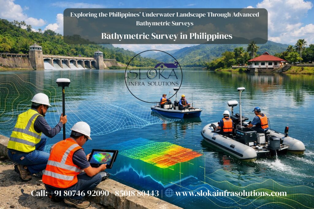
Bathymetric Survey in Philippines
Exploring the Philippines’ Underwater Landscape Through Advanced Bathymetric Surveys:-
Call: +91 80746 92090
Bathymetric Survey in Philippines — a simple phrase that opens a huge world beneath the waves: complex island arcs, ultradeep trenches, narrow straits, sprawling continental shelves, and thousands of kilometers of coastline. The Philippine archipelago (7,000+ islands) sits at the crossroads of the Pacific and the South China and Celebes Seas, making its marine spaces—From shallow coastal lagoons to the Mariana Trench—both ecologically priceless and logistically challenging to map. Accurate seafloor maps underpin safe navigation, coastal planning, disaster risk reduction, offshore construction, habitat protection, fisheries management, and strategic national interests.
Bathymetric Surveyor in Philippines
Bathymetric Surveyor in Philippines roles range from government hydrographers to private contractors and research teams—each bringing specialized instruments and workflows to chart a portion of these waters. Agencies such as the Philippines’ National Mapping and Resource Information Authority (NAMRIA) coordinate national hydrographic efforts and contribute survey data for nautical charts and coastal planning. Professional surveyors combine vessel operations, acoustic sensors, positioning systems, and post-processing to deliver reliable, quality-controlled bathymetry for clients that include ports, energy developers, environmental agencies, and researchers.
Why bathymetry matters in the Philippines (and why it’s difficult):-
The Philippines’ maritime geography is extraordinarily diverse: broad shallow shelves around large islands, steep submarine slopes near volcanic arcs, deep basins like the Philippine Sea, and important shallow reef systems. That variety means a one-size-fits-all surveying approach doesn’t work. Shallow coral reefs need gentle, non-invasive techniques; deep trenches require high-performance multibeam arrays and careful sound-velocity correction; narrow channels and ports demand very high horizontal and vertical accuracy. Good bathymetry reduces ship groundings, informs dredging and port design, supports offshore cables and pipelines, and provides baseline data for coastal resilience and habitat protection. International initiatives such as Seabed 2030 demonstrate the global push to fill gaps in ocean mapping—Seabed 2030 reported ocean mapping coverage rising to roughly 24.9% in May 2023—showing there’s still much of the world’s seafloor to chart.
A practical overview: how modern bathymetric surveys work
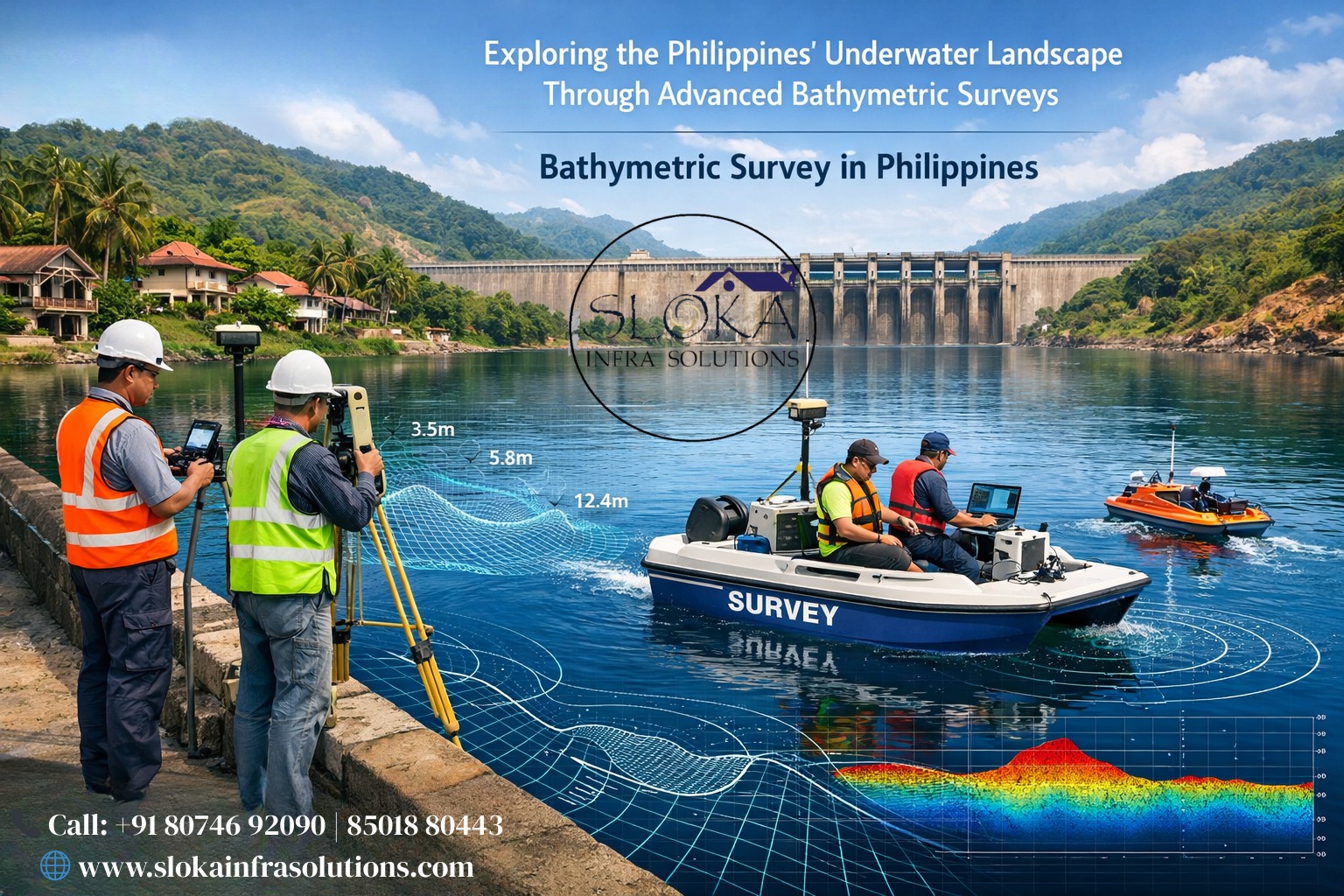
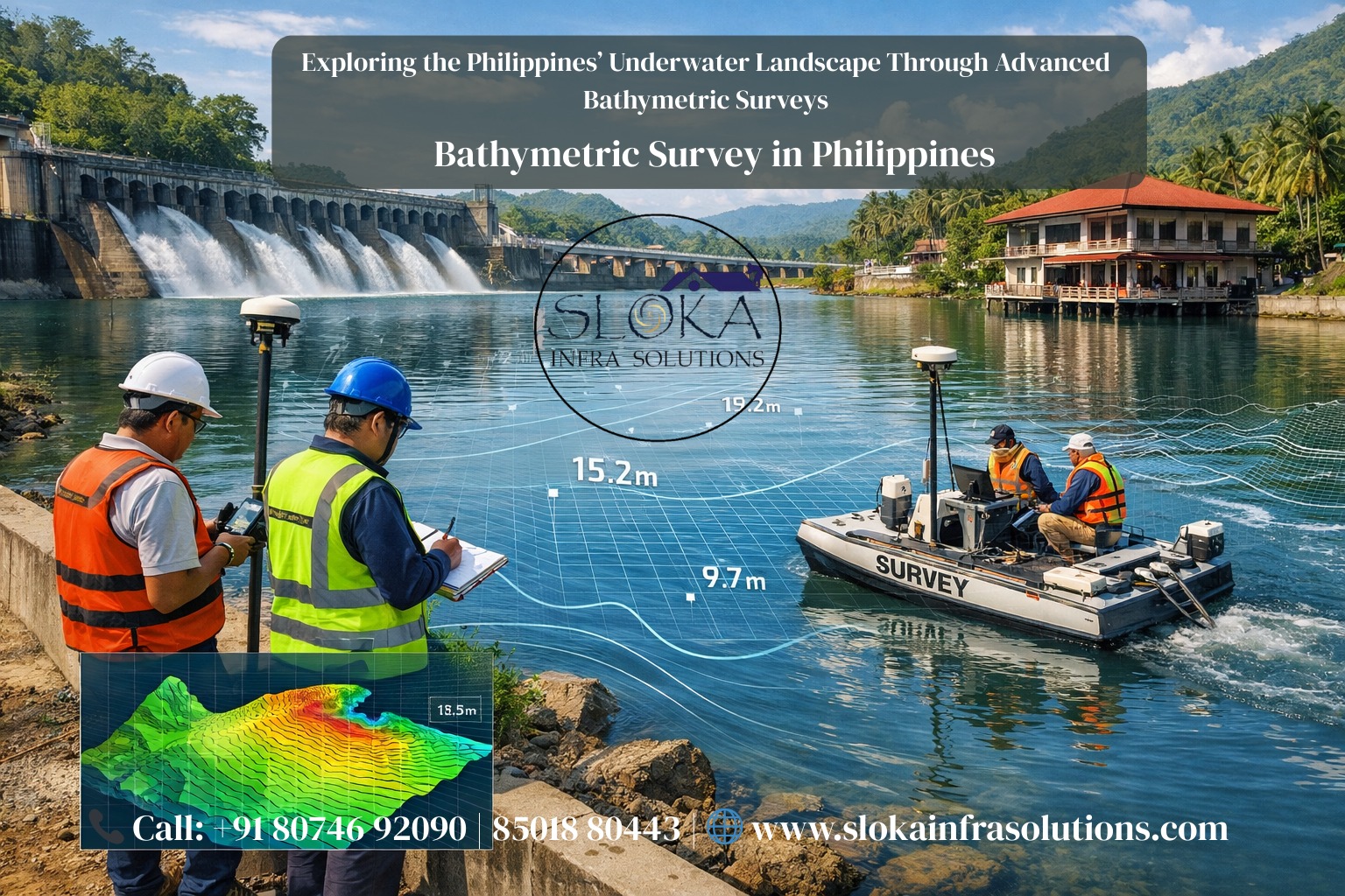
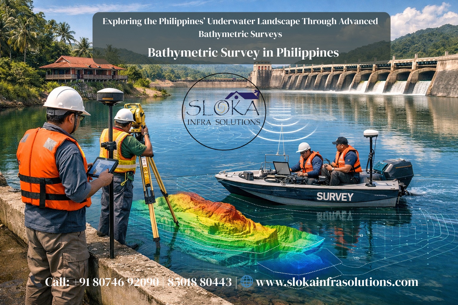
A modern survey combines four building blocks: (1) positioning (GNSS and RTK for shoreline and vessel positions), (2) acoustic depth sensing (single-beam or multibeam echosounders, side-scan sonar, sub-bottom profilers), (3) ocean environment measurements (sound-velocity profiles from CTDs or SVPs), and (4) data processing (tidal corrections, motion compensation, filtering and gridding). Survey design adapts to project goals: high-accuracy navigational surveys use dense multibeam swaths and controlled checkpoints, while regional mapping may combine sparse ship tracks with satellite-derived gravity where ships are impractical. Advanced projects often fuse LiDAR bathymetry for very shallow zones with vessel-based acoustics for deeper water to create continuous coastal elevation models.
Key instruments explained:-
Sub-Bottom Profilers :-
Sub-bottom profilers (SBPs) are acoustic systems designed not to measure the water depth but to “look beneath” the seabed. They transmit low-frequency sound pulses that penetrate sediments; returns reveal layers, buried channels, shoals, or old infrastructure and help interpret stratigraphy to a depth of a few meters (or more with certain seismic sources). For the Philippines, SBPs are invaluable in projects that require geotechnical context—such as foundation studies for bridges, ports, and offshore wind foundations (or future marine renewable infrastructure)—because they reveal sediment thickness and composition that control bearing capacity and consolidation behavior.
Operationally, SBPs are often hull-mounted or towed. The chosen frequency balances penetration (lower frequency for deeper penetration) against resolution (higher frequency for finer detail). Surveyors combine SBP records with core samples or grab samples to ground-truth interpretations. In areas of the Philippines with volcanic or coral substrates, SBPs can help distinguish between loose sediments and hard rock, which changes how anchors, piles, or dredging will perform. SBP data are frequently integrated into risk assessments (e.g., liquefaction potential, buried hazard detection) and environmental baseline reports because they show where sensitive habitats or cultural artifacts may be buried. For planners and engineers working in archipelagic and trench-adjacent waters, that subsurface view is often as crucial as the bathymetric surface map.
Side-Scan Sonar :-
Side-scan sonar (SSS) is an imaging sonar that produces wide, photo-like mosaics of the seafloor’s texture, scattering strength, and objects. Rather than returning a single depth value beneath the vessel, SSS emits fan-shaped acoustic pulses to the sides and records intensity variations; when stitched into a survey mosaic, these images highlight ripples, rock outcrops, wrecks, pipelines, coral bommies, and other seafloor features. In the Philippines’ coastal and reef environments, side-scan is a workhorse for habitat mapping, search and recovery, pipeline and cable route surveys, and archaeological prospection.
SSS operates typically in the 100–500 kHz band; higher frequencies render sharper images but with less range (commonly used in shallow coastal surveys). Towfish or hull-mounted systems are selected according to depth and feature scale. An expedition mapping a coral reef channel will often run overlapping SSS lines at close spacing to capture small reef heads and patch reefs that are invisible to lower-resolution bathymetry. Crucially, SSS complements bathymetric systems: a multibeam can give precise depth geometry while SSS reveals texture and objects that affect navigation and habitat interpretation. For offshore infrastructure planning in the Philippines, side-scan helps identify route hazards and sensitive benthic habitats, informing project siting and environmental management.
Single-Beam Echo Sounder:-
Single-beam echo sounders (SBES) are the classical depth-measurement tool: a transducer sends a vertical pulse and measures the two-way travel time to compute depth directly under the vessel. While technologically simpler than multibeam systems, SBES remains widely used because it’s robust, cost-effective, and portable—ideal for harbor surveys, maintenance dredging checks, preliminary reconnaissance, and projects with low budget constraints.
In the Philippine context, SBES is commonly deployed for small-boat surveys in constrained waters (estuaries, river mouths, lagoonal interiors, and smaller fishing harbor approaches) and for repeated monitoring (sedimentation studies, small port maintenance). The data are straightforward to process—after correcting for tide, sound-speed, and vessel motion, each ping yields a depth point. However, SBES only measures the nadir directly beneath the transducer, so coverage depends on vessel track spacing; wide areas require many parallel transects to build a continuous map, and small features between tracks can be missed. For many local government units and resource managers in the Philippines, SBES provides a pragmatic balance between accuracy and affordability, especially when combined with ground control and targeted high-resolution surveys.
Multibeam Echo Sounder surveys :-
Multibeam echosounders (MBES) are the modern standard for comprehensive bathymetric mapping. MBES emits a fan of beams across a wide swath beneath the vessel and returns a dense patch of depth soundings from a single ping, enabling high-resolution 3D mapping of the seafloor. Beamforming and angular information allow depth and backscatter measurements that describe both geometry and substrate roughness. MBES is essential for navigational charting, detailed habitat mapping, pipeline and cable corridor surveys, and deep-water geological studies.
In Philippine waters, MBES is the tool of choice for port approaches, major shipping lanes, and research programs that target submarine features (ridges, faults, and trench walls). Deploying MBES requires careful planning: survey lines must overlap, sound-velocity profiles must be taken regularly to correct acoustic ray paths, and vessel motion must be compensated by an IMU (inertial measurement unit). MBES systems range in frequency: higher frequencies (200–400 kHz) are used in shallow coastal and reef environments for fine resolution, while lower frequencies penetrate and perform better in deeper water. The machine-generated backscatter mosaic from MBES can also be used to classify seabed types—sand, rock, coral—further enriching the dataset for environmental and engineering decisions. For major Philippine projects—harbor upgrades, seabed cable routing, and scientific mapping—MBES delivers the confidence of dense, quality-controlled bathymetry.
Designing a survey for Philippine waters: practical considerations:-
Survey design in the Philippines must respect local hydrodynamics, weather windows, and environmental protections. Monsoon seasons dictate planning: calm seas in certain months favor high-resolution shallow surveys, while typhoon seasons halt or complicate operations. Shallow reefs and seagrass meadows often lie within a few meters of the surface—these areas benefit from airborne bathymetric LiDAR (green laser) or very shallow-draft boats with MBES/SSS towfish to avoid physical disturbance. Deep basins, trench walls, and submarine ridges require ocean-capable vessels and stronger acoustic systems.
Tides are another local challenge: in many Philippine harbors, tidal ranges exceed meter scales and must be corrected carefully. Sound-speed variability—caused by temperature and salinity gradients—alters acoustic ray paths and is especially important in thermally stratified waters near river mouths or upwelling zones. A good survey includes frequent sound-velocity casts (SVPs/CTDs) and, for high-accuracy projects, calibration lines and independent check points such as tide gauges or precisely surveyed benchmarks.
Data fusion is a best practice: combine MBES for overall depth geometry with side-scan for object detection, SBP for subsurface context, and LiDAR for the intertidal and very shallow zones. This “hybrid” approach reduces blind spots and ensures that shallow ecological features and deep geological structures are both resolved appropriately. For many clients in the Philippines—ports, conservation groups, offshore developers—this integrated dataset delivers maximum value.
Processing, quality control, and final deliverables:-
Raw acoustic returns become usable maps only after rigorous processing: tide correction, sound-speed correction, motion compensation, spike filtering, uncertainty modeling, and gridding. Quality control (QC) flags are applied so users know which areas meet charting standards and which are reconnaissance grade. Deliverables commonly include cleaned point clouds, gridded digital terrain models (DTMs), backscatter mosaics, side-scan mosaics, sub-bottom profiles, GIS layers, and metadata detailing methods, equipment, and accuracies.
A critical step is uncertainty reporting: modern practice is to report both vertical and horizontal uncertainty metrics so downstream users (navigators, engineers, regulators) can make informed decisions. For Philippine national mapping programs, sharing standardized datasets with metadata (following IHO or international conventions) improves reuse and contributes to global efforts such as Seabed 2030. The government–industry–research partnerships are already growing; national agencies coordinate surveys and compile datasets to improve nautical charts and coastal planning.
Applications: where bathymetry changes the game in the Philippines
1.Safe navigation and nautical charts: Updated approaches and harbor depths reduce grounding risk, especially for cargo ships, ferries, and fuel tankers.
2.Coastal infrastructure & ports: Bathymetry guides breakwater and berth design, dredging volumes, and reclamation planning.
3.Disaster risk and tsunami modeling: Accurate trench and shelf geometry are needed to model wave propagation and inundation.
4.Fisheries and habitat mapping: Seabed features and bathymetry influence fish distribution; managers use maps to protect spawning grounds and coral reefs.
5.Offshore energy and cables: Route planning needs bathymetric, geotechnical (subsurface) and backscatter data to avoid hazards and minimize environmental impact.
6.Archaeology and forensics: Side-scan and MBES help find wrecks, submerged cultural sites, and lost objects.
Large national and international projects benefit from unified datasets; for instance, academic teams and geoscientists recently produced new Philippine Sea bathymetric models using improved inversion techniques and shipborne data—demonstrating how local survey campaigns feed higher-level science and mapping products.
Choosing a bathymetric surveyor in the Philippines: checklist
- Proven experience in the target environment (reef, deep sea, estuary).
- Appropriate equipment: MBES for charting and corridors; SBES for small harbors; SSS for object detection; SBP for subsurface needs.
- Quality assurance procedures and willingness to share raw data and metadata.
- Local knowledge and permits: a competent surveyor coordinates with NAMRIA and local authorities.
- Safety and environmental sensitivity, especially when working over reefs or marine protected areas.
Case study snapshot — how integrated methods improved Philippine Sea mapping
Recent research has shown that blending shipborne single-beam data, gravity anomalies, and improved inversion methods yields higher-precision bathymetric models for parts of the Philippine Sea. These projects emphasized preselecting local parameter values, subdividing the large study area, and adapting processing to varying data density—practical lessons for scalable national mapping projects. The study’s approach and resulting model underscore that combining local surveys with regional and global datasets (including GEBCO and SIO gravity models) dramatically enhances map quality in areas where direct measurements are sparse.
Cost drivers and timelines
Costs depend on vessel time, equipment (MBES vs SBES, or LiDAR), required accuracy, water depth, and environmental constraints. MBES surveys require larger vessels and skilled crews; airborne LiDAR needs flight time and specialized processing. Small harbor SBES jobs can be compact and affordable, while detailed MBES + SSS + SBP surveys spanning long corridors or deep basins are more expensive but provide high value for engineering and safety. Timelines vary from days for quick harbor checks to months for regional campaigns and post-processing.
Environmental stewardship and best practice
Surveyors in the Philippines must minimize ecological disturbance—especially over coral reefs and seagrass. Non-invasive technologies (airborne LiDAR for shallow water, hull-mounted sonars with shallow drafts, careful towfish operations) and avoiding physical contact are key. Data collection should be coordinated with local conservation agencies to avoid sensitive seasons (spawning, nesting). In many projects, the survey data themselves become a conservation asset—informing marine protected area boundaries and restoration planning.
The future: satellites, AI, and collaborative mapping
Where ship tracks are absent, satellite altimetry and gravity-derived products give a coarse-scale picture of seafloor relief. Initiatives like Seabed 2030 coordinate international datasets to reduce blind spots, but in archipelagic areas with complex nearshore geometry (like the Philippines), vessel and airborne surveys remain essential for high accuracy. Emerging tools—machine-learning bathymetry prediction, full-waveform LiDAR processing, and automated mosaic classification—are already accelerating post-processing and feature extraction, meaning faster turnarounds and richer products for users. Continued investments in national hydrographic capacity, shared data platforms, and partnerships between government, industry, and academia will be critical to filling remaining gaps.
Practical tips for clients commissioning a survey
Define vertical and horizontal accuracy targets up front.
Specify deliverables (raw soundings, cleaned point cloud, grid spacing, mosaics, metadata).
Ask about QA/QC practices and uncertainty reporting.
Ensure tide and datum conventions are clear.
equest a plan for environmental protection during survey operations.
Closing thoughts:-
Bathymetric Survey in Philippines and Bathymetric Surveyor in Philippines are not just technical labels—they describe a living discipline that connects engineers, sailors, scientists, and coastal communities to the underwater landscape on which so much of the nation’s safety, economy, and biodiversity depends. With the right mix of technologies—multibeam for geometry, side-scan for texture, sub-bottom profilers for subsurface context, and targeted single-beam surveys for narrow or low-budget tasks—survey teams can deliver maps that are practical, defensible, and transformative for planning and stewardship.