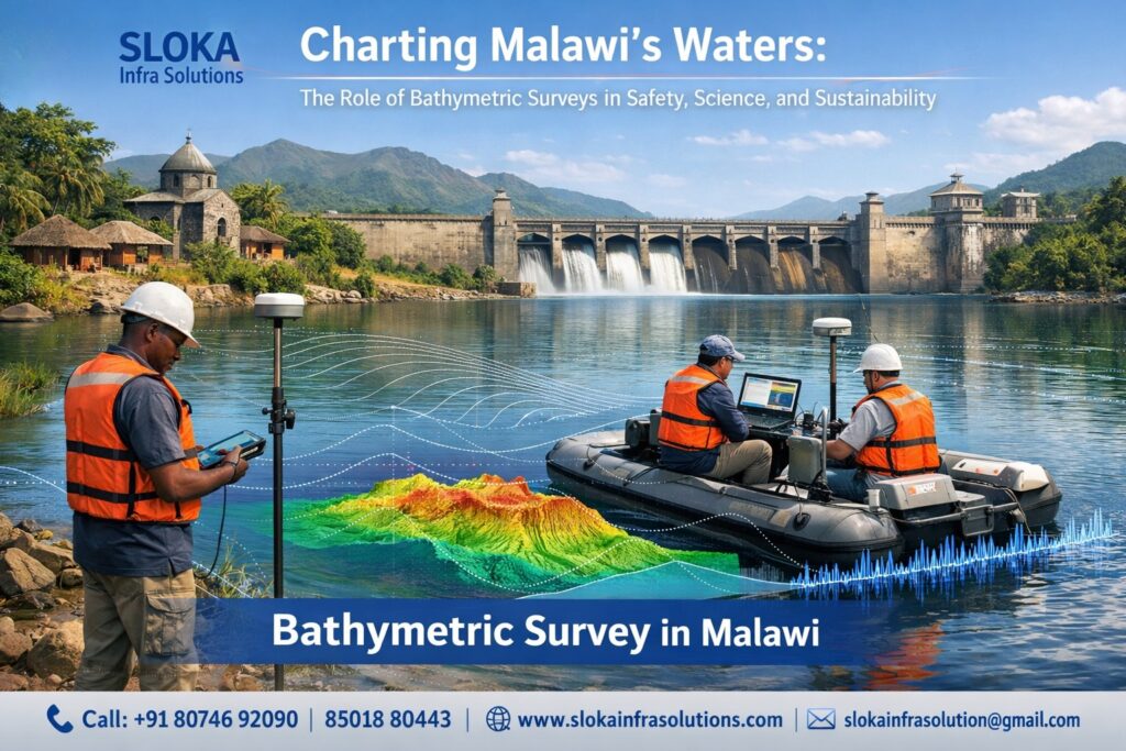
Bathymetric Survey in Malawi
Charting Malawi’s Waters: The Role of Bathymetric Surveys in Safety, Science, and Sustainability:-
Call: +91 80746 92090
Bathymetric Survey in Malawi begins with an understanding that water defines the country’s geography, economy, ecology, and future. Although Malawi is often described as landlocked, its extensive inland waters—dominated by Lake Malawi and supported by rivers, wetlands, and satellite lakes—form a vast aquatic system that behaves much like an inland sea. Mapping the depths, shapes, and sediment characteristics of these waterbodies is not simply a scientific exercise; it is a foundation for navigation safety, fisheries sustainability, hydropower reliability, climate resilience, and national development planning. From the steep escarpments of the Rift Valley beneath Lake Malawi to the shallow, sediment-sensitive basins of Lake Malombe and Lake Chilwa, bathymetric surveying provides the invisible framework upon which informed decisions are built.
Bathymetric Surveyor in Malawi
Bathymetric Surveyor in Malawi plays a critical role in translating underwater measurements into actionable knowledge for government agencies, researchers, engineers, and local communities. Working across deep freshwater lakes, dynamic rivers like the Shire, and reservoirs that support irrigation and power generation, surveyors combine hydroacoustic technology, satellite data, and geospatial analysis to reveal how Malawi’s waters are changing over time. Their work supports safe navigation, identifies sedimentation hotspots, informs fisheries management, and underpins infrastructure projects that depend on reliable water storage and flow. In a country where livelihoods, food security, and electricity generation are tightly linked to water, the expertise of bathymetric professionals has national significance.
Malawi’s water geography: a unique surveying environment:-
Malawi lies along the western branch of the East African Rift System, a geological setting that has shaped some of the deepest and most complex freshwater basins on Earth. Lake Malawi alone covers nearly a quarter of the country’s area and reaches depths exceeding 700 meters, with parts of its lakebed lying below sea level. The lake stretches over hundreds of kilometers, bordered by steep underwater slopes, submerged fault lines, and variable sediment regimes influenced by rivers entering from the west.
Beyond Lake Malawi, the country’s hydrology includes Lake Malombe—an outflow lake on the Upper Shire River—Lake Chilwa, numerous reservoirs, and a network of rivers that respond rapidly to seasonal rainfall. These waterbodies differ widely in depth, turbidity, sediment load, and ecological sensitivity. For bathymetric surveys, this diversity demands flexible methods capable of handling deep clear waters, shallow sediment-rich basins, and flowing river systems within the same national context.

Seeing below the waterline: A foundation for Malawi’s sustainable development:-
Bathymetric data is foundational to multiple sectors in Malawi:
1.Navigation and safety: Inland shipping and ferry transport on Lake Malawi depend on accurate depth charts. Outdated bathymetry increases the risk of groundings and accidents, especially near ports, harbors, and river mouths.
2.Fisheries management: Many fish species are closely linked to depth zones and bottom types. Understanding underwater topography helps identify breeding grounds, feeding habitats, and areas vulnerable to overexploitation.
3.Hydropower and irrigation: Nearly all of Malawi’s electricity generation depends on water flowing from Lake Malawi into the Shire River. Sedimentation in lakes and reservoirs reduces storage capacity and affects flow regulation.
4.Climate change adaptation: Changing rainfall patterns and rising temperatures alter lake levels and sediment dynamics. Repeat bathymetric surveys reveal long-term trends essential for resilience planning.
5.Environmental conservation: Sensitive benthic habitats, wetlands, and delta regions can only be protected effectively when their underwater characteristics are well understood.
A look at how underwater mapping developed in Malawi:-
Early bathymetric efforts in Malawi relied on manual sounding and limited positioning accuracy. While these surveys were valuable for their time, they cannot meet modern demands due to technological limitations and decades of environmental change. The introduction of dedicated survey vessels, improved echo sounders, differential GPS, and hydrographic software marked a turning point, enabling systematic data collection and chart production.
In recent years, the integration of satellite-derived bathymetry, advanced hydroacoustic systems, and geographic information systems has expanded coverage and improved resolution. These tools allow Malawi to survey vast areas more efficiently, while still relying on in-situ measurements for validation and high-precision applications.
Bathymetry and Malawi’s major waterbodies:-
Lake Malawi:
As one of the world’s deepest lakes, Lake Malawi presents both opportunities and challenges. Its clear waters are suitable for deep-water echo sounding and satellite-based techniques, yet its steep slopes and tectonic features require careful survey design. Bathymetric mapping here supports navigation, fisheries zoning, geological research, and cross-border water management.
Lake Malombe:
Shallower and more dynamic, Lake Malombe is highly sensitive to sedimentation from surrounding catchments. Bathymetric surveys have documented progressive shallowing over decades, with implications for fish productivity and downstream water regulation on the Shire River.
Lake Chilwa:
This lake is known for dramatic fluctuations in water level and periodic drying. Bathymetric data provides a baseline for understanding how climate variability and land-use change affect its extent and ecological function.
Shire River and reservoirs:
The Shire River connects Lake Malawi to the Zambezi system and is critical for hydropower. Reservoirs along the river and elsewhere in Malawi require regular bathymetric assessment to quantify sediment accumulation and remaining storage capacity.
Survey design in Malawi’s inland waters:-
Bathymetric survey design in Malawi must account for:
- Seasonal water-level variations linked to rainfall
- Sediment inflow from agricultural catchments
- Wind-driven waves on large lakes
- Accessibility constraints in remote or shallow areas
- The need to integrate new data with historical charts
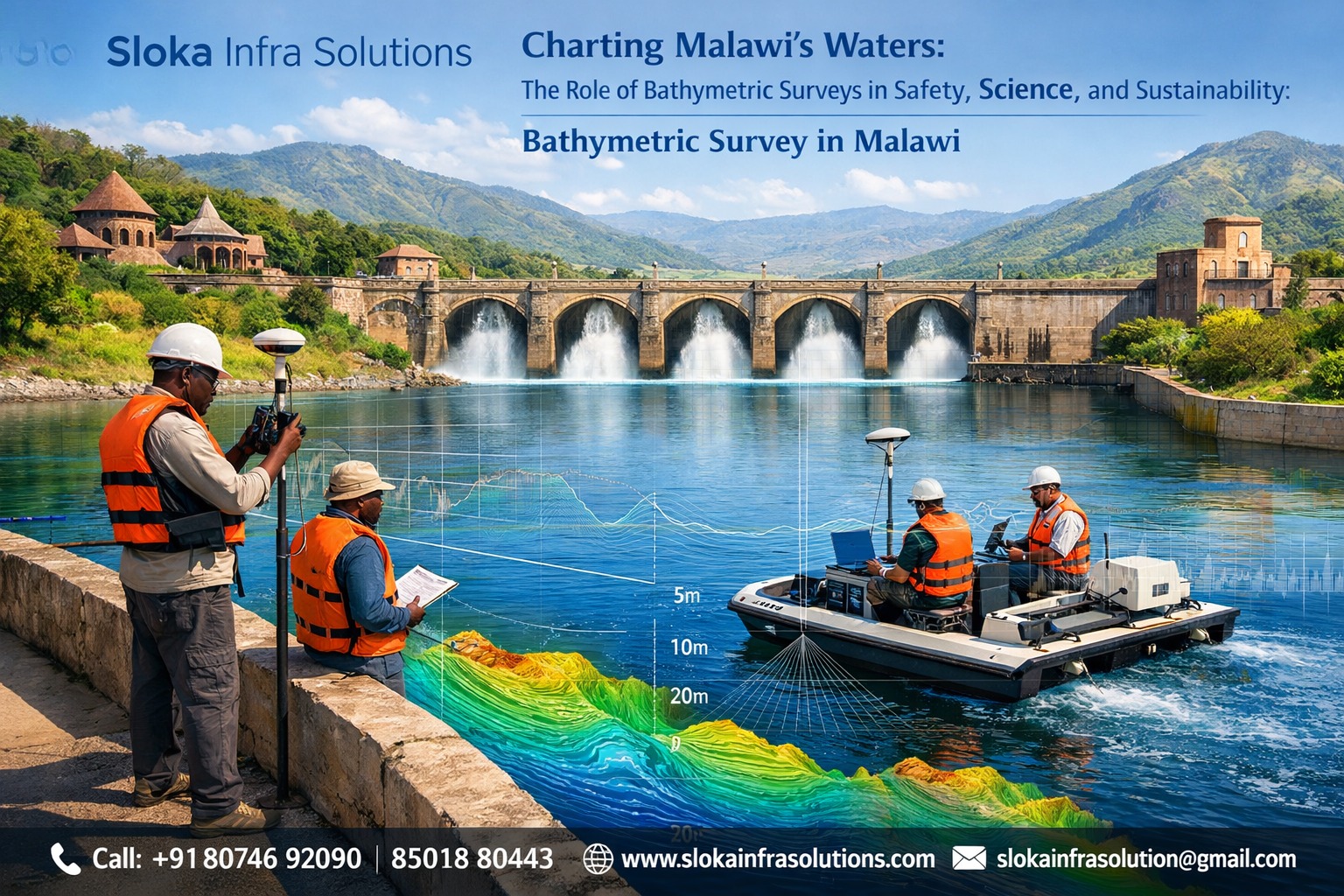
Survey lines are typically planned perpendicular and parallel to shorelines or river flow, with spacing adjusted to waterbody size and required resolution. Control points, water-level observations, and sound velocity measurements are essential for ensuring accuracy.
Side Scan Sonar in Malawi’s bathymetric surveys:-
Side Scan Sonar plays a vital role in enhancing bathymetric surveys across Malawi’s lakes and rivers by providing detailed imagery of the lakebed surface. Unlike depth-focused instruments, Side Scan Sonar emits acoustic pulses sideways from a towed or hull-mounted device, capturing high-resolution images that reveal bottom texture, objects, and morphological features.
In Lake Malawi, Side Scan Sonar is particularly valuable for identifying submerged hazards, rocky outcrops, wrecks, and abrupt changes in bottom type that may not be immediately apparent from depth data alone. These insights are crucial for navigation safety near ports, ferry routes, and anchorage zones. The technology also supports fisheries research by mapping habitats such as rocky reefs, sandy plains, and vegetated areas where different species congregate.
In shallower systems like Lake Malombe and sections of the Shire River, Side Scan Sonar helps visualize sediment deposition patterns, erosion zones, and anthropogenic features such as fishing structures or intake pipes. Because these environments are dynamic, repeat surveys can detect changes over time, informing management decisions.
The strength of Side Scan Sonar lies in its ability to complement bathymetric measurements. When combined with echo sounder data and geospatial analysis, it provides a richer understanding of underwater conditions, enabling surveyors to interpret not just how deep the water is, but what lies on the bottom and how it is changing.
Sub Bottom Profilers and sediment analysis:-
Sub Bottom Profilers extend bathymetric surveying beyond the visible lakebed by imaging sediment layers beneath the surface. This technology emits low-frequency acoustic signals that penetrate the bottom sediments, reflecting from subsurface layers and geological structures.
In Malawi, Sub Bottom Profilers are especially relevant in lakes and reservoirs where sedimentation poses long-term risks to water storage, fisheries, and infrastructure. In Lake Malombe, for example, sediment accumulation from upstream catchments has significantly altered basin morphology. Sub Bottom Profiling allows surveyors to estimate sediment thickness, identify buried channels, and understand historical deposition patterns.
Along the Shire River and in reservoirs supporting hydropower and irrigation, these profilers help quantify how much sediment has accumulated over time and where it is concentrated. This information is critical for planning dredging, assessing reservoir lifespan, and designing sediment management strategies.
Beyond engineering applications, Sub Bottom Profilers contribute to scientific research by revealing geological features linked to the Rift Valley’s tectonic evolution. Faults, ancient lakebeds, and depositional sequences captured in subsurface profiles provide valuable context for understanding how Malawi’s landscapes and waterbodies have evolved.
By integrating Sub Bottom Profiler data with surface bathymetry, surveyors gain a three-dimensional view of aquatic systems—one that supports both practical management and long-term environmental understanding.
Single Beam Echo Sounder surveys in Malawi:-
Single Beam Echo Sounders have long been a cornerstone of bathymetric surveying in Malawi due to their reliability, simplicity, and adaptability. These systems measure depth directly beneath the survey vessel by transmitting an acoustic pulse downward and recording the return time from the lakebed.
In Malawi’s diverse water environments, Single Beam Echo Sounders remain highly effective, particularly in shallow lakes, rivers, and nearshore zones. They are commonly used in Lake Malombe, Lake Chilwa, and along the Shire River, where depth variations are moderate and survey access may be limited. Their relatively low cost and ease of deployment make them suitable for routine monitoring and baseline surveys.
Single Beam surveys are often conducted along systematically spaced lines, producing depth profiles that can be interpolated into bathymetric maps. When combined with accurate positioning systems, they deliver dependable results for navigation charts, sedimentation studies, and environmental assessments.
While they do not provide full-coverage data like multibeam systems, Single Beam Echo Sounders are invaluable when resources are constrained or when focused measurements are required. In Malawi, they continue to support ongoing monitoring programs, infrastructure planning, and training of hydrographic personnel, forming a practical backbone of national bathymetric capability.
Multibeam Echo Sounder surveys and high-resolution mapping:-
Multibeam Echo Sounder surveys represent the most advanced approach to bathymetric mapping in Malawi’s inland waters. Unlike single beam systems, multibeam instruments emit multiple acoustic beams in a fan shape, capturing continuous swaths of depth data across the lakebed.
In deep and complex environments such as Lake Malawi, multibeam surveys provide unparalleled detail. They reveal steep slopes, underwater ridges, fault-controlled basins, and subtle morphological features essential for safe navigation and scientific research. High-resolution multibeam data also supports habitat mapping, enabling precise identification of ecological zones across depth gradients.
Multibeam systems are particularly valuable near ports, ferry routes, and infrastructure sites where full-bottom coverage is critical. Their ability to collect dense datasets reduces uncertainty and improves chart accuracy. When combined with sound velocity profiling and precise positioning, multibeam surveys produce three-dimensional models that can be analyzed from multiple perspectives.
Although multibeam surveys require higher investment and technical expertise, their long-term value is significant. In Malawi, strategic use of multibeam technology complements broader survey programs, filling gaps left by traditional methods and elevating the overall quality of bathymetric knowledge.
Integrating satellite-derived bathymetry and field surveys:-
Satellite-derived bathymetry has emerged as a powerful tool for expanding coverage in Malawi’s clear-water zones, particularly along Lake Malawi’s shoreline. By analyzing light penetration in satellite imagery, researchers can estimate depths in shallow to moderate ranges. While this approach cannot replace hydroacoustic surveys, it offers a cost-effective way to screen large areas, identify changes, and prioritize fieldwork.
Ground-truthing with echo sounders ensures accuracy and reliability, creating a hybrid approach that maximizes efficiency without compromising quality.
Data processing, analysis, and long-term monitoring:-
Modern bathymetric surveys in Malawi rely heavily on digital processing workflows. Depth data is cleaned, corrected for water level and sound velocity, and integrated into geographic information systems. These datasets are then used to generate contour maps, three-dimensional models, and analytical outputs for decision-makers.
Repeat surveys are essential for tracking trends such as sedimentation rates, shoreline changes, and lake-level fluctuations. Over time, these datasets form a valuable archive that supports evidence-based policy and adaptive management.

What lies ahead for Bathymetric Surveys in Malawii?
As pressures from climate change, population growth, and economic development intensify, the importance of bathymetric surveying in Malawi will only increase. Expanding survey coverage, upgrading equipment, strengthening institutional capacity, and investing in training will be key priorities.
Collaboration between government agencies, research institutions, and international partners can accelerate progress, ensuring that Malawi’s waters are mapped, understood, and managed sustainably.
Bigger picture beneath the surface:-
Bathymetric survey in Malawi is far more than a technical exercise; it is a strategic tool for national resilience. By revealing the hidden landscapes beneath Malawi’s lakes and rivers, bathymetric surveys empower informed decisions across navigation, energy, fisheries, and climate adaptation. Supported by skilled professionals, including every dedicated Bathymetric surveyor in Malawi, this discipline will continue to shape the country’s sustainable water future.